![]()
THE LAND OF PALESTINE
The land of Palestine can be divided a number of ways. For the purpose of the QuickSource Bible Atlas, we will look at four broad regions: the southern regions (Judah/Judea), the central regions (Israel/Samaria), the northern regions (Galilee), and the eastern regions (Transjordan).
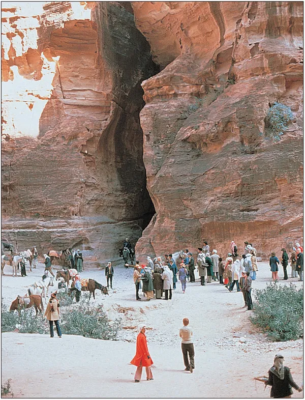
A view from the front of the so-called “treasury” building of the narrow entryway into the Nabatean city of Petra.
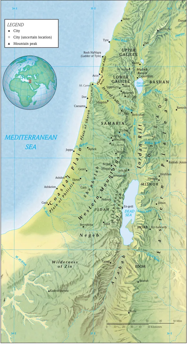
9 THE NATURAL REGIONS OF PALESTINE
THE SOUTHERN REGIONS
(Judah/Judaea)
The southern portion of Palestine, generally corresponding to the land of the southern kingdom of Judah, is composed of six distinct geographical regions: the hill country of Judah, the Shephelah, the Philistine coastal plain, the biblical Negev, the wilderness of Judah and the land of Benjamin.
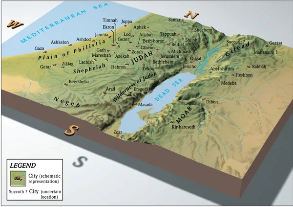
10 PHILISTINE PLAIN, SHEPHELAH, JUDAH, AND THE DEAD SEA
The Hill Country of Judah
The hill country of Judah formed the heartland of the Old Testament kingdom of Judah, as well as the New Testament province, Judea. In area the hill country covers approximately 480 square miles (40 miles × 12 miles), the size of an average county in the United States. The high point of the hill country, at Halhul (cp. Josh. 15:58) just north of Hebron, is 3,347 feet in elevation.
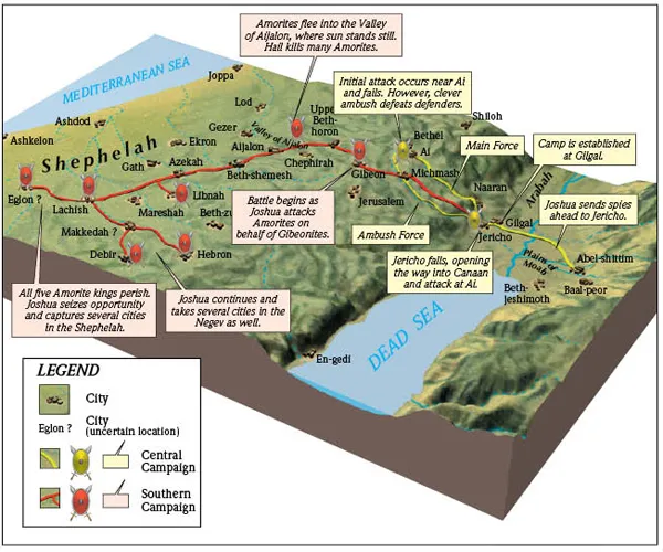
11 JOSHUA'S CENTRAL AND SOUTHERN CAMPAIGNS
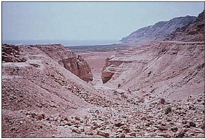
The wadi through the limestone cliffs of the Qumran area in Israel.
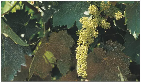
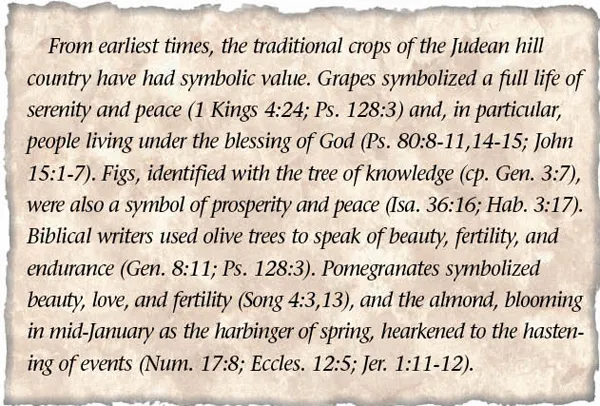
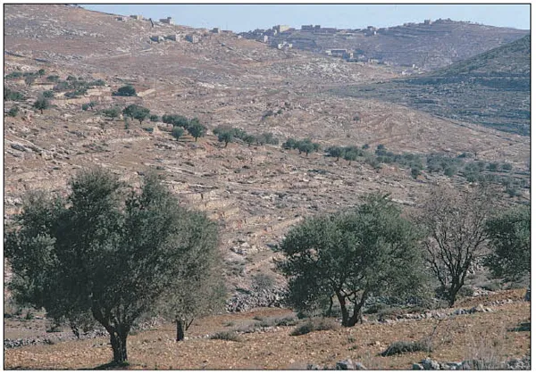
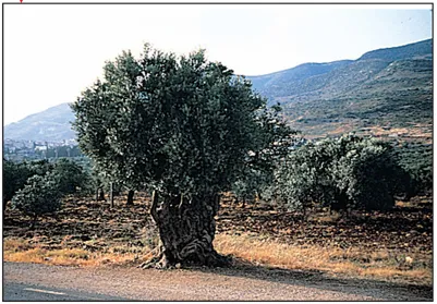
The watershed ridge, running northnortheast by south-southwest, forms the backbone of the hill country of Judah. From it wadis flow westward to the Mediterranean Sea and eastward to the Jordan Valley and Dead Sea. As these wadis cut through the hard Cenomanian limestone, they form deep, V-shaped valleys with steep, rugged sides. Because the limestone is bedded, it breaks on the wadi slopes into natural terraces that have been improved with considerable effort through the centuries into numerous small but fertile plots of agricultural land. Adequate winter rainfall, plentiful springs, and rich terra rosa soil have allowed farmers and villagers in the hill country of Judah to produce ample crops to sustain life. Since antiquity the traditional crops of the hill country have been grapes, figs, olives, pomegranates, and almonds (cp. Deut. 8:8). Grapes, figs, and olives, in addition to bread, were the staples of life.
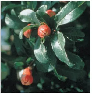
Pomegranate blossoms taken at Sabaste, Israel.
Young grapes growing near Tel Lakhish (Isa. 5:1-7).
The major cities of the hill country of Judah—Hebron, Bethlehem, and Jerusalem—are located just off the central watershed ridge. They are linked together by the main route through the hill country the central ridge route or Patriarchal Highway, which follows the line of this ridge. Of the hill country cities, Hebron has always held pride of place in terms of geographical and agricultural advantage, and it was there that David, born in Bethlehem and destined to find glory in Jerusalem, first reigned as king over Israel (2 Sam. 5:1-5).
Countryside between Jerusalem and Bethlehem. Olive trees can be seen in a small orchard.
The rugged wadis that drop out of the hill country tend to isolate the cities and villages of the watershed ridge from the International Coastal Highway to the west and the rift valley and King's Highway to the east (see INTERNATIONAL ROUTES, p. 16). A few natural routes following the continuous ridges that divide these wadi systems link Hebron, Bethlehem, and Jerusalem to the world beyond. Down one of these ridges that connects Bethlehem with the Elah Valley in the Shephelah (the “Husan Ridge Route”), a young David brought food to his brothers fighting the Philistines (1 Sam. 17:12-19). It was probably along this same route that Philip met an Ethiopian eunuch traveling from Jerusalem to Gaza (Acts 8:26-40).
Because of its rugged isolation and natural defenses, Judah has always been relatively closed to foreign cultural influences. The large powers of antiquity (Egypt, Assyria, Babylon, Greece, and Rome) were occasionally drawn into the hill country to fight against the Canaanites, Israelites, or Jews living in Jerusalem but seldom went out of their way to settle there. As a result, the local inhabitants of Judah tended to value stable and conservative lifestyles. It was here that Jeremiah preached the “old-time religion” of Moses, that Isaiah spoke of a coming Messiah to deliver His people (Isa. 40:9-11), and that Judaism took its formative steps in the centuries leading up to the New Testament. More than any other region in Palestine, the hill country of Judah represents the land in which God chose to dwell among His people.
During the biblical period the hill country of Judah was the “irreducible minimum” of God's promised land, the cradle of Israelite and Jewish life. On its protected ridges and slopes, God's people were given opportunity to take root and prosper. Their success was mixed and depended on their willingness to obey Him (Deut. 11:11-12; 28:1-68; Ps. 80:1-19).
The Shephelah
The Shephelah (lit. “lowland,” translated “western foothills” by the NIV) is the area of low, rolling Eocene hills between the hill country of Judah and the coastal plain (Deut. 1:7; Josh. 9:1; 10:40; 15:33-36; 1 Kings 10:27; 2 Chron. 26:10; Jer. 17:26). This region covers approximately 250 square miles (25 miles x 10 miles), and its hills vary in elevation from 300 to 1,200 feet.
A hard mineral crust called nari, three to five feet thick, covers the hills of the Shephelah, rendering them practically useless for agriculture. Only small trees and shrubs grow on these hills naturally. The broad valleys of the Shephelah, however, are quite fertile and particularly well suited for grain (wheat and barley), but vineyards and orchard crops also do well there. These valleys are the extension of the major wadi systems flowing west out of the hill country of Judah and are fed by ample runoff rainfall from the hills.
Five valleys of the Shephelah have figured prominently in the political history of Palestine. From north to south, they are the Aijalon, the Sorek, the Elah, the Guvrin, and the Lachish.
Several verses in the Bible mention the agricultural possibilities of the Shephelah. First Chronicles 27:28 mentions the sycamore tree, which produces an inferior type of fig, and the olive tree.
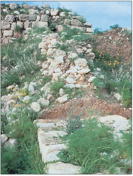
The Lachish Valley is named after Lachish, the second most important city in Judah during the late monarchy. The capture of Lachish by the Assyrian king Sennacherib in 701 BC (2 Kings 18:14,17; 19:8) and again by the Babylonian king Nebuchadnezzar in 587 BC (Jer. 34:7) signaled the fall of the entire Shephelah to foreign powers.
The definitive line of a wall at Lachish running from the south, northeast up to the high place.
Politically, the Shephelah has always functioned as both a bridge and a buffer between the hill country and the coastal plain. The eastwest orientation of the five valleys of the Shephelah provides easy access for the people of the coast to move into the hill country (e.g., the Philistines or international powers such as Egypt, Assyria, Babylon, Greece, and Rome). On the other hand, if the inhabitants of the hill country are to have any thoughts of expanding their influence in Palestine, they must first secure the agricultural lands and highways of the Shephelah. For this reason the valleys of the Shephelah historically have functioned like saloon doors of the Old West, swinging either in or out depending on the strength and ability of those pushing from either side. At times, however, a king in Jerusalem would attempt to close the doors altogether, building fortifications in the Shephelah as a front guard for his heartland in the hill country (2 Chron. 11:5-12).
As Judah's buffer zone toward the coast, the Shephelah witnessed assault after assault on Jerusalem. This was the region that Judah could scarcely afford to lose yet over time could scarcely control.
The Philistine Coastal Plain
Palestine's coastal plain stretches from north of Mount Carmel to the Sinai Peninsula. The portion of this plain that lies between the Yarqon River, a stream flowing through Joppa (the modern city of Tel Aviv), and the Nahal Besor just south of Gaza is commonly known as the Philistine coastal plain. This was the heartland of the Philistines during much of the time of the Old Testament.
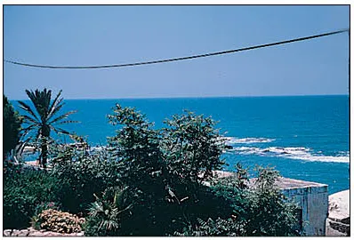
Joppa.
The Philistine coastal plain extends approximately 50 miles along the Mediterranean coast, varying in width from 10 miles in the north to 25 miles in the south. The plain rises gradually eastward to the hills of the Shephelah. Sand dunes dominate the coastline, but inland the sand mixes with alluvial and loess soils (from the Shephelah and Negev, respectively) to form a decent agricultural base. Historically, the major agricultural crops grown on the coastal plain have been grain, but citrus orchards are common in the area today.
12 MEDITERRANEAN COASTLINE
The shoreline of the Mediterranean coast is stiff and uninviting except for a small natural harbor at Joppa (modern Tel Aviv), Judah's desired seaport. For this reason, most traffic on the plain during the biblical period was land-based, moving north and south along two branches of the International Coastal Highway. One branch, tracking just behind the coastal dunes, linked Gaza, Ashkelon, Ashdod, and Joppa before turning inland to Aphek (1 Sam. 4:1; New T e s t a m e n t Antipatris—Acts 23:31), located at the head of the Yarqon River. An inland branch followed the western edge of the Shephelah, connecting Gerar, Gath, and Ekron to Aphek.
The openness of the Philistine coastal plain makes this a true international region. This was the homeland of the Philistines, and from their five cities (Gaza, Ashkelon, Ashdod, Ekron, and Gath—1 Sam. 6:17-18) the Philistines attempted to push into the hill country at the same time that Israel was trying to expand its influence toward the coast.
Panoramic view of the ancient tel of Gath.
Eventually large powers from the outside— Assyria and Babylon from the east, Greece and Rome from the west—swept down the coastal plain with their eye on the wealth of Egypt, running over the local inhabitants in the process. The Philistines disappeared from history, although their name lives on in the term Palestine. The Israelites and Judeans, able to find refuge in the rugged hill country to the east, survived as the spiritual ancestors of both Jews and Christians today.
The Philistine coastal plain was the highway of southern Palestine. Judah wanted to take advantage of the opportunities that living on this highway offered but, more often than not, was run over by mighty empires of the day in the process.
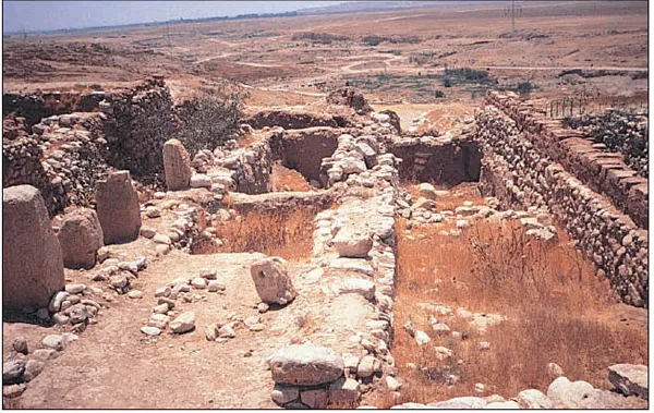
The Biblical Negev
Excavated storerooms at the site of ancient Beer-sheba in the Negev.
The biblical Negev (lit. “dry land” or “south”) is a geological depression reaching inland from the southern Philistine coastal plain to a point 12 miles west of the southern end of the Dead Sea. The western basin of the Negev ove...