How may Bohuslän rock art and landscape be perceived and understood? Since the Bronze Age, the landscape has been transformed by shore displacement but, largely due to misunderstanding and certain ideas about the character of Bronze Age society, rock art research in Tanum has drawn much of its inspiration from the present agrarian landscape. This perception of the landscape has not been a major issue. This volume, republished from the GOTAC Serie B (Gothenburg Archaeological thesis 49) aims to shed light on the process of shore displacement and its social and cognitive implications for the interpretation of rock art in the prehistoric landscape. The findings clearly show that in the Bronze Age, the majority of rock art sites in Bohuslän had a very close spatial connection to the sea.
Much rock art analysis focuses on the contemplative observer. The more direct activities related to rock art are seldom fully considered. Here, the basic conditions for the production of rock art, social theory and approaches to image, communication, symbolism and social action are discussed and related to palpable social forms of the "reading" of rock art. The general location and content of the Bronze Age remains indicate a tendency towards the maritime realm, which seems to have included both socio-ritual and socio-economic matters of production and consumption and that Bronze Age groups in Bohuslän were highly active and mobile. The numerous configurations of ship images on the rocks could indicate a general transition or drift towards the maritime realm. Marking or manifesting such transitions in some way may have been important and it is tempting to perceive the rock art as traces of such transitions or positions in the landscape. All this points to a maritime understanding of Bronze Age rock art in northern Bohuslän.
eBook - ePub
Elevated Rock Art
Towards a maritime understanding of Bronze Age rock art in northern Bohuslän, Sweden
- 272 pages
- English
- ePUB (mobile friendly)
- Available on iOS & Android
eBook - ePub
Elevated Rock Art
Towards a maritime understanding of Bronze Age rock art in northern Bohuslän, Sweden
About this book
Trusted by 375,005 students
Access to over 1.5 million titles for a fair monthly price.
Study more efficiently using our study tools.
Information
Topic
ArtSubtopic
Art TechniquesI
Launching
1
INTRODUCTION – THE ROCK ART PHENOMENON IN NORTHERN BOHUSLÄN
Introduction
The coastal region of Bohuslän, with its maritime location and its maritime history, ethnography and economy, has always been associated with the sea. Fishing and farming have a strong tradition in northern Bohuslän. For the costal population, combining these two sources of food has been a common practice in historical times and fisher-farmers or farmer-fishers have been common terms for the most usual livelihood in Bohuslän. The fishermen and sailors of Bohuslän have a historical reputation for skill and daring; Bohuslän has also been one of Scandinavia’s foremost boat-building centres (Hasslöf1949, 1970). In the 12th century, King Sverre of Norway introduced a system that divided Bohuslän into 16 skipreidor (ship levies), each of which was required to provide 40 maritime warriors. After 1658, when Bohuslän became a part of Sweden, the skipreidor were successively renamed härad (hundred). In the Late Medieval era the sea provided a glut of herring, which resulted in a period of economic and social prosperity. The historical accounts of these interactions are many and varied and so are the archaeological remains (Hasslöf 1949, 1970).
Most of the prehistoric remains are also oriented towards the sea. The earliest settlement sites from the Mesolithic are strongly associated with the seashore and maritime income seems to have dominated the economy (Andersson et al. 1988). Neolithic activity also seems to have been oriented towards the sea. Settlements and megalithic graves are often located on or in the vicinity of the contemporary shore and livelihood seems to have come from both maritime and terrestrial sources (Sjögren 2003).
Moreover, Bohuslän has Europe’s largest concentration of prehistoric rock art; about 1500 sites have been recorded. The most common feature on the rock is the cup mark and most of them were probably made during the Bronze Age (BA), 1700–500 BC (Bertilsson 1987). But there are indications that cup marks were made in the landscape both earlier and later than the figurative rock art (Bengtsson 2004; Goldhahn 2006). Furthermore, no other area with South Scandinavian BA rock art presents such a rich figurative repertoire and complex compositions of images as Bohuslän. Since the BA, however, the landscape has been transformed by shore displacement, so today most of the rock art, on bedrock of granite or gneiss, is located around 10 km inland. The most common figurative image is the ship; the region is known to contain some 10,000 ship images (Hygen & Bengtsson 1999).
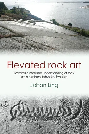
The figurative rock art in Bohuslän is extremely evocative and it is hardly surprising that over the years, this prehistoric feature or medium has inspired such a wide range of interpretations (cf. Baltzer 1911; Nordbladh 1995; Bertilsson 1987; Goldhahn 2006). The innovative expression and aesthetic artistry of the rock art images are hard to put into words. The images have been hammered out in stone with the emphasis on place, motion, light, form, style and content. They are performed so concretely that they tend to both fire and distort our reading of them. Another paradox with the rock art is that although the images are fixed in stone, they are full of life, vivid and mobile. They convey motion as often as immobility and this contradiction is so stimulating that one never tires of looking at the panels. Ideals of communication, landscape and motion seem to have been mixed with “iconic” symbols (fig. 1.1, see chapter 9).
Broadly speaking, the rock art may be described as a selection of images that represent concrete social actions, social positions and abstract ritual features and matters. Some compositions may be regarded as episodic, others rhapsodic, performed in a varied and ambiguous way. Mobility and conflict seem to go hand in hand with highly ritualised scenes or compositions. The images were most probably made before, in connection with or as a manifestation of specific socio-ritual events. They may be regarded in general as reproductive features of specific social and ritual values rather than representations of mundane life.
As to the causes or actions behind the making of this rock art, in the past two centuries the following themes have been suggested:
• Historical events (Sjöborg 1830; Holmberg 1848; Hildebrand 1869; Montelius 1874).
• Religious declarations (Worsaae 1882; Almgren 1927; Bing 1937; Ohlmarks 1963; Hultkrantz 1989; Larsson 1997; Fredell 2003; Kristiansen & Larsson 2005).
• Magi-religious incantations (Brunius 1868; Almgren 1927; Gjessing 1939; Althin 1945; Bengtsson 2004).
• Cult and cultic action (Almgren 1927; Kaul 1998, 2004; Bengtsson 2004; Kaliff 2007).
• Eschatology (Ekholm 1916; Nordén 1925; Randsborg 1993; Goldhahn 1999a, 2005).
• Socio-ritual initiations or celebrations of seasons, actions, genders (Yates 1993; Kaliff 1997; Kaul 1998, 2004; Kristiansen 2002; Goldhahn 1999a, 2005, 2007; Wahlgren 2002; Coles 2005).
• Socio-ritual and political dimensions and positions (Nordbladh 1980, 1989; Bertilsson 1987; Larsson 1994; Kristiansen 1998; Vogt 2006).
• Socio-ritual, communicative and spatial aspects of landscape (Mandt 1972; Nordbladh 1980; Sognnes 1983, 2001; Bertilsson 1987; Coles 1990, 2005; Nordenborg Myhre 2004; Vogt 2006).
• Semiotic approaches (Nordbladh 1980; Fredell 2003; Vogt 2006).
• Landscape, rituals and cosmology (Tilley 1991, 1999; Widholm 1998; Goldhahn 1999a, 2007; Helskog 1999; Bradley 2000; Sognnes 2001).
However, the perception of the landscape has not been a main topic for rock art research in Bohuslän. Moreover, the extent to which shore displacement has altered the landscape since the BA has traditionally attracted very little attention. Furthermore, due to a misunderstanding of shore displacement but also to certain ideas about the character of BA society, rock art researchers in Tanum (Bohuslän’s primary rock art centre) have tended to draw their inspiration from the present agrarian landscape.
“Finding the lost sea”
A major hazard when working with rock art in the Tanum landscape is the tug-of-war between shore displacement and the power and impact of today’s landscape. It is difficult to grasp the transformations that have occurred over more than 3000 years and to recognize that in the BA major parts of this landscape constituted a seascape, with its strikes, islands, isthmuses, bays and lagoons. Moreover, today there is an absence of perceptual and sensory features associated with a seascape, such as sounds, smells, light and specific animals and vegetation, for instance gulls, seaweeds, salty winds and odours, accompanied by the presence of typical agricultural features, such as arable land, cattle, farmers, tractors, trees and land-based birds. All this seems to contradict the fact that the BA rock art was made in a maritime environment.
In other words, there are important phenomena that cannot be either observed or recorded, which leaves you with more questions than answers concerning the prehistoric landscape’s cultural and natural features. It is sometimes as though one were chasing a ghost: although the GPS clearly demonstrates that the terrain and rock art in question were once located in a seascape, the prehistoric scene is hard to envisage. A Spanish colleague and friend, Manolo Santos, was right on the mark when he asked me: “Have you found your lost sea yet?”

Figure 1.1. Rock art from the panel Skee 1539, northern Bohuslän (documentation: Broström & Ihrestam, Vitlycke Museum Archive (VM).
Furthermore, as mentioned above, it is the present agrarian landscape that has traditionally inspired rock art research in Tanum (Almgren 1927; Bertilsson 1987; Fredell 2003, cf. Baudou 1997; Nordenborg Myhre 2004). Researchers have also tended to concentrate on ‘agrarian’ motifs, such as plough scenes, wedding scenes, chariots, net figures, sun horses and lure blowers, which in fact are far less common than the ship depictions in this area. Why has so little emphasis traditionally been given to issues connected with the great variety of ship features, ship formations and ship scenes in relation to real and ritual maritime interactions in the landscape? Lately, however, attempts have been made to explore spatial and social issues of the rock art in connection with the BA maritime landscape and interactions (Bradley 2000, 2006; Kvalø 2000, 2004; Kristiansen 2002, 2004; Kaul 2003, 2004; Coles 2004, 2005; Nordenborg Myhre 2004). These studies have been very inspiring and fruitful but I believe they have a propensity to be either too reserved or too general.
The purpose of the present study is to shed light on an issue that has traditionally been either ignored or treated only briefly by rock art research in Bohuslän, namely the process of shore displacement and its social and cognitive implications for the interpretation of rock art in the prehistoric landscape. However, my intention here is not to advocate a general model or law on how to interpret rock art in Bohuslän. At the same time, in some respects it would be fatal not to make use of the first extensive shore displacement study of northern Bohuslän (Påsse 2003; Berntsson 2006). The findings clearly indicate that the majority of the rock art sites in Bohuslän had a very close spatial connection to the BA shoreline.
Aims
The primary aims of this dissertation are to present an account of results obtained from new fieldwork involving GPS measurements of rock art (Ch. 7 and 8) and to compare these results with local studies of shore displacement (Ch. 6). In the light of these observations, I will focus and discuss various chronological, spatial and social aspects of rock art.
This approach includes a history of research (Ch. 4) and geographical analogies with other rock art areas in Scandinavia (Ch. 5). On the basis of these observations, I will discuss social and maritime aspects of rock art. The material that is presented and analysed here, which I have collected during many years of fieldwork, is fitted into a theoretical framework primarily built on social theory (Ch. 9, 10, 11 and 12). These theoretical considerations have enabled me to discuss the basic conditions for the production of rock art and the social approaches to images, symbolism and social action, related to the palpable social forms of the “reading” of rock art.
In the thesis I attempt to show that the BA social groups in Bohuslän were highly active and mobile. I also emphasise that the general location of the BA remains could indicate a transition or drift towards the maritime realm. I further argue that the rock art may constitute traces or manifestations of such transitions or positions in the landscape. My intention is to broaden our perceptions and to advocate a maritime understanding of the BA rock art in northern Bohuslän.
Temporal and spatial limitations
This rock art study has been limited chronologically to focus broadly on the time phase 1700–300 BC. However, the discussion will also include material and features from the LN II, 1950–1700 BC. Moreover, this study focuses primarily on the Tanum and Kville area in northern Bohuslän. However, chronological, spatial and social interpretations are also made on material from southern parts of Bohuslän.
In this thesis Bohuslän is divided as follows (e.g. Bertilsson 1987): southern Bohuslän: The Gothenburg area up to the island of Orust; central Bohuslän: The island of Orust up to the isthmus of Stångenäset; northern Bohuslän: The isthmus of Stångenäset up to Svinesund.
2
A GENERAL PICTURE OF THE BRONZE AGE IN BOHUSLÄN
Bronze Age conditions in Bohuslän
Europe’s largest concentration of prehistoric rock art is to be found in Bohuslän; about 1500 sites have been recorded. Today most ofthe rock art are located around 10 km inland. The most common figurative image is the ship; the region is known to contain some 10,000 ship images (Bertilsson 1987; Hygen & Bengtsson 1999). The rock art localities of northern Bohuslän represent one of the two general cultural landscape patterns that seem to have prevailed in most of southern Scandinavia during the Bronze Age. The first pattern, which includes northern Bohuslän, consists of rocky costal areas with limited conditions for agriculture, characterized by a high rate of BA rock art, cairns, and flint artefacts but few bronze items from the Early Bronze Age (EBA) and rather more from the Late Bronze Age (LBA). The second pattern, which includes Västergötland, Halland, Scania, and large parts of Denmark, consists of typical agricultural areas that are characterized by numerous BA settlement structures, barrows, and bronze items from the BA but very few rock art sites and cairns (Malmer 1981; Kristiansen 1987a).
At the beginning of the 20th century, about 50 percent of the costal area of northern Bohuslän consisted of bare rock, 20 percent of heath, 8 percent of forest and about 22 percent of arable land and pasture (Ljunger 1939; Bertilsson 1987). In the BA, however, new shore displacement studies show that about 30 percent of today’s arable land was covered by the sea and that the shoreline at the beginning of the BA was roughly 6 m higher than at the end. So during the BA less arable land was available for cultivation. Moreover, the shore displacement data indicate that a majority of the rock art sites were located close to the shore and that contemporary settlements were on higher ground, about 500–1000 m away from the sea (Ling 2006).
Pollen analyses have also contributed to our understanding of the northern Bohuslän landscape during the BA. Pollen studies from this region’s coastland show a generally similar chronological pattern, which may indicate that this development applied throughout the region. For instance, Fries’ pollen analyses of lake sediments and peat deposits from the 1950s in Bohuslän have been broadly verified by later attempts (Fries 1951, see Påsse 2003; Ekman 2004). The pattern also conforms to the broader picture in western Sweden (Fries 1951; Berglund 1969; Svedhage 1997; Påsse 2003; Ekman 2004).
The first phase of deforestation and expansion of heathland began around 2000 BC and lasted until about 500 BC (Fries 1951; Svedhage 1997; Påsse 2003; Ekman 2004). It is notable that this change in the landscape correlates with the archaeological record of bronze items, flint daggers and sickles from the Late Neolithic (LN) and EBA.
In northern Bohuslän, however, this early impact is not evident in all the rock art areas and the pollen records indicate that agricultural activity remained moderate here throughout the BA. Grazing and cattle breeding may have generated this deforestation. Thus different areas display different traits and phases. At Sotenäset, for instance, indications of more widespread grazing start from the beginning of the LBA (Engelmark et al. 2004: 4), while in Tanum this tendency seems to have been underway throughout the BA (Svedhage 1997: 11).
It should be noted, however, that some of the species which are regarded as indicative of land being grazed by cattle, such as Poaceae or Plantago, are also generated “naturally” by regressive shore displacement and may thus simply signify newly exposed shores (Påsse 2003: 63). So such traits do not necessarily point to increased cattle breeding. Pollen records from all areas in northern Bohuslän demonstrate that agricultural activity seems to have made its first general impact from about 0 BC onwards (Fries 1951; Svedhage 1997; Påsse 2003; Engelmark et al. 2004; Ekman 2004). It is notable that the making of figurative rock art in this area seems to have ceased at about this time.
It therefore seems to be the case that in the rock art rich areas of northern Bohuslän, agriculture was not particularly prevalent in the BA. In connection with the Tanum project, for instance, when intense environmental studies were made of 35 rock art panels in Askum parish at Sotenäset, no pollenbased evidence or other indications of prehistoric agricultural activity were found adjacent to the rock art panels (Engelmark et a...
Table of contents
- Cover
- Title Page
- Copyright
- Dedication
- Contents
- Abbreviations
- Abstract
- Preface
- Part I: Launching
- Part II: Embarking
- Part III: Social and Maritime praxis
- Part IV: Disembarking
Frequently asked questions
Yes, you can cancel anytime from the Subscription tab in your account settings on the Perlego website. Your subscription will stay active until the end of your current billing period. Learn how to cancel your subscription
No, books cannot be downloaded as external files, such as PDFs, for use outside of Perlego. However, you can download books within the Perlego app for offline reading on mobile or tablet. Learn how to download books offline
Perlego offers two plans: Essential and Complete
- Essential is ideal for learners and professionals who enjoy exploring a wide range of subjects. Access the Essential Library with 800,000+ trusted titles and best-sellers across business, personal growth, and the humanities. Includes unlimited reading time and Standard Read Aloud voice.
- Complete: Perfect for advanced learners and researchers needing full, unrestricted access. Unlock 1.5M+ books across hundreds of subjects, including academic and specialized titles. The Complete Plan also includes advanced features like Premium Read Aloud and Research Assistant.
We are an online textbook subscription service, where you can get access to an entire online library for less than the price of a single book per month. With over 1.5 million books across 990+ topics, we’ve got you covered! Learn about our mission
Look out for the read-aloud symbol on your next book to see if you can listen to it. The read-aloud tool reads text aloud for you, highlighting the text as it is being read. You can pause it, speed it up and slow it down. Learn more about Read Aloud
Yes! You can use the Perlego app on both iOS and Android devices to read anytime, anywhere — even offline. Perfect for commutes or when you’re on the go.
Please note we cannot support devices running on iOS 13 and Android 7 or earlier. Learn more about using the app
Please note we cannot support devices running on iOS 13 and Android 7 or earlier. Learn more about using the app
Yes, you can access Elevated Rock Art by Johan Ling in PDF and/or ePUB format, as well as other popular books in Art & Art Techniques. We have over 1.5 million books available in our catalogue for you to explore.