![]()
1
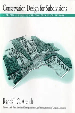
How This Handbook Can Help You
This handbook has been written and illustrated to make it relatively easy for readers to learn the basic steps involved in designing residential developments that maximize open space conservation without reducing overall building density.
In addition to working within the existing legal densities allowed under current zoning, this technique allows the land protected in new conservation subdivisions to remain under private ownership and control—preferably in an undivided manner and according to certain management standards—typically by a homeowners’ association or a local land trust.2
This handbook also shows how communities can use this technique, through state-of-the-art zoning and subdivision standards, to create an interconnected network of permanent open space using the conservation subdivision as the basic building block.
In addition to those designated wetlands, floodplains, and steep slopes that are often already regulated under federal, state, or local law, the types of open space that can easily be protected through the simple design approaches illustrated in this handbook include upland woodlands, meadows, and fields, plus historic, cultural, or scenic features of local or greater significance.
Readers might wonder why they should bother learning how to design subdivision sites for both conservation and development, when more commonly practiced approaches seem to work adequately. Here are several reasons:
(1)Simply put, conventional approaches to subdivision development ultimately produce nothing more than houselots and streets. This process eventually “checkerboards” rural areas into a seamless blanket of “wall-to-wall subdivisions” with no open space, except for perhaps a few remnant areas that are too wet, steep, or floodprone to build on. Whether one is a landowner, developer, realtor, planner, engineer, surveyor, landscape architect, or local official, few people can take a great deal of professional pride in helping to create just another conventional subdivision, converting every acre of natural land within a site to lawns, driveways, and streets.
(2) Alternative methods of designing for the same overall density while also preserving 50% or more of the site are not difficult to master, and they create more attractive and pleasing living environments that sell more easily and appreciate faster than conventional “houselot-and-street” developments (see Appendix E, “Economic Benefits of Open Space upon Real Estate”). This is particularly true for three large and growing sectors of the housing market—young households, single-parent families, and “empty-nesters.”
(3) The significant land protection achievable through “conservation subdivision design” should help smooth the local review and approval process by responding to many environmental concerns even before they are raised by officials or by members of the public interested in preserving wildlife habitat and protecting water quality in neighborhood streams, ponds, and aquifers.
(4) Conservation subdivisions are simply better places to live. When well designed, the majority of lots abut or face onto a variety of open spaces, from formal “greens” or “commons” to wildflower meadows,3 farm fields, mature woodlands, tidal or freshwater wetlands, and/or active recreational facilities. At present, only golf course developments offer comparable amounts of open space, but those green areas are managed for only one kind of activity, and they typically convert all previously natural areas (except wetlands and steep slopes) into intensively managed lawns that are off limits to everyone but golfers and that are uninviting to most forms of wildlife (except the more tolerant animals, such as geese).
One measure of the demand for open space among homebuyers is the fact that nearly 40 % of people living in golf course developments do not even play the game. One successful Florida golf course developer near Tampa has found that many non-golfers are attracted to those of his lots that back onto wetland areas, offering views of egrets and herons and of tree boughs laden with Spanish moss. In fact, in some of the new golf course developments in the Mid-Atlantic region, four out of five sales are to non-golfers. According to published reports, these people are buying “the parklike views of open space, views that can command a premium in a home’s initial sale price and its resale value” (see Appendix G for a feature article on this subject from the The Philadelphia Inquirer, September 26, 1993).
This handbook will show how virtually anyone can adapt—and improve upon—the basic technique used for decades by the designers of golf course communities. Briefly stated, that technique is to outline the open space first and to let its size and location become the central organizing element driving the rest of the design. The next three steps are to locate the houses around the open space, to trace in access street alignments, and finally to set the lot lines (where applicable).
It is almost as simple as it sounds. Naturally, a number of resource base maps are required (typically pertaining to soils, slopes, wetlands, floodplains, existing vegetation, wildlife habitats, and historic resources), and several elemental principles relating to physical layout and neighborhood design should be observed. These are illustrated and described in later chapters.
Of course, this publication does not reduce the need to engage a team of professionals (including a landscape architect or physical planner, in addition to a surveyor and engineer). It can, however, make everyone’s role clearer by articulating a “greener vision” for residential developments of nearly every size, shape, and variety. An added benefit stems from the fact that these design principles are applicable regardless of house type or sales price, meaning that they can be as easily used to provide starter homes for young people and other households with moderate incomes as they can for middle-aged folks and retirees with more ample means.
![]()
2
Conventional Layouts versus “Conservation Designs”: Comparisons and Contrasts
CONVENTIONAL RESIDENTIAL DEVELOPMENTS
As used in this handbook, the term “conventionally designed subdivision” refers to residential developments where all the land is divided into houselots and streets, with the only open space typically being undevelopable wetlands, steep slopes, floodplains, and stormwater management areas.
In these types of developments there are no nice places to walk, such as a central green or a wooded grove, or a riverbank or lakeshore, because all the land has been cut up and parcelled out to individual lot owners. There are no open meadows for wildlife, or playing fields for children (of any age). Because there are no community areas in which to take an evening stroll, to throw a frisbee, or have a game of catch, there are often no sidewalks, nor any informal trails. All the land has been paved over, built upon, or converted into lawns or backyards. Except for wetlands and steep slopes, all the natural areas have been cleared, graded, and planted with grass and nonnative shrubs and trees, which offer little to any remaining wildlife. In addition to there being fewer species of plants and animals, there is typically little community life, for the public realm has been reduced to an asphalt street sys-5 tem, and even that lacks much visual appeal because in most cases no one has thought to plant shade trees at regular intervals on each side. Without any parks, commons, or community woodlands, there are no informal places where neighbors can easily meet, engage in casual conversation, and gradually become better acquainted with each other. As a result, residents of conventional subdivisions miss a lot of social opportunities, and they depend on their cars even more to bring them into contact with other people.
Although no one ever sets out consciously to create these deficiencies, they have come about because minimal thought has been given to the results produced by basic development design standards contained in local ordinances which ask little, if anything, with respect to conserving open space or providing neighborhood amenities. Consequently, in the vast majority of cases, little or nothing is offered along these lines, and the deficiencies are repeated time and again until, at some point, people begin to notice that they are living amidst a lot of lawns and asphalt and realize that there must be more to life than just houselots and streets.
About thirty years ago, professional planners around the country touted the idea of “planned residential developments” (PRDs) as an improved alternative to conventional subdivisions. In PRDs, greater design flexibility is permitted by reducing standards for lot width and area, but the absence of any comprehensive standards for the quantity, quality, and configuration of open space allowed many uninspired designs to be proposed and approved. In many PRDs minimal land is set aside as open space, and this land typically consists of unbuildable areas, stormwater basins, and relatively narrow and unusable strips of grass between parking lots, with an occasional tennis court sometimes thrown in, perhaps as an afterthought.
The most notable exceptions to this pattern have been the “golf course PRDs,” where it is not unusual to find more than half the dry and otherwise buildable land now hosting fairways, sand traps, and putting greens. This specialized form of PRD offers a lot more than the opportunity to live near a golf course: to the creative observer it offers a general approach to development design that can transform ordinary PRDs and conventional subdivisions into “open space communities.” Fortunately, the basic steps involved in designing golf course developments can be applied to almost any residential development situation, regardless of scale, location, housing type, or market value.
CONSERVATION SUBDIVISION DESIGN
In its purest form, the term “conservation subdivision design” refers to residential developments where, as in golf course communities, half or more of the buildable land area is designated as undivided, permanent open space. This result is typically achieved in a density-neutral manner4 by designing residential neighborhoods more compactly, with smaller lots for narrower single-family homes, as are found in traditional villages and small towns throughout the United States. Alternatively, the objectives can be accomplished with semi-detached or attached dwellings or by combining these two approaches. (When market conditions are such that full economic return can be realized with fewer but more expensive homes, that method can also be used to preserve open space, although the smaller number of potential buyers for such upscale properties limits the applicability of that technique.)
Not surprisingly, the most important step in designing a “conservation subdivision” is to identify the land that is to be preserved. This should always be the first major design step that is taken, just as in golf course developments, where the course itself is the first and foremost element to be planned. This process is described in detail in Chapter 5, but basically open space identification involves delineating both “Primary Conservation Areas” (such as unbuildable wetlands, waterbodies, floodplains, and steep slopes), and “Secondary Conservation Areas” (including mature woodlands, upland buffers around wetlands and waterbodies, prime farmland, natural meadows, critical wildlife habitat, and sites of historic, cultural, or archaeological significance).
After deducting unbuildable “Primary Conservation Areas” (PCAs) from the total parcel acreage, calculations are made to determine the number of dwellings allowed by zoning on the remaining parts of the site (including the “Secondary Conservation Areas,” or SCAs).5 That number of units is then located around—but not within—those Secondary Conservation Areas. The result is a density-neutral subdivision with significant upland open space that would normally be developed. In conservation subdivisions, up to half of the dry, buildable land maybe used for houselots and streets, and the other half must remain as undivided open space. Of this open space, at least half should be retained as woodlands, meadows, or farm fields, while the balance may be converted to more formal, intensively managed open spaces, such as grassy commons and active recreation facilities (including ballfields, tennis courts, and fairways). In other words, looking at all the buildable land on a site, at least one-quarter must remain as relatively undisturbed open space, one-quarter may be modified for active recreational purposes, and up to one-half may be developed (at twice the normal density, to preserve the owner’s equity).
Because 18-hole golf courses typically consume more than a quarter of a site’s developable area, and generally leave much less than a quarter of the buildable land in a relatively undisturbed state, developments featuring them are usually not considered to reflect “conservation design,” where one of the primary objectives is the protection of natural areas. They are, instead, specialized forms of recreational developments, and they of course play an important role in meeting one kind of recreational need.
To the extent that many people who move into golf course communities have little or no interest in that game but are instead very interested in enjoying open space convenient to their homes, promoters of such facilities would be well advised to broaden the appeal of their developments by conserving more natural areas on their sites, such as woodland habitat and riverbanks where forest trails and waterside greenways would provide appealing opportunities for passive recreation and wildlife corridors.
It is not the purpose of this handbook to discourage further golf course developments, but rather to suggest ways in which these and other residential development forms could be significantly improved. It is obvious that there must be some limit to the number of new golf course developments that can be created before the total demand for this kind of community is satiated. Taking the best qualities of this development form, and leaving the rest behind, the following general recommendation may be stated: Let us build many more “golf course developments,” but for the most part without the golf courses themselves—substituting community greens for putting greens, and greenways for fairways.
This conservation-minded approach offers a unique opportunity to developers of parcels that are too small to accommodate golf courses (under 350 or 400 acres), giving them an easy way to provide significant open space amenities attractive to many potential homebuyers. In many developing communities it is no longer possible for developers to acquire 350 contiguous acres of buildable land. For them, the conservation subdivision approach offers a highly attractive alternative to conventional layouts, as golf course developments are not even an option in those areas.
RELATIONSHIP WITH THE “NEW URBANISM” AND REGIONAL PLANNING
The ideas in this handbook essentially complement, rather than compete with, the more formal design approach typically seen in “neo-traditional” neighborhoods (also called the “New Urbanism”). Although both approaches involve more compact lot sizes, the conservation subdivision has as its central principle the preservation of natural lands as building blocks in community-wide open space networks. As such, it is an appropriate development approach in less developed areas on the metropolitan fringe. It is es...