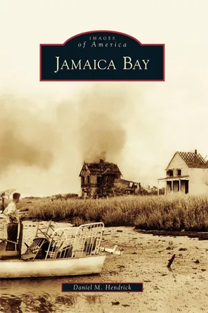
For more than two centuries after the Dutch settled its meandering shores, Jamaica Bay was little more than a watery expanse broken by small islands and a handful of mills. Rapid growth after the Civil War transformed the bay into a microcosm of a developing nation, as meadows gave way to houses and factories, and giant steamers and locomotives appeared. Plans to create the world's largest deepwater port here were never realized, yet Jamaica Bay did emerge as a hub for aviation; the first successful transatlantic flight departed over the bayfollowed by millions of flights that have taken off from John F. Kennedy International Airport ever since. Through historic photographs, Jamaica Bay illustrates the bay's transformation into a shellfishing haven, a recreational playground with hotels and casinos, and now the focus of a longterm environmental rehabilitation.
- 128 pages
- English
- ePUB (mobile friendly)
- Available on iOS & Android
eBook - ePub
Jamaica Bay
About this book
Trusted by 375,005 students
Access to over 1.5 million titles for a fair monthly price.
Study more efficiently using our study tools.
Information
Two
INDUSTRIALIZATION AND PLAYGROUND
The European settlers who displaced the Canarsie and Rockaway tribes from Jamaica Bay’s shores would have had little trouble recognizing it more than two centuries later. There was as a larger population, to be sure, but farming was still the main occupation, no bridges yet spanned the bay, and the islands and meadows remained where they had been for years.
Rapid modernization and industrialization in the mid-19th century changed that. Fish-oil and fertilizer factories appeared on Barren Island, initiating the bay’s role as a place for disposing of the unwanted. A commercial fishing industry opened for business, with Canarsie as its hub. Stables disappeared from Mill Island, replaced by landfill to extend Flatbush Avenue. Developers eyed Jamaica Bay’s northern and eastern shores for housing.
Railroads ushered in the most sweeping changes. The Brooklyn and Rockaway Beach Railroad fueled the growth of Canarsie, and to a lesser extent Bergen Beach, into resorts. Ferry service connected the two ports with the Rockaway Peninsula to meet vacationers’ increasing demand. A trestle later spanned the bay from Remsen’s Landing to Hammels. Stops along the way became destinations in their own right, with hotels, fishing clubs, and cottages clinging to the grassy hummocks.
In many ways, the years between the Civil War and World War I on Jamaica Bay were golden. Before the pressures of a burgeoning population had set in, the best weakfish on the East Coast could be had just moments away from nightclubs and casinos.


With the exception of Barren Island, Bergen Island, and Canarsie, Dripps’s 1852 map shows no property owners directly on the bay. The white areas in Flatlands denote farms, while the patch in “Jamaica South,” at the top of the map, is unowned salt meadow mowed to feed livestock. The thick marshes were largely responsible for keeping development at bay for so long. (Courtesy Queens Historical Society.)

James Remsen’s Seaside Hotel emerged as one of the best-known accommodations on the Rockaway Peninsula in the late 1850s. The three-story hotel had room for 300 guests with a restaurant on the main pier. It was destroyed in a fire on September 13, 1892, exactly one week before a much larger fire would engulf the entire neighborhood. (Courtesy W. W. Munsell and Company.)

Shellfish harvesting in Jamaica Bay began to take on a commercial character in the 1860s, after the planting of seed oysters became a common practice. Oysters were harvested from September until December, with many sold in Manhattan markets, like this one seen in 1870. (Courtesy Library of Congress.)

The smokestacks at rear were the hallmarks of Barren Island, where as many as 26 companies operated between 1859 and 1934. At its height, the island’s population numbered 1,500, enough to sustain a church and school. The main products were fertilizers from dead horses, and fish oil, which was used to mix paints and tan leather. (Courtesy Queens Borough Public Library, Long Island Division, Illustrations Collection.)

Barren Island’s topography contributed to its early development. At low tide, men and livestock could reach it from the mainland, while larger vessels could approach the south side. This 1877 map records the location of several structures, including the r...
Table of contents
- Title Page
- Copyright Page
- Table of Contents
- ACKNOWLEDGMENTS
- INTRODUCTION
- One - BEGINNINGS
- Two - INDUSTRIALIZATION AND PLAYGROUND
- Three - THE GREATEST PORT THAT NEVER WAS
- Four - ROBERT MOSES AND TRANSFORMATION
- Five - AVIATION
- Six - LIFE ON JAMAICA BAY
- Seven - ENVIRONMENTAL RECKONING
Frequently asked questions
Yes, you can cancel anytime from the Subscription tab in your account settings on the Perlego website. Your subscription will stay active until the end of your current billing period. Learn how to cancel your subscription
No, books cannot be downloaded as external files, such as PDFs, for use outside of Perlego. However, you can download books within the Perlego app for offline reading on mobile or tablet. Learn how to download books offline
Perlego offers two plans: Essential and Complete
- Essential is ideal for learners and professionals who enjoy exploring a wide range of subjects. Access the Essential Library with 800,000+ trusted titles and best-sellers across business, personal growth, and the humanities. Includes unlimited reading time and Standard Read Aloud voice.
- Complete: Perfect for advanced learners and researchers needing full, unrestricted access. Unlock 1.5M+ books across hundreds of subjects, including academic and specialized titles. The Complete Plan also includes advanced features like Premium Read Aloud and Research Assistant.
We are an online textbook subscription service, where you can get access to an entire online library for less than the price of a single book per month. With over 1.5 million books across 990+ topics, we’ve got you covered! Learn about our mission
Look out for the read-aloud symbol on your next book to see if you can listen to it. The read-aloud tool reads text aloud for you, highlighting the text as it is being read. You can pause it, speed it up and slow it down. Learn more about Read Aloud
Yes! You can use the Perlego app on both iOS and Android devices to read anytime, anywhere — even offline. Perfect for commutes or when you’re on the go.
Please note we cannot support devices running on iOS 13 and Android 7 or earlier. Learn more about using the app
Please note we cannot support devices running on iOS 13 and Android 7 or earlier. Learn more about using the app
Yes, you can access Jamaica Bay by Daniel M. Hendrick in PDF and/or ePUB format, as well as other popular books in History & North American History. We have over 1.5 million books available in our catalogue for you to explore.