Lincolnshire is a largely rural county, which was reflected in the early history of the railway lines. The main lines mostly passed through on their way to somewhere else and the local traffic was handled by a large number of branch lines. Author Alan Stennett explores the history of the railways in Lincolnshire, starting with the very early days when it was expected that Lincoln would be on a main line to the north, only to lose out to what we now know as the East Coast Main Line. Using archive maps, original photographs and other sources, he traces the development of railways in the county, and their role in serving the great fishing port of Grimsby, 'bracing' East Coast resorts such as Cleethorpes and Skegness, the iron and steel industries of Scunthorpe and the agricultural heartland of the Fens. The network saw many early closures before being savaged by the Beeching cuts, but the story continues to the present day, where new developments offer renewed hope for what is left of the system. This guide to the history and development of the railways in Lincolnshire will be of great interest to local history and railway enthusiasts. Illustrated with 210 colour and b&w original photographs.
- 160 pages
- English
- ePUB (mobile friendly)
- Available on iOS & Android
eBook - ePub
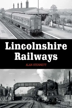
Lincolnshire Railways
About this book
Trusted by 375,005 students
Access to over 1.5 million titles for a fair monthly price.
Study more efficiently using our study tools.
Information
Subtopic
Transporte ferroviarioCHAPTER 1
Lincolnshire Before the Railways
A Difficult County for Travellers

General topography of Lincolnshire.
Communications in Lincolnshire before the railways was a matter of ancient routes and even older waterways. Our main highways still follow the roads that the Romans built two millennia ago, and a county where much of the land was frequently inundated found water transport an invaluable and sometimes essential way to get around.
This historic county has always presented difficulties to the traveller. The large areas of the Fens in the south-east, the Carrs of the Isle of Axholme at the opposite corner, and the marshes along much of the coast were constantly changing areas of mud, water and soggy bits of land, with few easily discernible ways through them. Most land routes, therefore, followed the limestone spine of the Heath and Cliff or the higher lands of the chalk Wolds in the north-east.
The influence of the Romans is very clear. The major north–south route within the county follows parts of Ermine Street, King Street and Mareham Lane from near Peterborough, through Sleaford and Lincoln, to the Humber close to Winteringham. The A46, still the main access to Lincoln from the west, follows the line of the Fosse Way as it strikes diagonally from Newark through Lincoln towards the north-eastern coast. From Lincoln to the coast, the road curves around the northern edge of the Fens to the Roman Banovallum – Horncastle – then on towards Wainfleet and what may well have been a Roman port, now lost to the sea, near Skegness. Other key routes include Tillbridge Lane, from just north of Lincoln to what was a ford over the Trent at Marton; more of Ermine Street through Ancaster towards Stamford; and the Salt or Salters Way – now the A52 – from near Grantham across the Bridge End Causeway to Donington, then towards the salt workings on the coast or in the marshes. It may also have served a port in Bicker Haven, then open to the sea.

Roman and other old routes in Lincolnshire.
Many other Roman roads and tracks have been identified, but it is likely that a number of them followed existing Iron Age or earlier track-ways. The Salt Way was almost certainly pre-Roman, and although the arrow-straight line of Ermine Street suggests that it was new in Roman times, it closely follows the older Jurassic Way cliff-edge paths of Middle Street and Pottergate. Caistor High Street, running north from Horncastle to Caistor, is almost certainly pre-Roman, as are the Bluestones Heath Road and Bartongate, along the edge of the Marsh. Mareham Lane could also have been in use before the Roman occupation.
Where the Iron Age salt merchants and the Roman legions failed to penetrate on land, they, and the locals, took to the water. The Witham itself, running north from near Grantham before turning through the Lincoln Gap then south to the Wash, with its tributaries the Slea, the Bain and the Brant, would have been the main water ‘highway’ into, and around, the county; but the other fenland rivers – Welland, Glen and Nene – remained important routes well into modern times. In the north, the Ancholme, the Trent and the Idle were all significant waterways, but a great deal of water traffic would simply have been along the creeks and lagoons of the Fens and marshes. Lincoln’s museum, the Collection, has a fine log boat found in the muds of the Witham, along with records of many similar vessels, and archaeological finds such as the Witham Shield, now in the British Museum, suggest that the waterways of the county had a strong religious significance, as well as facilitating travel in the county.
The Romans also made good use of the waterways, constructing the Foss Dyke linking the Witham at Lincoln and the Trent near Torksey. They are also the most probable diggers of the long cut known as the Carr Dyke, running along the fen edge from near Peterborough to Lincoln. It seems likely this was mainly a catch-water drain, taking water coming off the higher land to prevent it flooding into the Fens, which appear to have been drier in Roman times. It may have been used for transport, but the evidence is scanty. Excavations in Lincoln show it was an important centre for waterborne transport. Bawtry, on the Idle, was also a Roman port; Spalding and Bourne may well have been, and there seems little doubt that they made good use of the fenland waterways as well.
Doing as the Romans Did
All these options meant that Lincolnshire in about the third or fourth century ad had a reasonably comprehensive network of communications covering much of the county. Unfortunately, that was about where it stopped for the next few hundred years. The old roads remained, although opportunistic locals mined the Roman surfaces for their stone, but very little changed. New fenland routes linked growing settlements on the low ridges of dry land between the marsh and the fen from Spalding through Holbeach to Long Sutton and along the silt ridge from Boston towards Wainfleet. The influence of the landscape is clear from those roads and the path of what is now the A16, running due south from Spilsby to Boston through the ‘islands’ of Stickney and Sibsey. It follows the line of a glacial moraine, a low ridge of clay and stones marking the furthest limit of the last Ice Age in the area.
Through medieval times the pack-horse and the ox-drawn wagon would have been the main means of land transport in the county. It would probably be fair to say that very few people travelled any distance in what became a region of small market towns, spaced out according to how far it was practical to drive livestock and return within a day.
The rivers remained important, although the lack of central authority saw the Foss Dyke fall into disrepair, the Witham was often unnavigable for long periods and the fenland rivers frequently silted up. Lincoln and Stamford remained as important regional centres, and Boston became a major port, with a hinterland largely served by water transport. It developed an important role in trading wool to the Continent, often produced by the great monastic houses to be found all over Lincolnshire. Other smaller ports along the county’s coast thrived in medieval times on trades of fish, salt, peat and other goods, along the English coasts and to the near Continent.

A peat bog on the Isle of Axholme. Much of Lincolnshire would have been similar to this before large-scale drainage. LINCOLNSHIRE WILDLIFE TRUST
The reclamation of the Fens, the Isle of Axholme and the Ancholme Carrs in the seventeenth and eighteenth centuries improved communications there, since many of the new drains were navigable, allowing the transport of goods and people. Agricultural produce was the main traffic, but the rising populations of the Fens in particular saw a demand for packet boats into Boston, as well as market boats – in effect mobile water-borne shops. That traffic continued well into the twentieth century, supplemented in many areas by small-scale producers of commodities like milk, butter and eggs, taking them to the market towns by boat.
Rivers and Canals
The drainage work had the incidental benefit of improving the major rivers for navigation, with the Witham Navigation completed by 1770 and work carried out to improve through passage to the Foss Dyke a few years later. The Trent, the Glen, the Ancholme, the Bourne Eau and the Welland also saw increased use following improvement works.
Canal mania came early to Lincolnshire – the Louth Canal was planned in the 1750s, although it did not reach the town until 1770. The Sleaford Navigation and the Horncastle Canals were opened later in that century, although both were effectively canalized rivers that had been used by boats in the past. The Grantham Canal was a more serious engineering proposition, needing to cut through a ridge between the town and the Trent Valley before dropping steeply down a flight of locks to join the river itself near Nottingham. The Caistor Canal also required significant engineering works, with six locks in its 4-mile (6km) length, which probably accounted for it never reaching its intended terminus on Navigation Lane at Caistor, but petering out at Moortown, 3 miles (4km) away.
Despite that relative failure, the planned role of the canal, as laid out in the following quote from the prospectus, gave a good indication of the thinking behind all of Lincolnshire’s waterway projects, and that of most of the railways that followed.
By this canal, and the Ancholme Navigation, the surplus agricultural produce of the north of Lincolnshire is exported; and coal, agricultural lime, and general merchandise is the return to Caistor and its neighbourhood.

Turnpike roads and navigable waterways by the early 1800s.
At roughly the same time that the waterways were being upgraded, the same was happening on the roads. The old system of repair under which every local inhabitant was required to spend four days a year working on the roads, providing his own tools and transport, was never going to result in satisfactory surfaces. A partial solution was the introduction of Turnpike Trusts, with repairs paid for by tolls charged to users. Lincolnshire joined the turnpike revolution in 1726, when part of the Great North Road near Grantham was taken, followed a few years later by a further stretch south towards Stamford. Most Lincolnshire turnpikes, however, were established in the second half of the century. Toll bridges were an important part of the process, with Dunham Bridge opened in 1756 over the Trent on the road from Lincoln into Nottinghamshire, followed in 1791 by Gainsborough, also over the Trent, and Tattershall, over the Witham, in 1795. Two other bridges, Fosdyke and Cross Keys, over the Welland and Nene, respectively, were available to travellers by the early years of the next century.
Faster by Road
The new roads not only allowed goods to move more freely, they also permitted speedier travel, with stagecoaches running from Lincoln to London in 1784 and extended to the Humber a few years later. By 1820, a network of coaches covered much of the county, bringing with them some of the best-known inns and hotels to be found in the county.
As the railway age dawned elsewhere in Britain, it could reasonably be claimed that Lincolnshire’s communications were very nearly back to being as good as they had been during Roman times, and looked very similar. The system in the Fens was better, and a route across the north of the county, from Gainsborough to Louth by way of Caenby Corner and Market Rasen, was in regular use. Lincoln, Stamford, Grantham, Boston, Spalding, Brigg, Barton-upon-Humber and Gainsborough were well-established centres. Louth had become a more important communication centre, and Grimsby was growing rapidly after action had been taken to clear the Haven and to build new dock facilities.
The Agricultural Revolution had transformed the county’s main industry, as draining and enclosures made more land available, and better farming systems saw lower-quality pastures put under the plough for the first time. The need for improved agricultural implements to work that land also drove the Industrial Revolution in the county as small-scale blacksmiths, wheelwrights, tool-makers and foundries diversified into manufacturing what was needed. Wheelwright John Cooke built ploughs in Lincoln; foundryman William Howden of Boston constructed the county’s first portable steam engine; millwright James Hart built threshing machines at Brigg; and blacksmith’s apprentice Richard Hornsby made an adjustable harrow in his employer’s forge near Grantham.
All of these entrepreneurs, and the farming industry that they served, were in need of efficient, reliable transport to bring in raw materials and to take away produce and manufactured items. The county was ready for the railways.
CHAPTER 2
Dreams, Schemes and Competition
Mind the Gap?
Lincolnshire itself was not an obvious early target for railway promoters. The large area and widely distributed populations offered few opportunities to link population centres with passenger services or to develop a substantial flow of goods. The first line that we would now recognize as a railway opened between Stockton and Darlington in 1825, but no trains would run in Lincolnshire for another twenty years. However, one geographical feature in the county did attract a great deal of attention from early promoters, planners and surveyors: the Lincoln Gap, a break in the limestone ridge running north and south through the county, offered a level route for lines from London to the north, and compared favourably with the existing lines by way of Derby and Rugby. As far back as 1821 it had been suggested that the proposed London and Cambridge Railway should be extended to Lincoln and later to York. The proposed route had been surveyed by John and George Rennie in 1827, with trains crossing the Fens on the level, turning west through the Gap, then north up the Trent Valley to Yorkshire.
All but one of the proposals coming from the south made use of the Lincoln Gap, but many alternative ways to it were suggested. The two main options were lines coming over the Fens from the direction of Cambridge, and those, usually by way of Peterborough, that linked to existing lines there and offered the possibility of a faster, more direct, passage to the capital.
Before anyone could start to build a new line, a lengthy process of preparation and parliamentary scrutiny had to be gone through. A company would first be set up to raise enough money to survey the proposed route and assess its commercial pr...
Table of contents
- Cover Page
- Title Page
- Copyright Page
- Contents
- Introduction and Acknowledgements
- Chapter 1 Lincolnshire Before the Railways
- Chapter 2 Dreams, Schemes and Competition
- Chapter 3 The Builders Arrive
- Chapter 4 Filling the Gaps
- Chapter 5 The Eastern Comeback
- Chapter 6 Ships, Steel and the Seaside
- Chapter 7 Living with the Lines
- Chapter 8 Lincolnshire and the LNER
- Chapter 9 Optimism and Modernization
- Chapter 10 Fading Twilight or a New Dawn?
- Appendix: Railway Abbreviations
- Bibliography
- Index
Frequently asked questions
Yes, you can cancel anytime from the Subscription tab in your account settings on the Perlego website. Your subscription will stay active until the end of your current billing period. Learn how to cancel your subscription
No, books cannot be downloaded as external files, such as PDFs, for use outside of Perlego. However, you can download books within the Perlego app for offline reading on mobile or tablet. Learn how to download books offline
Perlego offers two plans: Essential and Complete
- Essential is ideal for learners and professionals who enjoy exploring a wide range of subjects. Access the Essential Library with 800,000+ trusted titles and best-sellers across business, personal growth, and the humanities. Includes unlimited reading time and Standard Read Aloud voice.
- Complete: Perfect for advanced learners and researchers needing full, unrestricted access. Unlock 1.5M+ books across hundreds of subjects, including academic and specialized titles. The Complete Plan also includes advanced features like Premium Read Aloud and Research Assistant.
We are an online textbook subscription service, where you can get access to an entire online library for less than the price of a single book per month. With over 1.5 million books across 990+ topics, we’ve got you covered! Learn about our mission
Look out for the read-aloud symbol on your next book to see if you can listen to it. The read-aloud tool reads text aloud for you, highlighting the text as it is being read. You can pause it, speed it up and slow it down. Learn more about Read Aloud
Yes! You can use the Perlego app on both iOS and Android devices to read anytime, anywhere — even offline. Perfect for commutes or when you’re on the go.
Please note we cannot support devices running on iOS 13 and Android 7 or earlier. Learn more about using the app
Please note we cannot support devices running on iOS 13 and Android 7 or earlier. Learn more about using the app
Yes, you can access Lincolnshire Railways by Alan Stennett in PDF and/or ePUB format, as well as other popular books in Tecnología e ingeniería & Transporte ferroviario. We have over 1.5 million books available in our catalogue for you to explore.