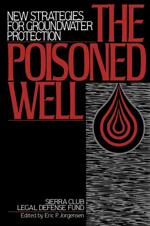
The Poisoned Well offers vital strategies for citizens, community organizations, and public officials who want to fight the battle against pollutants.
eBook - ePub
The Poisoned Well
New Strategies For Groundwater Protection
- English
- ePUB (mobile friendly)
- Available on iOS & Android
eBook - ePub
About this book
Information
PART I
GROUNDWATER AND CONTAMINATION
This part of The Poisoned Well provides the background information a citizen needs to implement the specific suggestions for action discussed in later chapters of the manual. This part begins with a brief introduction to groundwater—what it is and how it moves. Chapter 2 then explains how contaminants found in groundwater can affect your health, how those effects are measured, and how legal limits on contamination are established. Chapter 3 summarizes basic information about all of the major sources of groundwater contamination—what they are, what contaminants they produce, and how big a problem they create.
This part concludes with two chapters that will help citizens gather more basic information about the problem in their area. Chapter 4 explains how groundwater is monitored and tested, including how citizens can test their own water. Chapter 5 discusses techniques that can identify problem areas through the use of maps of groundwater and contamination sources.
Becoming an activist for groundwater protection means starting a continuing process of learning. The information contained in Part I will give the reader a solid foundation from which to begin taking concrete steps to preserve groundwater quality.
CHAPTER 1
Groundwater Basics
HYDROLOGIC CYCLE
WATER IS ALWAYS on the move. The sun evaporates it from oceans, lakes, ponds, streams, and the leaves of plants. It falls to earth as rain, snow, sleet, and hail. Gravity pulls it down to rivers and into the ground. Hydrologists call the total system the hydrologic cycle. (See Figure 1.1.) Groundwater is one of the less visible components of the cycle, but the global volume of groundwater is second only to the oceans and polar ice caps, and of all available fresh water in the United States, 96 percent is groundwater.
Groundwater is basically precipitation that has percolated down into soil and filled the spaces in the rock below in the same way that water fills a sponge. The first water entering soil from rainfall or snowmelt replaces water previously evaporated or used by plants during dryer periods. Some of this new water quickly repeats the hydrologic cycle: it evaporates, is taken up and transpired by plants, or runs off into streams. (See Figure 1.2.) Any remaining precipitation, or water that leaches from surface water bodies into the soil, travels through an upper portion of soil and rock that hydrologists call the unsaturated zone. While the degree of saturation varies with the amount of precipitation, the unsaturated zone is generally characterized as containing water and air in the smaller pores or spaces of rocks and soil. Any water in this area that is not left clinging to soil due to molecular attraction will drain from the unsaturated zone down to the water table. The water table is a seasonally fluctuating boundary between the unsaturated zone and the saturated zone. In the saturated zone the pores and cracks in rocks and soils are filled only with water.
AQUIFERS
Underground saturated rock formations that yield usable water are called aquifers. The minimum water content necessary to qualify a rock formation as an aquifer is a relative concept depending on the availability of other water sources in the region; what is one person’s rock may be another person’s aquifer. A geologic formation’s ability to yield water to wells is dependent on its porosity combined with its permeability. Porosity refers to the pores (spaces or cracks) in rocks, or the percentage of the rock’s volume that is not occupied by the rock itself. The quantity of water that any type of rock can contain depends on the rock’s porosity. Permeability refers to the degree to which underground pores are interconnected with each other, that is, the degree to which water can flow freely from one pore to another. The importance of permeability is illustrated by the substance clay, which, though it can have the same porosity as coarse gravel, will not be as good an aquifer as the gravel due to the clay’s lack of permeability.
FIGURE 1.1
DIAGRAM OF THE HYDROLOGIC CYCLE

FIGURE 1.2
HOW GROUNDWATER OCCURS IN ROCKS

SOURCE: USGS, Groundwater, 1981.
Varying layers of permeable and impermeable materials in the earth create different types of aquifers. The most familiar type is the unconsolidated aquifer, in which water is contained in the spongelike pore spaces of sand and gravel (this is known as “primary porosity”). All unconsolidated aquifers are underlain by a layer of impermeable material—called an aquitard—that prevents the water from flowing further down into the earth. One subcategory of unconsolidated aquifer, called an unconfined or surficial aquifer, has an aquitard below but none above. Thus, water is free to percolate into the aquifer from the earth’s surface and the unsaturated zone.
The other subcategory of unconsolidated aquifer, called a confined or artesian aquifer, has aquitards below and above. The upper aquitard severely limits water from entering the aquifer from directly above; instead, water enters laterally by sideways motion through the aquifer. Because it is sandwiched between two layers of impermeable material, this kind of aquifer may be under great pressure, and may spurt substantially above the earth’s surface when tapped by a well.
In some areas unconsolidated aquifers occur stacked in layers, with an unconfined aquifer on top and one or more confined aquifers beneath it, as illustrated in Figure 1.3.
The second major category of aquifer is the bedrock or consolidated aquifer, which occurs in areas of nonporous rock that lacks the capacity to absorb water. In such an aquifer, water is not found in pore spaces, but rather in fractures or holes in the rock (this is known as “secondary porosity”).
FIGURE 1.3
DIAGRAM OF GEOLOGIC STRATA AND VARIOUS TYPES OF WELLS

One example of a consolidated aquifer is a hard crystalline bedrock where the water resides in fractures or cracks. The well yield in such an aquifer will depend on the size and frequency of the water-bearing fractures intersected by the well.
Another example of a consolidated aquifer is karst limestone, which occurs in areas of soft limestone rock. As a result of millions of years of erosion caused by underground water flow, karst limestone formations have been cut through with a Swiss cheese network of fissures and holes, which, in some cases, are large enough to form underground caverns and caves.
GROUNDWATER AND CONTAMINANT MOVEMENT
Recharge and Discharge Areas
Any area of land allowing water to pass through it and into an aquifer is called a recharge area. Water moves from the recharge area through the aquifer and out to the discharge area. Discharge areas can be wells, lakes, springs, geysers, rivers, or oceans. The uniting of groundwater and surface water in recharge and discharge areas is extremely important. (See Figure 1.4.) Recharge areas are the conduits between surface contamination and groundwater supplies. (The reverse is also true. The discharge of contaminated groundwater may affect the more than 30 percent of our nation’s streamflow that comes from groundwater.)
In an unconfined or surficial aquifer, the recharge area is generally located immediately above and adjacent to the point at which drinking water wells have been drilled, so that pollution occurring near the wellhead can have a devastating effect on groundwater quality. By contrast, a confined or artesian aquifer is protected by an overlying aquitard and thus may be less vulnerable to pollution entering the ground near the wellhead. The recharge areas for such an aquifer can be located at substantial distances from the wellhead, making water quality vulnerable to the effects of faraway land uses. Recharge areas for bedrock and karst limestone aquifers can be located either near to or far from the wellhead, or both.
FIGURE 1.4
IDEALIZED PATTERN OF GROUNDWATER FLOW FROM RECHARGE TO DISCHARGE AREAS

SOURCE: USGS, Hydrology of Stratified-Drift Aquifers and Water Quality in the Nashua Regional Planning Commission Area, South-Central New Hampshire, 1987.
FIGURE 1.5
PLUME FORMATION OF GROUNDWATER CONTAMINANTS

Direction of Flow
The direction of flow from areas of recharge to areas of discharge is dependent on gravity, pressure, and friction. Generally, groundwater moves in response to a hydraulic gradient from points of high elevation and pressure to points of lower elevation and pressure. The high and low elevations must be taken into account over large areas of land, because groundwater flow does not correspond precisely with surface topography. The points of higher elevation usually serve as watershed boundaries, called drainage divides. Watersheds, also called drainage basins, are those areas of land which drain runoff water to surface water bodies. Aquifers are often found beneath the surface of drainage basins; the high elevations serving as watershed boundaries may also be aquifer boundaries.
If a pollution source contaminates groundwater, it most often affects only that portion of the aquifer downgradient of the site, that is the lower elevations and lower pressure areas, rather than that portion of the aquifer upgradient of the site. Tracking contaminant movement is not, however, always as simple as determining an upgradient-downgradient direction. Even in unconsolidated aquifers, where movement is most predictable, water can be diverted from its normal downgradient course by a deposit of impermeable material that obstructs flow. In bedrock or karst limestone aquifers, unpredictable flow patterns are the rule rather than the exception, and water will go wherever the often irregular underground cracks and holes lead it.
Speed of Flow
In unconsolidated aquifers, groundwater generally travels very slowly. Where stream velocity is measured by feet per second, groundwater velocity can be measured in feet or inches per day or year. Groundwater has a laminar flow pattern, meaning that it is subject to little mixing and follows distinctive paths; many contaminants entering groundwater will behave the same way. Such contaminants remain in concentrated masses called plumes, which resemble clouds or fingers, as illustrated in Figure 1.5. Unlike contaminants in surface water, contaminants in groundwater are subject to very little dispersion by mixing, sun exposure, temperature differentials, and variations in bacterial life-forms. Thus there is very little physical, chemical, or b...
Table of contents
- About Island Press
- About the Sierra Club Legal Defense Fund
- Dedication
- Title Page
- Copyright Page
- Acknowledgments
- Table of Contents
- Table of Figures
- FOREWORD
- INTRODUCTION
- PART I - GROUNDWATER AND CONTAMINATION
- PART II - CITIZEN ACTION
- PART III - GROUNDWATER AND FEDERAL PROGRAMS
- PART IV - STATE AND LOCAL PROGRAMS FOR GROUNDWATER PROTECTION
- APPENDIX A - EPA Regional Offices
- APPENDIX B - Government Sources for Reference Materials
- APPENDIX C - Organizations Providing Information and Services
- APPENDIX D - Hotlines, Emergency Assistance, and Other Important Phone Numbers
- APPENDIX E - Agencies Designated to Receive Notifications of Underground Storage Tanks
- INDEX
- SIERRA CLUB LEGAL DEFENSE FUND
- Also Available from Island Press
- Island Press
Trusted by 375,005 students
Access to over 1.5 million titles for a fair monthly price.
Study more efficiently using our study tools.
Frequently asked questions
Yes, you can cancel anytime from the Subscription tab in your account settings on the Perlego website. Your subscription will stay active until the end of your current billing period. Learn how to cancel your subscription
No, books cannot be downloaded as external files, such as PDFs, for use outside of Perlego. However, you can download books within the Perlego app for offline reading on mobile or tablet. Learn how to download books offline
Perlego offers two plans: Essential and Complete
- Essential is ideal for learners and professionals who enjoy exploring a wide range of subjects. Access the Essential Library with 800,000+ trusted titles and best-sellers across business, personal growth, and the humanities. Includes unlimited reading time and Standard Read Aloud voice.
- Complete: Perfect for advanced learners and researchers needing full, unrestricted access. Unlock 1.5M+ books across hundreds of subjects, including academic and specialized titles. The Complete Plan also includes advanced features like Premium Read Aloud and Research Assistant.
We are an online textbook subscription service, where you can get access to an entire online library for less than the price of a single book per month. With over 1.5 million books across 990+ topics, we’ve got you covered! Learn about our mission
Look out for the read-aloud symbol on your next book to see if you can listen to it. The read-aloud tool reads text aloud for you, highlighting the text as it is being read. You can pause it, speed it up and slow it down. Learn more about Read Aloud
Yes! You can use the Perlego app on both iOS and Android devices to read anytime, anywhere — even offline. Perfect for commutes or when you’re on the go.
Please note we cannot support devices running on iOS 13 and Android 7 or earlier. Learn more about using the app
Please note we cannot support devices running on iOS 13 and Android 7 or earlier. Learn more about using the app
Yes, you can access The Poisoned Well by Sierra Club Legal Defense Fund in PDF and/or ePUB format, as well as other popular books in Biological Sciences & Environmental Science. We have over 1.5 million books available in our catalogue for you to explore.