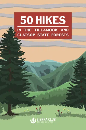
50 Hikes in the Tillamook and Clatsop State Forests is a guidebook highlighting the adventurous hiking trails within these state forests, ultimately promoting the conservation of these wondrous regional landscapes.
50 Hikes in the Tillamook and Clatsop State Forests provides hikers the chance to explore and experience the ever-changing environments of these forests through the studied eyes of the Sierra Club. This updated edition contains current trail information, path descriptions, driving directions, and regional history on some of Oregon's lushest yet unexplored trails. 50 Hikes includes a new introduction written by Daniel O'Neil, which details the history of this wondrous region; a foreword by Robert Kentta, cultural resources director of the Confederated Tribes of Siletz Indians; original illustrations of its plant life; and photographs collected by Sierra Club members. Readers will be imbued with a full sense of wonder for these forests. From coastal plains to canopied forests, 50 Hikes celebrates the adventurous landscapes of Northwest Oregon by revisiting the Sierra Club's iconic 2001 guidebook.
Trusted by 375,005 students
Access to over 1.5 million titles for a fair monthly price.
The OR-6 (Wilson River Highway) corridor between Banks and Tillamook is the most accessible and used stretch of the Tillamook State Forest. Both Gales Creek and the Wilson River provide gorgeous waterways across the entire route, and many small canyons and tributaries offer opportunity for off-trail adventuring to hidden waterfalls. Of course, it is the established infrastructure that makes this area more enjoyable for a variety of visitors. Numerous trailheads, picnic areas, campgrounds, and river beaches mean that, on a sunny summer day, space and quiet can be hard to find. It is a testament to the immense recreation potential and the exponential growth of the Portland metro area that this stretch of the Coast Range is so packed.
The Wilson River Trail is a collection of stand-alone sections that allows hikers to either pursue small day hiking opportunities or get ambitious and tackle the entire 22.6 miles (one way) with either an overnight or a coordinated car shuttle. Along with a great introduction to the Tillamook State Forest, the Wilson River Trail allows hikers to access the river along the way for a cooling dip in the summer or year-round fishing. The trail also connects with more strenuous opportunities including Kings Mountain and Elk Mountain.
1. Wildcat Mountain
This hike, which provides sweeping views of the Willamette Valley, sticks to gravel forest roads that are generally well maintained and easy to follow, with a few steep sections.
Difficulty
Moderate
Trailhead Coordinates
45.667983, -123.291733
Distance
9.8 miles round-trip
Elevation
1,300 feet
Suggested Maps
2012 Northwest Oregon Protection District Map
Getting There
From Portland, drive west on US-26, then veer left on OR-6 toward Tillamook. Just past milepost 39, turn right onto Timber Road. Drive 1.8 miles to an unmarked road on the right with a yellow gate. Park on the left side of the road and take care not to block the gate.
Photo courtesy of T. J. Carter
To begin your hike, pass through the yellow gate. On the right side of the road you will see a large sign letting you know you are on Wildcat Road. In about 0.1 miles you will come to a bridge over a small creek. The main road stays obvious until you reach 1.07 miles. Here you will pass under power lines, and the road splits. Take the road to the right and cross a wooden bridge over another small creek. Ignore the road that splits off to the right shortly after the bridge and continue on the main road.
If you are doing the hike in early summer, there will be a variety of flowers blooming alongside the road, including goatsbeard, foxglove, daisies, Douglas Spirea, and salmonberry.
Around 3 miles into your hike there is a fork in the road. Take the sharp left to stay on Wildcat Road. Hopefully you’ve saved some energy, because here the road inclines more steeply. The road levels out again at 3.3 miles. To your left is an old road with a large berm blocking it; ignore this and stay on the main road. The next mile of the hike is a pleasant series of slight inclines and declines.
At about 4.3 miles, take a sharp left, leaving Wildcat Road for a much rougher and steeper road that has recently been cleared. You will reach the end of the road and a large clearing at 4.8 miles. Here you can climb a berm at the top of a quarry for an impressive view of the Willamette Valley and the small community of Buxton.
2. Gales Creek
A tranquil hike along a tributary of the Tualatin River. This hike features lush second-growth forest after the original Tillamook Burn.
Difficulty
Moderate to strenuous
Trailhead Coordinates
45.64231, -123.35926
Distance
Up to 13.6 miles round-trip
Elevation
About 2,000 feet elevation gain
Suggested Maps
Wild Salmon Center and Outdoor Project Wilson River Map
Getting there
From Portland, drive west on US-26, then OR-6, toward Tillamook. At milepost 35, turn right at the sign for Gales Creek Campground and drive about a mile to the day use area. The campground is open May through October, and there is no fee for day use. Park in the lot and look for th...
Table of contents
Non-Liability Statement
Foreword
A Message from the Sierra Club
Introduction
Important Information about the Tillamook and Clatsop State Forests Hikes
Frequently asked questions
Yes, you can cancel anytime from the Subscription tab in your account settings on the Perlego website. Your subscription will stay active until the end of your current billing period. Learn how to cancel your subscription
No, books cannot be downloaded as external files, such as PDFs, for use outside of Perlego. However, you can download books within the Perlego app for offline reading on mobile or tablet. Learn how to download books offline
Perlego offers two plans: Essential and Complete
Essential is ideal for learners and professionals who enjoy exploring a wide range of subjects. Access the Essential Library with 800,000+ trusted titles and best-sellers across business, personal growth, and the humanities. Includes unlimited reading time and Standard Read Aloud voice.
Complete: Perfect for advanced learners and researchers needing full, unrestricted access. Unlock 1.5M+ books across hundreds of subjects, including academic and specialized titles. The Complete Plan also includes advanced features like Premium Read Aloud and Research Assistant.
Both plans are available with monthly, semester, or annual billing cycles.
We are an online textbook subscription service, where you can get access to an entire online library for less than the price of a single book per month. With over 1.5 million books across 990+ topics, we’ve got you covered! Learn about our mission
Look out for the read-aloud symbol on your next book to see if you can listen to it. The read-aloud tool reads text aloud for you, highlighting the text as it is being read. You can pause it, speed it up and slow it down. Learn more about Read Aloud
Yes! You can use the Perlego app on both iOS and Android devices to read anytime, anywhere — even offline. Perfect for commutes or when you’re on the go. Please note we cannot support devices running on iOS 13 and Android 7 or earlier. Learn more about using the app
Yes, you can access 50 Hikes in the Tillamook and Clatsop State Forests by Lori LaBissoniere,Riley Pittenger in PDF and/or ePUB format, as well as other popular books in Personal Development & North American History. We have over 1.5 million books available in our catalogue for you to explore.