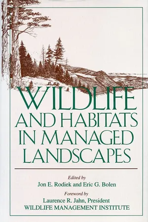
Americans are having an increasing impact on the rural landscape as development further encroaches in former wilderness areas. This disruptive land use is causing a decline in wildlife and wildlife habitats. Wildlife and Habitats in Managed Landscapes presents a new strategy for solving this problem by redefining habitats to include the concept of landscape. Employing this strategy, natural resource managers apply tools of planning, management, and design to entire landscapes to meet the needs of both wildlife and humans.
- English
- ePUB (mobile friendly)
- Available on iOS & Android
eBook - ePub
Wildlife and Habitats in Managed Landscapes
About this book
Information


1
Powerline Corridors, Edge Effects, and Wildlife in Forested Landscapes of the Central Appalachians
HUMAN DOMINATION of the landscape assumes a variety of forms. The process of urbanization produces perhaps the most noticeable forms.
Associated with this process are the landscape conversions that result from connecting many urban centers scattered throughout a larger natural ecosystem. We are referring to the powerline, gas pipeline, and highway right-of-way corridors that crisscross the landscape.
When corridors are cut through forested landscape, such as those found in the central Appalachians, several changes occur simultaneously. First, there is a physically dramatic disruption to the continuous vegetative community Second, there is a disruption to the structure and function of the wildlife habitats. Finally, there are impacts to the resident wildlife, which must negotiate, tolerate, or otherwise cope with these disturbances.
Urbanization fragments the natural ecosystem into smaller, less cohesive pieces of landscape. This fragmentation process raises many questions for the landscape manager concerned with wildlife. How do these large, spatial-scale landscape disturbances affect regional wildlife and habitat resources? Will wildlife be able to cope with this ever-growing process of reshaping the wild environment? Are there ways to optimally construct corridors in order to reduce the impacts they will have on the region’s wildlife and habitat resources?
Research wildlife biologists have discovered that the predictability of these effects on wildlife habitats is not as optimistic as once believed. Dr. Gates focuses his attention on the effects of changes in the wildlife habitats found in and around corridors in the forested landscape of the central Appalachians. His studies lend insight to the various ways corridors function within the forest matrix as special habitats, as behavioral barriers, as filters to the movement of wildlife, and as a source of influences on the larger forest matrix.
The work represented by Gates and others has at least two important effects. First, it points out the need to conduct research that creates options for wildlife habitats formed within this new landscape mosaic. Second, it suggests that corridors may be a modern-day necessity in the central Appalachians. His work presents certain opportunities to design, plan, construct, and maintain corridors incorporating concerns for wildlife and habitats in this forest.
INTRODUCTION
Depending upon the surrounding background habitat or matrix, corridors in the landscape can be categorized as either of two major structural types. Convex corridors, such as hedgerows or forested stream corridors in agricultural areas, have greater height than the adjacent matrix. Concave corridors, on the other hand, are characterized by lower heights than the surrounding matrix. Powerlines, gas pipelines, and highway rights-of-way in forested areas are examples of concave corridors. Each type has unique properties and special characteristics that influence the local wildlife populations (Forman and Godron 1986).
Corridors function in a variety of ways within the matrix. For example, they may function as specialized habitats, as behavioral barriers or filters to the movement of wildlife, and as a source of effects on the matrix (Forman 1987). Furthermore, they may link together different patches in the matrix, providing travel lanes for animals between patches (Forman 1987, Harris 1988, Lines and Harris 1989). The way a corridor functions depends on several factors, including the animal species or species assemblage under consideration. Factors that influence how, when, and why animals use corridors include the composition and structure of the plant community within and adjacent to the corridor, the nature of the edge between the corridor and matrix, the size and shape of the corridor, and the microenvironment within the corridor, as well as whether the corridor is nested within other corridors. A highway corridor within a wooded corridor through an agricultural region functions much differently from a highway corridor through a forested region, even though forests border both highway corridors. The phenology and stability of the vegetation within corridors also influence animal use of corridors seasonally, as well as over successional time periods.
This study addresses two major questions related to powerline corridors and animal species or species assemblages in forested landscapes of the central Appalachians. First, how do the activity patterns of animals differ among the major habitat types composing the corridor, edge, and forest? Second, what effects do specific corridor management practices have upon these activity patterns?
The Landscape Setting
The ridge and valley physiographic province of western Maryland was the location for the research. It is characterized by long, parallel ridges and intervening valleys oriented in a southwesterly to northeasterly direction. This region is bracketed by South Mountain in Washington County and Dans Mountain in western Allegany County. It contains strongly folded and faulted sedimentary rocks. The Great Valley in the eastern part of the region is formed on Cambrian and Ordovician limestone and dolomite. Farther west, a more rugged terrain has developed upon shale and sandstone bedrock that dates from the Silurian to Mississippian periods. There, some valleys are underlain by Silurian and Devonian limestones.
Within the western part of the region, two study sites, Green Ridge and Warrior Mountain, were selected along a 138 kV powerline corridor in Allegany County. This county has 83,603 ha, or 75.8% of the land area, in forestland. Of the productive forestland, 73.0% is in private ownership with most of the remainder in state forest, wildlife management areas, and parks. Two-thirds of the forestlands are classified as oak-hickory; a contiguous oak-hickory forest bordered both study sites. Overstory species included red (Quercus rubra), black (Q. velutina), and chestnut (Q. prinus) oaks; pignut (Carya glabra) and mockernut (C. tomentosa) hickories; and widely scattered pines (Pinus virginiana and P. rigida). The moderately dense (> 30% to 60% cover) understory was a mixture of oak, hickory, flowering dogwood (Cornus florida), red maple (Acer rubrum), and black gum (Nyssa sylvatica). Forest ground cover ranged from moderate (> 30% to 60%) to dense (> 60%), depending upon nearness to water, slope, or presence of canopy gaps. Species included seedlings of the understory and overstory trees, bracken fern (Pteridium aquilinum), common greenbrier (Smilax rotundifolia), and blueberry (Vaccinium sp.). This region receives 91.4 to 101.6 cm of rainfall annually.
GREEN RIDGE
This study site was located on the eastern slope of Green Ridge in Green Ridge State Forest. An herbaceous corridor was mowed with a rotary mower by personnel from the Maryland Forest, Park, and Wildlife Service on 5 August 1977, prior to and during the study on 18 July 1978, but not during the summer of 1979. Prior to mowing in 1978, the mean vegetation height was 27.6 cm (± 1.46 SE, N = 50); after mowing, vegetation height was reduced to 9.2 cm (± 0.83 SE, N = 25). Because of heavy rain, approximately 24.6 cm in July and August, the grasses in the corridor quickly recovered following mowing. The predominant grasses were orchard (Dactylis glomerata), redtop (Agrostis alba), and several panic (Panicum spp.) grasses. Forbs included spreading dogbane (Apocynum an-drosaemifolium), bracken fern, and lespedezas (Lespedeza cuneata and L. bicolor). Three lobes extending from the forest edge into the corridor were inaccessible to the mower and were dominated by blackberry (Rubus allegheniensis). The high-contrast linear edge was composed of seedlings and saplings of red, black, and chestnut oaks with a ground cover of orchard and redtop grasses, bracken fern, and small, scattered blackberry patches. The corridor width averaged 46 m (± 0.43 SE, N = 35). The site increased gradually in elevation from approximately 335 m to 427 m. It was crossed by one perennial stream and two intermittent tributaries. Soils included well-drained shaley silt loam and very stony loam.
WARRIOR MOUNTAIN
This study site was located on the eastern slope of Warrior Mountain in Warrior Mountain Wildlife Management Area. This shrubby corridor was managed for selected woody plant species by spraying with herbicides at 1- to 3-year intervals. Prior to the fieldwork, the most recent application occurred on 2 January 1978, when a mixture of 13.2 1 of Tordon 155 and 365.3 1 of no. 2 fuel oil was applied as a basal spray to certain target species. The most abundant shrub species was blackberry. Other species included staghorn sumac (Rhus typhina), mountain laurel (Kalmia latifolia), blueberry (V. angustifolium and V. vacillans), bear oak (Q. ilicifolia), and seedlings and saplings of sassafras (Sassafras albidum) and red maple. These species often were scattered throughout the corridor in small, irregular patches. Many small (< 8 cm dbh) snags were also present. Bracken fern, hayscented fern (Dennstaedtia punctilobula), whirled loosestrife (Lysimachia quadrifolia), and several species of panic grasses were the principal herbs. The two ferns often were found in large, homogeneous patches. Whirled loosestrife was prevalent throughout the corridor. The linear edge was of high contrast but less so than at Green Ridge. It was dominated by seedlings and saplings of red, black, and chestnut oaks, many of which later died from herbicide spraying. Large patches of blackberry and bracken fern extended from the edge into the corridor, providing some irregularity to an otherwise linear edge. The corridor averaged 52 m (± 0.60 SE, N = 35) in width. The site increased rapidly in elevation from about 335 m to 610 m. It was crossed by one small intermittent stream. Soils were well-drained cherty silt loam and stony sandy loam.
THE APPROACH
Activity patterns of animals were determined by recording the number and location of crossings (i.e., a line of tracks left by an animal) made by different species or species assemblages over a 24-hour period on a sand-tracking surface m...
Table of contents
- About Island Press
- Title Page
- Copyright Page
- Dedication
- Acknowledgments
- Table of Contents
- Foreword
- Introduction
- 1 - Powerline Corridors, Edge Effects, and Wildlife in Forested Landscapes of the Central Appalachians
- 2 - Windbreaks, Wildlife, and Hunters
- 3 - Managed Habitats for Deer in Juniper Woodlands of West Texas
- 4 - Browse Diversity and Physiological Status of White-tailed Deer During Winter
- 5 - Conservation of Rain Forests in Southeast Alaska: Report of a Working Group
- 6 - American Marten: A Case for Landscape-level Management
- 7 - Planning for Basin-level Cumulative Effects in the Appalachian Coal Field
- 8 - Breeding Bird Assemblages in Managed Northern Hardwood Forests in New England
- 9 - Wildlife Communities of Southwestern Riparian Ecosystems
- List of Authors
- Index
- About the Editors
- Also Available from Island Press
- Island Press Board of Directors
Trusted by 375,005 students
Access to over 1.5 million titles for a fair monthly price.
Study more efficiently using our study tools.
Frequently asked questions
Yes, you can cancel anytime from the Subscription tab in your account settings on the Perlego website. Your subscription will stay active until the end of your current billing period. Learn how to cancel your subscription
No, books cannot be downloaded as external files, such as PDFs, for use outside of Perlego. However, you can download books within the Perlego app for offline reading on mobile or tablet. Learn how to download books offline
Perlego offers two plans: Essential and Complete
- Essential is ideal for learners and professionals who enjoy exploring a wide range of subjects. Access the Essential Library with 800,000+ trusted titles and best-sellers across business, personal growth, and the humanities. Includes unlimited reading time and Standard Read Aloud voice.
- Complete: Perfect for advanced learners and researchers needing full, unrestricted access. Unlock 1.5M+ books across hundreds of subjects, including academic and specialized titles. The Complete Plan also includes advanced features like Premium Read Aloud and Research Assistant.
We are an online textbook subscription service, where you can get access to an entire online library for less than the price of a single book per month. With over 1.5 million books across 990+ topics, we’ve got you covered! Learn about our mission
Look out for the read-aloud symbol on your next book to see if you can listen to it. The read-aloud tool reads text aloud for you, highlighting the text as it is being read. You can pause it, speed it up and slow it down. Learn more about Read Aloud
Yes! You can use the Perlego app on both iOS and Android devices to read anytime, anywhere — even offline. Perfect for commutes or when you’re on the go.
Please note we cannot support devices running on iOS 13 and Android 7 or earlier. Learn more about using the app
Please note we cannot support devices running on iOS 13 and Android 7 or earlier. Learn more about using the app
Yes, you can access Wildlife and Habitats in Managed Landscapes by Jon Rodiek, Eric Bolen, Jon Rodiek,Eric Bolen in PDF and/or ePUB format, as well as other popular books in Biological Sciences & Zoology. We have over 1.5 million books available in our catalogue for you to explore.