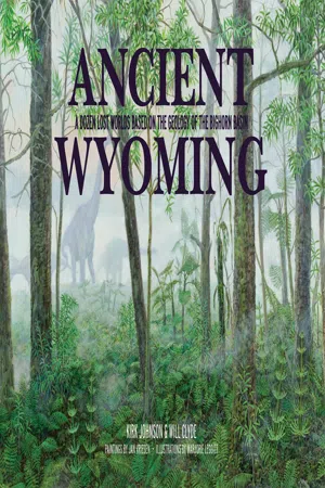
eBook - ePub
Ancient Wyoming
A Dozen Lost Worlds Based on the Geology of the Bighorn Basin
- 64 pages
- English
- ePUB (mobile friendly)
- Available on iOS & Android
eBook - ePub
Ancient Wyoming
A Dozen Lost Worlds Based on the Geology of the Bighorn Basin
About this book
Sponsored by a grant from the National Science Foundation to the Denver Museum of Natural History. Ever wondered what the ground below you was like millions of years ago? Merging paleontology, geology, and artistry,
Ancient Wyoming illustrates scenes from the distant past and provides fascinating details on the flora and fauna of the past 300 million years. The book provides a unique look at Wyoming, both as it is today and as it was throughout ancient history—at times a vast ocean, a lush rain forest, and a mountain prairie.
Information
Topic
Physical SciencesSubtopic
North American HistorySection 1
Welcome to the Bighorn Basin
The northwestern corner of Wyoming is home to two of the nation’s most famous national parks: Yellowstone and Grand Teton. Each year, these parks see more than 3 million visitors who arrive from all directions, and those who come to Yellowstone from the east by way of Cody must pass through a vast, dry depression known as the Bighorn Basin. The basin’s main towns are Thermopolis, Cody, Powell, Lovell, Greybull, and Worland, but we’d be remiss if we didn’t mention Shell, Ten Sleep, Meeteetse, Basin, Otto, and Bridger.
From outer space or on the Wyoming Highway Map, the basin appears as a giant oval hole about 150 miles long by 80 miles wide. The high points of the surrounding mountains reach more than 11,000 feet, while the low point of the basin is only 3,500 feet. The Bighorn Basin is a curious bit of topography, and it has one of the best geological stories on the planet.
In fact, the Bighorn Basin may be the best place on Earth to tell the story of our planet. Because of its geology, the Bighorn Basin contains layers of rock older than 2.5 billion years, as well as many, many younger rock layers. What makes this place so amazing is that it has layers of rock from almost every single geologic time period. If you had to pick one place in the world to tell the story of Earth’s history, you would pick this place. So we picked this place.
The layered rocks of the Bighorn Basin were once ancient landscapes, and the fossils in the rocks are clues to what these landscapes looked like, what the ancient vegetation was, and what kinds of animals lived here. Because the Bighorn Basin is a dry place, not many plants grow here today, so it is easy to see the rocks. If you can see the rocks, you can find the fossils in the rocks. In this place, the history of the Earth lies on the ground as if it were an open book. And the goal of our little book is to give you the tools to read the big rock book of the Bighorn Basin.
Using layered rocks and fossils, geologists and paleontologists are able to envision what these lost worlds looked like. To share them with you, we studied the rocks; tracked down the fossils; reconstructed the plants, animals, and landscapes; and then employed an artist to paint them, choosing ancient worlds ranging in age from 520 million years to 18,000 years old. There are so many layers of rock in the basin that we could have painted hundreds of them. We chose to paint twelve.
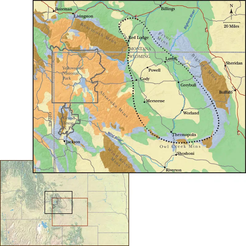
The Bighorn Basin is located in the Rocky Mountains in northwestern Wyoming, east of the Yellowstone Plateau. On this map it is shown as the oval depression surrounded by mountains.
This geological map of northwestern Wyoming and adjacent Montana and Idaho shows the age of the rocks exposed at the surface. The colors represent:

(66 million years ago through present day)

(66 million years ago through present day)

(252—66 million years ago)

(542—252 million years ago)

(2.5—1.7 billion years ago)
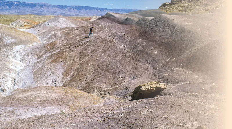
Prospecting for fossils in the Morrison Formation near Shell, Wyoming
AN
EXTREMELY
SHORT HISTORY
OF ROCKS, THE WORLD, AND THE BIGHORN BASIN
Our universe formed in the big bang around 13.8 billion years ago, and our solar system, with our sun and all of our planets, formed about 4.567 billion years ago. The early Earth was molten, but by 4 billion years ago, it had cooled enough that its surface was rocky, and water had filled large depressions to form the first oceans. Shortly thereafter, the first life in the form of bacteria appeared and began to colonize the planet.
The early continents were small and regularly broke apart and smashed into each other. The chunk that included what is now Wyoming formed about 2.5 billion years ago. By about 1.8 billion years ago, a number of small continents had collided to form the core of what would become North America. One geologist has called this the United Plates of America.
You can think of continents as thin, flat pieces of Styrofoam floating on a swimming pool — except the Styrofoam is hard rock, and the water is soft rock that can flow like super-gooey molasses. If you add a weight to the foam, it will float lower in the water. It is the same with continents: If you add weight to them, they will sink lower; if you remove weight, they will float higher. You can add weight by loading continents with sediments, ice sheets, or water. You can remove weight via erosion, melting ice sheets, or draining water.
When parts of a continent sink below sea level, the sea floods in and covers sections of it, and the weight of the water will make the continent sink more. Sediment carried into the sea from the continent’s eroding mountains will add yet more weight and make the continent sink further, creating room for more sediment. As the sediment layers get buried by more layers, they are compacted and become rock. That is how layers of sedimentary rock form and get preserved underground for millions and millions of years.
The Bighorn Basin is one of those singular places on Earth where lots of layers were deposited and stored underground for millions of years. They were later pushed up and exposed at the surface so that today we can see them in all of their glory. These layered rocks that poke out of the ground around the basin tell a pretty amazing story about our planet.
Although the first 3 billion years of life on Earth were ultimately dominated by very simple single-celled organisms like bacteria, by 542 million years ago, a host of more complicated multicelled marine animals had evolved. As the sediment piled up in places like the Bighorn Basin, it also piled up the bodies of the dead sea animals. The planet buries its dead, and the buried dead are called fossils.
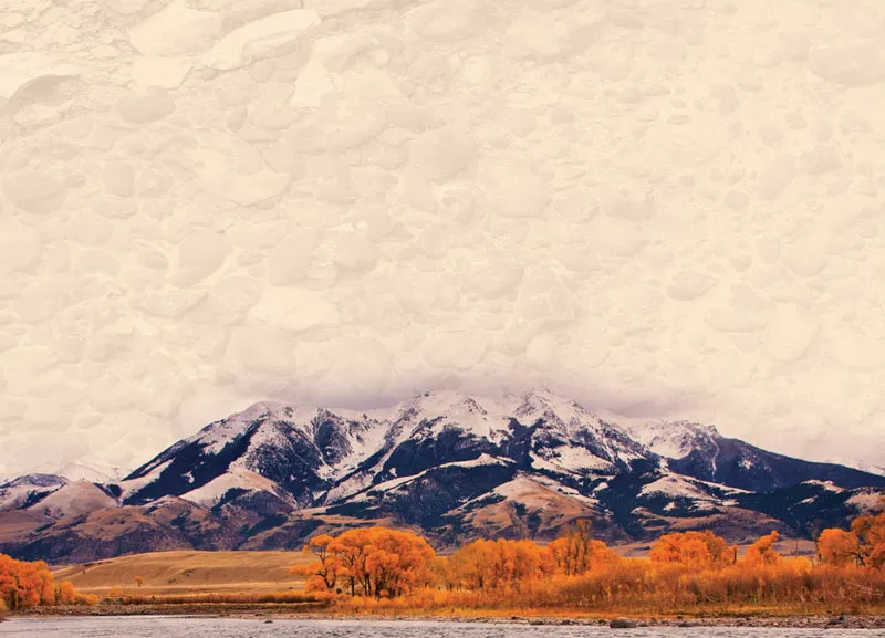
Cottonwoods in fall in Wyoming
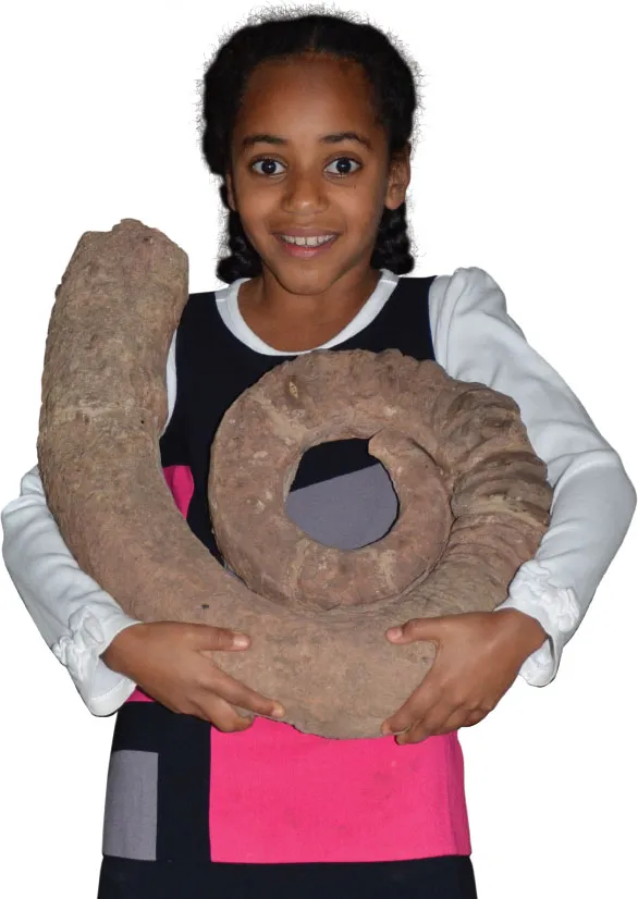
Abeba Ender struggles to hold Wilsonoceras bighornense, a large coiled cephalopod from the Ordovician Bighorn Dolomite.
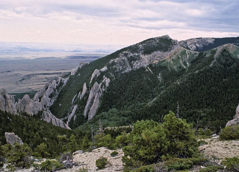
The view to the east from the flanks of the Beartooth Mountains near Red Lodge, Montana. The fins of rock near the girl’s elbow are beds of the Bighorn Dolomite that have raised over time so the once-horizontal layers are now almost vertical.
Between 542 and 60 million years ago, the northwestern part of Wyoming was on a part of North America that was sinking and accumulating layers of sediment that would become fossil-filled rock layers. About 60 million years ago, the mountains that today ring the Bighorn Basin began to form. As they formed, they lifted up and folded the rock layers that were already there. As those rock layers ...
Table of contents
- Cover
- Title Page
- Copyright
- Contents
- Preface
- Section 1: Welcome to the Bighorn Basin
- Section 2: Lost Worlds
- Section 3: Where to Go, What to Do
- About the Author
- Acknowledgment
Trusted by 375,005 students
Access to over 1.5 million titles for a fair monthly price.
Study more efficiently using our study tools.
Frequently asked questions
Yes, you can cancel anytime from the Subscription tab in your account settings on the Perlego website. Your subscription will stay active until the end of your current billing period. Learn how to cancel your subscription
No, books cannot be downloaded as external files, such as PDFs, for use outside of Perlego. However, you can download books within the Perlego app for offline reading on mobile or tablet. Learn how to download books offline
Perlego offers two plans: Essential and Complete
- Essential is ideal for learners and professionals who enjoy exploring a wide range of subjects. Access the Essential Library with 800,000+ trusted titles and best-sellers across business, personal growth, and the humanities. Includes unlimited reading time and Standard Read Aloud voice.
- Complete: Perfect for advanced learners and researchers needing full, unrestricted access. Unlock 1.5M+ books across hundreds of subjects, including academic and specialized titles. The Complete Plan also includes advanced features like Premium Read Aloud and Research Assistant.
We are an online textbook subscription service, where you can get access to an entire online library for less than the price of a single book per month. With over 1.5 million books across 990+ topics, we’ve got you covered! Learn about our mission
Look out for the read-aloud symbol on your next book to see if you can listen to it. The read-aloud tool reads text aloud for you, highlighting the text as it is being read. You can pause it, speed it up and slow it down. Learn more about Read Aloud
Yes! You can use the Perlego app on both iOS and Android devices to read anytime, anywhere — even offline. Perfect for commutes or when you’re on the go.
Please note we cannot support devices running on iOS 13 and Android 7 or earlier. Learn more about using the app
Please note we cannot support devices running on iOS 13 and Android 7 or earlier. Learn more about using the app
Yes, you can access Ancient Wyoming by Kirk Johnson,Will Clyde in PDF and/or ePUB format, as well as other popular books in Physical Sciences & North American History. We have over 1.5 million books available in our catalogue for you to explore.