A complex enclosure identified by aerial photography at Dunragit Galloway, was demonstrated by excavation to have been of Late Neolithic date, and comprised three concentric timber ramped post-rings, 120–300 m in diameter. The two outer post-rings each comprised large uprights interspersed with smaller members, probably forming a continuous palisade. Each was a single-phase structure and the posts had rotted out. The inner ring had largely been made up of large, freestanding posts, most of which had rotted away, but some of which had been deliberately removed, the post-holes being considerably larger than those of the two outer rings. Where posts had been pulled out, a number of elaborate deposits had been placed in the crater left by the post-removal. The entrances to the post-rings are not aligned and the preferred interpretation is that the monument as a whole had two phases of construction, in each of which a timber circle was surrounded by a palisade, and in which the middle post-ring succeeded the outer, or vice-versa.The enclosure had been preceded by a post-defined cursus monument in which all the post had been burned in situ and numerous other post-holes were located on the same axis as the cursus, extending beyond the monument itself.The most elaborate entrance, connected with the middle post-ring, is composed of two parallel lines of features, presumably post-holes, opening toward the south, and aligned on a large earthen mound at Droughduil, 400 m away. Droughduil Mote, though recorded as a medieval motte, recalls the association of various very large mounds with with henges or palisaded enclosures, as at Silbury Hill, Wiltshire. Excavation demonstrated that it had been constructed with stepped sides, and that a stone cairn had been constructed on its summit. A series of optically stimulated luminescence dates on the accumulated sand over the surface of the mound demonstrated that it was certainly not medieval, and was probably Neolithic in date.
eBook - ePub
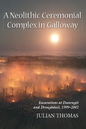
A Neolithic Ceremonial Complex in Galloway
Excavations at Dunragit and Droughduil, 1999–2002
- 240 pages
- English
- ePUB (mobile friendly)
- Available on iOS & Android
eBook - ePub
A Neolithic Ceremonial Complex in Galloway
Excavations at Dunragit and Droughduil, 1999–2002
About this book
Trusted by 375,005 students
Access to over 1.5 million titles for a fair monthly price.
Study more efficiently using our study tools.
Information
Subtopic
ArchaeologyIndex
Social Sciences1
INTRODUCTION
Location, topography and geology
The modern village of Dunragit lies between Stranraer and Glenluce in Western Galloway, immediately to the north of Luce Bay (at approximately NGR NX 150576). The major road between Stranraer and Newton Stewart, the A75, runs ESE-WNW through the village, parallel with the railway that links Girvan with the ferry port at Stranraer. Both of these exploit the expanse of flat ground that lies at the foot of Challoch Hill, which borders on the sand dunes of Torrs Warren to the south. The road has been established since at least the eighteenth century, when it was constructed to serve the port of Portpatrick (MacHaffie 2001). The level ground is narrowest immediately to the east of Dunragit, at East Challoch, where Challoch Hill overlooks Luce Sands. Dunragit is thus located on a natural routeway, where the north-south axis of the Water of Luce turns westward to the isthmus between Loch Ryan and Luce Bay. Further west, the country opens up onto the Rhins of Galloway, while to the east the coast skirts the low uplands of the Machars. North beyond Challoch Hill, the land rises toward Cairnscarrow and Cairnerzean Fell. Overall, then, the location of Dunragit represents an area of gently rolling lowland sandwiched between the uplands to the north and Luce Bay to the south.
South from the village, the large mound of Droughduil Mote stands on the border of Torrs Warren sands. This is a major dune system covering an area of 1200 hectares, with a coastal frontage of approximately 7 kilometres (Cowie 1996: 14). The uplands to the north and west of Dunragit, and the northern part of the Rhins of Galloway are composed of Ordovecian sedimentary rocks, while the southern Rhins and the country south of Glenluce are Silurian rocks of the Llandovery series. A broad strip running southward from Loch Ryan, however, is composed of more recent sediments, principally alluvium and glacial outwash gravel. This provides the subsoil at Dunragit itself. The place-name Dunragit may be derived from Din Rheged, meaning the fort of Rheged, which would refer to the Dark Age kingdom. This name probably does not relate to the prehistoric sites, but to Round Dounan, a fort located on a natural rock outcrop overlooking Dunragit village. The fort is stone built, with a containing wall and an entrance passage. It has been argued to be of fifth or sixth century AD date (Reid 1952).
Challoch Hill rises abruptly north of the village, but from the A75 southwards toward Piltanton Bridge the ground drops no more than 15 metres over a kilometre or so. Between the road and the railway running 150 metres to the south lies what was once the major employer in the village, Dunragit Creamery. The creamery was opened in 1882, and was one of the earliest of its sort in Scotland. It merged with the Valleyfield Dairy Company in 1891 to form the United Creameries Company, and later was operated by Nestlé. In recent years the creamery has closed down, and the building is now used by a light engineering company manufacturing motorbikes (Stell 1996: 55). The land between road and railway has largely been under pasture in recent decades, but the fields south of the railway have been under the plough, and have revealed spectacular results from air photography. South of these fields, Droughduil Mote is located in an area of woodland managed by Forest Enterprise. At this point the subsoil is sandier, and the mound itself is set on an ancient sand dune. West from the A748 (which runs south from the A75) air photographic cover is far poorer, as the land bordering the road is taken up by a large nursery growing small conifers. South and east from the nursery a very flat expanse of land, the Freuch, is drained by Piltanton Burn and stretches toward West Freuch airfield.

Figure 1.1 Dunragit, Galloway: location

Figure 1.2 Dunragit complex: central area of the palisaded enclosure, from the south-west
Discovery
The complex of cropmark features at Dunragit (focused on NX 14805735), was first identified from the air by Marilyn Brown of the Royal Commission on the Ancient and Historic Monuments of Scotland in 1992. A second series of photographs of the complex was taken in 1995, and together these images provide evidence of a remarkable group of prehistoric structures, bisected by the modern railway line (Figs. 1.2 to 1.5). These images show a large enclosure, composed of three concentric rings of what are now known to be post-holes (numbers 1 to 3 on Fig. 1.6). The middle ring of the enclosure appears to be associated with an entrance avenue leading toward the south, while the outer ring is more irregular, and is in-turned at two or three points on the southern side, which may represent less monumental entrances. Inside the inner ring there is a ring-ditch (4), and a second lies between the middle and outer post-rings on the western side of the enclosure (5). Immediately to the south of this ring-ditch a series of lines of post-holes or pits cuts across the enclosure on a northeast to southwest axis (6). In a similar position on the eastern side is a post- or pit-ring with a diameter of about 20 metres (7). Between the two innermost rings of the enclosure immediately to the west of the entrance avenue lies a small penannular enclosure, opening to the east (8). Two smaller enclosures of a similar kind, each with an apparent central feature of some form, are found north of the railway line and east of the outer post-ring of the enclosure (9 and 10). The outer ring of the enclosure can be identified to the west of these structures, and a further arc of features lies further west still (11). This is clearly not part of the palisaded enclosure, and was eventually identified as the terminal of a post-defined cursus, of earlier date (see Chapter 3 below). North of all of these elements is a line of large features running parallel with the A75 and now identified as road quarry pits (12). Two more penannular enclosures are found south of the railway line (13 and 14), the larger of them apparently forming the westerly termination of an alignment of post-holes or pits, which runs for some 150 metres. South of the eastern end of this alignment is an enclosure with five flattened sides, again formed of post-holes or pits (15). South of this in turn are two further pit- or post-alignments, in which the constituent features are closely-set, and perhaps intercutting (16 and 17). Finally, southwest of the enclosure lies a ring-ditch surrounded by a ring of posts or pits, with an overall diameter of about 25 metres (18).

Figure 1.3 Dunragit complex: central area of the palisaded enclosure, from the north
Most of these features are better defined in the fields to the south of the railway line, and it was to be presumed that various elements projected north into the pasture fields, where they were not all visible from the air. On morphological grounds, comparisons can be made between the Dunragit enclosure and a group of later Neolithic palisaded enclosures in Scotland, Ireland, Wales and England, which include Meldon Bridge (Burgess 1976; Speak and Burgess 1999), Forteviot (St. Joseph 1978; Noble and Brophy 2011a), Ballynahatty (Hartwell 1998), Mount Pleasant (Wainwright 1979), Walton and Hindwell (Gibson 1999). The inner two concentric rings of possible posts at Dunragit are well matched at West Kennet, while the distinctive entrance structure is paralleled at Meldon Bridge, Forteviot and Walton. With the exception of Meldon Bridge, all of these large palisaded enclosures are associated with groups of lesser features, as appears to be the case at Dunragit. At the time when fieldwork was undertaken at Dunragit, of the Scottish sites of this type it was only Meldon Bridge that had undergone extensive excavation. Since 2007, excavations have been undertaken by the Universities of Glasgow and Aberdeen at Forteviot and Leadketty (Noble and Brophy 2011a).

Figure 1.4 Dunragit complex: area north of the railway line
The area surrounding the Dunragit monument is one that contains dense traces of prehistoric activity. Immediately to the south, the sand dunes of Luce Bay have provided considerable evidence of Neolithic and Bronze Age occupation, in the form of scatters of artefacts, hearths and burials (Davidson 1952; McInnes 1964; Cowie 1996). In the hills to the north, there are numerous Neolithic and Bronze Age cairns (e.g. Corcoran 1969a; b). Coastal southern Galloway also has an extensive distribution of rock art (Morris 1979; van Hoek 1986). It is conceivable that the Dunragit enclosure represents a focus for much of the Late Neolithic and Early Bronze Age activity, and that the central part of Luce Bay constituted a place of importance through much of prehistory.

Figure 1.5 Dunragit complex: area south-east of the palisaded enclosure, with a pit- or post-alignment and a hengiform enclosure
Circumstances of the excavations
Between 1994 and 1998 the author had undertaken a series of excavations in the Dumfries area, investigating the Pict’s Knowe henge, the Holywood cursus complex, and the post alignment at Holm Farm, with the support of Historic Scotland (Thomas 2007a). Following the success of these investigations, a campaign of work at Dunragit was proposed, in order to test the date and character of the features, and to assess the state of their preservation. Parts of the complex have been under the plough in recent years, and it was evident from the results of fieldwork that many of the cut features investigated were severely truncated.
Four seasons of excavation took place on the Neolithic ceremonial complex at Dunragit during 1999–2002. These investigations demonstrated that the large enclosure was of Late Neolithic date, and had been constructed using timber uprights in ramped post-holes. The largest of the post-rings had a diameter of around 300 metres, while the innermost had a diameter of perhaps 120 metres. Both the outer post-ring and the middle were composed of large uprights interspersed with smaller members, probably forming a continuous palisade and comparable with the structure of the Late Neolithic enclosure at Meldon Bridge in Peebleshire (Speak and Burgess 1999). Both of these post-rings had been single-phase structures, and in both cases the posts had eventually rotted out and been replaced by silting and collapsed gravel packing. These two outermost rings of post-holes also produced very little in the way of material culture. By contrast, the inner ring had largely been made up exclusively of large, free-standing posts, most of which had rotted away, but some of which had been deliberately removed, although in one short stretch smaller posts were present. The post-holes of the inner ring were considerably larger than those of the two outer rings, and it is possible that their digging had involved a conspicuous expenditure of effort. Where posts had been pulled out, a number of elaborate deposits had been placed in the crater left by the post-removal.

Figure 1.6 Dunragit complex: plot of features revealed on aerial photographs
The enclosure had been preceded on the site by a postdefined cursus monument, one side and the terminal of which had been identified in the 1999–2001 seasons. The post-holes of the cursus were easily distinguishable from those of the enclosure, for in almost every case the post had been burned in situ. However, numerous other post-holes were located on the same axis as the cursus, extending beyond the monument itself. The coincidence of earlier Neolithic cursus monuments and later Neolithic enclosures on the same site is known from a number of other sites, including Dorchester on Thames in Oxfordshire, Llandegai in Gwynnedd, and Thornborough in Yorkshire (Atkinson, Piggott and Sandars 1951; Lynch and Musson 2004; Harding 2013). This suggests that the relationship is not fortuitous, and that the significance that a location achieved through the construction of a cursus was a significant factor in the positioning of later enclosures.
The aerial photographs taken by RCAHMS that were responsible for the identification of the Dunragit enclosure also show two possible sets of entrances, both located in the area immediately to the south of the modern railway line. It is notable that the entrance through the outer postring does not respect that which is connected with the middle ring. The outer entrance opens to the southwest, while the middle ring entrance is aligned to the south. Given that both of these palisade-rings are single-phase structures, while the central post-circle has two phases of construction, it may be that the three concentric circles are not all contemporary. On the contrary, an interpretation is preferred in which the monument as a whole had two phases of construction, in each of which a timber circle was surrounded by a palisade, and in which the middle post-ring succeeded the outer, or vice-versa.
The more elaborate of these entrances, connected with the middle post-ring, is composed of two parallel lines of features, which are presumably post-holes. It opens toward the south, and is aligned almost precisely on the large earthen mound at Droughduil, some 400 metres away. This mound presently stands in a plantation managed by Forest Enterprise, and had been cleared of trees shortly before fieldwork took place. It is located between the enclosure and the extensive dune systems of Luce Sands, and as such it stands in an area where the subsoil is much sandier than the outwash gravels on which Dunragit village has grown up. The mound is known as Droughduil Mote, and has been recorded as a medieval motte (Feachem 1956). However, the spatial relationship with the Dunragit enclosure is suggestive, and the site is by no means representative of local castle mounds. Mottes such as Mote Slap at Sandhead are generally high-lying, and have a profile which is much more flattened than the Droughduil mound. Moreover, a number of large Late Neolithic mounds are known in Britain, and many of these are directly associated with henges or palisaded enclosures. The best-known example is Silbury Hill in Wiltshire (Whittle 1997a), but others include the Conquer Barrow in Dorset, perched on the bank of the Mount Pleasant henge and overlooking the palisade enclosure that it contains; The Marlborough mound (Wiltshire); the Hatfield Barrow, contained within the Marden henge (Wiltshire); and Duggleby Howe, which contained an important sequence of Late Neolithic burials, and is enclosed within a massive causewayed ditch (Kinnes et al. 1983). Excavation on the Droughduil mound in 2002 demonstrated that it had been constructed with stepped sides, and that a stone cairn had been constructed on its summit. A series of optically stimulated luminescence dates on the accumulated sand over the surface of the mound demonstrated that it was certainly not medieval, and was probably Neolithic in date.
Introduction to the report
In writing the report on the Pict’s Knowe henge and other sites in the Dumfries area (Thomas 2007a: 4), a decision was made to present as complete as possible a record of the archaeological evidence, rather than limit the detailed description to the support of a particular narrative account of the sites. While i...
Table of contents
- Cover
- Title Page
- Copyright
- Contents
- List of Figures and Tables
- List of Contributors
- Acknowledgements
- Chapter 1: Introduction
- Chapter 2: Context: The prehistory of Luce Bay
- Chapter 3: Dunragit: features revealed by excavation
- Chapter 4: Droughduil Mote
- Chapter 5: Relative sea-level change and experiencing the Droughduil Mound
- Chapter 6: Prehistoric Pottery
- Chapter 7: Lithics from Dunragit
- Chapter 8: Cremated bone
- Chapter 9: Soil micromorphology of post-hole fills from Dunragit
- Chapter 10: Radiocarbon dating and Bayesian Modelling
- Chapter 11: Discussion
- Bibliography
Frequently asked questions
Yes, you can cancel anytime from the Subscription tab in your account settings on the Perlego website. Your subscription will stay active until the end of your current billing period. Learn how to cancel your subscription
No, books cannot be downloaded as external files, such as PDFs, for use outside of Perlego. However, you can download books within the Perlego app for offline reading on mobile or tablet. Learn how to download books offline
Perlego offers two plans: Essential and Complete
- Essential is ideal for learners and professionals who enjoy exploring a wide range of subjects. Access the Essential Library with 800,000+ trusted titles and best-sellers across business, personal growth, and the humanities. Includes unlimited reading time and Standard Read Aloud voice.
- Complete: Perfect for advanced learners and researchers needing full, unrestricted access. Unlock 1.5M+ books across hundreds of subjects, including academic and specialized titles. The Complete Plan also includes advanced features like Premium Read Aloud and Research Assistant.
We are an online textbook subscription service, where you can get access to an entire online library for less than the price of a single book per month. With over 1.5 million books across 990+ topics, we’ve got you covered! Learn about our mission
Look out for the read-aloud symbol on your next book to see if you can listen to it. The read-aloud tool reads text aloud for you, highlighting the text as it is being read. You can pause it, speed it up and slow it down. Learn more about Read Aloud
Yes! You can use the Perlego app on both iOS and Android devices to read anytime, anywhere — even offline. Perfect for commutes or when you’re on the go.
Please note we cannot support devices running on iOS 13 and Android 7 or earlier. Learn more about using the app
Please note we cannot support devices running on iOS 13 and Android 7 or earlier. Learn more about using the app
Yes, you can access A Neolithic Ceremonial Complex in Galloway by Julian Thomas in PDF and/or ePUB format, as well as other popular books in Social Sciences & Archaeology. We have over 1.5 million books available in our catalogue for you to explore.