About this book
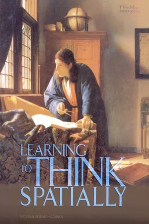
Spatial thinking"e;a constructive combination of concepts of space, tools of representation, and processes of reasoning"e;uses space to structure problems, find answers, and express solutions. It is powerful and pervasive in science, the workplace, and everyday life. By visualizing relationships within spatial structures, we can perceive, remember, and analyze the static and dynamic properties of objects and the relationships between objects. Despite its crucial role underpinning the National Standards for Science and Mathematics, spatial thinking is currently not systematically incorporated into the K-12 curriculum.Learning to Think Spatially: GIS as a Support System in the K-12 Curriculum examines how spatial thinking might be incorporated into existing standards-based instruction across the school curriculum. Spatial thinking must be recognized as a fundamental part of K-12 education and as an integrator and a facilitator for problem solving across the curriculum. With advances in computing technologies and the increasing availability of geospatial data, spatial thinking will play a significant role in the information- based economy of the 21st-century. Using appropriately designed support systems tailored to the K-12 context, spatial thinking can be taught formally to all students. A geographic information system (GIS) offers one example of a high-technology support system that can enable students and teachers to practice and apply spatial thinking in many areas of the curriculum.
Tools to learn more effectively

Saving Books

Keyword Search

Annotating Text

Listen to it instead
Information
Table of contents
- COVER PAGE
- THE NATIONAL ACADEMIES
- SUPPORT FOR THINKING SPATIALLY: THE INCORPORATION OF GEOGRAPHIC INFORMATION SCIENCE ACROSS THE K–12 CURRICULUM
- GEOGRAPHICAL SCIENCES COMMITTEE
- BOARD ON EARTH SCIENCES AND RESOURCES
- Acknowledgments
- Preface
- Contents
- Executive Summary
- Part I The Nature and Functions of Spatial Thinking
- Part II Support for Spatial Thinking
- Part III Supporting Spatial Thinking in the Future
- Appendixes
- Appendix A Biographical Sketches of Committee Members and Staff
- Appendix B Oral Presentations and Written Statements
- Appendix C Individual Differences in Spatial Thinking: The Effects of Age, Development, and Sex
- Appendix D The Role of Spatial Representations in Learning, Problem Solving, and Transfer
- Appendix E Software Descriptions and Resources
- Appendix F What is GIScience?
- Appendix G The Introduction of GIS into K–12 Education
- Appendix H Seasonal Differences: A Customized Eighth-Grade GIS Module
- Appendix I List of Acronyms
- Index
Frequently asked questions
- Essential is ideal for learners and professionals who enjoy exploring a wide range of subjects. Access the Essential Library with 800,000+ trusted titles and best-sellers across business, personal growth, and the humanities. Includes unlimited reading time and Standard Read Aloud voice.
- Complete: Perfect for advanced learners and researchers needing full, unrestricted access. Unlock 1.4M+ books across hundreds of subjects, including academic and specialized titles. The Complete Plan also includes advanced features like Premium Read Aloud and Research Assistant.
Please note we cannot support devices running on iOS 13 and Android 7 or earlier. Learn more about using the app
