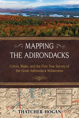
New York State’s famous Adirondack landscape is immense, spanning over six million acres of public forests, lakes, rivers, mountains, and private lands. In full color featuring hundreds of detailed maps and photos, Mapping the Adirondacks celebrates it all with the first clear account of the original surveyor who explored and fully comprehended it—Verplanck Colvin. “Everywhere below,” Colvin wrote, “were lakes and mountains so different from all maps, yet so immovably true.”His monumental accomplishment helped motivate the citizens of New York in 1894 to legally protect it for generations to come.
As an eighteen-year-old budding travel writer, explorer and surveyor, Colvin began personally mapping a half-million acres of true Adirondack wilderness in 1865. Then, shortly after the state began partially funding his audacious project, Colvin reinvented himself as the “Superintendent" of a “Survey of the Adirondack Wilderness” and hired another equally intrepid surveyor to help—his ever-dependable friend Mills Blake. They extended the scope and granularity of their survey several times, hired hundreds of Adirondack guides and other talented people to assist, and devoted twenty-eight years to the challenge of professionally surveying the Adirondacks.
Author Thatcher Hogan has carefully gleaned narratives and illustrations from Colvin’s notoriously dense annual reports and reassembled them with additional historic photographs to chronicle a compelling, true story of rugged exploration. After a novice’s explanation of Colvin and Blake’s surveying terms, the book follows their progress with one hundred of Hogan’s new maps and summit views. The Adirondack landscape remains formidable and fascinating—many of the views are those that Colvin first discovered. Along the way, Hogan uncovers a story of intense ambition, physical hardships, and a weatherproof friendship.
The state’s meager investment in their work paid off many times over. Colvin and Blake’s surveys provided New York with the incontrovertible evidence needed to prevail in hundreds of complex Adirondack land disputes. Most significantly, it enabled the state to consolidate and expand its extraordinary Adirondack Forest Preserves—the prized mountains, forests, and waters of today’s beloved Park.
eBook - ePub
Mapping the Adirondacks
Colvin, Blake, and the First True Survey of the Great Adirondack Wilderness
- English
- ePUB (mobile friendly)
- Available on iOS & Android
eBook - ePub
Mapping the Adirondacks
Colvin, Blake, and the First True Survey of the Great Adirondack Wilderness
About this book
Trusted by 375,005 students
Access to over 1.5 million titles for a fair monthly price.
Study more efficiently using our study tools.
Information
Subtopic
Historical BiographiesIndex
HistoryTable of contents
- Introduction
- 1 Whiteface Mountain: 1869, 1872
- 2 Snowy Mountain: 1868, 1870, 1872
- 3 Cheney Mountain for Bald Peak: 1872
- 4 Smiths Ledges on Frederica Mountain: 1872
- 5 Hurricane Mountain: 1873
- 6 Owls Head Mountain of Long Lake: 1873
- 7 Blue Mountain: 1873
- 8 Ampersand Mountain: 1873
- 9 Fieldwork: 1874–1876
- 10 Saint Regis Mountain: 1876
- 11 Bald/Rondaxe Mountain: 1876, 1877
- 12 Gore Mountain: 1877
- 13 Fieldwork: 1877–1878
- 14 Pharaoh Mountain: 1878, 1880
- 15 Stillwater Mountain: 1882
- 16 Signals: 1882–1884
- 17 Coney Mountain: 1890
- 18 Rediscovering Boundaries: 1886–1898
- 19 The Survey Ends: 1900
- 20 Indian Head Overlook: Today
- Appendix A: Timeline
- Appendix B: Exploring
- Acknowledgments
- Notes
- Bibliography
Frequently asked questions
Yes, you can cancel anytime from the Subscription tab in your account settings on the Perlego website. Your subscription will stay active until the end of your current billing period. Learn how to cancel your subscription
No, books cannot be downloaded as external files, such as PDFs, for use outside of Perlego. However, you can download books within the Perlego app for offline reading on mobile or tablet. Learn how to download books offline
Perlego offers two plans: Essential and Complete
- Essential is ideal for learners and professionals who enjoy exploring a wide range of subjects. Access the Essential Library with 800,000+ trusted titles and best-sellers across business, personal growth, and the humanities. Includes unlimited reading time and Standard Read Aloud voice.
- Complete: Perfect for advanced learners and researchers needing full, unrestricted access. Unlock 1.5M+ books across hundreds of subjects, including academic and specialized titles. The Complete Plan also includes advanced features like Premium Read Aloud and Research Assistant.
We are an online textbook subscription service, where you can get access to an entire online library for less than the price of a single book per month. With over 1.5 million books across 990+ topics, we’ve got you covered! Learn about our mission
Look out for the read-aloud symbol on your next book to see if you can listen to it. The read-aloud tool reads text aloud for you, highlighting the text as it is being read. You can pause it, speed it up and slow it down. Learn more about Read Aloud
Yes! You can use the Perlego app on both iOS and Android devices to read anytime, anywhere — even offline. Perfect for commutes or when you’re on the go.
Please note we cannot support devices running on iOS 13 and Android 7 or earlier. Learn more about using the app
Please note we cannot support devices running on iOS 13 and Android 7 or earlier. Learn more about using the app
Yes, you can access Mapping the Adirondacks by Thatcher Hogan in PDF and/or ePUB format, as well as other popular books in History & Historical Biographies. We have over 1.5 million books available in our catalogue for you to explore.