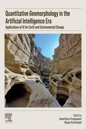
eBook - ePub
Quantitative Geomorphology in the Artificial intelligence Era
Applications of AI for Earth and Environmental Change
- 535 pages
- English
- ePUB (mobile friendly)
- Available on iOS & Android
eBook - ePub
Quantitative Geomorphology in the Artificial intelligence Era
Applications of AI for Earth and Environmental Change
About this book
Quantitative Geomorphology in the Artificial Intelligence Era: Applications of AI for Earth and Environmental Change focuses on bridging the gaps in this emerging discipline, it delves into the complex interplay between landforms and the processes that shape them, offering innovative solutions through AI and data-driven methods. The book addresses the standards, quality assessment of data, spatial and temporal analysis tools, and rigorous validation techniques in geomorphology. It uses computational intelligence as a pivotal tool alongside GIS, remote sensing, and other advanced technologies. Readers will find a holistic resource that fosters collaboration and knowledge exchange among geological fields, aiming to address geomorphological challenges, hazards, and solutions. By harnessing AI, GIS, remote sensing, machine learning, and geophysical techniques, it offers new dimensions to existing assessment methods and techniques.
- Applies quantitative geomorphology techniques to different geological topics through interdisciplinary practices
- Addresses the use of high and very-high resolution satellite imagery in geomorphic research for monitoring and assessment of quantitative geomorphology
- Provides guidance on quantitative techniques for assessing anthropogenic influences on natural materials and Earth processes
Information
Topic
Physical SciencesSubtopic
Geology & Earth SciencesTable of contents
- Title of Book
- Chapter 1 Hierarchical random forest classification using multisource, multitemporal PolSAR, and multispectral data for forest species mapping
- Chapter 2 Utilizing remote sensing data to assess geomorphic and land use changes in watersheds for water resource management and risk mitigation: Maharloo Lake watershed
- Chapter 3 Application of sample fraction and machine learning models for groundwater potential mapping: a remedy for Urmia Lake?
- Chapter 4 Impacts of climate change on geomorphological processes and hazards using high-resolution data derived from unmanned aerial vehicle photogrammetry and terrestrial laser scanning
- Chapter 5 Mitigation of groundwater salinity vulnerability through land cultivation scenarios
- Chapter 6 Geodiversity and biogeomorphology: Predicting species distribution, biodiversity changes, and climate adaptation
- Chapter 7 Investigating the nexus of climate change, land use change, and desertification using machine learning, stochastic models, and projected climate change scenarios
- Chapter 8 Mapping subsidence rate of the Kashan Plain using hybrid pluggable processing pipeline (HyP3) and stacking-InSAR method
- Chapter 9 Quantifying landslide risk: a critical reassessment of slope stability and human settlement impacts
- Chapter 10 Interstratal dissolution activities along the eastern portion of Ar-Riyadh city, Saudi Arabia
- Chapter 11 Assessment of water erosion using the ICONA model in arid and semiarid regions of northeastern Iran
- Chapter 12 Landscape metrics changes in Maharloo watershed, Fars Province, Iran
- Chapter 13 A multidisciplinary approach to understanding and mitigating erosional landforms
- Chapter 14 Spatial modeling of wildfires in the southern Zagros: a comparative analysis using frequency ratio and maximum entropy models
- Chapter 15 Examining the accuracy of G2 and RUSLE models in predicting soil erosion using Google Earth Engine information
- Chapter 16 Compilation of participatory management responses regarding landscape changes
- Chapter 17 Early warning systems for soil erosion assessment
- Chapter 18 Integrated geomorphological method for landslide and flood hazard mapping and risk assessment
- Chapter 19 Evaluating the accuracy of 3D photogrammetry models from uncalibrated aerial imagery for precision hydraulic river modeling
- Chapter 20 The importance of digital elevation model resolution on natural hazards studies
- Chapter 21 Geomorphological mapping for sustainable management of the Pacific coast of Costa Rica
- Chapter 22 Tracing dust sources in northern Iran using HYSLPIT model, remote sensing, and geomorphological analysis
- Chapter 23 Examining how changes in land use have affected land degradation patterns in northeastern Iran from 2002 to 2021
- Chapter 24 Mass movements analysis along the Southern Escarpment of the Bamileke Plateaus (Western Cameroon highlands) using a rainfall data analytical approach
- Chapter 25 Piping collapse: geodiversity in loessial landscapes
- Index
Trusted by 375,005 students
Access to over 1.5 million titles for a fair monthly price.
Study more efficiently using our study tools.
Frequently asked questions
Yes, you can cancel anytime from the Subscription tab in your account settings on the Perlego website. Your subscription will stay active until the end of your current billing period. Learn how to cancel your subscription
No, books cannot be downloaded as external files, such as PDFs, for use outside of Perlego. However, you can download books within the Perlego app for offline reading on mobile or tablet. Learn how to download books offline
Perlego offers two plans: Essential and Complete
- Essential is ideal for learners and professionals who enjoy exploring a wide range of subjects. Access the Essential Library with 800,000+ trusted titles and best-sellers across business, personal growth, and the humanities. Includes unlimited reading time and Standard Read Aloud voice.
- Complete: Perfect for advanced learners and researchers needing full, unrestricted access. Unlock 1.5M+ books across hundreds of subjects, including academic and specialized titles. The Complete Plan also includes advanced features like Premium Read Aloud and Research Assistant.
We are an online textbook subscription service, where you can get access to an entire online library for less than the price of a single book per month. With over 1.5 million books across 990+ topics, we’ve got you covered! Learn about our mission
Look out for the read-aloud symbol on your next book to see if you can listen to it. The read-aloud tool reads text aloud for you, highlighting the text as it is being read. You can pause it, speed it up and slow it down. Learn more about Read Aloud
Yes! You can use the Perlego app on both iOS and Android devices to read anytime, anywhere — even offline. Perfect for commutes or when you’re on the go.
Please note we cannot support devices running on iOS 13 and Android 7 or earlier. Learn more about using the app
Please note we cannot support devices running on iOS 13 and Android 7 or earlier. Learn more about using the app
Yes, you can access Quantitative Geomorphology in the Artificial intelligence Era by Hamid Reza Pourghasemi,Narges Kariminejad in PDF and/or ePUB format, as well as other popular books in Physical Sciences & Geology & Earth Sciences. We have over 1.5 million books available in our catalogue for you to explore.