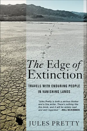
In The Edge of Extinction, Jules Pretty explores life and change in a dozen environments and cultures across the world, taking us on a series of remarkable journeys through deserts, coasts, mountains, steppes, snowscapes, marshes, and farms to show that there are many different ways to live in cooperation with nature. From these accounts of people living close to the land and close to the edge emerge a larger story about sustainability and the future of the planet. Pretty addresses not only current threats to natural and cultural diversity but also the unsustainability of modern lifestyles typical of industrialized countries. In a very real sense, Pretty discovers, what we manage to preserve now may well save us later.Jules Pretty's travels take him among the Maori people along the coasts of the Pacific, into the mountains of China, and across petroglyph-rich deserts of Australia. He treks with nomads over the continent-wide steppes of Tuva in southern Siberia, walks and boats in the wildlife-rich inland swamps of southern Africa, and experiences the Arctic with ice fishermen in Finland. He explores the coasts and inland marshes of eastern England and Northern Ireland and accompanies Innu people across the taiga's snowy forests and the lakes of the Labrador interior. Pretty concludes his global journey immersed in the discrete cultures and landscapes embedded within the American landscape: the small farms of the Amish, the swamps of the Cajuns in the deep South, and the deserts of California.The diverse people Pretty meets in The Edge of Extinction display deep pride in their relationships with the land and are only willing to join with the modern world on their own terms. By the examples they set, they offer valuable lessons for anyone seeking to find harmony in a world cracking under the pressures of apparently insatiable consumption patterns of the affluent.
- 256 pages
- English
- ePUB (mobile friendly)
- Available on iOS & Android
eBook - ePub
About this book
Trusted by 375,005 students
Access to over 1.5 million titles for a fair monthly price.
Study more efficiently using our study tools.
Information
Subtopic
SociologyIndex
Biological Sciences1
SEACOAST
Ngāi Tahu, Aotearoa (New Zealand)
10° West of Date Line*
The sun rises from the east over an ocean that covers one-third of the planetary surface. Cross the line, as the sun appears to do, from east to west, and you repeat the calendar day; cross from west to east and confusingly a day of your life seems to disappear. It is a jagged imaginary line from Wrangel Island to the Antarctic, in the middle a panhandle recently created to absorb Kiribati, Tokelau, and Samoa into the same time zone as the western ocean. Humans came late, spreading eastward from Asia some five thousand years ago in the world’s first oceangoing vessels. Later the Lapita carried by canoe domesticated pigs, dogs, and fowl, also taro, yam, coconut, and banana, traveling on to Fiji by 1300 bc, Tonga and Samoa two hundred years later, to Hawaii and Rapa Nui (Easter Island) by ad 700, and onward to South America to carry back kumara, the sweet potato, and gourd by ad 1000. Thor Heyerdahl was both right and wrong in 1947. People did travel from South America by sea, but they had come that way first. And they didn’t blunder around in a reed and balsa raft. Those navigators and canoe makers knew what they were doing, even though ocean distances must have seemed interplanetary.
The world’s last substantial landmass, apart from Antarctica, to be peopled was Aotearoa, now New Zealand, in about ad 1300. Using subtropical weather systems, Polynesians made heroic crossings from the Cook and Society Islands. When the Europeans came to the Pacific, first Ferdinand Magellan in 1521, then William Dampier, Abel Tasman, James Cook, and many others, they could not believe the indigenous people navigated without instruments or charts. Yet in this vast ocean, where there are six thousand square kilometers of water for every one of land, it was the navigators who were the most honored. The Europeans came with astrolabes and compasses, yet had no means of calculating longitude until the mid-1700s. By contrast the Pacific navigators had knowledge of stars and sun, swell patterns, clouds, homing birds, deep phosphorescence, wave refraction and reflection, currents and sea marks.
For three hundred years, the Pacific was reckoned to be a vast wilderness to discover and conquer. And to bring back booty. Locals were variously called hostiles, swindlers, heathens, and murderers, or were elevated into romantic myth. Most books about the Pacific and its navigation contain no reference to the locals’ capacity to populate remote islands in the first place, or to continue to move around. Many of those on the expeditions were oddly incurious. There were clues: Cook’s Endeavour, a converted collier thirty-three meters in length, was smaller than Fijian canoes that could carry 250 people. Cook wrote of canoes traveling at speeds of twenty-two knots; his ship could make six knots at top speed. The knowledge of the navigators was detailed, precise, and derived from experience, though in modern times fell away before recent revival by the Polynesian Voyaging Society.1
Navigators need to know the whole sky, and would have both sidereal star and wind compasses in their minds. At night, horizon stars can be used to steer by for a short time. The belt of hunter Orion, for example, always rises due east and sets due west, but as stars rise four minutes earlier every day, the sky needs to be known throughout the year. A night of sailing thus requires knowledge of the position and bearing of some ten to twelve horizon stars. Another method centers on knowledge of swell patterns, the waves that have traveled hundreds of miles beyond the wind systems that generate them. These are generally long, slow undulations, and the best navigators lie in their canoes and direct helmsman by what they feel of the swell. Navigators can also read the resonance patterns when reflected off distant land or refracted around islands. One technique is to leave a rope trailing behind the canoe, so that if a wave pushes the canoe off course, the rope remains true to the original line of travel. Canoes could also follow migratory birds, such as long-tailed or shining cuckoos, or shearwaters.
There is thus a zone of land indicators around every island. Some birds will travel only ten or twenty kilometers from land; others typically thirty. Terns and noddies are known to visit passing canoes at night, and then fly directly toward land, thus gifting a bearing to the navigator. Many birds also fly toward fishing grounds in the morning, and back to land in the evening. Clouds move more slowly over land, as if stuck, indicating islands over the horizon. If green beneath, they are above a lagoon; if bright, then above white sand or surf. Sea convection clouds over islands can be 150 kilometers away. In A Pattern of Islands, Arthur Grimble recorded sea marks or betia in Kiribati, then the Gilberts, stable lines of leaves or rubbish caught forever between currents. Many navigators also use deep phosphorescence, manifested in the form of streamers, flashes, or glowing plaques of light that are often common on dark, rainy nights, and always point toward land. Many journeys of discovery were search and return that relied on trade winds reversing at different times of the year. Sailing against or across the wind meant a relatively easy return; but traveling downwind would require return by a different route, and thus needed knowledge of other islands.
Still, though, two great islands between the southern latitudes of 34 to 48 degrees remained undiscovered. Pharaohs and their pyramids had come and gone, the Roman Empire too, William and the Normans had arrived in Britain, dispatched Harold and stayed, and still Aotearoa remained off the human map. Then a group of Polynesian navigators and mariners looked south and west from the central Pacific, and set off in their great canoes with outriggers to cross sixteen hundred miles of open ocean. The originating homeland became known as Hawaiki, and the people settled the two islands of endemic ground birds, dark fern forests, deep harbors, and crumpled mountains. According to Māori whakapapa genealogies, settlement occurred twenty-four to twenty-seven generations ago, confirming those first arrivals at about seven hundred years before today. Some say there was one great arrival, others that there were waves. Some may have been pushed onward by conflict, others guided by migratory whales.
It was too cold for coconut, breadfruit, and banana, but taro, yam, mulberry, cabbage trees, kumara, and gourds thrived. There were extinctions: moa and other species of large land birds were gone within two hundred years. In 1642, Tasman was the first European to arrive on the west coast, then 140 years or so later came Cook to stake his country’s ownership of New Zealand. Cook’s three voyages of discovery in the 1770s, as they were called, produced a new map of the Pacific, though this son of a Yorkshire laborer was to meet his end on the Sandwich Islands. But unlike many Aboriginal groups in Australia, Cook’s arrival did not bring the end for the many Māori cultures.
The waves of new colonialists took lands and resources, brought their own plants, animals, and language, yet within seventy years had signed the crucial Treaty of Waitangi in 1840 that formalized political and institutional space for Māori peoples. But still the Māori population fell dramatically, the result of disease, loss of land and resources, and despair: from eighty thousand in 1840 to half that by 1900. During the twentieth century, kā Māori people shifted from being almost all rural or coastal based to nearly nine-tenths urban by 2000. For urban Māori, identity tends now to be toward generalized Māori rather than the particular tribe or iwi. Māori in New Zealand, though, obtained the vote from 1902; Aboriginals in Australia had to wait until the 1960s.
My navigators will be members of the Ngāi Tahu iwi of South Island, and from the local university in Dunedin.2 The Ōtākou marae was the first Māori village encountered by Presbyterian settlers and whalers who had ventured into Dunedin’s deep fjord of a harbor. They rendered Ōtākou to Otago. I sleep at Tahu and Megan’s spare bungalow overlooking the slate-gray harbor, and had intended to rise early to walk the hills. In vivid dreams populated by cabbage trees, muttonbirds, wild harvest, and sacred lakes, I find myself wondering why it is so light so early in the country when it had been dark ten miles away in the city. In those becalmed dreams, all urgency has gone. Eventually I lean over to check the clock and find it is four minutes before our agreed departure time.
I leap up and bolt a warm coffee, breathe deeply, and step quickly down the hillside.
Tahu is relaxed. He is sitting at the kitchen table completing his weekly article on laptop. His hair is prematurely gray, Megan’s tousled brown. Their daughter is at school, younger son running around. No one’s in any hurry.
I remember how Pacific time can slow like this. I ran a course in a village in eastern Fiji. In sweltering humidity we sat in the chief’s house with three other leaders opposite a new bora communal barn, its steep roof being freshly thatched almost to the ground. The sea breeze hurried the curtains, and palm trees bent and quivered. The azure sky was deep and unending. We had brought peppery yaqoma roots, also known as kava, Piper methysticum, and these were pounded in a large communal bowl. For most of the humid afternoon, the ceremony continued, coconut bowls of muddy brown liquid exchanged and drunk, one clap of hands from the receiver, three by the giver, then two more by the receiver on completion. We exchanged murmured speeches. We the visitors could then enter the village; I stayed with the chief’s party. The kava filled the afternoon that was both long and too short. Outside plates rattled in bowls, chickens squabbled, a child called, leaves rustled. The wooden house was painted cream and blue. I remember watching white cumulus start to drift over. Each day started in the same way, and proceeded with a measured South Seas’ pace. “Small is the voice of a chief,” said Arthur Grimble on the Gilberts to the northwest.
From the kitchen window and beyond a picket fence, I can see white horses dashing across the two-mile-wide harbor flanked by scalped hills. The native vegetation hugs the hills, the imported stands out, explains writer Khyla Russell later. We drive north on the inside of the peninsula for formalities at the marae. This seems a straightforward arrangement, but there had been many prior discussions. You do not just come to the land without acknowledgment of history and intentionality. My coming had provoked talks about how formal or informal should be the arriving. There is always a proper way. You do not just show up like Cook and the others. The previous night at Edward Ellison’s six-hundred-acre farm, in the family since 1880, we had shared a meal of salty muttonbirds, with mashed potatoes and greens, and glasses of red wine from a South Island winery, the wood fire blazing in the stove.
We arrive at the marae, meeting place and spiritual center for the community. It is for encounters, a creative space alive with ancestors. Above the door is written Tamatea, the name of the legendary traveler from Hawaiki. Everything begins and ends here, where nature and culture cohere. At the gate, brick-red carvings span the entrance, and a plaque notes their centennial memorial in 1940, a hundred years after the treaty was signed here, and we walk up the curved path to the cream hall with sweeping red roof that almost meets the ground. All the pillars, eaves, and windows are carved with spiral forms and stacked ancestors standing on one another’s shoulders. In this bitter southeasterly that tugs and pulls, it still puts me in mind of that communal hall in Fiji. Inside, a stage is hidden by crimson curtains, and electric heaters hanging from the ceiling glow. A stained-glass window depicts a Māori soldier with bayoneted rifle, khaki shirt rolled above elbows, shorts and long socks with dark shoes. The sky is blue, and at the top is a face with bulging eyes and tongue outstretched. On the left is a roll of honor with one Ōtākou name under the Boer War, fourteen for 1914–18, and on the right another sixteen from 1939–45. Many are repeated, including three Ellisons, Robertsons, and Forsyths.
The group gathers on a line of chairs beneath the stage, and I sit tentatively in the audience with Megan, Edward’s daughter. Tahu welcomes, Khyla stands to add more, her lips blue with mata, two parallel lines down her chin, curling back in spirals. I stand to give thanks, announcing myself to the Māori ancestors here in the marae. I’m left with a feeling that I could have done this better. We chat about memories of the hall. Of playing badminton, and of community events with all the kids sleeping on mattresses and the grown-ups drinking outside. Death is a theme. It brings people together. Bodies are brought inside the marae before going to the cemetery next door. Everyone gets used to death, to living with ancestors.
“Sometimes you only know someone when they’re dead,” observes Tahu, as others nod.
There used to be a school associated with the marae, but it’s closed now. Yet the country’s first Māori doctor and lawyer were from Ōtākou, right here.
With a slow stride, we walk north along the thin strip between coast and cliff. Wrapped in coats and hats we talk along the bay. Long waves race through the narrow opening in the harbor. On the beach oystercatchers pipe mournfully and crouching shags gaze at the water. Other waders skitter as the waves rise and crash and retreat. On the hills above the houses and gardens are cabbage trees tall and branched, and clumps of golden gorse, a pest here, the parched pasture cropped by rabbits and sheep. We turn into Riki and Eleanor’s and stroll up the garden to where they run forty sheep on the hill.
By a thin stream that drains into a seasonal pond, Riki has built a fifteen-foot arch of rare kauri wood and carved an intricate pattern depicting ancestors and marking this particular piece of homeland. These native kauri, Aganthis, can reach fifty meters in height with trunk diameters of five meters or more, and normally live for six hundred years, the oldest a couple of thousand, rivaling the great sequoias of California on the other side of the Pacific. It’s a hard wood, says Riki, yet soft enough to carve. There is something dependable about very old trees. Some have seen off whole civilizations, stuck where their roots first took hold. When the Europeans came, they logged kauri for ship masts and spars; only a tenth of the original forests remained by 1900.
At the far end of the bay, we stop at the house of elders Paul and Natalie, and cramp in the front room warmed by a portable gas heater. The metal-framed windows are soon covered in condensation. Paul has a shock of white hair above broad face, his torso seeming to speak of rugby forward. Natalie glides around the room, smiling. They rent land out for cribs, small houses, but there’s a constant dance over rents. The edge is over commerce: is it right to be making a living, or is it the density of social relationships that matters most? Family members, for example, want housing rent-free, and almost everyone is family in some way. Paul was helping in the construction of a community garden with John Reid of Lincoln University when they discovered riwai potatoes growing wild on a tiny le...
Table of contents
- Previously
- Note on Weights and Measures
- 1. Seacoast: Ngāi Tahu, Aotearoa (New Zealand)
- 2. Mountain: Huangshan, China
- 3. Desert Coast: Murujuga (Burrup), Australia
- 4. Steppe: Tuva, Russia
- 5. Snow: Karelia, Finland
- 6. Swamp: Okavango, Botswana
- 7. Marsh-Farm: East Anglia, England
- 8. Coast: Antrim Glens, Northern Ireland
- 9. Snow: Nitassinan, Labrador, Canada
- 10. Farm-City: Amish Country, Ohio, United States
- 11. Swamp: Atchafalaya Basin, Louisiana, United States
- 12. Desert: Timbisha (Death Valley), California, United States
- Coda: Dreaming of the Day After
- Notes
- Bibliography
- Acknowledgments
Frequently asked questions
Yes, you can cancel anytime from the Subscription tab in your account settings on the Perlego website. Your subscription will stay active until the end of your current billing period. Learn how to cancel your subscription
No, books cannot be downloaded as external files, such as PDFs, for use outside of Perlego. However, you can download books within the Perlego app for offline reading on mobile or tablet. Learn how to download books offline
Perlego offers two plans: Essential and Complete
- Essential is ideal for learners and professionals who enjoy exploring a wide range of subjects. Access the Essential Library with 800,000+ trusted titles and best-sellers across business, personal growth, and the humanities. Includes unlimited reading time and Standard Read Aloud voice.
- Complete: Perfect for advanced learners and researchers needing full, unrestricted access. Unlock 1.5M+ books across hundreds of subjects, including academic and specialized titles. The Complete Plan also includes advanced features like Premium Read Aloud and Research Assistant.
We are an online textbook subscription service, where you can get access to an entire online library for less than the price of a single book per month. With over 1.5 million books across 990+ topics, we’ve got you covered! Learn about our mission
Look out for the read-aloud symbol on your next book to see if you can listen to it. The read-aloud tool reads text aloud for you, highlighting the text as it is being read. You can pause it, speed it up and slow it down. Learn more about Read Aloud
Yes! You can use the Perlego app on both iOS and Android devices to read anytime, anywhere — even offline. Perfect for commutes or when you’re on the go.
Please note we cannot support devices running on iOS 13 and Android 7 or earlier. Learn more about using the app
Please note we cannot support devices running on iOS 13 and Android 7 or earlier. Learn more about using the app
Yes, you can access The Edge of Extinction by Jules Pretty in PDF and/or ePUB format, as well as other popular books in Biological Sciences & Sociology. We have over 1.5 million books available in our catalogue for you to explore.