In Russia's Far East sits the wild Ussuri Kray, a region known for its remote highlands and rugged mountain passes where tigers and bears roam the cliffs, and salmon and lenok navigate the rivers. In this collection of travel writing by famed Russian explorer and naturalist Vladimir K. Arsenyev (1872-1930), readers are shuttled back to the turn of the 20th century when the Russian Empire was reeling from its defeat in the Russo-Japanese War (1904-1905) and vulnerable to its Far Eastern neighbors. What began as an expedition to survey the region's infrastructure for the Russian military turned into an adventure through a territory rich in ethnic and ecological diversity. Encountering the disappearing indigenous cultures of the Nanai and Udege, engaging the help of Korean farmers and Chinese hunters, and witnessing the beginning of indomitable Russian settlement, Arsenyev documents the lives and customs of the region's inhabitants and their surroundings. Originally written as "a popular scientific description of the Kray, " this unabridged edition includes photographs largely unseen for nearly a century and is annotated by Jonathan C. Slaght, a biologist working in the same forests Arsenyev explored. Across the Ussuri Kray is a classic of northeast Asian cultural and natural history.
eBook - ePub
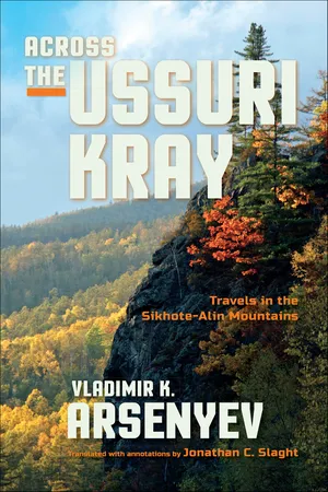
Across the Ussuri Kray
Travels in the Sikhote-Alin Mountains
- 488 pages
- English
- ePUB (mobile friendly)
- Available on iOS & Android
eBook - ePub
About this book
Trusted by 375,005 students
Access to over 1.5 million titles for a fair monthly price.
Study more efficiently using our study tools.
Information
PART I
The 1902 Expedition
1
THE GLASS VALLEY
Maytun Bay. The Village of Shkotovo. The Beytsa River.
An Encounter with a Leopard. Dadyanshan. Red Deer.
An Encounter with a Leopard. Dadyanshan. Red Deer.
During one of my assignments with a hunting team in 1902, I made my way up the Tsimukhe River, which flows into Ussuri Bay near the village of Shkotovo.1 My team consisted of six Siberian riflemen and four pack horses. The goal of this expedition was to militarily survey the area around Shkotovo and to learn what I could about the mountain passes of the Dadyanshan range, which is the source of four rivers: the Tsimukhe, Maykhe, Daubikhe, and Lefu. After which, I was to examine all trails in the area of Lake Khanka, and those near the Ussuri Railway.2
The mountain ridge in question rises near the village of Iman in the north, then runs south parallel to the Ussuri River from the north-northeast to the south-southwest, so that the Sungacha River and Lake Khanka lie to its west, and the Daubikhe River lies to its east. Then, the ridge splits into two branches: one going southwest to form the Bogataya Griva [“thick mane”; a ridge that extends along the entire Muravëv-Amursky peninsula], and the other running south, where it merges with the high range that is the watershed between the Daubikhe and Suchan Rivers.
The upper portion of Ussuri Bay is called Maytun Bay, which once cut somewhat further inland than it does now. This is evident from first glance, as there are coastal cliffs a good 5 kilometers inland. The mouth of the Tangouza River used to be where Sanpouza and Elpouza Lakes are now, and the mouth of the Maykhe River used to be a little further inland than that, where the railroad now crosses it. The whole area is now 22 square kilometers of wetland and filled with sediment from the Maykhe and Tangouza Rivers. There are still some small lakes among the wetlands; these represent areas where the ancient bay had been at its deepest. The slow process by which the sea cedes area to dry land continues in the present day, with the same fate befalling Maytun Bay, which is now quite shallow. Its western shores are composed of the igneous rock porphyry and the eastern side is made of Tertiary sediments: granite and syenite from the Maykhe River valley, and basalts from a little further east.3
We were starting out from Shkotovo, a village founded in 1864 on the right bank of the Tsimukhe River’s mouth. Shkotovo was burned by the Khunkhuz in 1868, but was later rebuilt.4 Przhevalsky was there in 1870 and described a village of six houses with thirty-four residents.5 I considered Shkotovo to now be a relatively large village.6
We spent two days in Shkotovo exploring the area and outfitting for our trip. The Tsimukhe River, which is about 30 kilometers long, flows from east to west and has only one tributary on its right bank, the Beytsa River. The valley through which this river flows is called Steklyannaya [“glass”] Valley by the locals, a name owing to a Chinese hunting cabin there that once had a small pane of glass for a window. It should be noted that there once were no glass factories in an area as remote as the Ussuri Kray; consequently this material was highly prized. Glass was even used as a unit of barter in the depths of these mountains and hills: an empty bottle could be exchanged for flour, salt, millet, and even furs. Old-timers said that during feuds, enemies tried to get into each other’s homes and destroy their glassware. No wonder then, that a piece of glass in the window of a Chinese fanza was considered a luxury.7 It clearly impressed the first Russian settlers, who gave the name Steklyannaya not just to that one fanza and the nearby river, but to the entire surrounding area.
A dirt road leads through the Tsimukhe valley from Shkotovo to the village of Novorossyskoye, after which it devolves into a trail. From this trail it is possible to get to Suchan and to the village of Novonezhino along the Kangouzu River. The road often switches from one side of the river to the other, which is why when water levels were high, all communications with that area are cut off.
We left Shkotovo early and made it that same day to the Steklyannaya valley, which we began to ascend. The Beytsa River flows in almost a straight line from the west-southwest, and only near its mouth does it turn to the west. The width of the Steklyannaya valley varies from about 100 meters at its narrowest to more than a kilometer at its widest. Like most valleys in the Ussuri Kray, it is surprisingly flat. It is fringed by steep-sloped mountains covered with gnarled oaks. The valley edges are quite steep, which suggests that at one time there was significant denudation here: the valley used to be much deeper and filled with river sediment over time.
The quality of the vegetation improved as we went deeper into the mountains. The open oak forest was replaced by dense mixed forest with a high proportion of Korean pine. A small path, cut by Chinese hunters and ginseng hunters, led us on. Two days later we reached the place where the “glass fanza” had been; but now only its ruins remained. The trail deteriorated with each passing day; it was evident that it had not been used for some time. It was overgrown with grass, frequently blocked by wind-fallen trees, and we soon lost it altogether. We followed game trails instead when we could, but mostly we cut our own trail. On the third day, closer to evening, we reached the Dadyanshan Ridge. Here it runs north–south with an average elevation of 700 meters. Leaving the team below, I ascended one of the nearby peaks with Junior Officer Olentyev to see how much farther it was until we reached the pass. I could see all the mountains quite well from up there, and saw that the divide was still 2 or 3 kilometers away.8 It was clear that we would not make it by nightfall, and even if we did we would risk spending the night without water, as at that time of year mountain rivers were practically dry. So I decided to make camp where we left the horses and ascend the pass the following morning.
Typically, instead of hiking until dark, I prefer to make camp with enough daylight left to set up tents and prepare firewood for the night. While the riflemen were making camp, I took advantage of my free time by exploring our nearby surroundings. My regular right-hand man for expeditions such as these was Junior Officer Polikarp Olentyev, a wonderful man and an excellent hunter. At that time he was about twenty-six years old, of medium height and well built. To give readers a sense of his appearance, he had brown hair, prominent facial features, and a small moustache. Olentyev was an optimist. He never lost his cheery attitude, even when we got into tough situations, and always tried to convince me that “all is for the best in this best of all worlds.” Having done what was needed at camp, the two of us grabbed our guns and went to look around.
The sun had only just dropped below the horizon, and as its rays gilded the mountain tops, shadows of twilight appeared in the valleys. Treetops with yellowing leaves contrasted sharply with the pale sky, and everything—the birds, the insects, the dry grass, and even the air—sensed autumn’s approach.
After crossing a low ridge, we dropped into a neighboring valley of dense forest and crossed a wide, dry river bed. Here we split up: I followed the pebble shoals to the left, and Olentyev went to the right. Not more than two minutes later I suddenly heard a shot ring out from his direction. I turned and at that moment saw something flexible and spotted flash through the air. I rushed over to Olentyev. He quickly reloaded his rifle, but one cartridge jammed in the magazine case and the bolt would not shut.
“What did you shoot?” I asked him.
“I think it was a tiger,” he said. “The beast was in a tree; I aimed well and think I hit him.”
Olentyev finally removed the jammed cartridge, reloaded his gun, and we cautiously moved toward the spot where we had last seen the animal. There was blood on the dry grass—this showed that it had indeed been injured. Olentyev stopped short and listened. Ahead of us and a little to the right, I heard what sounded like snoring, but it was impossible to see through the thick fern understory, and a large log lay on the ground to block our path. Olentyev was about to climb over it when the wounded animal charged. At point blank, Olentyev fired hastily without even aiming his rifle, and got lucky. The bullet struck the animal in the head, and it collapsed on the log in front of us and hung there, so that its head and front limbs were on one side, and the rear of its body was on the other. The dying animal made a few convulsive movements and chewed at the ground; in doing so its center of gravity shifted, and its body slid slowly forward to fall heavily at the hunter’s feet.
I knew instantly that this was a Manchurian panther, called a leopard by the locals, and this incredible specimen was one of the larger ones.9 It was 1.4 meters long from snout to tail. The leopard’s pelt was rusty yellow on its sides and back, and white on its belly. It was covered with black spots, which were arranged in rows similar to the stripes on a tiger. These spots were solid and small on the sides, paws, and head, whereas they were large and circular on its neck, back, and tail.
Leopards are found only in the southern parts of the Ussuri Kray, mainly in the Suyfunsky, Posyetsky, and Barabashevsky regions.10 Their primary prey are sika deer, roe deer, and ring-necked pheasant. This is an extraordinarily sly and cautious animal. When fleeing humans, a leopard will climb a tree and choose a branch on the opposite side of the tree from whence it came, so that it is parallel to the hunter’s line of sight. The animal will then stretch along this branch, putting its head between its front paws, and freeze in that position. The leopard understands quite well that from that angle, with its body pressed against the branch, it is far less noticeable than if its body were perpendicular to the hunter.
It took us more than an hour to skin the dead animal, and it was well after dark by the time we set off on the return journey. We walked for some time before finally seeing the fires of our camp. Then, among the trees, we could make out the silhouettes of people moving about and becoming obscured by the campfires. The dogs met us with friendly barks as we approached, and the riflemen surrounded the leopard, gave it a good look over, and loudly voiced their opinions. Such discussions carried on until late in the night.
The next day we continued our journey. The valley narrowed, and the going became harder. We were bushwhacking and cared only about moving in as straight a line as possible.
A guide must always look far ahead and must have a well-developed sense of orientation. He must follow the most efficient route while avoiding steep slopes. He must remember that people can follow horse trails but the opposite is not always true. A guide cannot lead circuitous paths that will sap the strength of the horses and men, but at the same time must avoid talus patches and areas choked by wind-fallen trees. As the detachment commander, this duty fell on my shoulders. I am unsure how well I fulfilled this task—my sense is passably.
By midday we came to the ridge, and its ascent was steep and difficult. The horses climbed with all their strength, but the strain caused their legs to tremble, and they would stumble with nostrils flared and fitful, heavy breaths. We walked in a switchback pattern in order to ease our ascent, pausing often and checking the horses’ pack straps. We finally made it to the top, where we rested for a full half hour. The ridge was forested and lush there; we had to move carefully and stop frequently to check our position. Otherwise, it would have been easy to get lost, especially in foggy conditions. An inexperienced traveler might decide to simply follow the ridgeline he can see ahead of him, but this would probably get him lost. These tall mountains are very often no more than side spurs of the main ridge, and following them can easily lead someone off course. I had fallen victim to similar circumstances in the past. In order to not repeat this mistake I ordered the men to stop and, selecting a tall pine, climbed limberly to its crown.
From there I could see the whole Dadyanshan as though it were in the palm of my hand. It ran to the north with a slight bend to the east. The ridge itself was somewhat vague and indistinct where we were, but farther to the east, which was likely the upper reaches of the Daubikhe and the Ulakhe Rivers, the ridge was tall and majestic. The western slope seemed more abrupt and steep, whereas the eastern slope was gentler. The Maykhe and Tsimukhe Rivers could be seen far to the left, and the rugged Suchan River basin was off to the right. ...
Table of contents
- Cover
- Half title
- Title
- Copyright
- Dedication
- Contents
- Foreword: The Unknown Arsenyev
- Preface to the 1921 Edition
- Translator’s Acknowledgments
- Translator’s Introduction
- Part I: The 1902 Expedition
- Part II: The 1906 Expedition
- Appendix 1: Historical and Current Names of Landmarks and Settlements
- Appendix 2: Biographical Information of Characters
- Bibliography
- Index
- About the Author
Frequently asked questions
Yes, you can cancel anytime from the Subscription tab in your account settings on the Perlego website. Your subscription will stay active until the end of your current billing period. Learn how to cancel your subscription
No, books cannot be downloaded as external files, such as PDFs, for use outside of Perlego. However, you can download books within the Perlego app for offline reading on mobile or tablet. Learn how to download books offline
Perlego offers two plans: Essential and Complete
- Essential is ideal for learners and professionals who enjoy exploring a wide range of subjects. Access the Essential Library with 800,000+ trusted titles and best-sellers across business, personal growth, and the humanities. Includes unlimited reading time and Standard Read Aloud voice.
- Complete: Perfect for advanced learners and researchers needing full, unrestricted access. Unlock 1.5M+ books across hundreds of subjects, including academic and specialized titles. The Complete Plan also includes advanced features like Premium Read Aloud and Research Assistant.
We are an online textbook subscription service, where you can get access to an entire online library for less than the price of a single book per month. With over 1.5 million books across 990+ topics, we’ve got you covered! Learn about our mission
Look out for the read-aloud symbol on your next book to see if you can listen to it. The read-aloud tool reads text aloud for you, highlighting the text as it is being read. You can pause it, speed it up and slow it down. Learn more about Read Aloud
Yes! You can use the Perlego app on both iOS and Android devices to read anytime, anywhere — even offline. Perfect for commutes or when you’re on the go.
Please note we cannot support devices running on iOS 13 and Android 7 or earlier. Learn more about using the app
Please note we cannot support devices running on iOS 13 and Android 7 or earlier. Learn more about using the app
Yes, you can access Across the Ussuri Kray by Vladimir K. Arsenyev, Jonathan C. Slaght in PDF and/or ePUB format, as well as other popular books in History & World History. We have over 1.5 million books available in our catalogue for you to explore.