This ground-breaking volume brings together contributions from scholars across a range of disciplines (including literary studies, history, geography and archaeology) to investigate questions of space, place and identity in the medieval city. Using Chester as a case study - with attention to its location on the border between England and Wales, its rich multi-lingual culture and surviving material fabric - the essays seek to recover the experience and understanding of the urban space by individuals and groups within the medieval city, and to offer new readings from the vantage-point of twenty-first century disciplinary and theoretical perspectives.
eBook - ePub
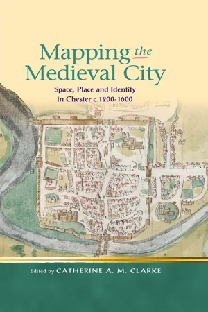
Mapping the Medieval City
Space, Place and Identity in Chester c.1200-1600
- English
- ePUB (mobile friendly)
- Available on iOS & Android
eBook - ePub
About this book
Trusted by 375,005 students
Access to over 1.5 million titles for a fair monthly price.
Study more efficiently using our study tools.
Information
Publisher
University of Wales PressYear
2011Print ISBN
9780708326527
9780708323922
Edition
1eBook ISBN
9781783164615
1
Introduction Medieval Chester: Views from the Walls
In September 2008, on a research trip to Chester as part of the AHRC-funded ‘Mapping Medieval Chester’ project, I picked up the leaflet for a ‘Walk around Chester Walls’: a ‘Unique Circular Walk’, which promised to be ‘Unmissable! – One of Britain’s Best Historic Walks’.1 As I followed the outlined route along the stone walls which encircle the early settlement, the leaflet drew my attention to the wonderful views over the city and its individual buildings, repeatedly emphasizing the multiple strata of history encoded within the urban landscape. Eastgate, for example, was described through a brief account of its various historical incarnations: ‘[t]he current 18th-century arch replaces a narrow, fortified medieval gateway, which in turn overlay the ruins of the ceremonial entrance to the Roman legionary fortress.’ The leaflet’s introduction to ‘England’s Walled City’ offered me a concise account of the history of Chester’s walls, from Roman fortress and Saxon burh through to medieval towers and early modern promenade. For a visitor to Chester, this walk around the walls presents an overview of the city – both literally and metaphorically – which gives an insight into its long, varied and multi-layered history.
As a privileged vantage point over Chester, the view from the walls recurs as a key motif throughout texts associated with the city from the medieval period to the present day. Most recently, the walls have become a ‘virtual’ point of entry into Chester for remote ‘visitors’ distant from the city itself. The very popular website ‘Chester: a Virtual Stroll around the Walls’ (www.chesterwalls.info), produced and maintained by local photographer and amateur historian Steve Howe, leads virtual tourists through the landscape and history of the city via a carefully constructed circular route, receiving visits from internet users all over the world. The digital resources produced by the AHRC-funded ‘Mapping Medieval Chester’ project (www.medievalchester.ac.uk) present an interactive digital atlas of the city c.1500, allowing users to move around the medieval walls and follow links to related descriptions and accounts in contemporary texts. Whilst working in new, digital media and presenting new possibilities for virtual interaction with the city’s material fabric, these online resources continue a long tradition of making the city accessible through the view from its historic walls. Across different texts associated with Chester, with their different cultural contexts, ideological positions and symbolic configurations of the urban space, the elevated perspective from the walls seemingly renders the city uniquely legible and comprehensible, whilst simultaneously revealing the desires and concerns of the author. The diverse views over the city presented in these texts offer a useful starting point for thinking about the different perspectives produced by our own studies, and the different versions of medieval Chester formed by our own critical mappings, whether visual or textual.
The descriptions of Chester’s walls by the novelist Henry James are amongst the most well-known accounts of the city. As well as the 1903 novel The Ambassadors, which begins with the visit of the American, Lewis Lambert Strether, to Chester, James’s collection of travel writing English Hours includes a sustained description of the city and its walls. This account is typical of Chester texts in its use of the walls as a device for comprehending the city: as with many writers before him, James’s view from this privileged vantage point reveals his own desires and anxieties mapped onto the urban landscape. For James, the walls of Chester represent the fantasy of the authentic ancient city, preserved in all its original integrity. He begins his account of the city by reporting that ‘I have been strolling and restrolling along the ancient wall – so perfect in its antiquity – which locks this dense little city in its stony circle,’ celebrating the ‘brave little walls’ as the exemplar of the English practice of ‘an ancient property or institution lovingly readopted and consecrated to some modern amenity’.2 Already here two key themes are clear: the notion of the ‘perfection’ of the urban enclosure, and the image (later to emerge as ambivalent) of the city ‘locked’ inside its enceinte. James goes on to insist further on the perfect compass of the walls, observing that:
The wall enfolds the place in a continuous ring, which, passing through innumerable picturesque vicissitudes, often threatens to snap, but never fairly breaks the link; so that, starting at any point, an hour’s easy stroll will bring you back to your station.3
However, this perfect circumscription of the city is James’s rhetorical construction. The walls had already been damaged and compromised in various ways by the mid-nineteenth century, the most major break in the circuit caused by the cutting for the Chester-Holyhead railway in 1846.4 In fact, James’s character Strether in The Ambassadors adopts a less idealised and more realistic view of the city’s walls when he imagines, ‘[t]he tortuous wall’ as a ‘girdle, long since snapped, of the little swollen city, half held in place by careful civic hands’.5 Strether experiences ‘delight’ at the views from the walls, but his description of the city resists the indulgence of picturesque fantasy admitted in the English Hours.6 Whilst James’s view from the walls reveals Chester as he wishes to see it – the still-perfect embodiment of the ancient European fortress enclosure – he also suggests that the walls represent a ‘prime necessity’ for the Cestrians themselves in terms of their ability to know and understand their own city.
For through it, surely, they may know their city more intimately than their unbuckled neighbours – survey it, feel it, rejoice in it as many times a day as they please.7
Again here, we have a version of the commonplace that the walls of Chester enable the city to be viewed, known and understood and thus enjoyed. For James too, his walk around the walls allows him to regard the city from above, making sense of the different views which emerge ‘[e]very few steps’.8
A shaded mall wanders at the foot of the rampart; beside this passes a narrow canal, with locks and barges and burly water-men in smocks and breeches; while the venerable pair of towers, with their old red sandstone sides peeping through the gaps in their green mantles, rest on the soft grass of one of those odd fragments of public garden, a crooked strip of ground turned to social account, which one meets at every turn, apparently, in England …9
Yet, whilst the walls lift James above the city, allowing him to survey and interpret the urban spaces and activities below, the streets of Chester itself offer a different experience. In his account of the city’s famous medieval Rows, James’s account becomes more ambivalent, exposing the negative implications of the city ‘locked’ and ‘buckled’ within its enclosing fortifications. The streets of Chester do offer picturesque interest and amusement for James, with their ‘random corners, projections and recesses, odd domestic interspaces … architectural surprises and caprices and fantasies’, yet the antique charms of the city are intermeshed with the spectre of ‘old-world pains and fears’.10 The architecture of the Rows suggests an oppressive, constricted way of life within the claustrophobic confines of the walled city. James asserts:
Fix one of them with your gaze, and it seems fairly to reek with mortality. Every stain and crevice seems to syllable some human record – a record of lives airless and unlighted.11
Although James attempts to imagine these quaint buildings as relics of ‘Merrie England’, his optimism and idealism fail at this point in his tour of the city.
Human life, surely, packed away behind those impenetrable lattices of lead and bottle-glass, just above which the black outer beam marks the suffocating nearness of the ceiling, can have expanded into scant freedom and bloomed into small sweetness.12
Thus, James’s fantasy of the authentic ancient city is entangled with anxieties about the confines and pressures of old-world feudal society. The walls of Chester lift James above the crowded, dark and cramped streets of the city, offering him a perspective which transcends the more bewildering and troubling urban spaces within. They offer an elevated view onto Chester’s grand historic architecture, expansive surrounding countryside and quaint picturesque scenes: a vantage point which elides the less attractive realities of urban life. However, James’s idealised vision of Chester’s ancient walls remains implicitly grounded on ambivalence. Whilst the walls fasten the city in an image of perfect, unbroken enclosure and historic survival – a delight for the visitor – they also ‘lock’ and ‘buckle’ the citizens into an oppressive, anachronistic old-world geography.
James’s paradoxical claim that the elevated, distanced prospect from the walls allows the viewer to ‘know [the] city more intimately’ resonates across medieval and early modern texts associated with Chester. In many descriptions of Chester, the walls are prominent both as the defining feature of the city, and as the foundation for the structure and perspective of the text itself. The imagined reader, usually constructed as a stranger or visitor to the city, is guided through Chester and its history via a walk around the walls, or through a series of aerial views which replicate its raised vantage points. For example, John Broster’s 1821 A Walk Round the Walls and City of Chester frames its account of the city through the model of a walking tour, in which the reader is led along a circuit of the walls. Whether in situ within Chester itself, or as a remote, ‘imaginative’ visitor, ‘the traveller is in this work conducted regularly from scite to scite’.13 Typically, the view from the walls in Broster’s text opens up an idealised perspective on the city which elides the more uncomfortable, untidy realities of urban life.
Chester – with respect to its situation – the salubrity of the air – the singular convenience of the rows – the delightful pleasantries of the walls – and the prospects of the adjacent country – merits the notice of the man of taste – claims the attention of the antiquary – and courts the admiration of the stranger.14
Broster’s vision of the walls as a place of delight and the picturesque reflects their use in this period as ...
Table of contents
- Cover
- Half Title
- Title
- Copyright
- Contents
- Series Editors’ Preface
- Acknowledgements
- Notes on Contributors
- Abbreviations
- Figures
- 1 Introduction: Medieval Chester: Views from the Walls
- 2 Urban Mappings: Visualizing Late Medieval Chester in Cartographic and Textual Form
- 3 Framing Medieval Chester: the Landscape of Urban Boundaries
- 4 St Werburgh’s, St John’s and the Liber Luciani De Laude Cestrie
- 5 The Spatial Hermeneutics of Lucian’s De Laude Cestrie
- 6 ‘3e beoð þe ancren of Englond . . . as þah 3e weren an cuuent of … Chester’: Liminal Spaces and the Anchoritic life in Medieval Chester
- 7 Sanctity and the City: Sacred Space in Henry Bradshaw’s Life of St Werburge
- 8 Plotting Chester on the National Map: Richard Pynson’s 1521 printing of Henry Bradshaw’s Life of St Werburge
- 9 The Outside Within: Medieval Chester and North Wales as a Social Space
- 10 Mapping the Migrants: Welsh, Manx and Irish Settlers in fifteenth-century Chester
- 11 Leeks for Livery: Consuming Welsh Difference in the Chester Shepherds’ Play
- 12 Remembering Anglo-Saxon Mercia in late medieval and early modern Chester
- Bibliography
Frequently asked questions
Yes, you can cancel anytime from the Subscription tab in your account settings on the Perlego website. Your subscription will stay active until the end of your current billing period. Learn how to cancel your subscription
No, books cannot be downloaded as external files, such as PDFs, for use outside of Perlego. However, you can download books within the Perlego app for offline reading on mobile or tablet. Learn how to download books offline
We are an online textbook subscription service, where you can get access to an entire online library for less than the price of a single book per month. With over 1.5 million books across 990+ topics, we’ve got you covered! Learn about our mission
Look out for the read-aloud symbol on your next book to see if you can listen to it. The read-aloud tool reads text aloud for you, highlighting the text as it is being read. You can pause it, speed it up and slow it down. Learn more about Read Aloud
Yes! You can use the Perlego app on both iOS and Android devices to read anytime, anywhere — even offline. Perfect for commutes or when you’re on the go.
Please note we cannot support devices running on iOS 13 and Android 7 or earlier. Learn more about using the app
Please note we cannot support devices running on iOS 13 and Android 7 or earlier. Learn more about using the app
Yes, you can access Mapping the Medieval City by Catherine A M Clarke in PDF and/or ePUB format, as well as other popular books in History & European Medieval History. We have over 1.5 million books available in our catalogue for you to explore.