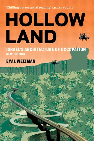
How does Israel extend its control over Palestinian lands? From the tunnels of Gaza to the militarized airspace of the Occupied Territories, Eyal Weizman unravels the mechanisms of control and how they have transformed Gaza and the West Bank into a war zone. This is essential reading for understanding how architecture and infrastructure are used as lethal weapons in the formation of Israel.
In this new edition, Weizman explains how the events following the invasion of Gaza in October 2023 bear witness to the continuing policies of oppression. He details how this book became a foundational text for Forensic Architecture.
- 336 pages
- English
- ePUB (mobile friendly)
- Available on iOS & Android
eBook - ePub
About this book
Information
1.
Jerusalem: Petrifying the Holy City
On 27 June 1967, twenty days after the Israeli Army completed the occupation of the eastern part of Jerusalem, the unity government of Levi Eshkol annexed almost 70 square kilometres of land and incorporated approximately 69,000 Palestinians within the newly expanded boundaries of the previously western Israeli municipality of Jerusalem.1 The new delimitations were designed by a military committee with the aim of redrawing the state’s 1949 borders, prior to any evacuation of occupied territories that might have been forced on Israel by international agreement. The outline attempted to include empty areas for the city’s expansion and to exclude, as far as it was possible, areas densely populated with Palestinians.2 The new boundaries sought to ‘unite’ within a single metropolitan area the western Israeli city, the Old City, the rest of the previously Jordanian-administered city, 28 Palestinian villages, their fields, orchards, and tracts of desert, into a single ‘holy’, ‘eternal’ and ‘indivisible’ Jewish capital. Years later, Mayor of Jerusalem Teddy Kollek (who served in this post on behalf of the Labor party between 1965 and 1993) would say of the incongruousness captured within these borders: ‘Jerusalem is, most likely, the only contemporary capital that pays drought compensation to farmers in villages within its boundaries …’3
The following year a new urban masterplan for the city outlined in drawings and verbal instructions the guiding principles of development and ‘unification’ of the urban ensemble now called Jerusalem. The ‘first and cardinal principle [of the 1968 masterplan] was to ensure [Jerusalem’s] unification … to build the city in a manner that would prevent the possibility of its being repartitioned’.4 Following this masterplan and a series of subsequent masterplans, amendments and updates during the forty years of Israeli occupation, twelve remote and homogenous Jewish ‘neighbourhoods’ were established in the occupied areas incorporated into the city. They were laid out to complete a belt of built fabric that enveloped and bisected the Palestinian neighbourhoods and villages annexed to the city. Industrial zones were located beyond the new neighbourhoods on the fringes of the municipal area, keeping West Bank Palestinians who provided the city with a cheap and ‘flexible’ labor force (until Palestinian labor was almost completely barred from the beginning of the second Intifada in the autumn of 2000) out of the city itself. An outer, second circle of settlements – termed by Israeli planners the ‘organic’ or ‘second wall’, composed of a string of dormitory suburbs – was established beyond the municipal boundaries, extending the city’s metropolitan reach even further. It is around this ‘second, organic wall’ that the concrete Separation Wall now meanders. An ever-expanding network of roads and infrastructure was constructed to weave together the disparate shards of this dispersed urban geography. ‘Greater Jerusalem’ became thus a sprawling metropolis reaching the outskirts of Ramallah in the north, Bethlehem in the south, and Jericho in the east – a massive section of the middle of the West Bank – isolating Palestinians from their cultural centres in Jerusalem and cutting off the north of the West Bank from the south. At present the new Jewish neighbourhoods within the municipal boundaries is home to about 200,000 settlers – almost the same number as all the other settlers in the West Bank combined. Together with the inhabitants of the dormitory settlements of the ‘second wall’ around the city, the total Jewish population of ‘Greater Jerusalem’ represents about three-quarters of all Israelis settled on areas occupied in 1967. Israeli activist Jeff Halper was therefore not exaggerating when he stated that ‘metropolitan Jerusalem is the occupation’.5
This project could not have been undertaken without massive government investments in infrastructure and subsidized housing for Jews, but an additional major factor in this colonization was a cultural one – the attempt to ‘domesticate’ the occupied and annexed territories – to transform, in the eyes of Israeli Jews, the unfamiliar occupied territories into familiar home ground. The problem of planners and architects was not only how to build fast on this ‘politically strategic’ ground, but how to naturalize the new construction projects, make them appear as organic parts of the Israeli capital and the holy city. Architecture – the organization, form and style by which these neighbourhoods were built, the way they were mediated, communicated and understood – formed a visual language that was used to blur the facts of occupation and sustain territorial claims of expansion. This project was thus an attempt to sustain national narratives of belonging while short-circuiting and even blocking other narratives.
This role invested in architecture has been written into the 1968 masterplan. Although the planning principles that guided this masterplan were largely based on modernist town planning principles, apparent in the plan’s promotion of massive traffic networks and the separation of the city into mono-functional zones (housing, shopping, service, industry), the 1968 masterplan also professed its ‘commitment’ to the orientalist aesthetics and urban development principles of ‘colonial regionalism’, a sensibility characteristic of the period of British rule over Palestine (1917–48), especially in its earlier years.6 The manifestation of this sensibility, promoted across the British Empire by followers and members of the ‘Arts and Crafts’ movement, was an attempt to preserve and incorporate local building traditions, materials and crafts within contemporary buildings. On the urban scale it was expressed in attempts to dissolve ‘old’ with new, archaeology with living fabric.

The Wall in the Jerusalem region. The red line includes the authorized and built sections of the Wall within and around the Jerusalem area. The dotted red line is the planned extension of the barrier eastwards around the settlement of Ma’ale adumim. The shaded area is the extent of Jerusalem’s municipal boundaries. The neighbourhoods/settlements are marked blue. Palestinian towns and village are marked brown.
A special section of the 1968 masterplan was dedicated to a discussion of a British Mandate-era municipal ordinance, a bylaw enacted in 1918 by the first military governor of the city, Ronald Storrs, which mandated a variety of different kinds of limestone, collectively and colloquially known as ‘Jerusalem Stone’, as the only material allowed on exterior walls in the city.7 During the early years of the Israeli state leading to the occupation (1948–67), the bylaw has remained officially in place, mainly at the centre of the western part of Jerusalem. However, as it became increasingly controversial in the eyes of architects and planners, it was not always rigorously enforced, especially not in the peripheries of the municipal areas. The 1968 masterplan supported the tightening of the stone bylaw and the use of stone cladding within the entire area annexed to the city. By emphasizing and reinforcing the power of the bylaw, stone cladding was used to authenticate new construction on sites remote from the historical centre, giving the disparate new urban shards a unified character, helping them appear as organic parts of the city. ‘The value of the visual impression that is projected by the stone’, stated the 1968 masterplan, is that it carries ‘emotional messages that stimulate other sensations embedded in our collective memory, producing [within the context of new construction] strong associations to the ancient holy city of Jerusalem’.8


Building in Jerusalem, 1967–72: Film stills, Ministry of Construction and Housing.
Storrs’ ‘stare of Medusa’
On 9 December 1917, surrounded and with their supply lines cut, the Jerusalem divisions of the Ottoman army surrendered to the Allied forces under General Sir Edmund Allenby in a battle celebrated in the British press as a modern crusade.9 Three weeks later, Colonel Ronald Storrs, a political attaché to the British military, was appointed military governor of Jerusalem. Storrs considered the return of Jews to their land as an act of salvation and historic justice. He later wrote that the Zionist enterprise was ‘forming for England “a little loyal Jewish Ulster” in a sea of potentially hostile Arabism’.10 Storrs saw Jerusalem through the religious-orientalist perspective of a European purview, and his role in Herodian terms, as a link in the long line of the city’s builders. Although Jerusalem of the late Ottoman era was a rather cosmopolitan city, with large, often lavish, compounds belonging to different nations and faiths, the war had transformed it quite radically. Mud, wood and tin constructions proliferated as Jerusalem became a destination for war refugees. For the British administration the urgent urban problem was the city’s ‘parasitic population … priests, caretakers, monks, missionaries, pious women, clerks, lawyers, and a crowd of riffraff’. The Jewish Quarter was referred to as a ghetto possessing ‘the squalid ugliness and disharmony of the cities of south-eastern Europe’.11 An artificial topography had been created outside the city walls by generations of refuse deposited there.
Determined to find a solution to the city’s ‘overcrowding and unsightliness’, Storrs invited Alexandria’s British city engineer, William H. McLean, to draw up a redevelopment plan. McLean arrived in Jerusalem in March 1918 and took two weeks to submit an initial report to the military administration recommending that all new structures within the Old City, including those rooftops that were visible from higher ground, were ‘to be constructed of and covered with stone’.12 Furthermore, according to McLean, the municipality should have removed all rubbish and ‘ramshackle buildings’ abutting the external perimeter of the Old City wall in order to make way for a ring-shaped park where thousands of trees were to be planted. Set in the centre of this green parkland, the Old City was to be presented as a precious rock, an exhibition-piece of living biblical archaeology. On 8 April 1918, a week after McLean’s departure, Storrs declared a freeze on all construction within and around the Old City. He went on to ban the use of plaster, mud, tents or corrugated iron as construction materials, stating that only local limestone was to be used in the construction of new buildings, extensions and rooftops within the perimeter around the Old City.13 Storrs then invited an architect of the British Arts and Crafts movement, Charles Robert Ashbee, one of the main promoters of ‘colonial regionalism’, whom he had met during his service in Cairo, to become director of a newly founded Pro-Jerusalem Society, which was conceived in 1919 to oversee the preservation and reconstruction of the city according to the McLean plan.
For Storrs, stone embodied biblical tradition. ‘Jerusalem is literally a city built upon rock. From that rock, cutting soft but drying hard, has for three thousand years been quarried the clear white stone, weathering blue-grey or amber-yellow with time, whose solid walls, barrel vaulting and pointed arches have preserved through the centuries a hallowed and immemorial tradition.’14 Although the stone regulation attempted to reinforce an image of orientalized locality, it had also made the cost of new construction prohibitive to all but the rich, the British authorities, and large overseas organizations; paradoxically, therefore, by pricing out the local population of Jerusalem, it delocalized the city with its own supposed vernacular crafts and architecture.
Although the aim of the McLean plan and Storrs’ stone regulation had been to isolate and differentiate the Old City from its surroundings, ten years after Storrs’ departure from Jerusalem, in the 1936 Town Planning Ordinance, the stone regulation was extended to apply to the entire municipal area and, significantly, to the new neighbourhoods that were rapidly sprawling beyond the Old City walls. By requiring the same architectural rigour outside the walls, this amendment allowed the outer neighbourhoods to share in the city’s particular visual character.15 The spread of Jerusalem had been accelerated by the relative prosperity of the 1920s and by improvements in building technology. As concrete technology developed and concrete structures became cheaper, more available and more efficient, the Arts and Crafts tradition promoted by Ashbee and Storrs through the Pro-Jerusalem Society, with its emphasis on traditional stone construction, came under attack from developers and builders. Towards the end of World War II and the period of the British Mandate, the pressure to develop led to a compromise that was represented by a seemingly minor textual modification of the stone regulation. While the previous Ordinance of 1936 demanded that ‘the external walls of all buildings shall be constructed of stone’, the masterplan of 1944 confirmed practices that were already in effect when it demanded only that ‘the external walls and columns of houses and the face of any wall abutting on a road shall be faced with natural, square dressed stone’16 [my emphasis]. This amendment reduced the role of stone from a construction material to a cladding material. Stone became a stick-on signifying element for creating visual unity between new construction and the Old City, thus visually confirming the municipal boundaries – as whatever building appeared to be built in stone was perceived part of the city of Jerusalem.
With the years, the layer of stone has thinned. At the beginning of the Mandate period, and following the principles of the ‘Arts and Crafts’ movement, stone was primarily used as a construction material, and walls were made of large blocks of solid stone. Since the 1930s a mixed concrete and stone construction technique became more common and a thinner layer of stone – 20cm thick – became part of the structural logic of the building, and together with reinforced concrete, took some of the building load. As mere cladding, the stone has become thinner still and no longer formed a structural part of the building. Today, Israeli building standards allow layers of sawn stone just 6cm thick.
In the 1948 war, Jerusalem was divided between the Kingdom of Jordan and the state of Israel, with the former securing total control over the Old City and its eastern neighbourhoods. In the Jordanian city, whose size under Jordanian administration was deliberately restricted to prevent it competing with the Jordanian capital, Amman, the 1944 masterplan still remained in full effect. The plan was updated in 1964 by its original architect, Henry Kendall, a Briton who continued to enforce the stone cladding bylaw throughout the entire though compact Jordanian city. On the other side of the partition lines, until the 1967 war, Jerusalem’s 1955 pla...
Table of contents
- Cover Page
- Halftitle Page
- Title Page
- Copyright Page
- Dedication
- Contents
- Preface
- Introduction: Frontier Architecture
- Interlude – 1967
- 1. Jerusalem: Petrifying the Holy City
- 2. Fortifications: The Architecture of Ariel Sharon
- 3. Settlements: Battle for the Hilltops
- 4. Settlements: Optical Urbanism
- 5. Checkpoints: The Split Sovereign and the One-Way Mirror
- 6. The Wall: Barrier Archipelagos and the Impossible Politics of Separation
- 7. Urban Warfare: Walking Through Walls
- 8. Evacuations: De-Colonizing Architecture
- 9. Targeted Assassinations: The Airborne Occupation
- Postscript
- Notes
- Index
Trusted by 375,005 students
Access to over 1.5 million titles for a fair monthly price.
Study more efficiently using our study tools.
Frequently asked questions
Yes, you can cancel anytime from the Subscription tab in your account settings on the Perlego website. Your subscription will stay active until the end of your current billing period. Learn how to cancel your subscription
No, books cannot be downloaded as external files, such as PDFs, for use outside of Perlego. However, you can download books within the Perlego app for offline reading on mobile or tablet. Learn how to download books offline
Perlego offers two plans: Essential and Complete
- Essential is ideal for learners and professionals who enjoy exploring a wide range of subjects. Access the Essential Library with 800,000+ trusted titles and best-sellers across business, personal growth, and the humanities. Includes unlimited reading time and Standard Read Aloud voice.
- Complete: Perfect for advanced learners and researchers needing full, unrestricted access. Unlock 1.5M+ books across hundreds of subjects, including academic and specialized titles. The Complete Plan also includes advanced features like Premium Read Aloud and Research Assistant.
We are an online textbook subscription service, where you can get access to an entire online library for less than the price of a single book per month. With over 1.5 million books across 990+ topics, we’ve got you covered! Learn about our mission
Look out for the read-aloud symbol on your next book to see if you can listen to it. The read-aloud tool reads text aloud for you, highlighting the text as it is being read. You can pause it, speed it up and slow it down. Learn more about Read Aloud
Yes! You can use the Perlego app on both iOS and Android devices to read anytime, anywhere — even offline. Perfect for commutes or when you’re on the go.
Please note we cannot support devices running on iOS 13 and Android 7 or earlier. Learn more about using the app
Please note we cannot support devices running on iOS 13 and Android 7 or earlier. Learn more about using the app
Yes, you can access Hollow Land by Eyal Weizman in PDF and/or ePUB format, as well as other popular books in Politica e relazioni internazionali & Pianificazione urbana e paesaggistica. We have over 1.5 million books available in our catalogue for you to explore.