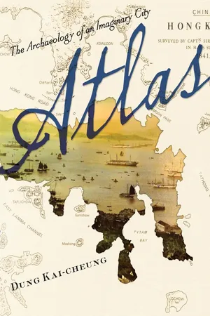
Set in the long-lost City of Victoria (a fictional world similar to Hong Kong), Atlas is written from the unified perspective of future archaeologists struggling to rebuild a thrilling metropolis. Divided into four sections—"Theory," "The City," "Streets," and "Signs"—the novel reimagines Victoria through maps and other historical documents and artifacts, mixing real-world scenarios with purely imaginary people and events while incorporating anecdotes and actual and fictional social commentary and critique.
Much like the quasi-fictional adventures in map-reading and remapping explored by Paul Auster, Jorge Luis Borges, and Italo Calvino, Dung Kai-cheung's novel challenges the representation of place and history and the limits of technical and scientific media in reconstructing a history. It best exemplifies the author's versatility and experimentation, along with China's rapidly evolving literary culture, by blending fiction, nonfiction, and poetry in a story about succeeding and failing to recapture the things we lose. Playing with a variety of styles and subjects, Dung Kai-cheung inventively engages with the fate of Hong Kong since its British "handover" in 1997, which officially marked the end of colonial rule and the beginning of an uncharted future.
eBook - ePub
Atlas
The Archaeology of an Imaginary City
- English
- ePUB (mobile friendly)
- Available on iOS & Android
eBook - ePub
Atlas
The Archaeology of an Imaginary City
About this book
Trusted by 375,005 students
Access to over 1.5 million titles for a fair monthly price.
Study more efficiently using our study tools.
Information
Subtopic
Literature GeneralIndex
LiteraturePART ONE
Theory

1
COUNTERPLACE
“Macao Roads,” drawn in 1810, demonstrated for the first time the possibility of a theory of counterplace. According to an ancient and almost forgotten saying, every place that appears on a map must have one or more counterplaces. This knowledge had been invalidated in the development of scientific mapmaking, and it regained attention only recently through extended researches into ancient maps.
“Macao Roads” was jointly produced by Daniel Ross and Philip Maughan, lieutenants of the Bombay Marine, for the British East India Company. At its center are the waters around what was later known as Hong Kong (including Hong Kong Island, the Kowloon Peninsula, the New Territories, and the Outlying Islands), while Macao only appears at the far left (west) of the map.
Placed in the middle of “Macao Roads” is an island named Hung Kong (literally, “red river”), and to its southeast lies a bay called Tytam (big load). To the north of Hung Kong, across a natural harbor, is a peninsula attached to the mainland. A place called Cow-loon (nine lanes) lies to the northeast of the peninsula. East of the harbor dividing Hung Kong from the mainland are two entrances, called Ly-ee-moon (gate of ceremonial garments) and Fo-tow-moon (gate of the fiery head), respectively, while the entrance to the northwest of the harbor is called Cap-sing-moon (gate of quick thought). Southwest of Hung Kong lies an island called Lama (blue hemp), and to its west lies another island called Tyho (big inlet) or Lantao, which has an area three times bigger than Hung Kong. A bay called Ty-po-hoy (big cloth opening) is located in the northeast of the mainland.
If we compare this map to other maps with similar topographic characteristics produced around the same time, we will discover numerous corresponding pairs in the local pronunciation, like Red River and Incense Harbor (also known as Fragrant Harbor), Big Load and Big Pool, Nine Lanes and Nine Dragons, Gate of Ceremonial Garments and Gate of Carps, Gate of the Fiery Head and Gate of the Buddhist Hall, Gate of Quick Thought and Gate of Pumping Water, Blue Hemp and Southern Fork, Big Inlet and Big Oyster, and finally Big Cloth Opening and Big Land Sea. This is evidence that, in the mimetic world of maps, a place will inevitably find its counterplace in another, parallel space. A Platonic relationship exists between counterplaces, that is, both (or more) are copies or simulacra of a common “reality” or “idea.” Or, to put it in other words, both are translations of an “original text.” The mutual reliance of counterplaces is built on their common connection with the same origin. Yet this connection only points at another name. The name “Hong Kong” allows both Red River and Fragrant Harbor to become distinct but not mutually exclusive “really existing” places.
Going further, Hung Kong (empty harbor), Tai Dam (big mouthful), Kow Lung (leaning on), Lai Yee Mun (gate of the little rascal), Fai Dau Mun (gate of the quick knife), Kap See Mun (gate of timeliness), Lan Ma (blocking the horse), Lan Tau (broken head), and Tai Bo Hoi (taking big strides) all become possible names (and as such possible places) on the “Macao Roads” of my memories and longings.
2
COMMONPLACE
When we study ancient maps, we find repeatedly that places with the same name appear in different forms. These places lumped together under one name are not in fact the same place but common places. Although they are not the same place, they have something in common. This is how the term “commonplace” is defined.
Examples of commonplaces are numerous. Take, for example, a place called Hung Heung Lou Shan (literally, “red incense burner mountain”). There is a small island called Hung Heung Lou shown on a map of San-on County (an area roughly corresponding to the Pearl River Delta) in the 1819 edition of the San-on County Gazetteer. Here the island is situated at the near southwest of the Kowloon Peninsula, to the north of Yeung Suen Chau and Kap Shui Mun. In an anonymous map drawn before 1840, entitled “A Map of the China Coast,” however, Hung Heung Lou Shan has been moved to the south of Yeung Suen Chau and its distance from Kowloon increased fivefold. This island is long and narrow, lying crosswise from the northwest to the southeast. Another “Map of San-on County” in the 1864 edition of the Guangdong Provincial Gazetteer shows a regularly shaped island called Hung Heung Lou Shun smack in the middle of waters south of Kowloon.
Given the similarities in their names and their overall relationship with landmarks in the general vicinity, it is safe to conclude that Hung Heung Lou, Hung Heung Lou Shan, and Hung Heung Lou Shun are commonplaces. Nevertheless, we must be on our guard against taking it for granted that they are the same place, for no place on any map can ever be the same place as any other place on any other map. Every map has its own set of places, and every place belongs exclusively to its own map. Therefore, no one single place could ever transgress the map to which it owes its existence and become one with another place. If similar configurations appear on different maps, it is because of the fact that these places are commonplaces to one another. The Red Incense Burner of 1819, 1840, and 1864 cannot be the same Red Incense Burner, but each of them can only be the Red Incense Burner of the maps labeled “1819,” “1840,” and “1864,” respectively.
As a matter of fact, these Red Incense Burners are commonplaces to the place called Hong Kong at a later age (or in another time and space), so that we come to the conclusion that Hong Kong is also a commonplace. It follows that when every place has its commonplaces, each of these places loses its distinctive character and becomes simply a common place. No place can transcend itself to attain an eternal and absolute state. When each and every place reiterates its existence through common means, replicating one another’s commonality and vainly attempting to raise this commonality to the highest degree, its repetitive self-affirmation may end up as a stale convention. This is the reason that modern maps of high precision lack imagination.
By making people forget that places can relate to one another only as commonplaces, these conventions fool us into believing that any place has always been the same—forever fixed and immutable.
3
MISPLACE
In the map in the 1819 edition of the San-on County Gazetteer, Tuen Mun Shun (garrison gate high water) is situated among a group of islands in the sea to the west of Kowloon Shun, standing next to Pui To Shan (cup crossing mountain). On the “Map of San-on County” in the 1864 edition of the Guangdong Provincial Gazetteer, however, Tuen Mun O (garrison gate bay) appears among the mountains on the eastern side of the mainland, to the north of Ma On Shan (saddle mountain), facing Pui To Shan from afar. Further, if we consult the 1897 edition of the Guangdong Provincial Gazetteer, we discover that Tuen Mun Shun has been relocated to the western side of the mainland, inside a bay called Tuen Mun (regiment gate), written with a different character for Tuen.
There are two questions that concern us here: first, the misrepresentation of the location of the place signified as Tuen Mun; second, the misrepresentation of certain locations on the maps as Tuen Mun. These two points imply that a misplaced place will always deprive another place of its correct representation, resulting in a double misreading. That is to say that, first of all, Tuen Mun is not where it “should be,” and second that Tuen Mun occupies a place where it “should not be.” Therefore, the prefix “mis” in “misplace” carries both the meaning of “wrongly taking one thing as another one” as in “mistake” or “misunderstand,” and the meaning of “should not be” as in “misbehavior.” As for the concept of “place,” in this school of thought, it can be understood as “representation” from the perspective of production, or as “reading” from the perspective of reception. In fact, “representation” and “reading” are just two sides of the same coin.
We can, for convenience’s sake, call this school cartocentric, since its members do not believe in any objective reality outside maps. Cartocentric scholars are totally unconcerned about the correct location of Tuen Mun and even deny the legitimacy of such questions. Their investigation is wholly preoccupied in how the “place” called Tuen Mun is being represented and read. According to this view, all representations of places are simultaneously both right and wrong: in whatever place Tuen Mun appears, it cannot be invalidated by factors exterior to the map. By the same token, anywhere that Tuen Mun appears is destined to be wrong. From this is derived the thesis that “all places are misplaces, and all misplaces are misreadings.” The map is regarded as the only operational field of spatial senses.
Investigations from this angle suggest that Hong Kong is also a misplace. Its appearance and evolution in the history of cartography inevitably imply meanings of mistakes, misunderstanding, and misdoing. However, it is also owing to this very inevitability and actuality that it earns legitimacy and correctness, at least literally so.
It is evident that the passion of the cartocentrics in rejecting and rebutting empirical knowledge does not necessarily elevate them above other schools of thought. It remains but one of many competing theories, all perhaps motivated by the desire to control the object of knowledge by seizing the ultimate power of interpretation.
Scholars, in truth, are no different from suspicious and possessive lovers whose derangement only increases the more deeply they probe, since lovers always fix their eyes on misplaces.
4
DISPLACE
The term “displace” can be understood in a narrow and a broad sense. In the narrow sense, it means that the position of one place is taken over by another place in the diachronic development of mapmaking. A good example can be found in “A Coastal Map of Guangdong” in A Comprehensive Account of Guangdong Province, written by Guo Fei in the late sixteenth century. This map is oriented in such a way that it faces toward the South China Sea from the mainland with the south at the top. It shows a big island across the water to the south of the Kwun Foo Guard Post (Kowloon Hills), on which Chek Chue occupies the center and is surrounded by places named Wong Nai Chung, Tai Tam, and Shau Kei Wan. To the southwest from the big island (by its upper right on the map), a small, lonely island named Hong Kong stands in the sea. Comparing “A Coastal Map of Guangdong” with some later maps, however, we discover that the location of the big island opposite Kowloon is taken over by Hong Kong or Hung Heung Lou. In the 1819 edition of the San-on County Gazetteer, Chek Chue has clearly been pushed farther south into the sea by Hung Heung Lou, becoming itself a small, isolated island. In “A Map of the Waterways of Guangdong Province” produced by a magistrate by the name of Chen in 1840, Chek Chue returns for the last time to a central position in the harbor. Nevertheless, Chek Chue is again displaced by Hung Heung Lou Shun in “A Map of San-on County” in the Guangdong Provincial Gazetteer of 1864, and it even disappears from the map.
It can be said that in this process of transformation, Chek Chue was gradually displaced by Hung Heung Lou, and Hung Heung Lou was displaced in turn by Hong Kong. There are two ways in which this displacement could have taken place. The first is Hong Kong (or Hung Heung Lou) displacing the place Chek Chue. This is a form of geographical transfer (at least geographical as understood in the context of cartographical discourse). In the second way, the signifier “Hong Kong” displaced the signifier “Chek Chue” and became the name of a more or less specific place on the map. No matter which is the case, it implies that one place can be replaced by another at any time, and the place being taken over will never be the same as before even though its form and position may remain unchanged.
There exists an even more radical theory that attempts to define the concept of “displace” in a broad sense, and in so doing extends it to a general and fundamental level. According to this theory, every place on a map is a displace. A place is never itself but is forever displaced by another. This is also to say that the map itself is a displacement, and cartography is such a process of displacement. No matter whether we understand them from the perspective of teleology or of utilitarianism, and no matter how scientifically and with what exactitude they are produced, maps have never been copies of the real world but are displacements. In the end, the real world is totally supplanted in the process of displacement and fades from human cognition. The sight of the Guangdong coast in the sixteenth century is forever beyond reach, but not the sight of the sixteenth century “Coastal Map of Guangdong.”
Traditional cartography seemingly instructs us on how to recognize and search for places, but in fact its real lesson is that we can never arrive at our desired place on the map, and yet, at the same time, we inevitably arrive at its displace.
5
ANTIPLACE
The “Map of the Sun-on-district,” drawn by the Italian missionary Simeone Volonteri in 1866, delineates in minute detail the positions of villages on the British-governed Hong Kong Island and Kowloon Peninsula as well as in the adjacent areas of San-on County, which at the time was still Chinese territory. Father Volonteri’s original plan was to have the map engraved in London, so as to acquire enough subscribers to cover the expenses of publication, and with the map would be attached a free copy of a pamphlet on cartography written by Volonteri himself. The engraving was eventually done in Leipzig for considerations of cost, while the complimentary pamphlets were discontinued following complications in matters of distribution. It is said, however, that two hundred copies of the pamphlets had been printed in London, although with the exception of a few copies presented as gifts to fellow cartographers, none survived the passage of time.
In his pamphlet, Volonteri proposed the concept of antiplace and illustrated it with examples from his “Map of the Sun-on-district.” It might be conjectured that the “Map of the Sun-on-district” was in fact a supplement for the purpose of illustrating the concept of antiplace. Since the pamphlets were lost while the maps survived, the theory of antiplace also fell into oblivion. It is now impossible to reconstruct Volonteri’s theory of antiplace. The most anyone can do is to piece together fragments of information scattered among surviving sources.
When the conditions of two places are the diametrical opposites of each other, Volonteri calls them antiplaces. The establishment of antiplaces has nothing to do with the relative positions of two places on a map. Any two points at the ends of any diameter of the earth, thus opposite each other in position on the surface of the sphe...
Table of contents
- Cover
- Half title
- Series Page
- Title
- Copyright
- Dedication
- Contents
- Preface: An Archaeology for the Future
- Introduction
- Part One: Theory
- Part Two: The City
- Part Three: Streets
- Part Four: Signs
- Acknowledgments
- Author And Translators
Frequently asked questions
Yes, you can cancel anytime from the Subscription tab in your account settings on the Perlego website. Your subscription will stay active until the end of your current billing period. Learn how to cancel your subscription
No, books cannot be downloaded as external files, such as PDFs, for use outside of Perlego. However, you can download books within the Perlego app for offline reading on mobile or tablet. Learn how to download books offline
Perlego offers two plans: Essential and Complete
- Essential is ideal for learners and professionals who enjoy exploring a wide range of subjects. Access the Essential Library with 800,000+ trusted titles and best-sellers across business, personal growth, and the humanities. Includes unlimited reading time and Standard Read Aloud voice.
- Complete: Perfect for advanced learners and researchers needing full, unrestricted access. Unlock 1.5M+ books across hundreds of subjects, including academic and specialized titles. The Complete Plan also includes advanced features like Premium Read Aloud and Research Assistant.
We are an online textbook subscription service, where you can get access to an entire online library for less than the price of a single book per month. With over 1.5 million books across 990+ topics, we’ve got you covered! Learn about our mission
Look out for the read-aloud symbol on your next book to see if you can listen to it. The read-aloud tool reads text aloud for you, highlighting the text as it is being read. You can pause it, speed it up and slow it down. Learn more about Read Aloud
Yes! You can use the Perlego app on both iOS and Android devices to read anytime, anywhere — even offline. Perfect for commutes or when you’re on the go.
Please note we cannot support devices running on iOS 13 and Android 7 or earlier. Learn more about using the app
Please note we cannot support devices running on iOS 13 and Android 7 or earlier. Learn more about using the app
Yes, you can access Atlas by Kai-cheung Dung, Anders Hansson, Bonnie McDougall, Kai-cheung Dung, Anders Hansson,Bonnie S. McDougall,Kai-cheung Dung in PDF and/or ePUB format, as well as other popular books in Literature & Literature General. We have over 1.5 million books available in our catalogue for you to explore.