- English
- ePUB (mobile friendly)
- Available on iOS & Android
eBook - ePub
About this book
By studying the many ways diverse peoples have changed, shaped, and conserved the natural world over time, environmental historians provide insight into humanity's unique relationship with nature and, more importantly, are better able to understand the origins of our current environmental crisis. Beginning with the precolonial land-use practice of Native Americans and concluding with our twenty-first century concerns over our global ecological crisis, American Environmental History addresses contentious issues such as the preservation of the wilderness, the expulsion of native peoples from national parks, and population growth, and considers the formative forces of gender, race, and class. Entries address a range of topics, from the impact of rice cultivation, slavery, and the growth of the automobile suburb to the effects of the Russian sea otter trade, Columbia River salmon fisheries, the environmental justice movement, and globalization. This illustrated reference is an essential companion for students interested in the ongoing transformation of the American landscape and the conflicts over its resources and conservation. It makes rich use of the tools and resources (climatic and geological data, court records, archaeological digs, and the writings of naturalists) that environmental historians rely on to conduct their research. The volume also includes a compendium of significant people, concepts, events, agencies, and legislation, and an extensive bibliography of critical films, books, and Web sites.
Trusted by 375,005 students
Access to over 1.5 million titles for a fair monthly price.
Study more efficiently using our study tools.
Information
Subtopic
North American HistoryIndex
HistoryPART ONE
Historical Overview
Topics and Themes
The American Environment and
Native-European Encounters, 1000–1875
Native-European Encounters, 1000–1875
CHAPTER ONE
The North American environment contains rich natural resources that, over time, have supported a succession of modes of living on the land. A core topic in environmental history is how different peoples at different times have used, perceived, managed, and conserved their environments. Native Americans developed several forms of land use appropriate to the resources of different regions of the United States. This chapter compares three patterns of Native American subsistence and the processes by which European settlers colonized particular North American landscapes: southwestern horticulture; northeastern hunting and gathering; and the Great Plains buffalo and horse cultures.
The Physical Environment and Natural Resources
The physical environment that constitutes the present United States can be characterized in terms of its area, location, climate, rainfall, and topography. Its total area is approximately 3.6 million square miles. The 48 contiguous states extend from the 24th parallel at the tip of Florida to the 49th parallel at their northern border with Canada, falling between 66 and 125 degrees west longitude. Alaska lies between 54 and 72 degrees north latitude and 130 degrees east longitude, with the westernmost point of the Aleutian Islands being in the Eastern Hemisphere at 172 degrees east longitude. The tropical Hawaiian Islands are situated between 19 and 25 north latitude and 155 and 176 west longitude.
The climate of the 48 mainland states is temperate, having cold winters and hot summers. The states east of the 100th meridian are characterized as humid, with 20–60 inches on average of annual rainfall distributed throughout the year; those west of the 100th meridian have an average between 5 and 20 inches, distributed mainly in the winter months. Topographically, the country extends westward from the Atlantic coastal plain at sea level upward to the Piedmont Plateau, between 500 and 1,000 feet in elevation, and the Appalachian Mountains, which rise to higher than 6,000 feet. Beyond the Mississippi River the elevation again rises gradually upward to about 4,000 feet, where the high plains approach the Rocky Mountains. The Rockies, Sierra Nevadas, and Cascades rise westward of the plains from around 4,000 to higher than 10,000 feet, interrupted by the intermontane Great Basin, between 4,000 and 6,000 feet above sea level. Westward of the Sierras, Cascades, and Coast Ranges, peaks in Alaska rise to 20,000 feet and in Hawaii to over 13,000 feet.
The country contains the rich natural resources required for agricultural and commercial systems. It has extensive forests in its eastern and western regions for fuel and building materials and extremely fertile soils along the eastern coastal plains, the Mississippi Valley, midwestern prairies, and Pacific coast valleys. Ample rainfall and water for agriculture are supplied from the snowmelts of the Appalachian Mountains to water the fertile soils of the eastern states. Snowmelt from the Rocky Mountains and Cascades fill the western river systems, while aquifers now supply water to the Great Plains, creating possibilities for irrigated agriculture in the arid regions of the West. The river systems and lowlands of the eastern coastal plains and Mississippi Valley make extended inland transportation and commerce feasible. The vast mineral treasury of the Appalachians and the western mountains, with their deposits of gold, silver, copper, iron, and coal, supply the energy and minerals needed for thriving industries. These natural features, resources, and climate patterns were utilized first by Native Americans and then by colonists from other continents to create subsistence- and market-oriented societies.
Native Americans and the Land
Indians occupied almost all of North America on the eve of European colonization. Their primary mode of subsistence was hunting, gathering, and fishing, combined—in the Southwest, Mississippi Valley, and eastern woodlands—with horticulture. Indian ecological relations with the land and the transformation of those relations under European settlement can be illustrated by cases from the Southwest where horticulture predominated; the hunting cultures of the Northeast; and the buffalo cultures of the Great Plains. In each case the process of transformation varied, but several factors predominated: the introduction of pathogens and other biota; trading in furs and hides; and the addition of cultural factors such as Christian religion and alphanumeric literacy.
Estimates of the precolonial Indian population of North America have ranged from 1 to 18 million, depending on methods used to extrapolate backward from existing records of population densities and the devastation of diseases, with recent assessments in the range of 4 to 7 million. There is also considerable debate about the process of the peopling of the Americas. Indian origin stories tell of the continued presence of native peoples on the continent from time immemorial, of an original emergence of people out of the earth in distant times, or of arrival from other lands after a long journey. The theory accepted by most Westerners, including many Indians, however, has been that of arrival over the Bering land bridge, or the Beringia theory. Between 80,000 and 23,000 years ago sea levels dropped, opening up possibilities for people to migrate across ice-sheets, and were even lower 23,000 to 10,000 years ago, when a broad land mass some 1,000 miles wide appeared. The Beringia theory holds that people from Asia were able to migrate north into the area that is now Russia and then across the Bering land bridge, thus entering the Americas. These earliest bands, which arrived at least 13,000 years ago (and possibly, some believe, as early as 35,000 years ago), were able to survive on food resources found at latitudes above 60 degrees and to live in very cold temperatures. Much of that survival was the result of following migrating herds of game.
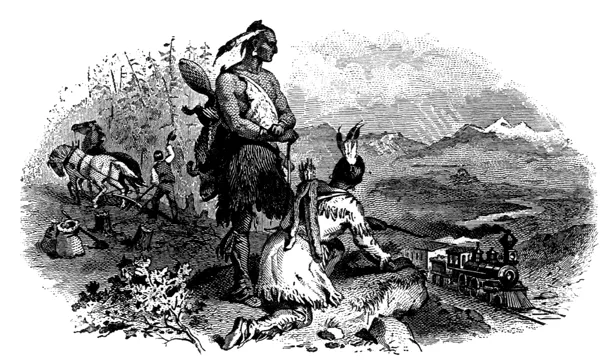
FIGURE 1.1 European Colonization. From Horace T. Martin, Castorologia (Montreal: W. Drysdale, 1892).
Between 13,000 and 11,000 years ago, the vast ice-sheets that covered present-day Canada and the Great Lakes receded, opening a corridor southward from Alaska through the Yukon and down along the slopes of the Canadian Rockies. A southward migration of people occurred through this Rocky Mountain Trench. Because of the relative scarcity of animal or plant life in that corridor, bands of people moved down it and then fanned out into the area that now constitutes the United States. A second theory holds that the migrations southward occurred primarily along the Pacific coast, where fish and wildlife were more abundant and sea levels were much lower than at present. Additionally, a third migration across the Bering land bridge into Alaska, between 11,000 and 8000 b.p. (before present) was made by Eskimo Aleut peoples.
People who migrated southward and eastward into the present-day United States also continued into Central and South America. Some recently discovered sites in Monte Verde, Chile, are perhaps 15,000 years old, although radiocarbon methods of dating the remains are subject to further verification, as is the question as to whether those sites were settled in the earliest Beringia migration or by migrations across the ocean. Other early sites, discovered in the eastern United States and in the Pacific Northwest, remain subject to additional verification as well.
The Beringia theory, however, supplies an additional explanation for later environmental transformations. The land bridge, or the Bering Strait itself, protected migrants from diseases associated with Europe and Asia because pathogens were unable to survive in the very cold temperatures. Although Amerindians did have a number of diseases (such as colds, intestinal parasites, and yaws), they lacked immunity to many diseases associated with domesticated animals and plants (such as smallpox, measles, bubonic plague, and scarlet fever) that the Europeans brought with them, and which rapidly decimated Indian populations. The timing and effects of epidemics varied according to type of disease, mode of transmission, rapidity of the spread of contagion, density of population, and types of contacts with Europeans. Debate centers on the validity of archaeological and historical records and the methods of counting and estimating population sizes in determining whether and when a disease reached a particular tribe. The vastly reduced populations gave European colonists an advantage over the weakened tribes. How did the early migrants from Asia to the Americas attain subsistence, and how did they transform the North American environment?
Pueblo Indians and the Southwest
In the American Southwest, a long history of environmental adaptation by Amerindians preceded the arrival of the Spaniards in the sixteenth century a.d. Early peoples changed and evolved over time in relationship to changing environmental conditions. Paleo-Indians (meaning ancient or very ancient) lived in the Southwest from about 11,500 to 8,000 b.p. (before present) by hunting mammoth and bison. The Clovis culture derives its name from the long pointed arrowheads, found first in Clovis, New Mexico, that were attached to spears thrown by atlatls (long rods) and used to hunt mammoth. Stone knives were also developed for butchering the prey. Following the Clovis culture, the Folsom culture developed shorter spears and stone tools for killing the bison that survived both climate change and paleo-Indian hunters. Throughout the West, mammoth and buffalo jumps have been found, where animals, herded by people on foot, were stampeded over the edges of cliffs and eroded gullies, where the kill was then butchered.
In the Southwest, following the age of large mammal hunting, a second type of culture emerged—the archaic culture, meaning old or early. The archaic culture, which existed from about 8000 b.p. to 4000 b.p., consisted of groups of hunting-gathering peoples who hunted the smaller animals that remained after mammoths and bison declined or disappeared from the region—deer, mountain lion, antelope, and rabbits. These groups moved continuously in small bands of related individuals as they foraged for plants and small animals, traveling with the seasons. They may have had sites to which they returned each year, or they may have found new locales where game was more abundant and where they knew that the plants they needed for survival could more easily be found. They developed snares and nets, stone and bowl chipping tools, and scraping and cutting tools to process the fibers, tubers, and seeds found in the arid environment.
Around 2,500 b.p., possibly owing to population pressure or the advent of crops and technologies diffusing northward from Mexico, people began to live in settled communities, growing maize—a unique new world crop—together with squash and, later, beans. The three foods became known as the “three sisters,” or the corn, beans, and squash complex. Melons and chili peppers were also added to the diet. People lived in settled communities, joining their labor together, women working with women and men with men.
In the area of the Southwest presently known as the Four Corners—where Utah, Colorado, Arizona, and New Mexico converge—a confluence of cultures existed. The Hohokam, who settled in southern Arizona, practiced irrigation-based horticulture, while the Anasazi dwelt in pueblos on the plateaus of the region and planted crops along rivers. These cultures reveal the development of sophisticated technologies for adapting to and manipulating the environment.
Knowledge of Hohokam irrigation systems is based on archaeological remains found in the area today, as well as on extrapolation from current cultures backward in time. Because the land was a desert, with rainfall amounts less than 10 inches a year, crops required catchment dams, irrigation canals, and water conservation. Environmental historian Donald Worster, in Rivers of Empire (1985), writes: “Water control relies on temporary structures and small-scale permanent works that interfere only minimally with the natural flow of streams…. [The users] are self-reliant, self-sufficient, and self-managing as individuals and as a community, though nature still sets in the main the terms on which their lives are lived.”1
Between a.d. 300 and 900, the Hohokam people manipulated the arid environment by building large canals, some as wide as 30 feet across, 7 feet deep, and 8 miles long, with as many as 8,000 acres at a time being fertilized with water from the Salt and Gila river systems. Indians could grow crops and store them throughout the year, so as to have a continual supply of food. An environmental consequence of irrigated agriculture, however, is that water from the rivers leaches out salts, drawing them up from the subsoil and leaving salinated topsoils. Just as the Mesopotamian cultures of the Near East were abandoned owing to salinization, so—it is hypothesized—the Hohokam were forced to abandon their villages and move elsewhere or to remain, evolving and adapting to changed conditions. By the time the Spanish arrived, they met Piman-speaking, Akimel O’odham Indians, who were still practicing a form of irrigation, but not on the enormous scale developed by the Hohokam. Other explanations for the demise of the Hohokam include flooding, drought, earthquakes, and deforestation, some of these hypotheses influenced by environmental events occurring at the time the explanation itself was put forward.
A second group of southwestern peoples, the Anasazi (or “ancient ones”), likewise developed sophisticated technologies for transforming the environment. Between a.d. 900 and 1150, in northwestern New Mexico, they constructed large multistoried communal houses in villages, or pueblos, in the bottom of Chaco Canyon, along the edges of a river where they planted crops. The communities consisted of many small villages with larger central cities containing four-story apartments and ramrod-straight roads that linked Chaco Canyon with other communities in the Southwest.
Not only did the Chaco people build roads and pueblos, they also developed an agricultural calendar that enabled them to utilize the southwestern environment through an understanding of astronomy, a technology illustrated in films such as The Sun Dagger (1963). They attained the ability to predict the advent of growing and harvesting seasons based on arrival of the solstices and equinoxes—the solstices (or longest and shortest days) occurring around June 21 and December 21 and the equinoxes (equal days and nights) around March 21 and September 23. They did so by building an “observatory” on Fajada Butte in Chaco Canyon, a stone-slab structure assembled so that a sliver of sunlight entered through two stones and fell on an engraved spiral petroglyph. They were thus able to determine the best times to plant and harvest their crops, gaining a measure of control over the vicissitudes of an arid environment.
Mesa Verde (meaning “green table”), an Anasazi pueblo from the same period, likewise illustrates the sophistication developed by southwestern peoples in manipulating their environment. Situated on a vast green plain with a level top consisting of a juniper and piñ...
Table of contents
- Cover
- Half title
- Title
- Copyright
- Contents
- List of Illustrations
- Acknowledgments
- Introduction
- Part I. Historical Overview—Topics and Themes
- Part II. American Environmental History A to Z—Agencies, Concepts, Laws, and People
- Part III. Chronology—An Environmental History Timeline
- Part IV. Resource Guide
- Bibliography
- Index
Frequently asked questions
Yes, you can cancel anytime from the Subscription tab in your account settings on the Perlego website. Your subscription will stay active until the end of your current billing period. Learn how to cancel your subscription
No, books cannot be downloaded as external files, such as PDFs, for use outside of Perlego. However, you can download books within the Perlego app for offline reading on mobile or tablet. Learn how to download books offline
Perlego offers two plans: Essential and Complete
- Essential is ideal for learners and professionals who enjoy exploring a wide range of subjects. Access the Essential Library with 800,000+ trusted titles and best-sellers across business, personal growth, and the humanities. Includes unlimited reading time and Standard Read Aloud voice.
- Complete: Perfect for advanced learners and researchers needing full, unrestricted access. Unlock 1.5M+ books across hundreds of subjects, including academic and specialized titles. The Complete Plan also includes advanced features like Premium Read Aloud and Research Assistant.
We are an online textbook subscription service, where you can get access to an entire online library for less than the price of a single book per month. With over 1.5 million books across 990+ topics, we’ve got you covered! Learn about our mission
Look out for the read-aloud symbol on your next book to see if you can listen to it. The read-aloud tool reads text aloud for you, highlighting the text as it is being read. You can pause it, speed it up and slow it down. Learn more about Read Aloud
Yes! You can use the Perlego app on both iOS and Android devices to read anytime, anywhere — even offline. Perfect for commutes or when you’re on the go.
Please note we cannot support devices running on iOS 13 and Android 7 or earlier. Learn more about using the app
Please note we cannot support devices running on iOS 13 and Android 7 or earlier. Learn more about using the app
Yes, you can access American Environmental History by Carolyn Merchant in PDF and/or ePUB format, as well as other popular books in History & North American History. We have over 1.5 million books available in our catalogue for you to explore.