A Very Great Sea
The Discovery of Oceania
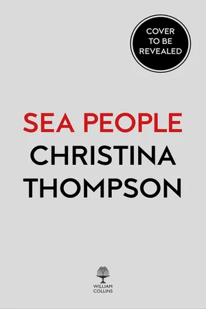
Globe showing the Pacific Ocean.
C. SCOTT WALKER, HARVARD MAP COLLECTION, HARVARD UNIVERSITY.
IF YOU WERE to look at the Pacific Ocean from space, you might notice that you would not be able to see both sides of it at the same time. This is because at its widest, the Pacific is nearly 180 degrees across—more than twelve thousand miles, or almost half the circumference of the earth. North to south, from the Aleutian Islands to the Antarctic, it stretches another ten thousand miles. Taken as a whole, it is so big that you could fit all the landmasses of earth inside it and there would still be room for another continent as large as North and South America combined. It is not simply the largest body of water on the planet—it is the largest single feature.
For most of human history, no one could have known any of this. They could not have known how far the ocean extended or what bodies of land it might or might not contain. They could not have known that the distances between islands, comparatively small at the ocean’s western edge, would stretch and stretch until they were thousands of miles wide. They could not have known that parts of the great ocean were completely empty, containing no land at all, or that the winds and weather in one region might be quite different from—even the reverse of—what was to be met with in another part of the sea. For tens of thousands of years, long after humans had colonized its edges, the middle of the Pacific Ocean remained beyond the reach of man.
The first people to reach any of the Pacific’s islands did so during the last ice age, when sea levels were as much as four hundred feet lower than they are today and the islands of Southeast Asia were a continent known as Sundaland. This meant that people could walk across most of what is now Indonesia, though only as far as Borneo and Bali; east of that, they had to paddle or swim. No one really knows how the first migrants did it—or, for that matter, who they were—but by sixty-five thousand years ago they had reached the large islands of Australia and New Guinea, which were then joined together in a separate continent called Sahul.
They crossed water again between New Guinea and the islands of the Bismarck Archipelago, reaching as far east as the Solomon Islands, where their progress appears to have been arrested. Perhaps they were stopped by rising sea levels or by the growing gaps of water between bodies of land or by the increasing poverty of plant and animal species as they moved farther out into the sea. Or perhaps they just petered out, like the Norse who tried to settle the island of Greenland and died there or gave up and retreated. In any case, this is how things stood for something like twenty to thirty thousand years. They had pushed out, as it were, to the edge of the shelf, but the vast expanse of the world’s largest ocean remained an insurmountable barrier.
Then, about four thousand years ago, a new group of migrants appeared in the western Pacific. A true seagoing people, they were the first to leave behind the chains of intervisible islands and sail out into the open ocean. They were perhaps the closest thing to a sea people the world has known, making their homes on the shores of small islands, always preferring beaches, peninsulas, even sandspits to valleys, highlands, and hills. They inhabited one of the richest marine environments in the world, with warm, clear tropical waters and mazes of coral in which hundreds of edible species lived. Most of their food came from the ocean: not just fish and shellfish, but eels, porpoises, turtles, octopuses, and crustaceans. They fished the quiet lagoon waters for reef species and trolled the open ocean for pelagic fish like tunas. They gathered sea snails and bivalves, Turbo, Tridacna, and Spondylus oysters, harvested slug-like sea cucumbers from the ocean floor, and pried spiny sea urchins from crevices in the rocks.
All their most ingenious technology—their lures, nets, weirs, and especially canoes—were designed for life at the water’s edge. They made hand nets and casting nets, weighted seine nets with sinkers and buoyed them with pumice floats. They shaped hooks and lures from turtle shell and the pearly conical shell of the Trochus snail. We refer to the vessels they built as “canoes,” but this barely begins to capture their character, something of which is reflected in the language they used. They had words for lash, plank, bow, sail, strake, keel, paddle, boom, bailer, thwart, anchor, mast, and prop. They had words for cargo, for punting and tacking, for embarking, sailing to windward, and steering a course. They had words for decking, for figureheads, and rollers; they even had a term, katae, for the free side of a canoe—the one opposite the outrigger—a concept for which we have no convenient expression.
They lived on the margin between land and sea, and their language was, not surprisingly, rich in terms for describing the littoral. Two of their key distinctions were between the lee side and the weather side of an island and between the inside and the outside of the reef. The principal axis of the directional system they used on land was toward and away from the ocean, and they had another system based on winds for when they were out at sea. They had countless words for water under the action of waves—foam, froth, billow, breaker, swell—and a metaphor in which open water was “alive” and sheltered water “dead.” They had a word for the kind of submerged or hidden coral that was attractive to fish but dangerous for boats, and another for smooth or rounded coral that translated literally as “blossom of stone.” They had words for pools, passages, and channels, and one for islets that was derived from the verb “to break off.” They had a word for the gap between two points of land (as in a passage through the reef), which evolved into a word for the distance between any two points (as in the distance between islands) and which, as these distances expanded, eventually came to mean the far, deep ocean, and even space itself.
The one thing they do not seem to have had is a name for the ocean as a whole, nothing that would correspond to our “Pacific Ocean.” They probably had names for parts of it, like their descendants the Tahitians, who referred to a region west of their islands as Te Moana Urifa, meaning “the Sea of Rank Odor,” and a region to the east as Te Moana o Marama, meaning “the Sea of the Moon.” But they seem not to have conceptualized the ocean in its entirety. Indeed, they could hardly be expected to have conceived of it as a discrete and bounded entity when, for them, it was not so much a thing apart as the medium in which they lived. It was tasik, meaning “tide” or “sea” or “salt water”; or it was masawa, meaning “deep or distant ocean” or “open sea.”
EUROPEAN UNDERSTANDING OF the Pacific has been quite different, in part, because it has a recorded starting point. It begins on the 25th (or possibly the 27th) of September 1513, when the Spanish conquistador Vasco Núñez de Balboa climbed over the Isthmus of Panama and caught sight of what he called the Mar del Sur. He referred to it as la otra mar, meaning “the other sea,” and for Europeans, who were already acquainted with both the Atlantic and Indian Oceans, this is precisely what the Pacific was. It was another ocean, defined by its relationship to already known bodies of water and land. If the Atlantic, also known as the Mar del Norte, was the ocean between Europe and the Americas, then the Mar del Sur was the ocean between the New World and the East. This was an essentially geographical perspective, and from the very beginning the principal questions for Europeans were: How big was this ocean, where were its boundaries, and how difficult might it be to cross?
The first European to cross the Pacific was the Portuguese navigator Ferdinand Magellan, who set sail from Spain in 1519 in search of a western route to the Spice Islands. Magellan had an idea that there might be a passage through South America, and after crossing the Atlantic, he picked up the South American coastline near what is now Rio de Janeiro and followed it south. He was at 52 degrees south latitude, nearly to the tip of the continent, before he found it: the winding, tortuous strait that now bears his name. To the north lay Patagonia, or the Land of Giants; to the south, Tierra del Fuego, or the Land of Fire. After thirty-eight difficult days, he emerged into an ocean that, thanks to a rare spell of good weather, was surprisingly calm. It was Magellan who gave the Pacific the name by which it is still known (though many storm-tossed travelers have since disputed its fitness).
But this was only the beginning of Magellan’s journey. Like other navigators of his era, he labored under a misapprehension about the size of the earth and the relationships of its landmasses to one another. He believed that once he reached the Mar del Sur it would be but a short distance to the Indies. In fact, it was a very great distance indeed. For over three months they sailed without sight of land, excepting a glimpse of two little atolls, that he named Los Desventurados, or the Unfortunate Isles. They had been short of provisions when they began their crossing; before it was over, the crew was reduced to eating rats, sawdust, and the leather on the ships’ yards. The voyage was marked by every possible calamity—mutiny, shipwreck, scurvy, starvation, not to mention the death of its commander, in a melee on an island in the Philippines. When, three years later, the expedition finally returned, it was with just one of the five original ships and eighteen of the original 188 men. They had, however, crossed the Pacific and discovered just how big it really was. They had also established that it was possible to reach the Indies by traveling west from Europe, though to do so, one would have to traverse “a sea so vast that the human mind can scarcely grasp it.”
And not only so vast, but so empty. Maps of the Pacific can give the impression that parts of the great ocean are filled with bits of land. But what looks like a V-shaped scattering of islands concentrated in the west and stretching across the tropics—as if some giant standing on the Asian mainland had taken a handful of earth and tossed it out in the direction of Peru—is really a kind of cartographic illusion. While there are a great many islands in the Pacific—some twenty to twenty-five thousand, depending on what you count—the vast majority are so minuscule that on most maps, if they were represented to scale, they would be too small to see. Indeed, the space taken up by the names of these islands is often many times greater than the land area they represent, and there are enormous stretches of ocean to the north, south, and east where there are no islands at all. So, while much is often made of the fact that Magellan managed to “miss everything” between the coast of Chile and the Philippines (and it is true that he succeeded in threading a number of archipelagoes without spotting any of the islands they contain), when you truly grasp how very little land there is and how much water, it’s almost more surprising that anyone ever found anything at all.
One of the few survivors of Magellan’s voyage, Antonio Pigafetta, wrote an account of his experience; it is from him that we know about the rats—traded, he tells us, at half an écu apiece—and the weevily biscuit powder, and the rank, revolting water they had to drink. His description of this part of the voyage is economical, as though perhaps it had been more horrible than he cared to recall, and he ends his chapter on the crossing of the Pacific with the following remark: “If our Lord and the Virgin Mother had not aided us . . . we had died in this very great sea. And I believe that nevermore will any man undertake to make such a voyage.” In this, however, he was mistaken. Magellan was followed into the Pacific by a series of navigators from several European nations. Drawn both by the known wealth of the Indies and by the tantalizing prospect of the unknown, they embarked on an ocean about which they knew almost nothing. But each one who returned brought back new information, and little by little, over the course of the next few centuries, a picture of the Pacific began to emerge.
THE PACIFIC WAS so large, and its exploration so difficult, that it took Europeans nearly three hundred years to complete it, and during this period the contact between islanders and outsiders was random and sporadic. Nevertheless, the accounts of these early explorers—our first eyewitnesses—have a unique value. Privileged observers, they see Polynesia at the moment of contact with the outside world, and they can tell us things that are hard to discover in any other way.
Take, for example, the size of Polynesian populations. This has been an enduringly difficult number to pin down, in part because one of the things outsiders brought to the Pacific was disease. Epidemics—of smallpox, influenza, measles, scarlet fever, dysentery—affected virtually every island group and dramatically increased Polynesian mortality. So, even before any kind of official census could be taken, many island populations were already in decline. But we can look to the early eyewitnesses for a sense of how densely populated the islands were before any of this had happened. Their estimates are hardly scientific, and scholars continue to debate their validity, but they are a key piece of evidence nonetheless.
We can see other things, too, through the eyes of the early explorers. It is helpful, for example, to learn what animals they found on different islands. Polynesians brought four main animals with them into the remote Pacific: the pig, the dog, the chicken, and the rat. These animals, sometimes referred to as “commensals” because they exist in a symbiotic relationship with people, are an interesting proxy for human movement in the Pacific. Since they were unable to travel from island to island on their own, their presence tells you something about where the people who must have transported them went.
Not all of these animals made it to all of the islands. There were only rats and chickens on Easter Island when Europeans arrived (no pigs or dogs), and only rats and dogs (no pigs or chickens) in New Zealand. In the Marquesas, they had pigs, chickens, and rats, but there is no early record of dogs. And then there are the islands on which Europeans puzzlingly found dogs but no people. On some islands, the animals may have died out (this appears to have been the case with the Marquesan dog, which turns up in archaeological digs); in other cases, they may never have arrived. Either way, their absence suggests something about the difficulty of successfully transporting animals about the Pacific. It may also tell us something about the frequency of prehistoric voyaging, because if you were missing both chickens and pigs and you had the chance to get them from another island, wouldn’t you do it?
Of course, there were lots of things the early explorers did not see, and many of their accounts are maddeningly superficial. Early visitors to the Marquesas saw none of the monumental architecture and sculpture that links that archipelago to both Tahiti and Easter Island. Early visitors to Easter Island reported the presence of “stone giants” but were confusing on the question of how easy it was to grow food. And the first European visitors to New Zealand saw nothing, being too scared of the Māori to go ashore.
Much has been made in histories of the Pacific about the problem of observer bias. Early European explorers saw the world through lenses that affected how they interpreted what they found. The Catholic Spanish and Portuguese of the sixteenth century were deeply concerned with the islanders’ heathenism; the mercantile Dutch, in the seventeenth century, were preoccupied by what they had to trade; the French, coming along in the eighteenth century, were most interested in their social relations and the idea of what constituted a “state of nature.” Still, the project on which these explorers were embarked was, very broadly s...