The Earth's oceans are currently undergoing unprecedented changes: rivers have suffered a severe reduction in their sediment transport, and as a result, sediment input to the oceans has dropped lower than ever before. These inputs have varied over millennia as a result of both natural occurrences and human actions, such as the building of dams and the extraction of materials from riverbeds.
Sedimentary Crisis at the Global Scale 1 examines how river basins have been affected by the sedimentary crises of various historical epochs. By studying global balances, it provides insights into the profound disruption of the solid transport of fluvial bodies. The book also explores studies of various rivers, from the Amazon, which remains relatively unaffected, to dying rivers such as the Colorado and the Nile.
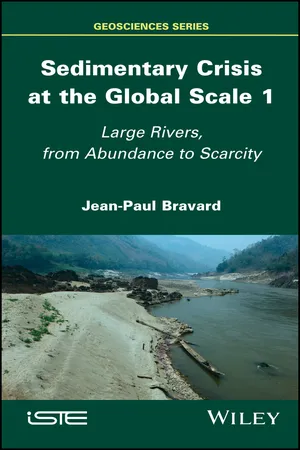
eBook - ePub
Sedimentary Crisis at the Global Scale 1
Large Rivers, From Abundance to Scarcity
- English
- ePUB (mobile friendly)
- Available on iOS & Android
eBook - ePub
About this book
Information
1
The Torrential Crisis in the European Mountains (14th–19th Centuries)
1.1. Introductory generalities on global fluvial systems
Fluvial systems function according to universal principles, governed by fluid mechanics, while remaining subject to regionalized constraints under climatic control; this provides partially distinct forms to northern, temperate and tropical rivers. In most matters and to stick to the circulation of water and sediment, the scientific literature distinguishes “sediment production” zones* (essentially localized in mountain and hill regions), “sediment transfer” zones* and “sedimentary deposit” zones downstream (alluvial plains, deltas, ocean margins). This longitudinal zonation is also governed all over the globe by secondary processes that nuance the general principle.
First, river styles* are under the control of climate, vegetation that more or less protects slopes, and geology that conditions lithology and the ability to mobilize certain types of soft materials. If the balance or equilibrium between liquid flow (capable of ensuring sediment transport) and solid flow (sediment to be transported) is in favor of the former, the material is easily evacuated and the river presents a simple morphology, demonstrating a single winding channel, sometimes classified as a meandering* channel. These channels are found in regions that produce little sediment (mountains and hills with heavy rainfall, wooded, sparsely populated) and in the transfer zone.
If, on the contrary, the liquid/solid fluxes balance is in favor of the latter, then the flows are not capable of transporting the entire load originating from the production zone. This situation is very frequently seen in regions with semi-arid climates (the slopes there are badly protected), in regions of the globe with a contrasted relief and a fragile structure, and finally in elevated areas that have been cleared and over-exploited for pastures and agriculture (Figure 1.1).

Figure 1.1. The Selle torrent in the Massif des Écrins (France); it is fed here by an avalanche cone whose base is eroded by lateral erosion from the torrent. The bed comes loose downstream and adopts a braid style
(source: J.-P. Bravard)
The production zone and sometimes even the transit zone are then saturated with rough material; in response, the river channel adopts a particular shape and mode of functioning, braiding*.
The braid style is classically contrasted with the meander style, even though composite or hybrid styles are frequently seen. The excess sediment therefore has a descriptor, or marker, which is braiding, easy to diagnose and interpret based on the dynamic function of the basin. Without anticipating too much further, we can assume that braided channels reveal crises, which are the subject of the first chapters of this work.

Figure 1.2. A river in British Colombia, the Squamish River. This wandering gravelbed river*, with a basin well provided in both water and sediment, meanders and braids at the same time in a former glacial basin [HIC 75]
(source: J.-P. Bravard)
Some further questions have join those stated above, at the forefront of scientific investment. These concern:
- 1) the precise methods of mobilizing material on slopes until they enter channels (this is slope–river bed coupling* or “decoupling”);
- 2) revealing permanent deposit sites at the foot of eroded slopes far from active channels; these are long-lasting, for they are sheltered from erosion by channels (we generally speak of “colluvia”* to distinguish them from alluvia);
- 3) the importance of alluvial plains as deposit sites for alluvia brought when channels flood; the question also needs to be asked of these materials being recovered when the river channels move on the plain and recover these deposits to incorporate them into its load;
- 4) the chronology of sedimentary recovery that can ensure a transfer to the system’s traps downstream, even during phases with limited material entry into rivers from production zones. In short, the process chain involving production–transfer–deposit and the morphological “continuum”* involving mountain–piedmont plain–valley are not sufficient to correctly grasp the load of a river that is building its delta.
Finally, let us observe that the globe’s rivers, aside from increasingly rare exceptions, have stopped presenting the “pure” mechanisms, that were briefly described, for more than a century (sometimes longer). Sedimentary traps, the complexity of which was just explained, have moved to the background, behind the reality of artificial traps constituted by dams-reservoirs, the number and capacity of which exploded across the globe in the 20th Century.
However, let us move to the heart of the subject of this first chapter, which is the sedimentary crisis of the Little Ice Age (abbreviated as LIA). The knowledge we have of the LIA is progressing in the fields of both hydrology and sediment transfer and deposit, not to exclude the mechanisms that connect these two components. Let us take the example of hydrology. A very in-depth study of the archives of cities on the Lower Rhone has provided great insight into the hydrological rhythm of the river at the outlet of its basin [PIC 14b]. The study of the floods on the Rhône, spread across decades and four degrees of gravity based on their manifestation in the riverbed and in its floodplain, revealed new elements, particularly their classification into two hydrological “hyperphases,” the first dating back to 1450–1599 and the second to 1647–1711. The hyperphases are separated from one another by a period of moderate hydrology (1600–1646). On an even finer level, the decade 1701–1710 was the hardest in the history of the river, and before it, the period from 1481 to 1500. During hyperphase 1, an isolated event, the 1548 flood, would surpass even that of 1856, despite it being considered the most significant flood in the Rhône’s history, i.e. the absolute “reference” for risk managers in France. Another discovery is the way in which the contemporary hydrological regime was established, with boosts in strong hydraulicity in the decades 1770–1780, 1801–1810 and 1841–1850. If the floods in 1840 and 1856 do not belong to these sequences, it is because these are isolated manifestations on a foundation of weak hydraulicity (Figure 1.3). This figure is one of the markers of the river’s new hydrology according to the authors of the study, G. Pichard and E. Roucaute.
It is possible to evoke the reality and the gravity of the long crisis of the Little Ice Age (LIA), because the proofs of highly active processes that affected the torrents and torrential rivers are numerous enough to be convincing. These manifestations allow us to understand the extent of the means used by the inhabitants of slopes and floodable plains to find initially local and provisional solutions, then more or less definitive ones, occasionally benefitting from the help of the public authorities. We will consider the question of the torrential crisis from the LIA from the perspective of several European mountain ranges.

Figure 1.3. Hydrological hyperphases (black curve) and flood periods (red curve) from the 14th to the 20th Century. The gray line emphasizes the LIA period (source: [PIC 14b]). For full color image see: www.iste.co.uk/bravard/sedimentary1.zip
1.2. Manifestations of the LIA crisis in the river valleys of Western Europe
1.2.1. Mountain crises
Historians have collected testimonies in the high valleys of the Western Alps. Two works are interesting insofar as they pose the question of a change in the torrential and river landscapes during the Middle Ages based on texts and in little-known terms, without being able to reference the later notion of the Little Ice Age, which did not yet exist when they were written. The medievalist historian T. Sclaffert [SCL 26, SCL 59] observes that Seyssins, located near Grenoble, had a port on the Drac, from which, curiously, boats departed, whereas (later) iconography shows us that the Drac was a torrent congested with pebbles in the modern era. The historian hardly goes beyond the 14th Century to find torrential activity in the Northern and Southern Alps, but the crisis (in the broad sense) is indeed present. T. Sclaffert describes valley floors covered in fields, orchards and prairies on riverbanks; later, the rivers become torrential, capable of ravaging the valley floors during floods. The agricultural wealth went along with the existence of numerous mills and “artifices” that have since disappeared. This research provides raw facts that are all the more interesting in that they had no explanatory objective and that no manifestation of the change in landscape is sought to support a theory that did not yet exist.
Here, we will use the great work by forester Paul Mougin (1866–1939). It certainly comes after the laws voted on in France to restore mountain territories (1860 and 1882), but it provides a very interesting historical overview of the causes of deforestation in Savoy.
P. Mougin [MOU 14] adopts the standpoint of his original post when he positively emphasizes the foresight of the mountains’ inhabitants (both monks and farmers) but negatively emphasizes their “spirit of profit and plunder” to explain elevated clearings and illegal deforestation as well as pastureland abuses in the forest, not to mention supplying mines, salt manufacturing and glass factories with lumber and fuel, or even the destructive effects of wars. The degradation of forests seems to be attested to in the Ancien Régime in France (1589–1789), but it is not possible to create a hierarchy of these factors. The author dates the first measures to ban deforestation back to the decisions of the Senate in Savoy (the first in 1559, renewed in 1594, 1654, 1666 and 1667); these decisions went into effect through a royal decree in 1723 applicable in the Duchy of Savoy, then by the Royal Constitutions of 1729 and 1770. P. Mougin accuses the confiscation of religious and noble property, following the annexation of the Sardinian province in 1792, of having allowed a loss of all control over the forests to exclusively favor the communes and their inhabitants; the end of the Empire (1815) is also a period considered by P. Mougin to be harmful for aff...
Table of contents
- Cover
- Table of Contents
- Foreword
- Preface
- Introduction
- 1 The Torrential Crisis in the European Mountains (14th–19th Centuries)
- 2 Continuity in European Hydraulic Science (16th–18th Centuries)
- 3 Exploited Nature and the River’s Responses to the Globe’s Surface
- 4 From Hills to the Ocean: Production, Transfer and Trapping
- 5 The Recent Hydrosedimentary History of Some of the Globe’s Largest Rivers
- Conclusion
- Glossary
- Bibliography
- Index of Common Terms
- Index of Places
- Index of Names
- End User License Agreement
Trusted by 375,005 students
Access to over 1.5 million titles for a fair monthly price.
Study more efficiently using our study tools.
Frequently asked questions
Yes, you can cancel anytime from the Subscription tab in your account settings on the Perlego website. Your subscription will stay active until the end of your current billing period. Learn how to cancel your subscription
No, books cannot be downloaded as external files, such as PDFs, for use outside of Perlego. However, you can download books within the Perlego app for offline reading on mobile or tablet. Learn how to download books offline
Perlego offers two plans: Essential and Complete
- Essential is ideal for learners and professionals who enjoy exploring a wide range of subjects. Access the Essential Library with 800,000+ trusted titles and best-sellers across business, personal growth, and the humanities. Includes unlimited reading time and Standard Read Aloud voice.
- Complete: Perfect for advanced learners and researchers needing full, unrestricted access. Unlock 1.5M+ books across hundreds of subjects, including academic and specialized titles. The Complete Plan also includes advanced features like Premium Read Aloud and Research Assistant.
We are an online textbook subscription service, where you can get access to an entire online library for less than the price of a single book per month. With over 1.5 million books across 990+ topics, we’ve got you covered! Learn about our mission
Look out for the read-aloud symbol on your next book to see if you can listen to it. The read-aloud tool reads text aloud for you, highlighting the text as it is being read. You can pause it, speed it up and slow it down. Learn more about Read Aloud
Yes! You can use the Perlego app on both iOS and Android devices to read anytime, anywhere — even offline. Perfect for commutes or when you’re on the go.
Please note we cannot support devices running on iOS 13 and Android 7 or earlier. Learn more about using the app
Please note we cannot support devices running on iOS 13 and Android 7 or earlier. Learn more about using the app
Yes, you can access Sedimentary Crisis at the Global Scale 1 by Jean-Paul Bravard in PDF and/or ePUB format, as well as other popular books in Biological Sciences & Ecology. We have over 1.5 million books available in our catalogue for you to explore.