eBook - PDF
Big Data and Archaeology
Proceedings of the XVIII UISPP World Congress (4-9 June 2018, Paris, France) Volume 15, Session III-1
- 107 pages
- French
- PDF
- Disponible sur iOS et Android
eBook - PDF
Big Data and Archaeology
Proceedings of the XVIII UISPP World Congress (4-9 June 2018, Paris, France) Volume 15, Session III-1
À propos de ce livre
Big Data and Archaeology presents the papers from two sessions of the 18th UISPP World Congress (Paris, June 2018): Session III-1 (CA): 'Big data, databases and archaeology', and Session III-1 (T): 'New advances in theoretical archaeology'. The advent of Big Data is a recent and debated issue in Digital Archaeology. Historiographic context and current developments are illustrated in this volume, as well as comprehensive examples of a multidisciplinary and integrative approach to the recording, management and exploitation of excavation data and documents produced over a long period of archaeological research. In addition, specific attention is paid to neoprocessual archaeology, as a new platform aimed at renewing the theoretical framework of archaeology after thirty years of post-modernism, and to the refinement of the concept of archaeological cultures, combining processual, contextual and empirical approaches.
Approuvé par les 375,005 étudiants
Accès à plus de 1,5 million de titres pour un prix mensuel raisonnable.
Étudiez plus efficacement en utilisant nos outils d'étude.
Informations
Sujet
Sciences socialesSujet
ArchéologieTable des matières
- Cover
- Contents
- Title Page
- Copyright Page
- UISPP PROCEEDINGS SERIES VOLUME 15
- Foreword to the XVIII UISPP Congress Proceedings
- List of Figures
- Introduction au volume
- François Djindjian
- Mégadonnées et archéologie : une introduction
- How Big Is Big Data?
- Paola Moscati
- Figure 1. J.-C. Gardin’s and P. Braffort’s paper presented at the UNESCO International Conference on Information Processing (Paris 1959). <https://unesdoc.unesco.org/ark:/48223/pf0000157450?posInSet=3&queryId=5331e227-746e-401d-8db9-d395fb6d21e6>.
- Figure 2. The Virtual Museum of Archaeological Computing, section Protagonists: interactive itinerary dedicated to Robert G. Chenhall. <http://archaeologicalcomputing.isma.cnr.it/itineraries/>
- Figure 3. The Virtual Museum of Archaeological Computing, section Events: interactive itinerary dedicated to the European postgraduate course on Data Processing and Mathematics Applied to Archaeology (Valbonne-Montpellier 1983). <http://archaeologicalcomp
- Figure 4. The Virtual Museum of Archaeological Computing, section Projects: interactive itinerary dedicated to the project ‘Automatisation of Etruscan corpora’. <http://archaeologicalcomputing.isma.cnr.it/itineraries/>.
- Figure 5. The Virtual Museum of Archaeological Computing, section Institutions: interactive itinerary dedicated to the Centre de recherches sur les TraitementsAutomatisés en Archéologie Classique (TAAC). <http://archaeologicalcomputing.isma.cnr.it/itinera
- Figure 6. Spatial distributions of the article published in «Archeologia e Calcolatori»n. 2014-2017 on Peripleo search engine. <https://peripleo.pelagios.org/>.
- Les statistiques et l’analyse spatiale des sites archéologiques sont à notre portée
- Olivier Buchsenschutz
- Innovative multidisciplinary method using Machine Learning to define human behaviors and environments during the Caune de l’Arago (Tautavel, France) Middle Pleistocene occupations
- Sophie Grégoire1, Nicolas Boulbes1, Bernard Quinio2, Matthieu Boussard3, Caroline Chopinaud3, Anne-Marie Moigne4, Agnès Testu1,Vincenzo Celiberti1, Cédric Fontaneil1, Christian Perrenoud4, Anne-Sophie Lartigot Campin1, Thibaud Saos1, Tony Chevalier1, Véro
- Figure 1. The Caune de l’Arago cave (Tautavel, Oriental Pyrenees, France).
- Figure 2. A conceptual model of research.
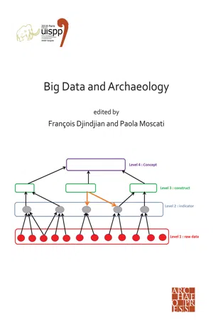
- Figure 3. Example of a part of the cognitive map of the occupation duration and site function scenario (red: general archaeological considerations, yellow: faunal raw data and indicators, blue: lithics raw data and indicators, grey: constructs and concept
- Figure 4. 2D visualization of high dimensional data with TSNE.
- Figure 5. Biome’s predictions in the stratigraphic levels of Caune de l’Arago cave.
- Figure 6. Variable importance plot for the level O.
- Figure 7. Visualization (force plot) of the prediction’s explanation of the majority class from the level J.
- Figure 8. Result of prediction classifying by short (C, green), not short (NC) output class. The training set has learnt on three expert labels: short, not short, and unknown (?) assigned and predicted on the whole layers (red: concordant predictions). Th
- Figure 10. Principle of the triple loop learning in AI.
- Cagny-l’Épinette (Somme valley, France), Thirty Years of Mixed Data: Potential and Limits
- Floriane Peudon1, Éric Masson2, Patrick Auguste3, Agnès Lamotte1, Anne-Marie Moigne4, Alain Tuffreau1
- Figure 1. 3D-Model of the location of the site of Cagny-l’Épinette, Somme Valley, Northern France (Map: Modified after d-map.com; 3D-Model: Modified after Marcy in Tuffreau et al. (2001)).
- Figure 2. Field recording protocol applied at the site of Cagny-l’Épinette from 1980 to 2010. A – Photo coverage by film photography in the 1980s, then by digital photography, B – Manual coordinate measurements in the 1980s, then replaced with a Total Sta
- Figure 3. Methodological protocol submitted to the archives of the site of Cagny-l’Épinette (BDD: A. Lamotte, A.-M. Moigne, P. Auguste; plans, montage & CAD: F. Peudon).
- Figure 4. Rule set applied on the digitized georeferenced maps with the OBIA-software eCognition: A – Raster digitized georeferenced plan, B – Initial Segmentation, C – Classification and Objects Merging, D – Removal of the landmarks, Background Merging a
- Figure 5. Overall digitalization of the archaeological vestiges of Level I1 overlapped by a corresponding scatter plot, both with their respective attribute tables linked through the ID Number. Grey: Digitized remains (Lithic and faunal remains), Red Dots
- Figure 6. Integrity assessment of the spatial information of the Level I1 with three identified main degrees of integrity: areas with complete spatial Data (field drawings and coordinates (x, y, z)), areas with either field drawings or coordinates (x, y,
- Réjane Roure1,2, Hakima Manseri1, Sébastien Munos2, Michel Py3
- Towards an Archaeological Information System: the evolution of Syslat, an archaeological data management software
- Figure 1.1. The Syslat software.
- Figure 2.1. Cover of Lattara 4.
- Figure 2.2. Cover of Lattara 10.
- Figure 3.1. A mind map of the Syslat architecture.
- François Djindjian
- L’archéologie néoprocessuelle
- Figure 1.
- Figure 2. Evolution des « cultures » du paléolithique supérieur européen depuis les débuts du stade isotopique 3 jusqu’à la fin du stade isotopique 2, illustrée par le modèle de Holling.
- Figure 3. Evolution des systèmes d’exploitation des territoires des groupes humains depuis les débuts du stade isotopique 3 jusqu’à la fin du stade isotopique 2, illustrée par le modèle de Holling.
- Figure 4. Evolution des procédés de fabrication de l’industrie lithique depuis les débuts du stade isotopique 8 jusqu’à la fin du stade isotopique 2, illustrée par le modèle de Holling.
- Figure 5. Processus concernés par la simulation globale d’une société complexe.
- Pascaline Gaussein
- Transcending ‘Technocomplexes’ When French Empiricism calls for Hypothetico-deductive Method
- Figure 1. Simplified framework for the interpretation of variability, homogeneity and change of material culture styles. After Wobst 1977; Wiessner 1986, 1990; Boer (de) 1990; Macdonald 1990; Gosselain 2000, 2011. CAD P. Gaussein.
- Figure 2. Contextualized framework for the interpretation of variability, homogeneity and change of material culture styles. After Wiessner 1990; Whallon 2006; Kelly 2013. CAD P. Gaussein.
- Figure 3. Schematic mapping of social unit territories depending on the application of human density: a. ‘archaeological application’ according to known archaeological settlements; b. and c. ‘global application’, archaeological map none taken into account
- List of Authors
- Back cover
Foire aux questions
Oui, vous pouvez résilier à tout moment à partir de l'onglet Abonnement dans les paramètres de votre compte sur le site Web de Perlego. Votre abonnement restera actif jusqu'à la fin de votre période de facturation actuelle. Découvrir comment résilier votre abonnement
Non, les livres ne peuvent pas être téléchargés sous forme de fichiers externes, tels que des PDF, pour être utilisés en dehors de Perlego. Cependant, vous pouvez télécharger des livres dans l'application Perlego pour les lire hors ligne sur votre téléphone portable ou votre tablette. Apprendre à télécharger des livres hors ligne
Perlego propose deux formules : Essential et Complete
- Essential est idéal pour les apprenants et les professionnels qui aiment explorer une grande variété de sujets. Accédez à la Essential Library avec plus de 800 000 titres de confiance et best-sellers dans les domaines du business, du développement personnel et des sciences humaines. Inclut un temps de lecture illimité et la voix Standard Read Aloud.
- Complete : Parfait pour les apprenants avancés et les chercheurs ayant besoin d'un accès total et sans restriction. Débloquez plus de 1,5 million de livres dans des centaines de sujets, y compris des titres académiques et spécialisés. Le forfait Complete inclut aussi des fonctionnalités avancées telles que Premium Read Aloud et Research Assistant.
Nous sommes un service déabonnement à des manuels scolaires en ligne, qui vous permet d'accéder à une bibliothèque en ligne entière pour moins que le prix d'un seul livre par mois. Avec plus de 1,5 million de livres sur plus de 990 thèmes, nous avons ce qu'il vous faut ! Découvrir notre mission
Recherchez le symbole Écouter sur votre prochain livre pour voir si vous pouvez l'écouter. L'outil Écouter lit le texte à haute voix pour vous, en surlignant le passage qui est en cours de lecture. Vous pouvez le mettre sur pause, l'accélérer ou le ralentir. En savoir plus sur la fonctionnalité Écouter
Oui ! Vous pouvez utiliser l'application Perlego sur les appareils iOS et Android pour lire à tout moment, n'importe où, même hors ligne. Parfait pour les trajets quotidiens ou lorsque vous êtes en déplacement.
Veuillez noter que nous ne pouvons pas prendre en charge les appareils fonctionnant sur iOS 13 et Android 7 ou versions antérieures. En savoir plus sur l'utilisation de l'application
Veuillez noter que nous ne pouvons pas prendre en charge les appareils fonctionnant sur iOS 13 et Android 7 ou versions antérieures. En savoir plus sur l'utilisation de l'application
Oui, vous pouvez accéder à Big Data and Archaeology de François Djindjian, Paola Moscati, François Djindjian,Paola Moscati aux formats PDF et/ou ePub, ainsi qu'à d'autres livres populaires dans Sciences sociales et Archéologie. Nous avons plus de 1,5 million de livres disponibles dans notre catalogue pour vous.