Geography
Boundary Disputes
Boundary disputes refer to disagreements or conflicts between two or more entities over the demarcation of their territorial limits. These disputes can arise due to historical, political, or geographical reasons and often involve negotiations, legal processes, or even diplomatic interventions to reach a resolution. They are a significant aspect of geopolitics and can impact international relations and regional stability.
Written by Perlego with AI-assistance
Related key terms
1 of 5
10 Key excerpts on "Boundary Disputes"
 eBook - ePub
- J. R. V. Prescott(Author)
- 2014(Publication Date)
- Routledge(Publisher)
5 Boundary DisputesBoundary Disputes have long been a popular subject for research amongst political geographers. These subjects have a refreshing topicality, and generally result in the publication of much information useful to the geographer, which would not otherwise be available. The general term boundary dispute’ includes four quite different types of dispute between political units having some measure of autonomy, for it must be recognized that disputes occur over the whole range of international and internal boundaries. This chapter will consider only international Boundary Disputes: internal Boundary Disputes will be examined in Chapter 6 .The first type of dispute may be described as a territorial dispute, and this results from some quality of the borderland which makes it attractive to the state initiating the dispute. The second type of dispute concerns the actual location of the boundary, and usually involves a controversy over interpreting the delimitation or description of the boundary. This type may be called positional disputes. Both territorial and positional disputes have as their aim a change in the position of the boundary, but the remaining two types do not require any change in boundary location. The third type arises over state functions applied at the boundary, and they may be described as functional disputes. The last type of boundary dispute concerns the use of some trans-boundary resource such as a river or mineral reserves. Disputes of this type usually have as their aim the creation of some organization which will regularize use of the particular resource, and they may be known as disputes over resource development.Geographers are not alone in studying Boundary Disputes, which have also been a profitable field of research for political scientists, historians and international lawyers, but the facility of geographers with maps and their understanding of regional characteristics, have given them an advantage in such studies. There are clearly some aspects of Boundary Disputes which a geographer is not competent to consider, such as the involved decisions about the legality of treaties, and the role of individual persons in successfully pressing arguments in favour of one or another case. There still remains a great deal which the geographer can study in making a distinct contribution to understanding the situation. It is suggested that the analysis of any dispute should be aimed at discovering the initial cause of the dispute, the trigger action which creates a favourable situation for a claim to be made, and the underlying aims of the states concerned. The analysis should then continue to evaluate those arguments based in geography, and assess the results eBook - ePub
Territorial Disputes and Conflict Management
The art of avoiding war
- Rongxing Guo(Author)
- 2012(Publication Date)
- Routledge(Publisher)
2 Territorial Disputes From Dormancy to ActivationBoundary and territorial disputes can be easily found throughout the world. This is simply due to the very fact that most, if not all, existing political boundaries are either inappropriately or imprecisely defined. Except those that are either defined by latitude and longitude (the major portion of the US–Canada land boundary is an example) or by other quantitatively identified coordinates, most of the land boundaries shown in Appendix I.1 are not defined with completely accurate details.1 Also, as shown in Appendix I.2, many exclusive economic zones (EEZs) claimed by neighboring coastal states overlap. Fortunately, most existing territorial disputes stemming from the inappropriate or imprecise definitions of international boundaries are dormant.However, under certain conditions and circumstances, boundary and territorial disputes that have been dormant for a long period of time may be activated and evolve into more serious cross-border conflicts and wars. In this chapter, ten cases of cross-border disputes and wars – which differ in geography, political, economic and cultural backgrounds – will be analyzed. Our task is to test – qualitatively and, if necessary, quantitatively – how various factors (such as resource scarcity, locational feature, domestic politics, geopolitical competition and cultural difference) have decisively influenced the cross-border tensions in the disputed territories throughout the world.2.1 Resource ScarcityBoundary and territorial disputes are often the result of divergent material claims, especially regarding land, freshwater and mineral and energy resources. This has particularly been the case in the international context, where sovereign control within one’s territorial boundaries is thought to be a defining characteristic of a state.2
- Gbenga Oduntan(Author)
- 2015(Publication Date)
- Routledge(Publisher)
4 Province of international Boundary Disputes determined DOI: 10.4324/9780203776841-4Pertinent questions here include whether it is indeed possible to identify the basic kernel of what constitutes an international dispute. Disputes over territory come in various forms and shapes and are usually entwined together with other issues of law and politics, sometimes making it near impossible to isolate the strictly legal issues that may be treated in resolving the dispute.4.1 What are international Boundary Disputes?
The boundaries between nations (land, maritime and air) present many opportunities for international disputes. Land Boundary Disputes may involve disagreement over interpretation of applicable treaties that delimit the boundaries between two or more states. It may involve trespass by nationals of another state which occur advertently or inadvertently (such as the way in which up to 33 Nigerian small villages shifted and followed a receding lake, thereby crossing into Cameroonian territory without any governmental involvement).Deliberate incursion by military personnel would nearly always create serious contention and reaction from the territorial state (Djiboutian–Eritrean border conflict).1In relation to the sea; adjacent or opposite states may disagree over the boundaries separating their respective maritime zones (e.g., Qatar v Bahrain Maritime Delimitation and Territorial Questions and the evolving situation in the Gulf of Guinea). One state may claim the right to conduct naval manoeuvres in the EEZ of another state whilst the latter would typically deny the existence of such rights.2Another state may seek to exclude fishermen from neighbouring states and exercise powers of arrest over them for many miles from its coast (Africa–European Union disputes; Namibia–South Africa).3The right of a sovereign to continue fishing in the waters of a separatist territory may be called into question (Morocco–Western Sahara).4In the air, on an annual basis, states experience dozens of contentious disagreements over the trespass of aircraft, drones and other aerial vehicles into national territory.5Although not as prevalent as it is of the case in the Middle East and Europe, the African continent has recorded many aerial trespass disputes of its own.6Invariably disagreement over ownership of a territory will extend to a contest over the airspace above that territory. There is also the possibility of dispute over the spatial demarcation problem in international law (i.e. the height at which other states must steer clear of national territory in aerial or space flight in order not to violate airspace). At least two African states – Nigeria and Tunisia – have already expressed a clear opinion on this problem which may put them potentially in conflict with developed states.7 eBook - ePub
- Rongxing Guo(Author)
- 2017(Publication Date)
- Elsevier(Publisher)
For example, as a result of the Cold War in the late 1990s, China and Russia found that, compared to the United States and its political allies in Asia and Europe, they would have been politically or militarily lonelier had they not decided to resolve the obstacles hindering them from establishing a friendlier political (if not economic) relationship. Therefore, it is quite easy to understand that, as discussed in detail in Section 10.4.1, Cooperative Geopolitical Games, the quick settlement of the disputed border area (which was a Chinese territory but was occupied by Russia in the 1920s and had been claimed by China since then) in the early 2000s was to a large extent the joint (cooperative) response to the potential external threats to both China and Russia. 11.3 Political Economy of Territorial Disputes 11.3.1 Costs of Territorial Disputes The term ‘territorial dispute’ refers to the disagreement over a piece of territory that is claimed by two or more independent countries. More specifically, a territorial dispute exists between two or more states when ‘at least one government does not accept the definition of where the boundary line of its border with another country is currently located, whereas the neighbouring government takes the position that the existing boundary line is the legal border between the two countries based on a previously signed treaty or document’ (Huth, 1998, p. 19). Literally, ‘Boundary Disputes’ (conflicts over how to draw border lines) and ‘territorial disputes’ (conflicts over larger tracts of land or water) are different terms eBook - ePub
Border Disputes
A Global Encyclopedia [3 volumes]
- Emmanuel Brunet-Jailly(Author)
- 2015(Publication Date)
- ABC-CLIO(Publisher)
Positional disputes can emerge either at the time of boundary demarcation, for instance, when the demarcation commission struggles with the landscape and the boundary, or later, when an aspect of the boundary is challenged. Demarcation errors, as the boundary is marked on a map, treaty, or other written texts are often triggers for disputes. These cases may involve large amounts of land, for instance, when a boundary is determined by reference to a few points on a map and one point is disputed or reference to a historical boundary that has multiple locations, histories, and representations. It may also arise when an error is made. Sometimes, it is wording in the language of the text that leads to the positional challenge. Other positional challenges can arise from an unclear reference to physical features of the landscape—a mountain crest, a water line—that may vary with time as they are affected by weather or even seasons. Similar issues arise from references to coastlines that vary greatly, for instance, in estuaries that change due to tides. Sometimes, positional issues also result from references to unclear place names that have different locations and/or different objects (a valley, a house) (e.g., see in this volume the discussions about Ecuador-Peru and Greece-Turkey).Kratochwil, Rohrilch, and Mahajam (1985) and Kocs (1995) suggest that positional disputes are also typical in areas where boundary delineation or disputes have been partially addressed or have found partial solutions. Basically, when states have recognized each other’s claim and agreed on the border but the exact location of the border remains unclear, there is a case of positional dispute.Positional disputes have become prominent as a result of two historical trends. First, decolonization led to the international recognition of a large number of new states around the world (see the introduction to Volume 1 of this encyclopedia for details). Second, following their international recognition these new members of the international community made every effort to precisely delineate their territorial, sea, and air boundaries as a way to assert their sovereignty and they have engaged with their neighbors to clarify the marking of their land, sea, and air boundaries.
- J. R. V. Prescott(Author)
- 2014(Publication Date)
- Routledge(Publisher)
If the matter is settled by the transfer of territory, a wide range of consequences are possible. Some people in the transferred region who opposed the change may cross the new boundary to remain citizens of their original country; new patterns of administrative organization might be established; the orientation of the region’s economy may be altered towards the country which has acquired the land; different forms of production might be encouraged by the new regulations which apply to the area and by access to a different market. It would require careful fieldwork in each case to establish the range of changes which occurred following the alteration of the boundary. Sanguin (1983) described the problems in that part of Italy which was transferred to France in 1947 and showed how some of the present problems can be traced to that change. In some cases the dispute will enter a dormant phase without any transfer of territory, and this may be encouraged by an agreement between the two countries regarding their border relations. For example, in 1967 Somalia and Ethiopia reached an understanding, which, though not ending the dispute, did encourage better relations between the two countries, promote easier travel across the boundary, and guarantee some safeguards for the civil rights of Somalis living in the Ethiopian borderlands.Positional Boundary DisputesAlthough the basic cause of territorial Boundary Disputes is superimposition of the boundary on the cultural or physical landscape, positional Boundary Disputes arise because of incomplete boundary evolution. It is not the quality of the borderland but rather the defect of the boundary which is crucial. Positional disputes will usually arise at one of two stages. Most of them will arise during the demarcation of the boundary because the commission will be faced with the problem of matching the boundary definition to the landscape. However, it is also possible that positional disputes will arise at a much later date if the demarcation commission makes an error. There is probably an important legal distinction between these two situations because the existence of a demarcated boundary for a considerable period may be used as justification by the satisfied party for maintenance of that location, but essentially they arise from the same causes. These causes are found in the boundary definition and can be grouped into two categories. First, some of the terms will be imprecise because they will allow more than one interpretation; secondly, some of the turning points along the boundary will be defined in two ways which are contradictory. eBook - PDF
Litigating International Law Disputes
Weighing the Options
- Natalie Klein(Author)
- 2014(Publication Date)
- Cambridge University Press(Publisher)
In most cases, significant effort has been made prior to litigation to resolve the dispute by some other means, usually negotiation. Prior to their litigation in Gulf of Maine, the United States and Canada engaged in ‘more than five years of intensive high-level negotiations which failed to reach an agreed result’. 54 Some disputes take much more time to reach litigation. The maritime boundary in Nicaragua v. Colombia, for example, is closely tied to a 1928 treaty allocating insular territory in the south-western Caribbean Sea. Fischer’s overall foreign policy factor, while undoubtedly paramount, is difficult to quantify. By definition, maritime boundary disputants are neighbouring states. As such, disagreement about the location of a mar- itime boundary is likely to be one of many past or current disagreements between those proximate states. In the circumstance of adjacent states, those neighbours will also share a land border, a possible source of addi- tional disputes. Argentina and Chile, the parties to the Beagle Channel maritime delimitation case, share one of the world’s longest land borders, which itself has been the subject of several litigations. 55 Trade relation- ships across land borders would also fall under this category of foreign policy considerations. 56 We must assume that long-term neighbours have Netherlands), [1969] ICJ Rep. 3; Trial of Pakistani Prisoners of War (Pakistan v. India), [1973] ICJ Rep. 328. 53 Fischer, above n. 51, 255–61. 54 David A. Colson, ‘Canada–United States (Gulf of Maine)’, in Jonathan I. Charney and Lewis M. Alexander (eds.), International Maritime Boundaries, Vol. I (Dordrecht: Martinus Nijhoff, 1993) 401. 55 Marcelo G. Kohen, ‘The “Laguna del Desierto” Case between Argentina and Chile’, (1993) 1 International Boundaries Research Unit, Boundary and Security Bulletin 70. 56 Simmons cites figures that ‘suggest that arguments over territory may exact a high oppor- tunity cost in terms of trade’. eBook - PDF
Enduring Territorial Disputes
Strategies of Bargaining, Coercive Diplomacy, and Settlement
- Krista Wiegand, Gary Bertsch, Howard Wiarda(Authors)
- 2011(Publication Date)
- University of Georgia Press(Publisher)
In 2008, these two major powers settled their longstanding territorial dispute after several decades of hostility and unwillingness to resolve the dispute. The resolution of this territorial dispute has removed a significant barrier in Sino-Russian relations. Each of these disputes has the potential to be explained by any of the theo-ries, but it appears that the theory of territorial disputes as bargaining leverage can better explain why settlement attempts are less likely and, therefore, why some territorial disputes are enduring, while others are resolved. All of these disputes are located in key strategic and economic areas of the world, making them very policy relevant. The Senkaku/Diaoyu Islands dispute exists between two of the world’s major powers and the dominant powers in East Asia, who have a longstanding record of animosity and distrust. The Lebanese-Israeli border dispute not only partly sparked the 2006 Lebanon War between Hez-bollah and Israel but also has major ramifications for the greater Arab-Israeli conflict, involving not only Lebanon but also Golan Heights, hotly disputed between Israel and Syria, and the Palestinian-Israeli peace process. The use of the North African enclaves acting as a bridge from Africa to Europe for illegal immigrants into the eu has created major problems for the eu and more spe-cifically for Spain. The Sino-Soviet/Russian dispute involved the only conven-tional armed conflict that has occurred between two states with nuclear weap-ons. Until this dispute was resolved, the territorial issue played a major role in tensions between these two major powers, and as a result, it played a key role in us attempts to balance the Soviet Union during the Cold War. [ 78 ] chapter four Variables Though the dependent and independent variables are not always clearly defined in qualitative studies, it is critical to clearly specify how these variables are mea-sured, just as with a quantitative study (George and Bennett 2005). eBook - PDF
On Dangerous Ground
A Theory of Bargaining, Border Settlement, and Rivalry
- Toby J. Rider, Andrew P. Owsiak(Authors)
- 2021(Publication Date)
- Cambridge University Press(Publisher)
The value of the disputed territory itself may also undercut conflict man- agement, even among states like democracies that are theoretically predisposed toward it (see Park and James 2015). We therefore outline expectations for border settlement conditional on both conflict management and power endow- ments. The theory we advance predicts that conflict management techniques will be much more likely to produce settlement in the absence of power endowments. Such cases present smaller hurdles to settlement that third parties can more easily address. We break with much previous research, however, to argue that the commitment problem – expected and exacerbated when power endowments are present – will make states reluctant to settle their borders, even with the help of third-party conflict managers. 3.2 the salience of border territory States disagree over many issues; nonetheless, disputes over territory are particularly dangerous. Territorial disputes are more likely than disputes over other issues to become militarized (Senese and Vasquez 2008; Vasquez and Henehan 2001), to recur (Hensel 1994), and to escalate to war (Holsti 1991; Vasquez 2009). Despite this general trend, however, not all territorial disputes are alike. In particular, disagreements over the delimitation of mutual borders (a subset of territorial disputes) may produce much of the conflict associated with the broader category of territorial disputes (Gibler 2012; Holsti 1991; Huth 1996; Kocs 1995; Owsiak 2012; Vasquez 2009). A review of recent research confirms this latter point. Neighboring states that have not delimited their mutual borders, for example, experience a disproportionately high likelihood of interstate conflict.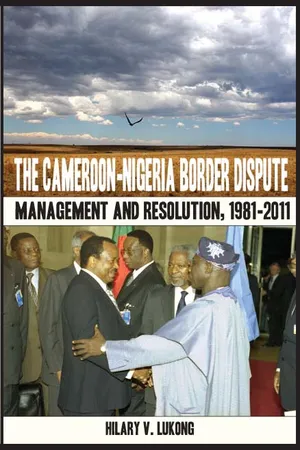 eBook - PDF
The Cameroon Nigeria Border Dispute
Management and Resolution, 1981-2011
- V. Lukong(Author)
- 2011(Publication Date)
- Langaa RPCIG(Publisher)
9 Chapter 1 Stakes and Causes of the Border Dispute At independence, Cameroon and Nigeria kicked start the delimitation of their common boundary built on a foundation laid down by European colonizers—Britain, Germany, and France—from 1885 to 1931. As a consequence, in 1964, the two countries adhered to the OAU doctrine of uti possedetis juris by inheriting the colonial administrative borders whose delineation in some parts was either imperfect or not demarcated or both. The two countries therefore tried to correct these anomalies.But, such efforts were later thwarted by incessant geostrategic and dilatory tactics in the seventies and eighties that persisted and resurfaced in the nineties with a more determined posture. The result was of course dispute over many border areas from the Lake Chad region in the North, through the Land Boundary area to the Maritime Zone in the South. In the Lake Chad region, there was dispute in over 33 villages notably Naga’a, Tchika, Toro Liman, Darack, Dambore and their environs. Along the Land Boundary from Lake Chad to astride the Bakassi Peninsula, there was dispute in 17 sectors. From north to south, this concerned the localities of Limani, River Keraua, River Kohom, from Ngosi to Humsiki, from Mount Kuli to Bourha, Kotcha (Kontcha), the source of River Tsikakiri, from pillar 6 to Wammi Budungo, Maio Senche, Jimbare and Sapeo, Nomberou-Banglang, Tipsan, the Mayo Yim passes, the region of Mount Hambere, from Mount Hambere to River Mburi, Bissaula-Tosso and River Sama. In the Maritime Zone, there was dispute over the Bakassi Peninsula and on the Maritime Frontier (see map 1). These disputes had socio-economic, geostrategic and historico-diplomatic underpinnings. The socio-economic considerations concerned the quest for subsistence by frontier populations which orchestrated constant population movements across the frontier thereby making the enforcement of frontier regulations difficult.
Index pages curate the most relevant extracts from our library of academic textbooks. They’ve been created using an in-house natural language model (NLM), each adding context and meaning to key research topics.