Geography
Coastal Landscapes in the UK
Coastal landscapes in the UK are diverse and dynamic, shaped by a combination of geological, physical, and human processes. They include features such as cliffs, beaches, spits, and salt marshes, which are constantly evolving due to erosion, deposition, and sea level changes. Human activities, such as coastal management and tourism, also play a significant role in shaping and impacting these landscapes.
Written by Perlego with AI-assistance
Related key terms
1 of 5
7 Key excerpts on "Coastal Landscapes in the UK"
- eBook - PDF
- Murat Ozyavuz(Author)
- 2012(Publication Date)
- IntechOpen(Publisher)
Ecological Landscape Planning, with a Focus on the Coastal Zone 241 Ecological features and natural resources found in coastal zones, which penetrate from the coastline into the land to a certain degree, have an influence on human life and make it possible for them to benefit from coastal zones in different ways. Among the natural resources in coastal zones are (Arslan, 1988): -Wetted areas and outfall bays, -Alluvial pools, which resemble lagoons in shape, formed in coastal areas following tidal currents, -Natural resources that must be protected for future scientific research, and educational, instructional and social activities, -Arable areas and those areas that are suitable for forestry, -Reserve areas, -Mineral deposits, -Beaches and dunes, -Areas and waters that can be used for recreation, -Visual features. In addition to their natural structures and biological diversities, coasts are an ecosystem in which nature is connected to cultural texture and different types of flora/fauna communities with different characteristics are enabled to live, reproduce and grow. Establishing a strong link between land and sea resources, coastal ecosystems play a key role in regulating the life quality of living creatures. The circle in coastal ecosystems is closely intertwined with and depends heavily on the natural structure of coastal zones, their geological features, their micro-climatic impacts, their hydrologic features, their flora and fauna, their soil structure, human activities, cultural structures and the way human beings use water. Coastal zones are dynamic compositions that can be different depending on the quality and intensity of human activities on them. One of the most significant factors in landscape, population growth has rapidly caused human beings to diversify their demands on coastal resources, which, in turn, has led to an increase in use pressure on unit area. - eBook - PDF
- Mateo Gutierrez(Author)
- 2012(Publication Date)
- CRC Press(Publisher)
11 COASTAL GEOMORPHOLOGY 1. Introduction 2. Brief history of coastal geomorphology 3. Temporal and spatial scales 4. Sea level variations 5. Waves, currents, and tides 6. Cliff coasts and rocky platforms 7. Coral reef coasts 8. Beaches, barriers, and spits 9. Coastal dunes 10. Mudflats, salt marshes, and mangroves 11. Estuaries and deltas 12. Coastal environments: Uses, management, and risks 11.1 Introduction Bird (2000) defines coastal geomorphology as the study of the evolution of coastal landforms, the processes that affect them, and the changes they undergo. These landforms include cliffs, rocky coastal margins, beaches, dunes, estuaries, lagoons, and deltas. The world’s coastal margins are about 100 m wide and 440,000 km long; humans use them for industrial pur- poses, transportation, and recreation. These human activities profoundly impact these areas. The United Nations estimates that 66% of the world’s population lives within a few kilom- eters of the coast (Pethick, 1984). As a result, food produc- tion, communication, cities, and recreational areas all affect the coast. Coasts have significant problems that include flood- ing, erosion, pollution, and sea level variations that require constant attention. Interdisciplinary studies by coastal engi- neers, oceanographers, and geomorphologists have led to significant advances in coastal management (Stephenson and Brander, 2003). In addition, coasts are constantly changing; the change may be catastrophic or imperceptible. Modifica- tions may occur over decades or centuries but they can also take place in a period of hours or minutes. 11.2 Brief history of coastal geomorphology Prior to the 20th century, research on coastal geomorphology was limited to engineering topics related to coastal erosion (Walker and MacGraw, 2005). Charles Darwin made impor- tant observations on coral reefs and the origin of atolls during his famous voyage on the British ship, the Beagle, in 1835 (Shepard, 1959). - eBook - PDF
- Kimon Hadjibiros(Author)
- 2013(Publication Date)
- CRC Press(Publisher)
Values, Alterations and Degradation of the Natural Landscape 99 © 2010 Taylor & Francis Group, LLC • Forest fires • Over-grazing and resulting soil erosion • Overhunting and overfishing • Excessive wood cutting and deforestation • Surface extraction • Excessive road-cutting (mainly mountain or coastal roads) • Vacation houses or tourist developments • Construction of technical works with insufficient environmental control Coastal landscapes are particularly vulnerable to human activities and their degradation is, as a rule, non-reversible and for this reason especially serious. In spite of public perception, sea pollution is not generally a serious problem, given that it is only localized in a few coastal areas. The disposal of liquid urban and industrial waste, the accumulation of rubbish, pollu-tion by petroleum products, agricultural runoff, burdening of the atmo-sphere by transports and coastal industrial activities usually create local phenomena of marine pollution. On the other hand, forest fires, erosion, drainage of wetlands, all kinds of thoughtless excavations, the haphazard expansion of vacation houses and tourist activities, loud noise sources, free camping, uncontrolled use of recreation vessels, over-fishing etc. are factors that exert intense pressures on the coastal environment. Many coastal land-scapes and seascapes are immediately threatened by technical works, such as the construction of coastal roads, fishing shelters, marinas etc., but they may also be threatened by the use of campers, power boats, underwater equipment etc. Thus the rare species of flora and fauna that live in certain coasts are significantly receding or are in immediate danger of extinction. 5.5.4 Greek Landscape: A Characteristic Example 5.5.4.1 Landscape Attributes and Alterations Greece is a typical Mediterranean country with significant forest cover; according to recent data, the forest covers 25% of its area. - eBook - PDF
- John A Agnew, David N Livingstone, John A Agnew, David N Livingstone, SAGE Publications Ltd(Authors)
- 2011(Publication Date)
- SAGE Publications Ltd(Publisher)
22 Landscape J o h n W y l i e INTRODUCTION ‘Vernacular’ landscapes The landscape: what is it? In due course this chapter will give one specialist answer to this question, by focusing upon how landscape has been defined and used by human geogra-phers. However, to contextualise this, and to offer a particular point of entry for readers, I’d like to begin with some more general, expansive observations. From the reading I’ve done, and from the many conversations about landscape I’ve had over the years, with colleagues from geography and other disci-plines, with cohorts of geography students, and, importantly also, with friends, family and various passing strangers, I’ve come to the conclusion (at least for now) that ‘land-scape’ is usually and most often understood in three different ways. I am conscious that these may seem obvious and basic to many readers, however as the chapter progresses the point in choosing to start in this way should become clear. First and most basically, many people seem to have a sense that landscape com-prises the world around them, and especially the outdoor world. ‘The landscape? It’s [with an expansive, circling hand gesture] all this. The world around us’. Two important things to note about this ‘world around us’ under-standing is that landscape is defined in terms of a world or environment – built or natural – that is (a) distinctively external , and which is (b) made of material, visible, tangible, really-existing things: roads, houses, rivers, hills, valleys. The landscape is the terrain , the topography, and the features visible within it. The landscape is thus out there, all around us, and it is real , in a prosaic, unre-markable way that chimes with our everyday Western sense of an objective external world whose existence we can take for granted (it doesn’t disappear when we stop looking at it; it will still be there, more or less the same, every morning). - eBook - PDF
The Cultural Landscape and Heritage Paradox
Protection and Development of the Dutch Archaeological-Historical Landscape and its European Dimension
- Tom Bloemers, Henk Kars, Arnold Van der Valk, Mies Wijnen, Tom Bloemers, Henk Kars, Arnold Van der Valk, Mies Wijnen(Authors)
- 2010(Publication Date)
- Amsterdam University Press(Publisher)
Analysis of the context of use The biography of landscape can be viewed as a way to disseminate historical knowledge. In the case of the Oer-IJ estuary, two contexts of use can be identified, both in the field of policy; these are planning and archaeological heritage management. Both contexts need a firm topographical basis because they deal • THE CULTUR AL L ANDSC APE AND HERITAGE PAR ADOX 214 495 500 505 510 515 520 100 105 110 115 495 500 505 510 515 520 100 105 110 115 2500 BC 1000 BC Terrestrial landscapes Tidal landscapes Stagnating water Line symbols Point symbols Sub-tidal landscape Intertidal landscape Inter- and supratidal landscape Supra-tidal landscape Coastal dune landscape Peat landscape Supra-tidal landscape North Sea, estuary and large tidal channels Mud flats Beach sands and wash-overs Salt marshes Coastal barriers and low dunes Fresh water lakes Brackish water lagoons Medieval reclamation dating to the tenth century A.D. Uncertain border Mediocre certain border Certain border Archaeological site Location of planning area Coastal plain generally filled with peat Reed peat landscape (eutrophic) Sphagnum and heath peat (meso- and oligotrophic) Former mud flats Former wash-overs and salt marsh heights Former creek ridges Former salt marsh plains IV.2 IMAGINATION - FAC TS AND CONSTRUC TIONS • 215 primarily with space. It follows that maps need to be carriers of landscape history. The incorporation of old landscape elements in new landscape design means that the analysis of the landscape history should result in development principles underlying the shaping of the landscape and in this way will continue to safeguard its integrity. In the field of archaeological heritage management it is paramount to legitimize the reasons for protection in the light of the pressure on land. This characteristic is probably dependent on local spatial development and might be a specifically Dutch problem of the metropolitan region. - eBook - PDF
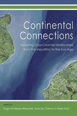
- Hugo Anderson-Whymark, Duncan Garrow, Fraser Sturt(Authors)
- 2015(Publication Date)
- Oxbow Books(Publisher)
2 From sea to land and back again: understanding the shifting character of Europe’s landscapes and seascapes over the last million years Fraser Sturt Introduction The palaeogeography of the north-west margin of Europe has changed markedly, and regularly, since humans first occupied the region around one million years ago (Parfitt et al . 2010; Cohen et al . 2014). Britain as we know it today has morphed from peninsula to island and back again in response to glacial cycles on at least five occasions over this period. Understanding the timing, nature and extent of these changes is fundamental to appreciating the context within which archaeologically attested activity occurred. That being said, it is argued here that rather than just providing an environmental backdrop to a well-known story, knowledge of the rate, pace and degree of change can provide a secure vantage point from which to reconsider a range of key questions concerning connectivity and social change throughout prehistory. With advances in computational approaches to landscape reconstruction and increasing knowledge of offshore geology (Cohen et al . 2012; 2014; Hijma et al . 2012) it is now possible to do more than just note the island or peninsula status of Britain. Through combination of bathymetric (elevation of the seafloor) and topographic data with outputs from glacial isotactic adjustment (GIA) models (which account for changes in the altitude of the earth’s crust due to differential loading and unloading by ice sheets, along with variation in the volume of water in the world’s oceans and seas) within geographical information systems (GIS), we can begin to consider land and seascape change at ever finer temporal and spatial resolutions for the late Pleistocene and Holocene. - eBook - PDF
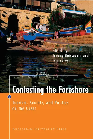
Contesting the Foreshore
Tourism, Society and Politics on the Coast
- Jeremy Boissevain, Tom Selwyn, Jeremy Boissevain, Tom Selwyn(Authors)
- 2004(Publication Date)
- Amsterdam University Press(Publisher)
1 Introduction Tom Selwyn and Jeremy Boissevain Aims and Approaches This volume of essays is concerned with questions of place and space on coasts and is rooted in the ethnographic study of coastal villages, towns, resorts and marine parks, together with the land, sea, and nat-ural resources that surround them. Although the larger part of the collection consists of work on the European coastline, the book is in-tended to have implications for geographical areas elsewhere in the world. The primary focus is upon coastal settlements and the con-texts under which these evolve. These contexts are routinely under-pinned by conflict between different interest groups contesting the ownership and control of the foreshore and its resources. We shall turn to the structural nature of this contestation at the conclusion of this Introduction. Each chapter examines particular sites framed by structures, pro-cesses and relations, each having dimensions which are at once eco-nomic, environmental, political, social, and symbolic. The aim of this Introduction is to identify and draw out these dimensions. In ap-proaching the ethnographic data in this way, our intention is to point to threads of argument binding the chapters together into a coherent whole. Tourism and its development play significant roles in many coastal economies and societies, and the essays in the book reflect this. However, as implied above, we are concerned not so much with tourism itself but with the complex sets of relations within which the organisation and development of tourism are located together with other aqua-cultural and coastal practices. 11 Structures, Processes and Relations Place and Imagination: Land and Landscape In saying that the essays in this collection are infused by a primary concern with place, it is worth emphasising the dual nature of this term. It mirrors the distinction between terms that are in some re-spects comparable, namely land and landscape.
Index pages curate the most relevant extracts from our library of academic textbooks. They’ve been created using an in-house natural language model (NLM), each adding context and meaning to key research topics.
