Geography
GIS
GIS, or Geographic Information System, is a technology that captures, stores, analyzes, and presents geographic data. It integrates various types of data, such as maps, satellite images, and demographic information, to provide a comprehensive view of a location or area. GIS is widely used in urban planning, environmental management, natural resource exploration, and many other fields.
Written by Perlego with AI-assistance
Related key terms
1 of 5
11 Key excerpts on "GIS"
 No longer available |Learn more
- (Author)
- 2014(Publication Date)
- University Publications(Publisher)
________________________ WORLD TECHNOLOGIES ________________________ Chapter- 7 Geographic Information System A geographic information system (GIS) , geographical information system , or geospatial information system is any system that captures, stores, analyzes, manages, and presents data that are linked to location(s). In the simplest terms, GIS is the merging of cartography, statistical analysis, and database technology. GIS may be used in archaeology, geography, cartography, remote sensing, land surveying, public utility management, natural resource management, precision agriculture, photogrammetry, urban planning, emergency management, navigation, aerial video, and localized search engines. As GIS can be thought of as a system, it digitally creates and manipulates spatial areas that may be jurisdictional, purpose or application oriented for which a specific GIS is developed. Hence, a GIS developed for an application, jurisdiction, enterprise, or purpose may not be necessarily interoperable or compatible with a GIS that has been developed for some other application, jurisdiction, enterprise, or purpose. What goes beyond a GIS is a spatial data infrastructure (SDI), a concept that has no such restrictive boundaries. Therefore, in a general sense, the term describes any information system that integrates, stores, edits, analyzes, shares, and displays geographic information for informing decision making. GIS applications are tools that allow users to create interactive queries (user-created searches), analyze spatial information, edit data, maps, and present the results of all these operations. Geographic information science is the science underlying the geographic concepts, applications and systems. GIS can be studied in degree and certificate programs at many universities. No longer available |Learn more
- (Author)
- 2014(Publication Date)
- Research World(Publisher)
________________________ WORLD TECHNOLOGIES ________________________ Chapter 5 Geographic Information System A geographic information system (GIS) , geographical information system , or geospatial information system is the system that captures, stores, analyzes, manages, and presents data with reference to geographic location data. In the simplest terms, GIS is the merging of cartography, statistical analysis, and database technology. GIS may be used in archaeology, geography, cartography, remote sensing, land surveying, public utility management, natural resource management, precision agriculture, photogram-metry, urban planning, emergency management, landscape architecture, navigation, aerial video, and localized search engines. As GIS can be thought of as a system, it digitally creates and manipulates spatial areas that may be jurisdictional, purpose or application oriented for which a specific GIS is developed. Hence, a GIS developed for an application, jurisdiction, enterprise, or purpose may not be necessarily interoperable or compatible with a GIS that has been developed for some other application, jurisdiction, enterprise, or purpose. What goes beyond a GIS is a spatial data infrastructure (SDI), a concept that has no such restrictive boundaries. Therefore, in a general sense, the term describes any information system that integrates, stores, edits, analyzes, shares, and displays geographic information for informing decision making. GIS applications are tools that allow users to create interactive queries (user-created searches), analyze spatial information, edit data, maps, and present the results of all these operations. Geographic information science is the science underlying the geographic concepts, applications and systems. No longer available |Learn more
- (Author)
- 2014(Publication Date)
- The English Press(Publisher)
________________________ WORLD TECHNOLOGIES ________________________ Chapter- 4 Geographic Information System A geographic information system (GIS) , geographical information system , or geospatial information system is any system that captures, stores, analyzes, manages and presents data that are linked to location(s). In the simplest terms, GIS is the merging of cartography, statistical analysis and database technology. GIS may be used in archaeology, geography, cartography, remote sensing, land surveying, public utility management, natural resource management, precision agriculture, photogrammetry, urban planning, emergency management, navigation, aerial video and localized search engines. As GIS can be thought of as a system, it digitally creates and manipulates spatial areas that may be jurisdictional, purpose or application oriented for which a specific GIS is developed. Hence, a GIS developed for an application, jurisdiction, enterprise, or purpose may not be necessarily interoperable or compatible with a GIS that has been developed for some other application, jurisdiction, enterprise, or purpose. What goes beyond a GIS is a spatial data infrastructure (SDI), a concept that has no such restrictive boundaries. Therefore, in a general sense, the term describes any information system that integrates, stores, edits, analyzes, shares and displays geographic information for informing decision making. GIS applications are tools that allow users to create interactive queries (user-created searches), analyze spatial information, edit data, maps and present the results of all these operations. Geographic information science is the science underlying the geographic concepts, applications and systems. GIS can be studied in degree and certificate programs at many universities. No longer available |Learn more
- (Author)
- 2014(Publication Date)
- Academic Studio(Publisher)
________________________ WORLD TECHNOLOGIES ________________________ Chapter- 5 Geographic Information System A geographic information system (GIS) , geographical information system , or geospatial information system is any system that captures, stores, analyzes, manages and presents data that are linked to location(s). In the simplest terms, GIS is the merging of cartography, statistical analysis and database technology. GIS may be used in archaeology, geography, cartography, remote sensing, land surveying, public utility management, natural resource management, precision agriculture, photogrammetry, urban planning, emergency management, navigation, aerial video and localized search engines. As GIS can be thought of as a system, it digitally creates and manipulates spatial areas that may be jurisdictional, purpose or application oriented for which a specific GIS is developed. Hence, a GIS developed for an application, jurisdiction, enterprise, or purpose may not be necessarily interoperable or compatible with a GIS that has been developed for some other application, jurisdiction, enterprise, or purpose. What goes beyond a GIS is a spatial data infrastructure (SDI), a concept that has no such restrictive boundaries. Therefore, in a general sense, the term describes any information system that integrates, stores, edits, analyzes, shares and displays geographic information for informing decision making. GIS applications are tools that allow users to create interactive queries (user-created searches), analyze spatial information, edit data, maps and present the results of all these operations. Geographic information science is the science underlying the geographic concepts, applications and systems. GIS can be studied in degree and certificate programs at many universities.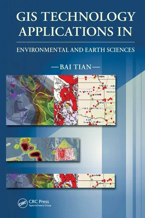
- Bai Tian(Author)
- 2016(Publication Date)
- CRC Press(Publisher)
1 General Overview of GIS What Is GIS? A Geographic Information System (GIS) is a computer system that helps users to collect, process, edit, store, manage, share, analyze, model, and visu- alize large volumes of datasets to understand spatial relationships, patterns, and trends, and make educated and sound decisions. The two key words in its name, “geographic” and “information,” make GIS a unique technology, different in many ways from other traditional cartographic mapping and data management systems and applications. “Geographic” (also known as geospatial or spatial) means that GIS mainly deals with spatial data features, which are in one way or another references to locations on the earth, such as sampling location points, utility lines, and land parcel polygons. By manipu- lating spatial data layers (also known as themes), GIS is capable of producing maps similar to other mapping systems, such as a computer-aided design and drafting (CADD) system. In addition to mapping capabilities, GIS incorporates tabular data (i.e., “information”) and links information to spatial data features (e.g., attaching analytical results to sampling locations) to enable data analysis, modeling, and visualization for better understanding of data and making decisions. For example, by analyzing the population/demographic information, traffc, existing business, and client data layers of an area with a GIS, a business owner or manager will be able to identify the best locations for businesses, such as shopping centers, restaurants, hotels, offces, warehouses, service facilities, and so on.
- William Sims Bainbridge, William S. Bainbridge(Authors)
- 2011(Publication Date)
- SAGE Publications, Inc(Publisher)
738 A geographic information system (GIS) can be defined as a computer application capable of per-forming virtually any conceivable operation on geographic information, from acquisition and compilation through visualization, query, and analysis to modeling, sharing, and archiving (Longley et al. 1999, 2010). In turn, geographic information is defined as information linking locations on or near the Earth’s surface to the properties, characteristics, and phenomena found at those locations. Today, one can find GIS applications in any area of sci-ence dealing with phenomena distributed over the Earth, from research on global climate change to the study of patterns of disease and crime or the distribution of plants and animals. GIS is used in a wide range of human activi-ties from simple wayfinding using global positioning sys-tems (GPS) (Kennedy 2009) to the management of utilities and natural resources, and some of its basic ideas, includ-ing the use of data derived from satellites, are now familiar to the general public. This is a vast arena, and current estimates are that the associated commercial activity now amounts to $20 billion per year, in sales of software and data and associated con-sulting. The term GIS will be used in this chapter in the broad sense implied by the definition earlier, but several other terms are also in active use. The adjective geospatial is a comparatively recent coinage and similarly broad, distinguishing the space of the Earth’s surface and near-surface from other spaces, such as that of the cosmos or the human brain. The field as a whole is sometimes termed geoinformatics or geomatics , and its systematic study, together with the fundamental issues it raises, are often termed geographic information science . Numerous questions have arisen as the field has evolved from very simple and unconnected beginnings in the 1960s. eBook - PDF
Spatial Decision Support Systems
Principles and Practices
- Ramanathan Sugumaran, John Degroote(Authors)
- 2010(Publication Date)
- CRC Press(Publisher)
In the 1980s, powerful workstation comput-ers were the common hardware systems for which GIS development was most commonly taking place. However, with cheaper and more powerful computing power and memory resources, GIS development for PCs took off in the 1990s. The development of graphical user interfaces in the 1990s led to immense growth in the use of GIS in the 1990s, with Environmental Systems Research Institute (ESRI)’s ArcView being an example of a desk-top-based GIS with user-friendly interfaces. The uptake and use of GIS technology has continued into the 2000s with networking and communi-cation technologies leading to mobile and Web-based GIS developments. The growth in other geospatial technologies, such as GPS and remote sensing, has been commensurate with that of GIS in the last few decades. Indeed, the combination of these and other computing, communication, and networking and communication technologies has led to an explosion of spatially explicit applications in recent years. 3.4.2 Definitions of GIS There is not a single agreed-upon definition of GIS. However, a review of several GIS textbooks shows some commonality in definitions of GIS: “A geographic information system (GIS) is a computer system for • capturing, storing, querying, analyzing, and displaying geospa-tial data” (Chang 2009, p. 1). Components of SDSS I: Geographic Information Systems 71 “[G]eographic information systems are systems designed to • input, store, edit, retrieve, analyze, and output geographic data and information” (DeMers 2009, p. 19). “A GIS is designed for the collection, storage, and analysis of • objects and phenomena where geographic location is an impor-tant characteristic or critical to the analysis” (Aronoff 1995, p. 1). “A computer-based system to aid in the collection, maintenance, • storage, analysis, output, and distribution of spatial data and information” (Bolstad 2005, p. 1).
- Sami Faiz, Saoussen Krichen(Authors)
- 2012(Publication Date)
- CRC Press(Publisher)
GIS is also able to provide information about the repartition of the political parties and propose eventual locations for the polling. To strengthen the analysis, GIS offers the possibility of displaying the above mentioned information in the map. • Water resources: Study of the network scaling to satisfy consumers’ demands. Geographical Information Systems: Basic Concepts 11 12 Geographical Information Systems and Spatial Optimization • Public lighting: Location of luminous points and electrical networks. • Waste management: Determination of the suitable number of containers, depots and optimal paths for waste collecting. • Environment: Flood areas, nuisance areas, propagation of aerial and aquatic pollution. • Security: Delimitation of fire bounds and simulation of natural disasters. • Urbanism: Land use and development plans. Regarding the above examples, GIS are viewed as efficient tools for recording, exploiting, analyzing and displaying geographical data. 1.3.4 Main components of a GIS A GIS is an automatic system that merges data from various sources. It collects, organizes, stores, manages, analyzes and visualizes information geographically localized to enrich the knowledge of the addressed space. As outlined in figure 1.4, a GIS contains three main components: 1. Data acquisition • Acquisition of large volumes of data in many different ways: digitalizing maps, scanning images, remote sensing, aerial photography, GPS, terrain and existing files. 2. Processing • Storage, handling, operation and spatial analysis. • Interrogation and treatment (command language, spatial query language, interactive manipulation with icons and menus). • Sets (intersection, inclusion, union). • Geometry (calculating distances, perimeters and areas). • Conversion (scale, projection, internal representation: vector to raster and vice versa). • Overlay of layers. • Networks as optimal path finding. eBook - PDF
- Jorge Rocha, Patrícia Abrantes, Jorge Rocha, Patrícia Abrantes(Authors)
- 2019(Publication Date)
- IntechOpen(Publisher)
This context is perceived as an added value for geog-raphy. In addition to reinforcing its importance as a science of innovation, it still benefits from a new dimension of space, which leads to virtual geography, support-ing the development of a geography with new contours, supported by the prolifera-tion of new digital technologies [14]. The contents that are part of the GISc are: • Data collection—all forms, from total stations, Global Navigation Satellite System (GNSS) receivers, satellites and drones, smartphones, devices of IoT and to the users themselves, who are also “walking sensors.” • Storage platforms and data management—here, we talk about anything that can store some kind of data or information, which can be in local servers, in the cloud, or in any other place. Geographic Information Systems and Science 6 Figure 1. Dimensions of geographic information science [16]. • Data modeling, algorithms, and processes—the different data formats—vector, raster, point clouds, tables, and so on—how are they modeled, converted, and used. • Data visualization—a few decades ago printed maps were the visualization standard but the emergence of computation led cartography to the screens. Today the geographic information is in the palm of our hand (e.g., smart-phones), but also in new platforms such as virtual and augmented reality glasses, 3D printers, etc. • Data analytics tools—not long ago, the power of layering or mapping the best route between multiple points was restricted to “semigods who inhabited the geoisland,” but today anyone has the power of GIS in two clicks away (neo-geography [15]). • Institutional aspects—this is the item that makes it clear that GISc is much more than geotechnology because institutional issues involve politics, conflict of interests, cultural differences, disputes over ownership of data, and many others. • Data sharing—finally, the ways of sharing information have changed a lot and will advance even more rapidly in the near future. eBook - ePub
Quantitative Geography
Perspectives on Spatial Data Analysis
- A Stewart Fotheringham, Chris Brunsdon, Martin Charlton(Authors)
- 2000(Publication Date)
- SAGE Publications Ltd(Publisher)
1 This is not an endorsement of Arc/Info as a GIS package, neither is it a critique of Arc/Info; it merely reflects the authors’ familiarity with this package, and its availability in many universities in the UK and the USA. However, many of the GIS operations to be described in this chapter are available in one form or another in other GIS systems; thus the comments that follow are intended to be general, rather than particular to one software system.The term ‘geographical information systems’ can be confusing. At one extreme, it is often used to describe a piece of software, such as Arc/Info, or SPANS. Such software is intended to be general purpose by providing a means of storing, querying, integrating, retrieving, displaying and modelling spatial data. They are characterized by a command language or menu system of some complexity and considerable skill is usually required to operate them. In one sense, such packages are the GIS analogue of statistical packages, such as SAS or SPSS, which are collections of statistical routines that can be applied to a wide variety of data. With GIS, as with statistical packages, it is up to the user to decide which are the appropriate operations for data management and analysis in any given situation. Merely because some technique is provided in a package, does not imply that it is of universal applicability. At the other extreme, GIS might be a specifically tailored, turnkey system for aiding such activities as traffic management, automated mapping or facilities management, as is often found within the offices of public agencies. A predetermined subset of operations (perhaps prepackaged behind a graphical user interface) will be available for operators. There will be a well-defined means of data entry and the operations will be highly specific to the task for which the software has been designed.What is the role of GIS in the quantitative analysis of spatial data? The latest thinking and ideas on GIS are contained within the academic literature in journals such as the International Journal of Geographic Information Science and Transactions in GIS eBook - PDF
- Sharma, Premjit(Authors)
- 2021(Publication Date)
- Genetech(Publisher)
4 Understanding GIS In the real world, the landscape is composed of soil (never enough), rocks (too many), water (often too little), plants (more often weeds) and a vicissitude of biological life. In the paper world, words, numbers and graphics are used to represent these things. A traditional map is a graphical representation that accounts for geographic space (where) as well as the characteristic and condition (what). A GIS takes the traditional map to new heights and may be described by its process, data, and analytical capabilities. The GIS process involves encoding, storage, processing and display of computerized (digital) maps. Processing functions include: — computer mapping; — spatial database management; and — spatial statistics, analysis and modeling. These functions are descriptive and interpretive as well as prescriptive in nature. Computer mapping is a descriptive process that rapidly creates and updates map products. It provides tools for automating the cartographic process, but does not alter the inherent nature of a traditional map. Spatial database management is used to combine and interpret sets of mapped data. It provides new procedures for geo-query of the data. For example, a database map can be searched for map compartments with certain requirements (i.e., low pH values in a certain soil type), then produce a map This ebook is exclusively for this university only. Cannot be resold/distributed. locating these areas. The spatial modeling capabilities extend the descriptive and interpretive uses of maps by deriving new information through the relationships among existing maps. For example, template maps can be “summarized” for typical characteristics (such as average slope for each mapping compartment), and the result can be added as a new column to the database. Part of the revolution in GIS simply involves digitizing (converting ink to numbers) familiar maps.
Index pages curate the most relevant extracts from our library of academic textbooks. They’ve been created using an in-house natural language model (NLM), each adding context and meaning to key research topics.