Geography
GPS
GPS, or Global Positioning System, is a satellite-based navigation system that provides location and time information anywhere on Earth. It consists of a network of satellites that transmit signals to GPS receivers, allowing users to determine their precise position. GPS is widely used in geography for mapping, surveying, and navigation purposes.
Written by Perlego with AI-assistance
Related key terms
1 of 5
11 Key excerpts on "GPS"
 No longer available |Learn more
- (Author)
- 2014(Publication Date)
- College Publishing House(Publisher)
____________________ WORLD TECHNOLOGIES ____________________ Chapter 7 Global Positioning System The Global Positioning System ( GPS ) is a space-based global navigation satellite system (GNSS) that provides reliable location and time information in all weather and at all times and anywhere on or near the Earth when and where there is an unobstructed line of sight to four or more GPS satellites. It is maintained by the United States government and is freely accessible by anyone with a GPS receiver. GPS was created and realized by the U.S. Department of Defense (USDOD) and was originally run with 24 satellites. It was established in 1973 to overcome the limitations of previous navigation systems. In addition to GPS other systems are in use or under development. The Russian GLObal NAvigation Satellite System (GLONASS) was for use by the Russian military only until 2007. There are also the planned Chinese Compass navigation system and Galileo positioning system of the European Union (EU). Automotive navigation system in a taxicab ____________________ WORLD TECHNOLOGIES ____________________ Artist's conception of GPS Block II-F satellite in orbit ____________________ WORLD TECHNOLOGIES ____________________ Civilian GPS receiver (GPS navigation device) in a marine application ____________________ WORLD TECHNOLOGIES ____________________ GPS receivers are now integrated in many mobile phones History ____________________ WORLD TECHNOLOGIES ____________________ The design of GPS is based partly on similar ground-based radio navigation systems, such as LORAN and the Decca Navigator developed in the early 1940s, and used during World War II. In 1956 Friedwardt Winterberg proposed a test of general relativity using accurate atomic clocks placed in orbit in artificial satellites. To achieve accuracy requirements, GPS uses principles of general relativity to correct the satellites' atomic clocks. eBook - PDF
Sinusoids
Theory and Technological Applications
- Prem K. Kythe(Author)
- 2014(Publication Date)
- Chapman and Hall/CRC(Publisher)
6 Global Positioning System The Global Positioning System (GPS) is a worldwide, satellite-based nav-igation system, funded by the U.S. Department of Defense (DoD). It was originally designed for military use, but later the system was made available for civilian use. We will provide some details about this technology. 6.1 GPS Structure There are 32 GPS satellites located above the Earth (originally 24), each send-ing out signals with the following information: the satellite i ( i =1 , 2 ,..., 32), location of the GPS receiver r , and the time t the information was sent. Each satellite sends out not only its location but also orbital data about the loca-tions of other satellites in the form of ephemeris and almanac data that are stored by the GPS receiver for later calculations. To determine its own loca-tion r on Earth, the receiver computes the time between the signal sent by the satellite i and the time it was received. From this time difference the distance between the receiver and the satellite is calculated using the speed of light c . By taking data from other satellites the current location of the receiver can be computed by trilateration, which requires at least four satellites to deter-mine the location r . The method using three satellites is called a dilateration (2D-position fix) which is a two-dimensional location determination because the receiver is assumed to be located on Earth’s surface regarded as a plane. However, using four or more satellites, the location of the receiver in a three-dimensional space can be absolutely fixed with the three spatial coordinates ( trilateration ). The GPS receiver uses the messages so received to determine the transit time of each message and computes the distance to each satellite using the speed of light. Each of these distances and satellite locations define a sphere. No longer available |Learn more
- (Author)
- 2014(Publication Date)
- Orange Apple(Publisher)
________________________ WORLD TECHNOLOGIES ________________________ Chapter- 2 Global Positioning System The Global Positioning System ( GPS ) is a space-based global navigation satellite system (GNSS) that provides reliable location and time information in all weather and at all times and anywhere on or near the Earth when and where there is an unobstructed line of sight to four or more GPS satellites. It is maintained by the United States government and is freely accessible by anyone with a GPS receiver. GPS was created and realized by the U.S. Department of Defense (USDOD) and was originally run with 24 satellites. It was established in 1973 to overcome the limitations of previous navigation systems. In addition to GPS other systems are in use or under development. The Russian GLObal NAvigation Satellite System (GLONASS) was for use by the Russian military only until 2007. There are also the planned Chinese Compass navigation system and Galileo positioning system of the European Union (EU). Automotive navigation system in a taxicab ________________________ WORLD TECHNOLOGIES ________________________ Artist's conception of GPS Block II-F satellite in orbit ________________________ WORLD TECHNOLOGIES ________________________ Civilian GPS receiver (GPS navigation device) in a marine application ________________________ WORLD TECHNOLOGIES ________________________ GPS receivers are now integrated in many mobile phones. History ________________________ WORLD TECHNOLOGIES ________________________ The design of GPS is based partly on similar ground-based radio navigation systems, such as LORAN and the Decca Navigator developed in the early 1940s, and used during World War II. In 1956 Friedwardt Winterberg proposed a test of general relativity using accurate atomic clocks placed in orbit in artificial satellites. To achieve accuracy requirements, GPS uses principles of general relativity to correct the satellites' atomic clocks. eBook - PDF
- Jack C. McCormac, Wayne A. Sarasua, William J. Davis(Authors)
- 2012(Publication Date)
- Wiley(Publisher)
Chapter 15 The Global Positioning System (GPS) 15.1 INTRODUCTION Humankind has looked for an accurate system for locating points on the earth’s surface since almost the beginning of recorded history. Such a system is now available—it is the global positioning system (GPS). This system may turn out to be the greatest surveying tool ever developed. GPS points can be quickly and accurately located on earth by measuring distances to artificial satellites. You may be quite surprised to learn that locations of points on the earth and the distances between those points, whether short or long, can be determined as accurately or more accurately by measuring distances to satellites located thousands of miles out in space rather than by using conventional techniques right on the earth where the points are located. In 1978 the Department of Defense (DOD) began to launch satellites into space with the goal of being able to quickly and accurately locate positions on the earth. This system was kept secret for five years. In 1983, a Soviet military aircraft shot down a Korean civilian airliner that strayed into Soviet airspace due to navigational errors. All 269 passengers and crew on board were killed. Soon after, President Ronald Reagan announced that GPS would be made available for civilian uses once it was completed. By 1985, the 10 initial “Block 1” experimental satellites had been launched and validated the capability of the system. In January 1994, a constellation of 24 Block 1 and the more modern Block 2 satellites provided complete coverage of the earth. As the estimated life of each satellite is approximately seven years it is necessary to periodically launch replacements. Newer satellites have added significant navigational improvements to the system. The gravitational pull of the mass of the earth keeps the satellites in orbit. Each satellite tries to fly by the earth in a straight line at about 8,650 mph but the gravitational force of the earth pulls it down. eBook - PDF
- Michael Kennedy(Author)
- 2009(Publication Date)
- CRC Press(Publisher)
Allowing any person or piece of equipment to know the exact time has tremendous implications for things we depend on every day (like getting information across the Internet, like synchronizing the electric power grid and the telephone network). If we were naming the system today, knowing what we know now, we would probably call it GPTS: the Global Positioning and Timing System. An added benefit is that knowing time so precisely allows human knowledge to be enhanced by research projects that depend on know-ing the exact time in different parts of the world. For example, it is now possible to track seismic waves created by earthquakes, from one side of the Earth, through its center, to the other side, because the exact time* may be known worldwide.† GPS AND GIS The subject of this book is the use of GPS as a method of collecting locational data for Geographic Information Systems (GIS). We will concentrate on using ArcGIS from ESRI in Redlands, California.‡ The appropriateness of this seems obvious, but let’s explore some of the main reasons for making GPS a primary source of data for GIS: Availability: In 1995, the U.S. Department of Defense (DoD) declared • NAVSTAR to have “final operational capability.” Deciphered, this means that the DoD has committed itself to maintaining NAVSTAR’s capability for civilians at a level specified by law, for the foreseeable future, at least in times of peace. Therefore, those with GPS receivers may locate their posi-tions anywhere on the Earth. Accuracy: GPS allows the user to know position information with remark-• able accuracy. A receiver operating by itself can let you locate yourself within 5 to 10 meters of the true position. (And later you will learn how to get accuracies of 2 to 5 meters.) At least two factors promote such accuracy: * Well, right, there is no such thing as “exact” time. No longer available |Learn more
- (Author)
- 2014(Publication Date)
- Academic Studio(Publisher)
____________________ WORLD TECHNOLOGIES ____________________ Chapter 2 Global Positioning System Artist's conception of GPS Block II-F satellite in orbit ____________________ WORLD TECHNOLOGIES ____________________ Civilian GPS receiver (GPS navigation device) in a marine application. ____________________ WORLD TECHNOLOGIES ____________________ Automotive navigation system in a taxicab. ____________________ WORLD TECHNOLOGIES ____________________ GPS receivers are now integrated in many mobile phones. The Global Positioning System ( GPS ) is a space-based global navigation satellite system (GNSS) that provides reliable location and time information in all weather and at all times and anywhere on or near the Earth when and where there is an unobstructed line of sight to four or more GPS satellites. It is maintained by the United States government and is freely accessible by anyone with a GPS receiver. The GPS project was started in 1973 to overcome the limitations of previous navigation systems, integrating ideas from several predecessors, including a number of classified engineering design studies from the 1960s. GPS was created and realized by the U.S. Department of Defense (USDOD) and was originally run with 24 satellites. It became fully operational in 1994. In addition to GPS, other systems are in use or under development. The Russian GLObal NAvigation Satellite System (GLONASS) was in use by the Russian military only until it was made fully available to civilians in 2007. There are also the planned Chinese Compass navigation system and the European Union's Galileo positioning system. ____________________ WORLD TECHNOLOGIES ____________________ History The design of GPS is based partly on similar ground-based radio navigation systems, such as LORAN and the Decca Navigator developed in the early 1940s, and used during World War II. No longer available |Learn more
- (Author)
- 2014(Publication Date)
- Research World(Publisher)
________________________ WORLD TECHNOLOGIES ________________________ Chapter 2 Global Positioning System Artist's conception of GPS Block II-F satellite in orbit ________________________ WORLD TECHNOLOGIES ________________________ Civilian GPS receiver (GPS navigation device) in a marine application. ________________________ WORLD TECHNOLOGIES ________________________ Automotive navigation system in a taxicab. ________________________ WORLD TECHNOLOGIES ________________________ GPS receivers are now integrated in many mobile phones. The Global Positioning System ( GPS ) is a space-based global navigation satellite system (GNSS) that provides reliable location and time information in all weather and at all times and anywhere on or near the Earth when and where there is an unobstructed line of sight to four or more GPS satellites. It is maintained by the United States government and is freely accessible by anyone with a GPS receiver. The GPS project was started in 1973 to overcome the limitations of previous navigation systems, integrating ideas from several predecessors, including a number of classified engineering design studies from the 1960s. GPS was created and realized by the U.S. Department of Defense (USDOD) and was originally run with 24 satellites. It became fully operational in 1994. In addition to GPS, other systems are in use or under development. The Russian GLObal NAvigation Satellite System (GLONASS) was in use by the Russian military only until it was made fully available to civilians in 2007. There are also the planned Chinese Compass navigation system and the European Union's Galileo positioning system. ________________________ WORLD TECHNOLOGIES ________________________ History The design of GPS is based partly on similar ground-based radio navigation systems, such as LORAN and the Decca Navigator developed in the early 1940s, and used during World War II.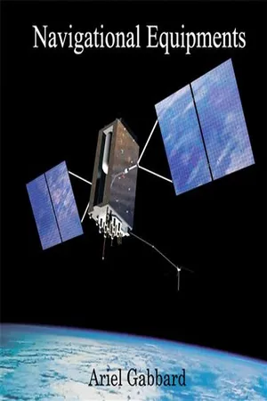 No longer available |Learn more
- (Author)
- 2014(Publication Date)
- White Word Publications(Publisher)
________________________ WORLD TECHNOLOGIES ________________________ Chapter 7 Global Positioning System Artist's conception of GPS Block II-F satellite in orbit ________________________ WORLD TECHNOLOGIES ________________________ Civilian GPS receiver (GPS navigation device) in a marine application. ________________________ WORLD TECHNOLOGIES ________________________ Automotive navigation system in a taxicab. ________________________ WORLD TECHNOLOGIES ________________________ GPS receivers are now integrated in many mobile phones. The Global Positioning System ( GPS ) is a space-based global navigation satellite system (GNSS) that provides reliable location and time information in all weather and at all times and anywhere on or near the Earth when and where there is an unobstructed line of sight to four or more GPS satellites. It is maintained by the United States government and is freely accessible by anyone with a GPS receiver. The GPS project was developed in 1973 to overcome the limitations of previous navigation systems, integrating ideas from several predecessors, including a number of classified engineering design studies from the 1960s. GPS was created and realized by the U.S. Department of Defense (USDOD) and was originally run with 24 satellites. It became fully operational in 1994. In addition to GPS, other systems are in use or under development. The Russian GLObal NAvigation Satellite System (GLONASS) was in use by the Russian military only until it was made fully available to civilians in 2007. There are also the planned Chinese Compass navigation system and the European Union's Galileo positioning system. ________________________ WORLD TECHNOLOGIES ________________________ History The design of GPS is based partly on similar ground-based radio navigation systems, such as LORAN and the Decca Navigator developed in the early 1940s, and used during World War II. eBook - PDF
- Barry Allred, Jeffrey J. Daniels, Mohammad Reza Ehsani, Barry Allred, Jeffrey J. Daniels, Mohammad Reza Ehsani(Authors)
- 2008(Publication Date)
- CRC Press(Publisher)
This can be provided by GPS which, depending on the accuracy required, can be used in one of the positioning modes discussed in this chapter. GPS can, in general, provide 3D geolocation of the sensing device as well as a precise timing stamp (1 pps signal), if timing information is required. One way of defining or classifying geospatial applications that are relevant in the context of this book is to adopt some accuracy requirements, such as follows (Rizos, 2002b): Scientific Surveys (category A): better than 1 ppm • Precise engineering deformation analysis, geodynamics applications • Geodetic Surveying (category B): 1 to 10 ppm • Geodetic surveys for establishing, maintenance, and densification of geodetic control • General Surveying (category C): lower than 10 ppm • Engineering and cadastral applications • Geophysical mapping, and so forth • Mapping/Geolocation (category D): better than 2 m • General-purpose geolocation tasks primarily for GIS data capture, some geophysical • mapping Regardless of the accuracy requirement and GPS technique used, each GPS mapping project consists of five basic steps: Mission Planning • : All the initial preparations that take place before GPS and geophysical sensor data are collected Data Collection • : Collecting GPS and geophysical sensor data in the field Manipulation • : All the processing of GPS data that occurs between the collection period and data analysis, such as the downloading, export, quality control, and processing of GPS data Analysis • : Using GPS data as spatially referenced information in a research problem: here— geolocation of geophysical quantities mapped Application • : Applying the results of the analysis phase in the real world Stanoikovich and Rizos (2002) and Stewart and Rizos (2002) provide excellent reviews of the GPS survey planning process and carrying out of a mapping task. eBook - PDF
Mathematics That Power Our World, The: How Is It Made?
How Is It Made?
- Joseph Khoury, Gilles Lamothe(Authors)
- 2016(Publication Date)
- World Scientific(Publisher)
Chapter 4 Global Positioning System (GPS) 4.1 Introduction Recently, after a family trip, a friend of mine decided to go back to use his old paper map in his travels and to put his car GPS to rest forever. This came after a series of deceptions by this little device with the annoying automated voice, the 4 00 screen and the frequently interrupted signal (his words not mine). The latest of these deceptions was a trip from Ottawa to Niagara Falls which took a turn in the US. Admittedly, such a turn is normal especially if the GPS is programmed to take the shortest distance, except that my friend’s family did not have passports on them that day. If you have used a GPS before, you must have experienced some set-backs here and there. But let us face it, the times when the trip goes smoothly without any wrong turns or lost signal, we cannot help but ad-mire the magic and ingenuity that transforms a little device into a holding hand that takes you from point A to point B , sometimes thousands of kilo-meters apart. It is almost “spooky” to think that someone is watching you every step of the way from somewhere “out of this Earth”. In this chapter, you will learn that there is nothing magical about the GPS. It is the result of collective efforts of scientists and engineers with Mathematics as the main link. After reading this chapter, use your time on the road in your next trip to try to reveal to your co-travelers (with as little mathematics as possible) the secret behind this technology. It works every time I want to put my kids to sleep on a long trip. 95 96 The mathematics that power our world 4.1.1 Before you go further Although the chapter is intended to be self-contained as much as possi-ble, it is the heaviest in mathematical content compared to other chapters. The structure of the GPS signals involves the use of abstract mathemat-ical concepts, chiefly from abstract algebra like group theory, finite fields, polynomial rings and primitive elements. eBook - PDF
Satellite Geodesy
Foundations, Methods, and Applications
- Günter Seeber(Author)
- 2008(Publication Date)
- De Gruyter(Publisher)
The inclusion of information on congestion, snowfall, or roadwork, for instance, will improve the service. Additional features are automatic location transmission in case of emergency, or theft. 372 7 The Global Positioning System (GPS) Fleet management is essential for shipping agencies, train and bus systems, police and emergency services, and fire brigades. In connection with a traffic management system, traffic light priority can be given to public transportation and emergency ve-hicles. At large construction sites a logistic system can be installed to organize and guide the construction vehicle traffic. Each vehicle gets a certain time slot when entering the site, and a GPS based local navigation equipment is deployed in each car as long as it operates inside the construction area. A particular application is the mobility of blind people. A precise DGPS system and a precise and detailed specific digital map, connected to a voice generator enables a user to navigate in an unknown environment aided perhaps only by a stick. A large potential market is developing for location based services. Tourists can request information on nearby touristic highlights, restaurants and public transporta-tion. Parents can supervise their children, and persons with a critical health status can be remotely monitored by a medical center. A particular application will be the automatic location of a mobile phone in con-nection with the emergency calls E-911 in the U.S., or E-112 in Europe. A further step will be a combination of outdoor and indoor navigation within a single hybrid location device. 7.6.2.6 Engineering and Monitoring Almost unlimited possible uses and applications may be conceived in this field. The corresponding observation and evaluation methods are as discussed in the previous sections. Since the distances are usually small it is possible to achieve mm accuracy with routine methods.
Index pages curate the most relevant extracts from our library of academic textbooks. They’ve been created using an in-house natural language model (NLM), each adding context and meaning to key research topics.