Mathematics
Coordinate Systems
Coordinate systems are mathematical frameworks used to locate points in space. They consist of axes, typically labeled x, y, and z, and a point's position is defined by its distances from these axes. Common coordinate systems include the Cartesian coordinate system, polar coordinate system, and spherical coordinate system. These systems are essential for representing and analyzing geometric shapes and physical phenomena.
Written by Perlego with AI-assistance
Related key terms
1 of 5
12 Key excerpts on "Coordinate Systems"
 eBook - PDF
- Narayan Panigrahi(Author)
- 2014(Publication Date)
- CRC Press(Publisher)
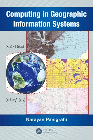
They give spatial ordering to spatial objects for searching, sorting, visualizing and understand-ing the spatial relationship of an object with its surroundings. The spatial ordering of spatial objects helps to understand and create a mental picture of the terrain. There are many well known Coordinate Systems being used for representation of spatial data. Each of these Coordinate Systems has some mathematical properties which make it suitable for representing spatial data associated with a particular domain. This section describes the key features of different Coordinate Systems. The concept of datum or geo-datic datum to mathematically model the shape of the Earth is important before applying a coordinate system. The concept of datum with specific emphasis on WGS-84 (World Geodatic Datum 1984) which is a terrestrial reference frame univer-sally accepted by many agencies worldwide is discussed. There are many Coordinate Systems prevailing and under use in GIS. Some prominent coordinate system used in GIS are listed below. Each one of these Coordinate Systems has its strengths and weaknesses and was developed with different constraints keeping in mind the specific application. Therefore the application specific Coordinate Systems are: 1. Rectangular Cartesian coordinate system 2. Geographic coordinate system Reference Systems and Coordinate Transformations 39 3. Spherical coordinate system 4. Cylindrical coordinate system 5. Polar and log-polar coordinate system 6. Earth centered Earth fixed (ECEF) coordinate system 7. Inertial terrestrial reference frame (ITRF) 8. Concept of grid, UTM, Mercator’s grid and military GRID 9. Celestial coordinate system 3.5.1 The Rectangular Coordinate System Cartesian coordinates then are rectangular, or orthogonal if one prefers, de-fined by perpendicular axes from an origin, along a reference surface. These elements can define a datum, or framework, for meaningful coordinates. eBook - PDF
- D.H. Maling(Author)
- 2013(Publication Date)
- Pergamon(Publisher)
C H A P T E R 2 Coordinate reference systems on the plane It is impossible not to feel stirred at the thought of the emotions of men at certain historic moments of adventure and discovery-Columbus when he first saw the Western shore, Pizarro when he stared at the Pacific Ocean, Franklin when the electric spark came from the string of his kite, Galileo when he first turned his telescope to the heavens. Such moments are also granted to students in the abstract region of thought, and high among them must be placed the morning when Descartes lay in bed and invented the method of co-ordinate geometry. A. N. Whitehead Introduction In this chapter we review some of the fundamental ideas about the plane Coordinate Systems which are used in surveying and mapping, both from the viewpoint of studying the mathematics of map projections and the practical tasks which arise in cartography. Coordinates are a convenient method of recording position in space. They may be used to locate position in two dimensions, such as a point on a graph. An extension of this method to map use allows the location of a place by its grid reference. Definition of coordinate position on the surface of a three-dimensional body such as a sphere or spheroid is rather more difficult. However, the reader should already be aware of the method of describing location by means of latitude and longitude, which are geographical coordinates. These are defined in Chapters 3 and 4, where the differences between defining latitude on a sphere and on a spheroid are introduced. In addition to providing a means of reference, coordinates can also be used as a convenient way of solving certain geometrical problems. The branch of mathematics known as coordinate geometry analyses problems through the relationship between points as defined by their coordinates. By these means, for example, it is possible to derive algebraic expressions defining different kinds of curve which cannot be done by Euclidean geometry. eBook - PDF
The Shape of Algebra in the Mirrors of Mathematics
A Visual, Computer-Aided Exploration of Elementary Algebra and Beyond (With CD-ROM)
- Gabriel Katz, Vladimir Nodelman;;;(Authors)
- 2011(Publication Date)
- WSPC(Publisher)
The idea of coordinates goes back to René Descartes (1596-1650), the great French mathematician and philosopher. By now, his idea is so common that it is difficult to appreciate its truly revolutionary nature. By drawing a grid on a blank page (by converting it into a sheet of math paper) we attach a pair of real numbers ( x A , y A ) to every point A of the page. Moreover, any A can be uniquely located if you know its coordinates! This profound observation of Descartes is a crucial bridge between geometry and algebra. In this chapter, we will present some basic examples of two-dimensional modular spaces, and will discuss alternative models for a variety of mathematical objects, objects that can be characterized by two parameters. Maps, Models and the Coordinate Plane 3 The pair of numbers may be the length and the height of a rectangle, the size of the two axes of an ellipse, the x - and y -intercepts of a line in a Cartesian plane, or any other ordered pair of numerical characteristics of some mathematical object. Then the corresponding point in the plane is no longer just a point, but a model for a rectangle, an ellipse, a line. We explore the conceptual benefits of such nonstandard interpretations. The most important of them is the focus on families of like-objects rather than on individual objects. In this context, such objects can be organized into a mathematical universe, the structure of the universe reflecting the common properties of the objects. This fundamental shift of investigation focus from a prototypical object to a universe of like objects, a modular space, is a characteristic of modern science. Deep mathematical insights can emerge from investigating the linkage between different two-dimensional representations of the same mathematical universe. The linkage can be expressed as a map from one modular space to the other. eBook - PDF
- Thomas Luhmann, Stuart Robson, Stephen Kyle, Jan Boehm(Authors)
- 2019(Publication Date)
- De Gruyter(Publisher)
x' y' x' y' Fig. 2.3: Image coordinate system in negative (left) and positive image (right). 2.1 Coordinate Systems 35 2.1.4 Object coordinate system The term object coordinate system , also known as the world coordinate system, is here used for every spatial Cartesian coordinate system XYZ that is defined by reference points of the object. For example, national geodetic Coordinate Systems (X = easting, Y = northing, Z = altitude, origin at the equator) are defined by geodetically measured reference points. 1 Another example is the local object or workpiece coordinate system of a car body that is defined by the constructional axes (X = longitudinal car axis, Y = front axle, Z = height, origin at centre of front axle) or a building with design axes in one corner (Fig. 2.5). A special case of three-dimensional coordinate system is an arbitrarily oriented one used by a 3D measuring system such as a camera or a scanner. This is not x y z = z' by bz O' O x y x' y' z bx Fig. 2.4: Model coordinate system. X Y Z X Y Z Fig. 2.5: Object Coordinate Systems. 1 National systems of geodetic coordinates which use the geoid as a reference surface are equiva-lent to a Cartesian coordinate system only over small areas. 36 2 Mathematical fundamentals directly related to any superior system or particular object but if, for instance, just one reference scale is given (Fig. 2.6), then it is still possible to measure spatial object coordinates. The definition of origin, axes and scale of a coordinate system is also known as the datum . 2.2 Coordinate transformations 2.2.1 Plane transformations 2.2.1.1 Homogeneous coordinates Homogeneous coordinates can be derived from Cartesian coordinates by adding one dimension and scaling by an arbitrary factor λ . In two dimensions this leads to: x = x y 1 2 6 4 3 7 5 = λ u v w 2 6 4 3 7 5 where x = u = w , y = v = w , λ ≠ 0 (2 : 3) Three-dimensional Cartesian coordinates are converted to homogeneous coordinates in an analogous way.
- Henning F Harmuth(Author)
- 1993(Publication Date)
- World Scientific(Publisher)
The usual coordinate system used in connection with differential calculus as-sumes nondenumerably many points for each coordinate axis. Essentially all our concepts of space are based on the mathematical abstraction of non-denumerably many points and the continuum. The use of a finite number of discrete points leads to very different results. A second reason is that space is not a physically observable thing like the rods and the spheres of Fig.3.1-14. Hence, its features are not derived from experience and observation but from definitions that came from ab-stract mathematics. For instance, it is often claimed that the space of our 50 3 Coordinate Systems 3 . 1 Coordinate Systems BASED ON RINGS FlG.3.1-14. Photograph of a model of the coordinate system of Fig.3.1-13. The spheres for z = 0 have one black ribbon, those for z = 2 have two, while those for 2 = 1 have none. FlG.3.1-15. Three axes x, y, z with angles 7r/2 between them are often used to claim that our space is three-dimensional. everyday experience has three dimensions since we can visuahze only three vectors perpendicular to each other; a typical illustration for this claim is shown by Fig.3.1-15. Although this illustration looks very persuasive, it is readily disproved by Fig.3.1-16. This illustration shows four vectors or axes x, y, 2, w. The right angle between x and z is measured in the plane XOZ, the right angle between y and w in the plane WOY. The right angles be-tween x and y, y and 2, z and w, as well as between w and x are measured on 51 52 3 Coordinate Systems FIG.3.1-16. Four axes x, y, z, w with angles 7r/2 between them. Some of the angles are measured on a conical surface rather than on an Euclidean plane. conical surfaces whose apexes coincide with the origin O of the axes x, y, z, w. eBook - PDF
- Daniel C. Alexander, Geralyn M. Koeberlein(Authors)
- 2019(Publication Date)
- Cengage Learning EMEA(Publisher)
(See Appendices A.2 and A.3 for further information.) In much of this chapter, we deal with equations containing two variables; to relate such alge- braic statements to plane geometry, we will need two number lines. The study of the relationships between number pairs and points is known as analytic geometry. The Cartesian coordinate system or rectangular coordinate system is the plane that results when two number lines intersect perpendicularly at the origin (the point corresponding to the number 0 of each line). This two-dimensional coordinate plane is often called the Cartesian plane, named in honor of René Descartes (see Perspective on History for Chapter 9). The horizontal number line is known as the x-axis, and its numer- ical coordinates increase from left to right. On the vertical number line, the y-axis, values increase from bottom to top; see Figure 10.1. The scale (unit size) is generally the same for the x-axis and the y-axis. The two axes separate the plane into four quadrants, which are numbered counterclockwise I, II, III, and IV, as shown. The point that marks the com- mon origin of the two number lines is the origin of the rectangular coordinate system. It is convenient to identify the origin as (0, 0); this notation indicates that the x-coordinate (listed first) is 0 and also that the y-coordinate (listed second) is 0. In the coordinate system, each point has the order (x, y) and is called an ordered pair. In Figure 10.2, the point (3, 22), for which x 5 3 and y 5 22, is shown. The point (3, 22) is located by moving 3 units to the right of the origin and then 2 units down from the x-axis. The dashed lines shown emphasize the reason why the grid is often called the rectangular coordinate system. The point (3, 22) is located in Quadrant IV. In Figure 10.2, ordered pairs of positive and negative signs characterize the signs of the coordinates of a point located in each quadrant. eBook - PDF
Fundamental Maths
For Engineering and Science
- Mark Breach(Author)
- 2017(Publication Date)
- Red Globe Press(Publisher)
20 Coordinate Systems What this chapter is about In this chapter you will investigate spatial relationships in a two-dimensional plane. By the end of this chapter you will be able to calculate distance and orientation in a two-dimensional plane, the areas of straight-sided figures, find the intersection of lines, and calculate parameters and formulae of circles. You will be able to change from Cartesian to polar coordinates and vice versa and to apply Pythagoras’ theorem in three dimensions. 20-01 Cartesian coordinate system applications The Cartesian coordinate system was introduced in Chapter 6 and it is now appropriate to look at some of its implications. The first is that not everyone uses it in the same way as mathematicians. In the Cartesian coordinate system the primary reference direction is the x -axis and orientation is measured anticlockwise from it. Geographers, and particularly land and engineering surveyors, use a system in which the primary direction is north and orientation, such as a compass bearing, is measured clockwise from it. Although the fundamental mathematical relationships are not affected by this difference, their applications may be. 20-02 Distance and orientation between two points Two points in a coordinate frame may be joined by a straight line. The length of that line will be the distance between the two points. The orientation of the line is measured with 209 Figure 20.1 north east α P ( E P , N P ) x -axis y -axis α P ( x P , y P ) respect to the x -direction within the Cartesian coordinate system and with respect to the north direction in the geographical frame. An application of Pythagoras’ theorem can be used to find the length of the line, and the tangent of its orientation relates the sides of the right angled triangles in Figure 20.2. eBook - ePub
- Fletcher Dunn, Ian Parberry(Authors)
- 2011(Publication Date)
- A K Peters/CRC Press(Publisher)
Chapter 1Cartesian Coordinate Systems
Before turning to those moral and mental aspects of the matter which present the greatest difficulties, let the inquirer begin by mastering more elementary problems.— Sherlock Holmes from A Study in Scarlett (1887)3D math is all about measuring locations, distances, and angles precisely and mathematically in 3D space. The most frequently used framework to perform such calculations using a computer is called the Cartesian coordinate system . Cartesian mathematics was invented by (and is named after) a brilliant French philosopher, physicist, physiologist, and mathematician named René Descartes, who lived from 1596 to 1650. René Descartes is famous not just for inventing Cartesian mathematics, which at the time was a stunning unification of algebra and geometry. He is also well-known for making a pretty good stab of answering the question “How do I know something is true?”—a question that has kept generations of philosophers happily employed and does not necessarily involve dead sheep (which will perhaps disturbingly be a central feature of the next section), unless you really want it to. Descartes rejected the answers proposed by the Ancient Greeks, which are ethos (roughly, “because I told you so”), pathos (“because it would be nice”), and logos (“because it makes sense”), and set about figuring it out for himself with a pencil and paper.This chapter is divided into four main sections.- Section 1.1 reviews some basic principles of number systems and the first law of computer graphics.
- Section 1.2 introduces 2D Cartesian mathematics, the mathematics of flat surfaces. It shows how to describe a 2D cartesian coordinate space and how to locate points using that space.
- Section 1.3
 eBook - PDF
- Thomas Luhmann, Stuart Robson, Stephen Kyle, Jan Boehm(Authors)
- 2013(Publication Date)
- De Gruyter(Publisher)
2 Mathematical fundamentals This chapter presents mathematical fundamentals which are essential for a deeper understanding of close-range photogrammetry. After defining some common Coordinate Systems, the most important plane and spatial coordinate transformations are summarised. An introduction to homogeneous coordinates and graphical projections then follows and the chapter concludes with the basic theory of least-squares adjustment. 2.1 Coordinate Systems 2.1.1 Image and camera Coordinate Systems The image coordinate system defines a two-dimensional, image-based reference system of right-handed rectangular Cartesian coordinates, x'y'. In a film camera its physical relationship to the camera is defined by reference points, either fiducial marks or a réseau , which are projected into the acquired image (see section 3.3.2.1). For a digital imaging system, the sensor matrix normally defines the image coordinate system (see section 2.1.2). Usually the origin of the image or frame coordinates is located at the image centre. y' x' P' M' O' +c -c x' y' x' P' P' z' P B 1 : negative B 2 : positive Fig. 2.1: Image and camera coordinate system The relationship between the plane image and the camera, regarded as a spatial object, can be established when the image coordinate system is extended by the z' axis normal to the image plane, preserving a right-handed system (see Fig. 2.1). This 3D coordinate system will be called the camera coordinate system and its origin is located at the perspective centre O'. This axis coincides approximately with the optical axis. The origin of this 3D camera coordinate system is located at the perspective centre O'. The image position B 1 corresponds to a location in the physically acquired image, which is the image negative. For a number of mathematical calculations it is easier to use the corresponding image position B 2 , in the equivalent positive image (see Fig. 2.1) .
- David Bartlett(Author)
- 2013(Publication Date)
- Cambridge University Press(Publisher)
2 Coordinate Systems The two most common Coordinate Systems used for positioning and navigation are: 1. Latitude, longitude and height above mean sea level; 2. Cartesian systems in which (x,y,z) axes are arranged orthogonally to one another. However, in our day-to-day lives, most position and location information is described contextually: I’m at work; I’m sitting at my desk; I’m in the car; I’m travelling south on the M1; I’m sitting next to Jim; etc. This sort of contextual information is what most applications would ideally like to have available to them, but for the purposes of computing a position or location, most locating systems work in Cartesian space (including GPS), although the resulting position may be presented as latitude, longitude and height. 2.1 Latitude and longitude 2.1.1 A simple definition Latitude and Longitude are two angles used to describe a terrestrial location on the surface of the Earth. See Figure 2.1. Latitude is measured north and south from the equator, which is an imaginary line running around the circumference of the Earth so that 90 degrees north is the north pole and 90 degrees south is the south pole. Lines of latitude run east–west linking points having the same angular measurement from the zero degree parallel, the equator. Longitude is measured east and west from the prime meridian, some- times called the Greenwich meridian because it was defined to run through the Royal Observatory, Greenwich, in the United Kingdom. 13 2 Coordinate Systems The two most common Coordinate Systems used for positioning and navigation are: 1. Latitude, longitude and height above mean sea level; 2. Cartesian systems in which (x,y,z) axes are arranged orthogonally to one another. However, in our day-to-day lives, most position and location information is described contextually: I’m at work; I’m sitting at my desk; I’m in the car; I’m travelling south on the M1; I’m sitting next to Jim; etc. No longer available |Learn more
- (Author)
- 2014(Publication Date)
- Learning Press(Publisher)
They are most appropriate in any context where the phenomenon being considered is inherently tied to direction and length from a center point. For instance, the examples above show how elementary polar equations suffice to define curves—such as the Archimedean spiral—whose equation in the Cartesian coordinate system would be much more intricate. Moreover, many physical systems—such as those concerned with bodies moving around a central point or with phenomena originating from a central point—are simpler and more intuitive to model using polar coordinates. The initial motivation for the introduction of the polar system was the study of circular and orbital motion. Position and navigation Polar coordinates are used often in navigation, as the destination or direction of travel can be given as an angle and distance from the object being considered. For instance, aircraft ________________________ WORLD TECHNOLOGIES ________________________ use a slightly modified version of the polar coordinates for navigation. In this system, the one generally used for any sort of navigation, the 0° ray is generally called heading 360, and the angles continue in a clockwise direction, rather than counterclockwise, as in the mathematical system. Heading 360 corresponds to magnetic north, while headings 90, 180, and 270 correspond to magnetic east, south, and west, respectively. Thus, an aircraft traveling 5 nautical miles due east will be traveling 5 units at heading 90 (read zero-niner-zero by air traffic control). Modeling Systems displaying radial symmetry provide natural settings for the polar coordinate system, with the central point acting as the pole. A prime example of this usage is the groundwater flow equation when applied to radially symmetric wells. Systems with a radial force are also good candidates for the use of the polar coordinate system. eBook - PDF
- Jean Kovalevsky, P. Kenneth Seidelmann(Authors)
- 2004(Publication Date)
- Cambridge University Press(Publisher)
Now, let us divide (3.47) by either sin b sin A or sin a sin B , which are equal following (3.46) and, rearranging it, one finally gets cos c cos B = sin c cot a − sin B cot A, (3.48) and, by permutation, five other relations. 3.8 Coordinate Systems Astronomy has used and continues to use a number of different Coordinate Systems, reference frames, origins and transformations depending on the observations, pur- poses and accuracies required. The dynamical reference system at an epoch, based on the moving equinox and mean equator for a fixed time, has been the primary ref- erence frame of the past. A new, fixed fundamental reference frame based on very distant radio sources is being introduced with sub-milliarcsecond accuracy. This change is from a dynamical system, based on the orbital motions of the planets, to a kinematic system, based on the rotations and motions of the Earth. While this reference frame is fixed at an epoch, the motions of the Earth, a common observing platform, will still be involved. Thus, the transformations between coordinate sys- tems must be considered as necessary. The relationships or transformations may be given in spherical trigonometry expressions, or matrices and vectors. Also, there are necessary transformations for the appropriate relativistic time scales for the different reference frames (see Section 5.5). The standard coordinate frame is defined as a right-handed system usually de- noted in terms of x , y , z . Any positions can be designated in terms of this coordinate system. The origin and two of the axes are arbitrary. Thus, a plane, defined by two axes, and an origin, a fiducial direction defining one axis in the plane, are sufficient to define a coordinate system. Combinations of rotations can be accomplished by matrix multiplications. Care must be exercised concerning the signs, or directions, of the rotations. Let us take, as an example, the transformation using Eulerian angles (see Fig. 3.5).
Index pages curate the most relevant extracts from our library of academic textbooks. They’ve been created using an in-house natural language model (NLM), each adding context and meaning to key research topics.