Introducing Geographic Information Systems with ArcGIS
A Workbook Approach to Learning GIS
- English
- ePUB (mobile friendly)
- Available on iOS & Android
Introducing Geographic Information Systems with ArcGIS
A Workbook Approach to Learning GIS
About this book
An integrated approach that combines essential GIS background with a practical workbook on applying the principles in ArcGIS 10.0 and 10.1
Introducing Geographic Information Systems with ArcGISintegrates a broad introduction to GIS with a software-specific workbook for Esri's ArcGIS. Where most courses make do using two separate texts, one covering GIS and another the software, this book enables students and instructors to use a single text with an integrated approach covering both in one volume with a common vocabulary and instructional style.
This revised edition focuses on the latest software updates—ArcGIS 10.0 and 10.1. In addition to its already successful coverage, the book allows students to experience publishing maps on the Internet through new exercises, and introduces the idea of programming in the language Esri has chosen for applications (i.e., Python). A DVD is packaged with the book, as in prior editions, containing data for working out all of the exercises.
This complete, user-friendly coursebook:
- Is updated for the latest ArcGIS releases—ArcGIS 10.0 and 10.1
- Introduces the central concepts of GIS and topics needed to understand spatial information analysis
- Provides a considerable ability to operate important tools in ArcGIS
- Demonstrates new capabilities of ArcGIS 10.0 and 10.1
- Provides a basis for the advanced study of GIS and the study of the newly emerging field of GIScience
Introducing Geographic Information Systems with ArcGIS, Third Edition is the ideal guide for undergraduate students taking courses such as Introduction to GIS, Fundamentals of GIS, and Introduction to ArcGIS Desktop. It is also an important guide for professionals looking to update their skills for ArcGIS 10.0 and 10.1.
Frequently asked questions
- Essential is ideal for learners and professionals who enjoy exploring a wide range of subjects. Access the Essential Library with 800,000+ trusted titles and best-sellers across business, personal growth, and the humanities. Includes unlimited reading time and Standard Read Aloud voice.
- Complete: Perfect for advanced learners and researchers needing full, unrestricted access. Unlock 1.4M+ books across hundreds of subjects, including academic and specialized titles. The Complete Plan also includes advanced features like Premium Read Aloud and Research Assistant.
Please note we cannot support devices running on iOS 13 and Android 7 or earlier. Learn more about using the app.
Information
Part I
Basic Concepts of GIS
Chapter 1
Some Concepts That Underpin GIS
You Ask: “What Is GIS About?”
And So You Ask Again: “What Is GIS About?”
- The site should not have trees (to reduce costs of clearing land and prevent the unnecessary destruction of trees). A regional agricultural preservation plan prohibits conversion of farmland. The other categories (urban, barren, and wetlands) are also out. So, the land cover must be “brush land.”
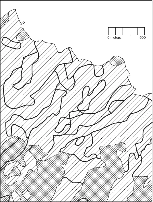
- The building must reside on soils suitable for construction.
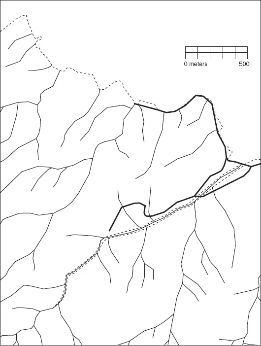
- A local ordinance designed to prevent rampant development allows new construction only within 300 meters of existing sewer lines.
- Water-quality legislation requires that no construction occur within 20 meters of streams.
- The site must be at least 4000 square meters to provide space for building and grounds.
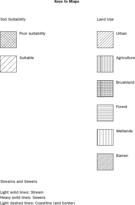
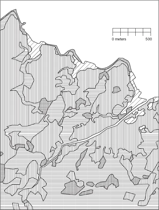
| LC CODE | LC TYPE |
| 100 | Urban |
| 200 | Agriculture |
| 300 | Brush land |
| 400 | Forest |
| 500 | Water |
| 600 | Wetlands |
| 700 | Barren |
More of What GIS Is About
Table of contents
- Cover
- Contents
- Title
- Copyright
- Dedication
- Foreword
- Preface
- Preface to First Edition
- Introduction
- Part I: Basic Concepts of GIS
- Part II: Spatial Analysis and Synthesis with Gis
- Afterword: From Systems to Science by Michael Goodchild
- Index
- Notes
- Download CD/DVD Content