![]()
1
The Geographies of Western Kenya
Slippery ground does not recognize kings.
—Abaluyia proverb1
FROM THE shores of Lake Victoria to the foothills of Mount Elgon, the landscape of what would become western Kenya undulates with immense ecological and topographical variety, from gentle hills and flat-bottomed valleys to deeply gorged rivers fringed with lush tropical rainforests. For centuries, African settlers moving through this area greeted each other with the term “Mulembe.” In its many variations, “Mulembe” asked visitors where they had been, where they were going, and entreated them to come and go in peace.2 A Luganda-English dictionary defined the term as “may he bring you in peace to your community.”3 Community members struck the murembe tree, with its brilliant red flowers, to undo taboos or to consecrate peace between warring communities.4 Despite its wide use across eastern Africa, Luyia elders in western Kenya claimed the term as central to their formulations of community, migration, and home: anywhere they traveled, “to be Muluyia was to say ‘Mulembe.’”5
The environmental diversity northeast of Lake Victoria invited a host of African settlers to cultivate the land and graze their cattle. Diverse migratory routes and relatively recent patterns of settlement created a linguistically and culturally mixed region: in the words of the doyen of Kenyan history, Bethwell Ogot, “lying in an ancient migration corridor, the traditional history of the district is one of the most confused and complex in the whole of East Africa.”6 This traditional history was a continual source of contention and argumentation, complicated by regional networks of trade and cultural exchange across complementary ecological zones. Migrating communities practiced a particular form of itinerant territoriality, a portable ideology of territorial control and belonging that linked networks of clans to particular tracts of land. African communities settled into niche environments and developed a diverse range of small-scale and defensive clan structures characterized by multiple and overlapping systems of authority. The precolonial space of the lake region represented a dynamic area of expanding frontiers, heterarchical social formations, and ethnic interdependence.7
Colonial conquest enclosed these frontiers and mapped new lines of exchange, community, and power. First circumnavigated by Henry Morton Stanley in 1875, the lake region was known to early traders, explorers, and colonial administrators as the Nyanza basin and its people as Kavirondo.8 Colonial conquest brought all the imperial instruments of state fixity—map, census, and tax—to bear on these diverse and decentralized African communities. Colonial geographers enlisted local inhabitants as amateur surveyors, guides, and porters to track rivers and navigate forests, to set out survey beacons, and to “beat the bounds” of their newly demarcated boundaries. The new maps introduced by imperial cartographers at the turn of the century imposed a top-down geographic vision that overwrote local conceptions of space and fixed named African communities to particular mapped territories. However, Africans around and across these newly mapped boundaries turned their spatial strategies to resistance, sabotaging the work of colonial surveyors, adopting new cartographic practices and symbols, and purposefully mistranslating their own geographic conceptions to countermap colonial geographies. The construction of colonial boundaries fostered new geographic imaginations of labor, obligation, and resistance and precipitated the remapping of authority, moral community, and competing territorialities in the making of western Kenya.
ENVIRONMENT AND SOCIETY: MAPPING PRECOLONIAL COMMUNITIES
As John Iliffe argued in his seminal text Africans, the history of the African continent and its peoples must be understood against the backdrop of a diverse and difficult environment.9 In his study of the Taita in Kenya, Bill Bravman put the point succinctly: “Geography is not exactly destiny . . . but it has powerfully influenced the history of the people who live there.”10 In the Great Lakes region, the ability to control and profit from this rough and potentially rich environment provided the primary source of tension for precolonial societies.11 This geographic space, however, was more than just a backdrop against which diverse African political systems, social relations, and material cultures evolved: this space, both physical and cognitive, was dynamic and ever changing, inspiring and constraining the geographic imaginations of these communities over time.
Northeast of one of eastern Africa’s Great Lakes, named Lake Victoria in the nineteenth century by British explorer John Hanning Speke, lies a land of immense ecological and topographical variety. Created by a faulting in the geological crust, two main reliefs dominate the topography: the fertile lake plateau composed of a broad belt of granite soils studded by massive granite boulders and the drier highlands that flank the region to the north and east, where cool, moist air nurtures healthy volcanic soils. Altitudes range from 3,770 feet (1,150 meters) along the shores of the lake to over 7,050 feet (2,150 meters) on the slopes of Mount Elgon.
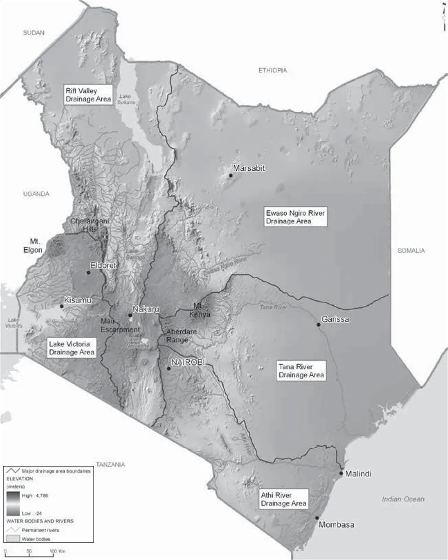
FIGURE 1.1. Topographical map of Kenya and magnification of western Kenya. World Resources Institute, Natural Benefits in Kenya.
This geomorphology has been described as “pockets”: although predominantly grassland savanna, bordered by equatorial forest to the north and tropical rainforest to the east, a series of interlocking ridges, hills, and valleys alternate to create an undulant plain. Two distinct seasons keep the region fairly regularly well watered: the dry season, from mid-December to mid-February, and the rainy season, from March to December, with annual rainfall between 61.7 and 76.3 inches.12 A tilt in the African Plateau allows water to flow through numerous rivers and streams from northeast to southwest and drain into the lake. This varied relief created a great diversity of agro-ecological zones with niche economic and settlement potentials.13
This distinct and varied terrain formed a migratory corridor in eastern Africa that invited a long history of human settlement.14 In the “classical age” of African settlement in the Great Lakes region, from 1000 BCE to 400 CE, new developments in ironwork and crop production encouraged more intensive agricultural practices and the development of more settled and complex social and political systems. Early evidence of scattered settlements of southern Cushites, Bantu, and southern Nilotic groups existed in the southern regions around the lake, joined by an influx of Kalenjin- and Maa-speaking settlers further north at the turn of the millennium. Scholars have dated the current settlements to the fourteenth and fifteenth centuries.15 Though still a point of heated debate, most historians concur that Bantu settlements existed before the arrival of the Nilotic Luo from the Sudanese north in the late fifteenth century.16 Luo migrations dislocated these Bantu settlements, creating two distinct northern and southern blocks of Bantu communities around Lake Victoria: the Bantu communities of the north and the Gusii, or Kisii, of the south.
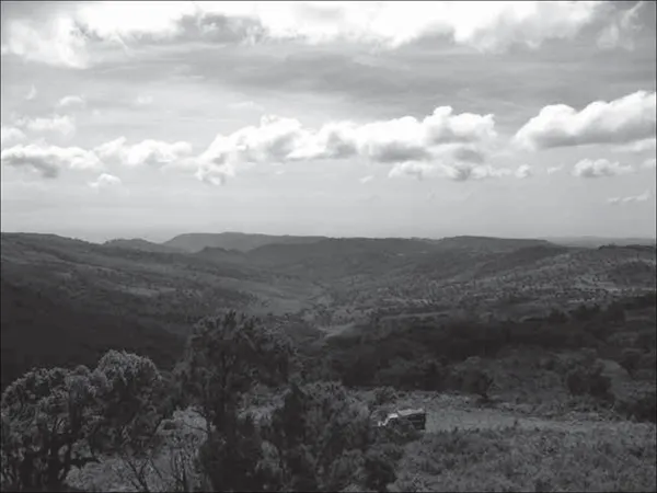
FIGURE 1.2. Southern view from Mount Elgon. Photo by author, March 2007.
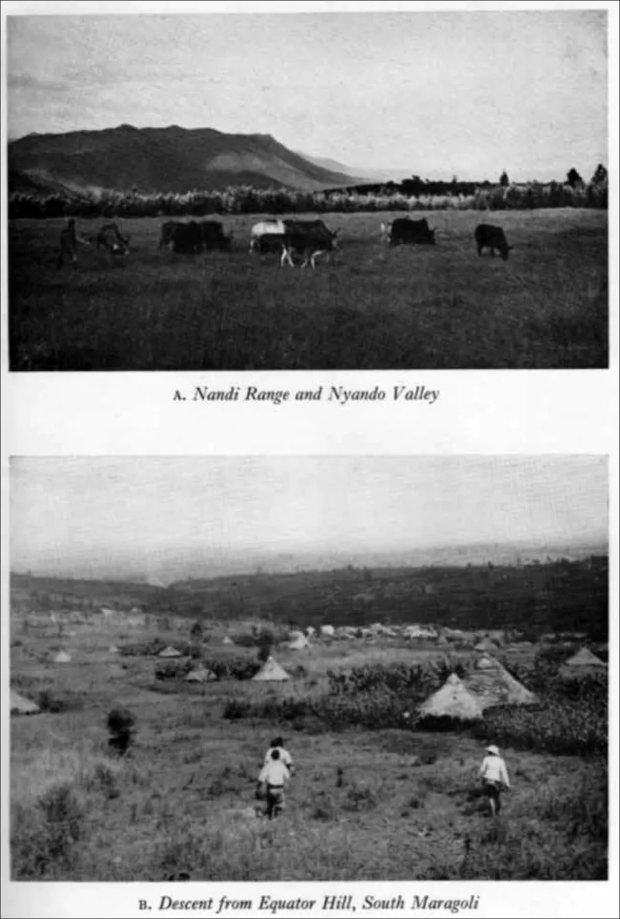
FIGURE 1.3. Photos of North Kavirondo. Wagner, Bantu of North Kavirondo, vol. 1, plate 1.
Those Bantu populations pushed north by the arrival of Luo settlers settled into the ecologically diverse and productive region northeast of the lake extending up to Mount Elgon. The sixteenth century marked an explosion of new settlements and population growth that put pressures on cultivation, cattle, and land. The arrival of the Nilotic Teso in the mid-seventeenth century marked another important shift, as Teso-Bukusu/Bagisu wars over the next few centuries created a wedge between these two communities around Mount Elgon.17 Bantu and Luo settlers continued to arrive well into the eighteenth century, penetrating the outline of this region from multiple routes and settling into productive agricultural and fishing niches around the lake.
This linear narrative of migration and settlement in the region, however, belies the urgent and contentious argumentation at stake in the telling of these histories. Narratives of how and when particular groups arrived in the region have been recast to fit partisan projects of ethnic imagining throughout the colonial and postcolonial era. Bethwell Ogot’s pioneering text History of the Southern Luo, for example, was the product of ongoing partisan history projects among Luo intellectuals.18 Ogot’s dual volume Luo Historical Texts created an “archival patrimony” that obscured the intellectual work of other Luo historians.19 While early partisan historians such as Shadrack Malo and Samuel Ayany “consciously and unconsciously suppressed the signs and substance of discoordination and contention” to achieve a harmonized Luo past, Ogot went a step further, offering “the careful and patient reader a view of a people, a nation, Canaan, constructed out of critical tensions and conflicts over land, political domination, and domestic insecurity.”20 Luo historians drew their constituents in line through direct descent from their fifteenth-century founding ancestor, Ramogi. Across the various projects of ethnic imagining in Kenya, patriotic historians wrote of unified and purposeful migrations to subsume divergent claims, to draw their partisans in patrilineal descent to a mythic founding father, and to promote the past as a model for contemporary threats to their moral communities.21
Further north, Gideon Were produced a similar archival reference entitled Western Kenya Historical Texts, cataloguing the oral clan histories of Bantu and Kalenjin settlers.22 In his history of these migrations, Were drew a sharp distinction between the largely settled and agriculturalist Bantu communities and their pastoralist neighbors, who, in the nineteenth century, were “still busy expanding northwards into their present territories.”23 In this way, Were glossed over the multiple and complex migrational routes of Bantu agriculturalists to lay claim to a longer history of settlement. However, unlike Ogot, Were was harder pressed to create an overarching historical narrative out of the stubbornly diverse clan histories of these Bantu settlers, with no “Ramogi” common ancestor or common linguistic grounding. While Ogot could provide a unifying thrust to Luo migrations, Were was continually obliged to acknowledge the diverse origins of his subjects. At stake in these partisan histories were urgent...