Geography
Disintegration of States
The disintegration of states refers to the process by which a political entity breaks apart or loses its ability to govern effectively. This can occur due to factors such as internal conflict, economic instability, or ethnic and cultural divisions. The disintegration of states can have significant geopolitical and humanitarian implications, leading to issues such as refugee crises and regional instability.
Written by Perlego with AI-assistance
Related key terms
1 of 5
6 Key excerpts on "Disintegration of States"
 eBook - PDF
Political Geography
Territory, State and Society
- Kevin R. Cox(Author)
- 2008(Publication Date)
- Wiley-Blackwell(Publisher)
There have also been disintegrating effects, however. Decolonization and the breakup of the Belgian, British, Dutch, French, and Portuguese empires produced a massive increase in the number of individual states during the period from about 1950 to 1980. Since the ending of the Cold War there has been another burst of territorial fragmentation. The most obvious expression of this has been the breakup of the Soviet Union, creating the independent states of Ukraine, the Baltic states of Estonia, Latvia, and Lithuania, and those of the Caucasus (e.g. Armenia, Azerbaijan) and former Soviet Central Asia (Turkmenistan, Uzbekistan, etc.). But the former state of Yugoslavia has given way to five independent states. In Italy the northern region has threatened to break away and form its own state. In the UK substantial devolution to Wales, Northern Ireland, and Scotland is under way, raising questions as to how long the United Kingdom will indeed remain “united.” All of these partitions and fragmentations have effects on movements; and that, of course, is the point. They can, for example, lock up fiscal resources: prevent the leakage of taxes to populations elsewhere. The drive for an inde-pendent Scotland, for example, gains energy from the prospect of diverting the highly lucrative severance taxes imposed on the North Sea oil industry centered in Aberdeen to exclusively Scottish use. They can alter the geogra-phy of civil service appointments so that cultural minorities are no longer administered by those defined as alien: Croats by Serbs, Estonians by Rus-sians, and so on. And they can protect infant industry from “foreign” compe-tition and so nurture a native capitalist class. These are tendencies, moreover, that apply at many different geographical scales: not just the more global with its nation states, empires, and free trade areas but also the metropolitan. eBook - ePub
Politics
Critical Essays in Human Geography
- Virginie Mamadouh, John Agnew(Authors)
- 2017(Publication Date)
- Routledge(Publisher)
meanings of state boundaries. Territories may then have different relations with each other through their border areas, along a continuum stretching from alienated borderlands through to completely integrated borderlands (Martinez, 1994). As far as the effects of interdependence and integration inside states are concerned, this means that new voices will arise to articulate their interests. Much recent research in the field of IR has concentrated on the need to identify the political identities and social groupings which have been previously effectively suppressed by the hegemony of states (Minhha, 1996; Shapiro and Alker, 1996).Fragmentation resulting from self-government in ‘fourth world’ nations (Nietschmann, 1994; Griggs and Hocknell, 1995) could also result in an increase, rather than decrease, in the number of territorial, and perhaps new state, boundaries. Processes of conflict resolution, euphemistically labelled peace processes, bring about new lines of separation and physical barriers as conflicting nations retreat into their own territorial compartments. Conflict resolution is, more often than not, characterized by separate, rather than shared, spaces (Harbottle, 1994; Williams, 1994; Newman, 1996a; 1996b).The contemporary world is thus characterized by both diverging social, political and economic processes and very different interpretations of what they mean. Sociologist Oommen (1995) argues that the world we live in is characterized simultaneously by endisms (the end of history, geography, nature, ideology), postisms (postmodern, postindustrial, postcapitalist) and heyondisms (beyond the nation-state, beyond the cold war), and that these developments signify contradictory trends and tendencies. If endisms indicate a world without boundaries, postisms announce the emergence of fresh boundaries and beyondisms allude to the elongation of boundaries. Concomitantly, there is a set of newisms, eBook - ePub
- David Newman(Author)
- 2013(Publication Date)
- Routledge(Publisher)
22- The deterritorialisation of the state and the associated changing roles and functions of international boundaries. Notions of state deterritorialisation largely follow on the ‘end of the nation state’ thesis, and assume that the era of ‘territorial absolutism’ is ended.23 By association, boundaries, the demarcators of territorial compartmen-talisation, have also disappeared. While the functions and roles of boundaries have, indeed, changed as they become more permeable to trans-boundary movements and flows, they continue to display a powerful impact on the world map, with more boundaries of territorial separation being erected between ethnic and national groups seeking their own respective self-government and independence.24 These two themes, the impact of globalisation on state sovereignty, and the deterritorialisation of the state thesis,25 form the core of what has been called the postmodern debate in geopolitics and form the theme around the contents of this volume.
- The study of geopolitical texts, narratives and traditions.26 The texts and narratives of geopolitical discourse are varied. They range from the memoirs of policy makers and statesmen, past and present, to the analysis and deconstruction of that most basic of geo-texts, the map. The villains of the geopolitical story, such as Mackinder and Haushoffer, are now legitimate subjects for study, not simply for the ideas they propagated, but also in terms of textual deconstruction concerning their own positioning with respect to the academic and national communities within which they worked; academics in service of their states, feeding on and, in turn, promoting notions of imperialism, geostrategic power, and attempts at global dominance. The politics of map-making is another area that is beginning to attract significant interest, as the power of maps in the formation of foreign policy is reflected in the scale used, the semantics and naming of places and the extent to which they are used as part of a wider process of cartographic propaganda and territorial socialisation.27 The geopolitical texts and narratives of the non-English speaking world are also of great importance in any attempt at understanding how the complex system of states undergoes constant positioning and re-positioning in the re-ordering of the world political map.28
 eBook - ePub
Political Change and Territoriality in Indonesia
Provincial Proliferation
- Ehito Kimura(Author)
- 2013(Publication Date)
- Routledge(Publisher)
This intellectual trajectory on territoriality was an important step forward in that it recognized the discontinuous nature of the modern state system and its potential erosion. Overwhelmingly this perspective saw forces such as Europeanization and globalization as fundamentally weakening states, trivializing boundaries, and undermining territorial sovereignty. Though the state formation and the state erosion perspectives differed in many ways, they did share the tendency to link territoriality to the level of the nation-state. A third trajectory of scholarship has helped to chip away at this trend.This third perspective actually countered the premise of weakening territoriality in an era of globalization. According to these scholars notions of territorial “unbundling” or “deterritorialization” were problematic in their simplistic depiction of changes occurring in the world. As the early projections of the sweeping impact of globalization abated, these scholars observed that states and territoriality remained remarkably resilient. The changes taking place were not that of “deterritorialization” but of reterritorialization (Kahler and Walter 2006 ).In making these arguments, scholars employed the concept of scale which highlights the way territories of differing size are nested within one another such as the global, national, and local levels (Delaney and Leitner 1997 ; Cox 1998 ). Because scales are malleable and dynamic, territoriality can then move upwards and downwards along the scale. Globalization is thus not destroying territory but rather rescaling it upwards to the supra-national level and downwards to the sub-national level. It is leading not to deterritorialization of the state, but rather to its denationalization (Brenner 1999 ). Said differently, rather than an unbundling of territory, there has been a process of rebundling , for example, upwards to the European level (Ansell and Palma 2004 ). In this sense, what is emerging today is a world where territory and authority are more fragmented, and not wedded to strict national territorial boundaries (Ansell and Palma 2004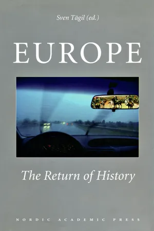 eBook - ePub
Europe
The Return of History
- Sven Tägil(Author)
- 2001(Publication Date)
- Nordic Academic Press(Publisher)
Other types of union for now-sovereign states, such as a confederation, have also been considered. Yet postwar Europe has also witnessed an escalating tendency toward fragmentation. Perhaps the future holds an independent Flanders and an independent Wallonia in place of the current state of Belgium. Maybe tomorrow’s Europe includes a Basque state and an independent Scotland. 2 In Eastern Europe, in areas that were subject to Soviet domination until the late 1980s, fragmentation has proceeded swiftly. As the Soviet empire shattered, it left behind room for new, independent states, with Russia the largest of these in an area steeped in uncertainty and instability. And in the historically volatile Balkans, the dissolution of Yugoslavia demonstrated that new state-formations do not solve old problems. Major changes in the state system may have profound consequences for Europe. Scholars throughout Europe have conducted extensive studies on, for instance, economic integration and political decision making at the supranational level. However, existing research tends to neglect certain critical issues. First, it is important to note that integration can occur in different arenas–economic, political and cultural–and that developments within these arenas need not coincide. Furthermore, previous research tends to lack a long-term historical perspective concerning the integrative/separatist tendencies in Europe. The origins of today’s realities must be found in the past; an analysis of relevant historical developments is essential if we are to understand what is before us. In addition, no existing theory does full justice to the importance of territorial identity, although it has been argued that “one of mankind’s continuing problems” is “how best to give political recognition to these identities.” 3 This book emphasizes territorial identity and identification as key factors both in the trend toward supranationalism and in the trend toward regional separatism eBook - PDF
Human Geography
People, Place, and Culture
- Erin H. Fouberg, Alexander B. Nash, Alexander B. Murphy, Harm J. de Blij(Authors)
- 2015(Publication Date)
- Wiley(Publisher)
Nevertheless, as we seek solutions to complex political conflicts, we continue to work with the nation-state idea as the social and institutional framework capable of bringing long-term peace. People trying to find solutions to the conflicts in the former Yugoslavia and in Israel/Palestine have tried to draw state boundaries around nations—to make nation and state fit. In all of these ways, the European state became the world model and is still shaping the political orga- nization of space in the world. Scale Representation of a real-world phenomenon at a certain level of reduction or generalization. In cartography, the ratio of map distance to ground distance; indicated on a map as a bar graph, representa- tive fraction, and/or verbal statement. 74 CHAPTER 3 Political Geography CANADA UNITED STATES U.S. (Alaska) GREENLAND MEXICO BERMUDA GUATEMALA BELIZE EL SALVADOR HONDURAS NICARAGUA COSTA RICA PANAMA JAMAICA BAHAMAS CUBA HAITI DOMINICAN REPUBLIC PUERTO RICO BARBADOS TRINIDAD & TOBAGO VENEZUELA COLOMBIA ECUADOR PERU BOLIVIA BRAZIL FRENCH GUIANA SURINAME GUYANA PARAGUAY URUGUAY ARGENTINA CHILE U.S. (Hawaii) 60° 40° 40° 20° 0° 20° 20° 20° 40° 60° 40° 60° 40° 60° 40° 60° 160° 140° 120° 80° 60° 40° 20° 20° Tropic of Cancer Equator Tropic of Capricorn S O U T H E R N O C E A N P A C I F I C O C E A N A T L A N T I C O C E A N 0 0 2000 1000 3000 Kilometres 1000 2000 Miles WORLD - PER CAPITA GROSS NATIONAL INCOME, 2009 Over 10,000 3,000–10,000 1,000–2,999 Below 1,000 Data not available High Adequate Low Very low FIGURE 3.23 Per capita gross national income (GNI), 2009. 3.3 How Is the Governance of States Spatially Organized? In the 1950s, political geographer Richard Hartshorne de- scribed the forces that unify people within a state as centrip- etal and the forces that divide them as centrifugal. According to Hartshorne, a nation’s (or a state’s) contin- ued existence depends on the balance between centripetal and centrifugal forces.
Index pages curate the most relevant extracts from our library of academic textbooks. They’ve been created using an in-house natural language model (NLM), each adding context and meaning to key research topics.