Geography
Glacial Environment
A glacial environment refers to a landscape shaped by the movement and melting of glaciers. It is characterized by features such as U-shaped valleys, moraines, and cirques, as well as the presence of glacial lakes and rivers. Glacial environments play a significant role in shaping the Earth's surface and influencing local climates.
Written by Perlego with AI-assistance
Related key terms
1 of 5
10 Key excerpts on "Glacial Environment"
 At the immediately local scale glaciers obscure former land surfaces, creating a new ice surface with particular topographic and micro-environmental characteristics. Beneath the ice a unique assemblage of geological, geomorphic and hydraulic conditions comes into effect in the subGlacial Environment, altering the previous surface to varying degrees by subglacial processes. At the regional scale, even small glaciers install into the landscape a whole suite of climatic, geomorphological and hydrological conditions that control surface processes not only in the vicinity of the ice but also, through influences on sediment supply and fluvial regime, downstream of the ice throughout any drainage basin inhabited by glaciers. The effects of glaciers extend through hydrological, geochemical and sedimentological effects into the oceans and atmosphere at a global scale. The global distribution of loess, and the presence of iceberg-rafted glacial sediments in the deep oceans, both testify to the range of glacial processes beyond the limits of glaciation. Subglacial, ice-marginal, pro-glacial and paraGlacial Environments (Chapter 9) form a time-transgressive geographical system linking geomorphology, sedimentology and hydrology. It is a pervasive and persistent influence that superimposes sequences of effects, and preserves a record of environmental phenomena in the landscape. Whatever location or time period we consider, we cannot escape the glacial character of our landscapes. Earth surface processes and environmental conditions are ultimately controlled by solar, geothermal and gravitational energy. Differences in solar heating of the Earth's surface control major components of the global environmental system by driving ocean/atmosphere dynamics and the hydrological cycle
 eBook - PDF
- Gary Nichols(Author)
- 2009(Publication Date)
- Wiley-Blackwell(Publisher)
7 Glacial Environments Glaciers are important agents of erosion of bedrock and mechanisms of transport of detritus in mountain regions. Deposition of this material on land produces characteristic landforms and distinctive sediment character, but these continental glacial deposits generally have a low preservation potential in the long term and are rarely incorporated into the stratigraphic record. Glacial processes which bring sediment into the marine environment generate deposits that have a much higher chance of long-term preserva- tion, and recognition of the characteristics of these sediments can provide important clues about past climates. The polar ice caps contain most of the world’s ice and any climate variations that result in changes in the volumes of the continental ice caps have a profound effect on global sea level. 7.1 DISTRIBUTION OF Glacial EnvironmentS Ice accumulates in areas where the addition of snow each year exceeds the losses due to melting, evapora- tion or wind deflation. The climate is clearly a control- ling factor, as these conditions can be maintained only in areas where there is either a large amount of winter snow that is not matched by summer thaw, or in places that are cold most of the time, irrespective of the amount of precipitation. There are areas of permanent ice at almost all latitudes, including within the tropics, and there are two main types of glacial terrains: tempe- rate (or mountain) glaciers and polar ice caps. Temperate or mountain glaciers form in areas of relatively high altitude where precipitation in the winter is mainly in the form of snow. Accumulating snow compacts and starts to form ice especially in the upper parts of valleys, and a glacier forms if the summer melt is insufficient to remove all of the mass added each winter. These conditions can exist at any latitude if the mountains are high enough. eBook - PDF
Geomorphology: The Research Frontier and Beyond
Proceedings of the 24th Binghamton Symposium in Geomorphology, August 25, 1993
- J.D. Vitek, J.R. Giardino(Authors)
- 2013(Publication Date)
- Elsevier Science(Publisher)
This is an areal concept, which comprises all studies on geomorphic processes and land-forms in a special zone or belt. It is accepted, even if Washburn, the grand old man of peri-glacial geomorphology describes the perigla-cial concept in general as sufficiently broad and unprecise to defy (climatic) quantifica-tion (Washburn, 1979, p. 2). For Washburn (1979,p.4), PERIGLACIAL GEOMORPHOLOGY IN THE 21 ST CENTURY 143 the term periglacial designates primarily terrestrial, non-glacial processes and features of cold climates character-ized by intense frost action, regardless of age or proximity to glaciers. French (1987, p. 5) accepts this generally adopted definition as he writes: Periglacial geomorphology seeks to explain the geo-morphic processes and landforms of cold non-glaciated environments... There are two criteria which identify per-iglacial regions. These are ( 1 ) the existence of intense freezing and thawing of the ground, either on a seasonal or daily basis, and (2) the formation and preservation of perennially frozen ground or permafrost. This definition represents the same um-brella as the other definitions, even if the first critérium for identifying periglacial regions is extremely unprecise: The intensity of freezing and thawing can be given by the (daily or an-nual) number of freeze-thaw cycles related to ground or air temperatures, by the intensity of the freezing using mean minimum ground or air temperatures, etc. None of the given possi-bilities is really convincing as a general critérium. In a recent paper, Thorn (1992) tries to avoid these uncertainties, defines periglacial geomorphology as follows (Thorn, 1992, pp. 1,24): Periglacial geomorphology is that part of geomorphol-ogy which has as its primary object physically based ex-planations of the past, present, and future impacts of diurnal, seasonal, and perennial ground ice on landform initiation and development. eBook - PDF
Surface and Ground Water, Weathering, and Soils
Treatise on Geochemistry, Second Edition, Volume 5
- J.I. Drever(Author)
- 2005(Publication Date)
- Elsevier Science(Publisher)
5.07 Geochemical Weathering in Glacial and ProGlacial Environments M. Tranter University of Bristol, UK 5.07.1 INTRODUCTION 190 5.07.2 BASIC GLACIOLOGY AND GLACIER HYDROLOGY 191 5.07.2.1 Glaciers, Ice Caps, and Ice Sheets 192 5.07.2.1.1 Cold or warm ice at the bed? 192 5.07.2.1.2 Sources of water and flow paths 192 5.07.2.1.3 Rock : water ratios and rock – water contact times 193 5.07.2.2 The Proglacial Zone 193 5.07.2.2.1 Broad definition: zone of ice advance and retreat 193 5.07.2.2.2 Permafrost 194 5.07.2.2.3 Seasonal freezing 194 5.07.2.2.4 Evapoconcentration 194 5.07.3 COMPOSITION OF GLACIAL RUNOFF 194 5.07.3.1 General Features in Comparison with Global Riverine Runoff 194 5.07.3.2 Relation to Lithology 194 5.07.3.3 Chemical Erosion Rates 195 5.07.3.4 pH, P CO 2 , and P O 2 195 5.07.3.5 87 Sr : 86 Sr Ratios 196 5.07.3.6 Ge/Si Ratios 197 5.07.3.7 d 18 O, d 13 C DIC , d 34 S, and d 18 O SO 2 2 4 197 5.07.3.8 Nutrients 198 5.07.4 GEOCHEMICAL WEATHERING REACTIONS IN GLACIATED TERRAIN 198 5.07.4.1 Trace-reactive Bedrock Components are Solubilized 198 5.07.4.2 Carbonate and Silicate Hydrolysis 198 5.07.4.3 Cation Exchange 198 5.07.4.4 Carbonate and Silicate Dissolution: Sources of CO 2 and Strong Acids 198 5.07.4.5 Sulfide Oxidation Using O 2 and Fe(III) 199 5.07.4.6 Oxidation of Kerogen, Sulfate Reduction and Onwards to Methanogenesis? 199 5.07.4.7 Nutrients from Glacial Flour 200 5.07.4.8 Other Lithologies 200 5.07.4.9 Little Necessity for Atmospheric CO 2 200 5.07.5 GEOCHEMICAL WEATHERING REACTIONS IN THE PROGLACIAL ZONE 200 5.07.5.1 Similarities with SubGlacial Environments 200 5.07.5.2 Evapoconcentration and Freeze Concentration 201 5.07.5.3 Ingress of Water from Channels into the Proglacial Zone 201 5.07.5.4 Enhancement of Glacial Solute Fluxes 202 5.07.6 SUMMATION: IMPACT ON LOCAL AND GLOBAL GEOCHEMICAL CYCLES 202 5.07.6.1 Local Effects 202 5.07.6.1.1 Redox conditions and pH may range widely within subGlacial Environments 202 eBook - ePub
The Earth′s Land Surface
Landforms and Processes in Geomorphology
- Kenneth J Gregory(Author)
- 2010(Publication Date)
- SAGE Publications Ltd(Publisher)
Reprinted with permission from the National Academies Press, Copyright 2008, National Academy of Sciences. Landscapes produced as a result of glacial erosion and deposition include classic landforms resulting from erosion, deposition and fluvioglacial processes (see Table 7.2) 7.2 P ROGLACIAL LANDSCAPES Proglacial literally means in front of the glacier and so includes all landforms adjacent to ice margins, although French and Williams (2007) contend that the proGlacial Environment, referring specifically to ice-marginal conditions, is a periGlacial Environment in the original sense of Lozinski (see section 7.3 below). According to where the ice margin terminates, the environment includes combinations of glacial, fluvial, lacustrine and sometimes marine processes, often indicating the way in which the proglacial zone has expanded and contracted with recent fluctuations of the ice margin. A classification of proGlacial Environments is proposed in Table 7.3. Terrrestrial ice marginal environments can include proglacial lakes, created when glacial meltwater is dammed by a barrier such as an ice mass blocking a valley or terminal or lateral moraines. Outburst floods (‘jökulhlaups’, Icelandic for glacier-burst) from such systems can constitute high magnitude, high frequency fluxes of meltwater relative to normal ablation-controlled discharge. In addition to their significance in englacial and subglacial systems, most jökulhlaups transport sediment to proglacial sandur, with jökulhlaup deposits forming distinctive sedimentary assemblages, coupled with suites of high-energy erosional landforms (Russell et al., 2006). Meltwater inputs to proglacial systems, which are low-magnitude–high-frequency, primarily controlled by ablation inputs from the source glacier, can produce glacial drainage channels. Moraines produced at ice margins can be recessional if a sequence occurs and may be push moraines if affected by ice movement eBook - ePub
- Simon Catling, Tessa Willy, Author(Authors)
- 2018(Publication Date)
- SAGE Publications Ltd(Publisher)
environmental geography. These aspects of geography have a long history – for instance, when regional geography was a dominant approach in school geography in the first half of the twentieth century, regions were discussed in terms of their physical geography, including rivers, lakes, plains, mountains, valleys, ecology and geology, and their human geography, such as types of industry, products, trade, settlements, commerce and ways of life. However, they were rarely considered in terms of environmental geography – for instance, how people have changed the landscape over time, human impact on climate, extracting resources, deforestation and pollution. Understanding physical, human and environmental geography is important to understand our planet, our lives and their incontrovertible interrelationships. This is the focus of this chapter, but we begin by noting briefly the geological context in which we live.Living in a geological epoch
The interrelationship between the physical environment and human activities is argued to have become much greater in recent centuries. It is contended that humans have had such an impact on the natural environment that we should have a new name for the current geological time in which we live and that this name should be the Anthropocene (Hamilton et al., 2015; Goudie and Viles, 2016; Bonneuil and Fressoz, 2017). The term ‘Anthropocene’ is being used to identify a ‘new’ geological epoch (Schwägerl, 2014; McNeill and Engelke, 2014). Its purpose is to reinforce just how significant humans have become in affecting the physical environment of the Earth. We have done this, it is argued, through our actions, such as deforestation, energy extraction and generation, mobility and travel, urbanisation and industrial practices (Goudie, 2013; Holden, 2012; Whitehead, 2014; Goudie and Viles, 2016; Kress and Stine, 2017). Such developments have led to changes in our vegetation, land cover, oceans, atmosphere and climate, and weather systems and patterns. One impact is described in the term ‘climate change’ and debated in relation to the warming of the Earth’s atmospheric and ocean temperatures (Maslin, 2014). This is having the effect of heating our planet at a much faster rate than has hitherto happened, hence the use of the phrase ‘global warming’ (Maslin, 2014). The Earth’s climate has constantly changed; the difference today is that it is happening, in geological terms, very quickly, and that it appears already to be affecting our environments and lives very seriously through such events as higher temperatures and increased and heavier rainfall, resulting in such effects as the increased frequency and severity of storms, flooding, drought and wildfires (Core Writing Team et al eBook - PDF
Physical Geology
The Science of Earth
- Charles Fletcher(Author)
- 2017(Publication Date)
- Wiley(Publisher)
459 CHAPTER 15 CHAPTER OUTLINE 15.1 A glacier is a river of ice. 15.2 Glaciers are found in a wide diversity of forms and environments. 15.3 Ice moves through the interior of a glacier as if on a one-way conveyor belt. 15.4 Glacial landforms are widespread and attest to past episodes of glaciation. 15.5 The majority of glaciers and other ice features are retreating in reaction to global warming. 15.6 The ratio of oxygen isotopes in glacial ice and deep-sea sediments provides a proxy for global climate history. 15.7 Earth’s recent history has been characterized by alternating cycles of ice ages and interglacials. 15.8 During the last interglacial, climate was warmer and sea level was higher than at present. 15.9 Paleoclimate is influenced by the timing and location of sunlight reaching Earth. 15.10 Together, orbital forcing and climate feedbacks produced the paleoclimate. Glaciers and Paleoclimatology Mira/Alamy Glaciers are rivers of ice that sculpt the land surface by eroding the crust and depositing sediments as they move. Almost every mountain system in the world has evidence of past glaciation. What would evidence of past glaciation look like? LEARNING OBJECTIVES 15.1 Describe glaciers and where they occur today. 15.2 List and define the various types of glaciers. 15.3 Describe how ice moves in a glacier and explain how this movement affects the front of the glacier. 15.4 Compare and contrast depositional and erosional features formed by glaciers. 15.5 Describe the response of various ice environments to global warming. 15.6 Describe how oxygen isotopes provide a proxy for global climate history. 15.7 Define marine isotopic stages and explain what they indicate. 15.8 List characteristics of the last interglacial that are relevant to understanding the consequences of modern global warming. 15.9 Define the Earth-Sun orbital parameters. 15.10 Describe climate feedbacks and give examples. eBook - PDF
- James Petersen, Dorothy Sack, Robert Gabler, , James Petersen, James Petersen, Dorothy Sack, Robert Gabler(Authors)
- 2021(Publication Date)
- Cengage Learning EMEA(Publisher)
4. Glaciation is truly an interdisciplinary topic. In addition to physical geographers, what other scientists do you think are involved in the study of glaciers and why? 1. These tables show the position (elevation) of the toe of a Northern Hemisphere glacier as measured yearly on Sep- tember 30 during the 1970s, then again during the 2010s. ■ PRACTICAL APPLICATIONS Use decadal averages and annual rates of change of position to help you describe how the behavior of the glacier in the 2010s differed from that of the 1970s. Year 1970 1971 1972 1973 1974 1975 1976 1977 1978 1979 Elevation (meters) 2634 2631 2632 2629 2630 2629 2627 2625 2624 2623 Year 2010 2011 2012 2013 2014 2015 2016 2017 2018 2019 Elevation (meters) 2660 2666 2672 2679 2686 2694 2702 2710 2719 2728 2. Diamonds were recently found at three separate sites in Canada in till deposited by the Pleistocene ice sheet. At Site A, nearby ice-scoured troughs now occupied by lakes are elongated from NNE to SSW. Site B lies 60 kilometers west of Site A, and striations in adjacent bedrock show a NE to SW orientation. Lying 60 kilometers east of Site A, Site C has nearby drumlins with their tail end pointed SSE and their blunt end NNW. Using this information, how might you proceed in narrowing down a search area for the bedrock from which the diamonds originated? Copyright 2022 Cengage Learning. All Rights Reserved. May not be copied, scanned, or duplicated, in whole or in part. Due to electronic rights, some third party content may be suppressed from the eBook and/or eChapter(s). Editorial review has deemed that any suppressed content does not materially affect the overall learning experience. Cengage Learning reserves the right to remove additional content at any time if subsequent rights restrictions require it. 567 C H A P T E R 1 9 A C T I V I T I E S 1. Using Google Earth, identify the landforms at the following locations (latitude, longitude). eBook - PDF
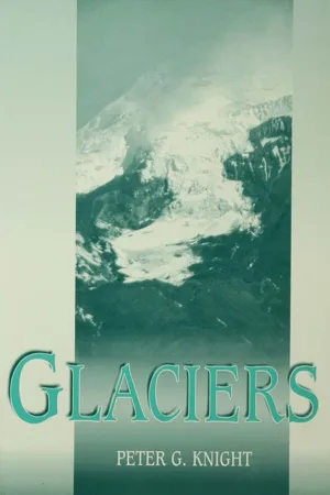
- Peter G. Knight(Author)
- 2008(Publication Date)
- Wiley-Blackwell(Publisher)
A number of contemporary glacierized landscapes have been used as modern analogues for the landform–sediment assem-blages produced by different glaciation styles and ice dynamics in differing climatic, geological and topographic settings. The identification of modern landsystems, for example those pertain-ing to active temperate glacier snouts, surging glaciers, ice streams, valley glaciers, subaqueous depocentres, arid polar glac-iers and plateau icefields (Evans, 2003a), provide glacial geomor-phologists with the criteria to decipher palaeoglacier dynamics and former glacier–climate relationships in ancient glaciated terrain. Figure 18.5 Landsystems model of the main glacigenic features and sediments on a passive continental margin, exemplified by the northern Norwegian shelf (from Vorren, 2003). 88 D. J. A. Evans 19.1 Glaciers The Canadian High Arctic comprises the Queen Elizabeth Islands (QEIs), located north of Parry Channel (Fig. 19.1). Present-day ice cover ranges from large ice caps that feed outlet glaciers and piedmont lobes, to small plateau icefields. The smaller islands of the central and western QEIs are characterized by lowland topog-raphy, and glacier cover is restricted to scattered, small ice-masses. Subpolar glaciers of the QEIs are characterized by a frozen mar-ginal zone that passes up-glacier into warm-based ice (Blatter, 1987; Skidmore & Sharp, 1999). Glaciers with a relatively high-mass turnover and/or strong converging flow will contain the most extensive zones of warm-based ice. This thermal regime means that subpolar glaciers can be characterized by both sub-glacial and supraglacial/lateral meltwater systems, and by signifi-cant compressive stresses where the zone of warm-based ice passes into the frozen bed at the margin. These characteristics are critical for debris entrainment and transport and are reflected geomorphologically and sedimentologically in the subpolar glacier landsystem (Fig. 19.2). eBook - PDF
- Alan F. Arbogast(Author)
- 2017(Publication Date)
- Wiley(Publisher)
Amazing. History of Glaciation on Earth The many examples of glacial landforms demonstrate that ice sheets have been an important and widespread feature around the world in the past. The presence of drumlins in places like New York and Michigan, for example, indicates that ice sheets once existed where they no longer do. You might wonder if it is possible for such conditions to return at some point in the future. This is a great question and provides the context for a discussion of Earth’s glacial history. In order to provide the proper context about the glacial past, some fundamental terminology must be established. Periods of glacial advance, when glaciation is a dominant worldwide process, are called glacials. During glacials, temper- atures are cooler on average, ice sheets expand and become larger, and sea level is lower because more water is stored in the ice sheets. Periods of glacial retreat, such as we are in now and have been for about the past 10,000 years, are called inter- glacials. During interglacials, average global temperatures are warmer, ice sheets and alpine glaciers are smaller, and sea level is higher because meltwater from the glaciers has returned to the sea. Although the evidence is extremely vague, the first major glacial period on Earth appears to have occurred during Precambrian time about 2.3 billion years ago. This glaciation was in response to a major fluctuation in the composition of the early atmosphere. Prior to this period, the atmosphere was composed Getty Images FIGURE 17.27 Kettle lakes. Kettle lakes form when ice blocks break off the front of a glacier, are subsequently buried by glacial sediment, and then melt, forming a depression and a lake if the water table is high. Geo Media Depositional Glacial Landforms Like many other Earth processes, the formation of glacial land- forms can be better understood when visualized in animated form. To do so, go to the Geo Media Library and select Depositional Glacial Landforms.
Index pages curate the most relevant extracts from our library of academic textbooks. They’ve been created using an in-house natural language model (NLM), each adding context and meaning to key research topics.