Geography
River Landscapes
River landscapes refer to the physical features and processes associated with rivers, including their channels, floodplains, and surrounding environments. These landscapes are shaped by erosion, transportation, and deposition of sediment, as well as human activities such as urbanization and agriculture. They play a crucial role in shaping the Earth's surface and supporting diverse ecosystems.
Written by Perlego with AI-assistance
Related key terms
1 of 5
12 Key excerpts on "River Landscapes"
 eBook - PDF
Material Science and Environmental Engineering
Proceedings of the 3rd Annual 2015 International Conference on Material Science and Environmental Engineering (ICMSEE2015, Wuhan, Hubei, China, 5-6 June 2015)
- Ping Chen(Author)
- 2015(Publication Date)
- CRC Press(Publisher)
Each component has its own features. 2.1.1 Water body Water body is the main body of urban river land- scape. The hydrological environment of a river, which is under the influence of its surrounding geographic environment and natural ecology, can determine the basic orientation of river landscape design. Water body can affect multiple senses (vision, hearing, smelling, kinesthesia and touch) and impact on men’s judgment and comment on this special environment. The existence of water can make men’s communication place become more intelligential and attractive; the natural prop- erties of water flow, flexibility and volatility, can add diversity and enjoyment to urban landscape, while the ecosystem formed by water flow plays a crucial role in greening urban images. 2.1.2 River bank River bank, one of the components of river space, is the transition of water and land areas. 1 INTRODUCTION Since China’s reform and opening up, the accel- erated urbanization process has led to the dete- rioration of urban environment gradually. The convergence of a mass of industrial and domestic sewage and wastes in urban rivers has resulted in the constant interruption and vanishing of urban rivers; some rivers have even turned into waste rivers that jeopardize the health of the residents living around tremendously. Since 1990s, many Chinese cities have started to realize the impor- tance of urban environment. Urban river land- scape design has become the hot point of urban landscape planning and design at present. As the open space in urban area, river landscape has entered into various levels of a city, in the wake of the increasingly enhanced spiritual demands of residents and tourists in culture, leisure and entertainment. 2 OVERVIEW ON URBAN RIVER LANDSCAPE Urban rivers normally indicate natural or artifi- cial river sections flowing through urban regions.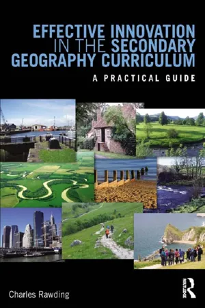 eBook - ePub
Effective Innovation in the Secondary Geography Curriculum
A practical guide
- Charles Rawding(Author)
- 2013(Publication Date)
- Routledge(Publisher)
Recent developments in physical geography at an academic level have been focused on notions of the anthropocene — that is to say the geological period that has been heavily influenced by human activity. Such a concept developed for the classroom automatically integrates human and physical geography by looking closely at people—environment links and human influences on the development of landscape and society. In this context, making use of a realist approach to physical geography should enable effective explanation in the classroom. Such an approach aims to blend general principles in physical geography with local events: looking at the space or area involved, the timing of events, the thresholds involved in the changes in process intensity, and the frequency of the processes involved (Suggitt 2010). An incorporation of these elements into the study of any physical environment provides a transferable framework for understanding physical geography in a wide range of contexts.The remainder of this chapter will focus on a series of examples from physical geography to illustrate how the most recent developments within the sub-discipline can be incorporated within the Geography classroom. However, it is important to bear in mind the integrated nature of physical geography and the importance of being able to understand the development of physical processes in different contexts.Fluvial geomorphology
The very phrase fluvial geomorphology suggests quintessential physical geography. However, if we look at recent work in this area it becomes very clear that the themes discussed above are permeating all areas of physical geography (Charlton 2008). Above all, there is a call for integration, the need to be able to understand entire systems in all their complexity, even where this necessitates focusing on individual elements initially. For instance, the interactions between hillslope systems and channel—floodplain systems need to be fully appreciated to understand how the fluvial system responds to change. The basic unit of the fluvial system is the drainage basin, which is influenced by a very wide range of factors (see Table 8.3 eBook - PDF
- John A Agnew, David N Livingstone, John A Agnew, David N Livingstone, SAGE Publications Ltd(Authors)
- 2011(Publication Date)
- SAGE Publications Ltd(Publisher)
The term has long been a cardinal trope of geography, a key prism through which both human and physical worlds have been made visible and apprehended. Indeed at times in the past (though not at present) the term ‘landscape’ has arguably been synonymous with human geographical study in particular, such that human geography has been defined per se as the study of landscapes. Yet the history of the landscape concept within geography is a vexed one. Landscape’s meaning and scope has changed quite radi-cally over time, and has differed also from place to place and according to institutional context. The specific aim of this chapter from this point forward is thus to outline signifi-cant phases in landscape’s intellectual histo-ries within the discipline of geography. The chapter will discuss, in roughly chronologi-cal order, three major geographical under-standings of landscape: (1) landscape as material record; (2) landscape as way of seeing and (3) landscape as dwelling. The quick historical and definitional sketches given above hopefully help to cement the notion that landscape is an inherently ambiv-alent and multiple concept. The remainder of this chapter can be thought of as an extended discussion of the ways in which landscape geographers in particular have negotiated this fact. What the discussion reveals is that for the most part different approaches have tended to emphasise one particular side of the landscape coin; that is, either the material/ objective side or the perceptual/symbolic side. And over the past 30 years, within UK-based geography in particular, an empha-sis upon the discursive and symbolic aspects of landscape has been quite dominant. Nevertheless, as we shall also see, questions around materiality and perception have con-tinued to haunt landscape geographies. eBook - PDF
Flooding and Management of Large Fluvial Lowlands
A Global Environmental Perspective
- Paul F. Hudson(Author)
- 2021(Publication Date)
- Cambridge University Press(Publisher)
2 Rivers and Landscapes: A Drainage Basin Framework The most important environmental change that influenced fluvial activity . . . during last 10,000 years involved the conversion of a late Holocene mosaic of prairie and forest to a landscape dominated by cropland and pastureland . . . —J. C. Knox (2006) 2.1 THE FLUVIAL SYSTEM: A LARGE RIVER PERSPECTIVE Large rivers are supplied by many smaller rivers that drain varied landscapes. The tripartite division of drainage basins into supply, transport, and deposition zones provides an organ- izational framework to consider spatial variability in fluvial form and process. Headwater processes influence large rivers and deltas, suggesting the importance of employing a drainage basin perspective in examining human impacts to fluvial low- lands (Schumm, 1977; Syvitski et al., 2009). From upstream to downstream, fluvial systems are distinctively nonlinear with increasing drainage area. The nonlinearity pertains to key hydraulic, hydrologic, topographic, and sedimentary processes and features that drive change to lowland floodplains and deltas at the terminus of large river basins (Figure 2.1). Nevertheless, because of their vast size, larger fluvial lowlands have unique processes and features that can seem to be inde- pendent of basin headwaters (Phillips, 2003; Lewin and Ashworth, 2014a,b). 2.1.1 Headwater Zone Primary controls in the headwater zone are geology, topography, climate, vegetation, and humans (Table 2.1). Parent material minerology and sedimentology under specific climatic regimes influence rates of rock weathering, infiltration, and runoff, and ultimately downstream discharge and sediment regimes (Milliman and Meade, 1983). Fundamental distinctions usually occur between igneous crystalline, clastic sedimentary, and car- bonate lithologies that influence upper basin soil development and erosional and hydrologic processes. eBook - PDF
- Stefan Schmutz, Jan Sendzimir(Authors)
- 2018(Publication Date)
- Springer Open(Publisher)
These theoretical frameworks seek to understand and to quantify interactions between landscape conditions over large spatial extents and instream responses. Ultimately, the catchment approach was even implemented into legal frameworks, such as the Water Framework Directive (WFD), which recognizes the river basin as relevant management scale (European Parliament 2000 ). C. Trautwein ( * ) · F. Pletterbauer Institute of Hydrobiology and Aquatic Ecosystem Management, University of Natural Resources and Life Sciences, Vienna, Austria e-mail: fl [email protected] © The Author(s) 2018 S. Schmutz, J. Sendzimir (eds.), Riverine Ecosystem Management , Aquatic Ecology Series 8, https://doi.org/10.1007/978-3-319-73250-3_13 241 However, the bases of these concepts originate in landscape ecology and its inherent landscape-scale thinking, which was traditionally focused on terrestrial ecosystems. In turn, relationships between landscape patterns and their consequences are dependent on the characteristics of the mosaic of the surrounding landscape at multiple temporal and spatial scales. Moreover, river networks are highly effective in linking different landscape elements even over large distances. Hence, Wiens ( 2002 ) suggested to take the “ land ” out of landscape ecology to emphasize the importance of integrating landscape ecological approach into river research and to deepen the understanding on the interplay between terrestrial and aquatic ecosystems which should enable to perceive riverine ecosystems as “ riverscapes ” as proposed by Ward ( 1998 ). After Fausch et al. ( 2002 ) and Wiens ( 2002 ), encouraging researchers and managers to consider the entire river environment, it was Burcher et al. ( 2007 ) who introduced the land cover cascade concept in which disturbance stimuli are propagated through a series of hierarchical entities until they ultimately affect biota in their habitat.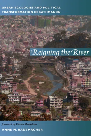 eBook - PDF
Reigning the River
Urban Ecologies and Political Transformation in Kathmandu
- Anne Rademacher(Author)
- 2011(Publication Date)
- Duke University Press Books(Publisher)
Any concept of nature is, in fact, “produced through the interaction of biophysical processes that have a life of their own and human dis-turbance of the biophysical” (Sivaramakrishnan 1992:282). Thus, na-ture is conceived out of this interaction between the human and the biophysical. Sivaramakrishnan continues, “Human agency in the en-vironment, mediated by social institutions, may flow from cultural representations of processes in ‘nature’ but we cannot forget the ways in which representations are formed in lived experience of so-cial relations and environmental change” (ibid.). Understanding how biophysical constraints and social imaginings converge on a given landscape, then, is fundamental to studying ecology as the sets of ex-perience and action (Peet and Watts 1996; Redclift and Benton 1994) that I will call “ecology in practice” within this book. In this book, I outline the biophysical contours of river degradation (chapter 3), but I focus on the range of social processes through which they were fashioned and engaged as an ecological problem situated in time and place. My intention here is to underline that the river-scape—a facet of urban nature—was produced at a nexus of cultural and biophysical processes, and to illuminate the social dimensions of this nexus. To do this, I pay attention to differently positioned actors A Riverscape Undone 17 involved in river change and to the ways that they defined, understood, and represented that change as problematic. I focus on competing claims about the stakes of river transformation and on assertions about the sociopolitical formations that would best facilitate river res-toration. In short, I ask, what did river degradation and restoration mean for different people during a specific political moment? A city in crisis Nepal’s capital city is located in the Kathmandu Valley, an area con-tiguous with the 600-square-kilometer Upper Bagmati Basin, which drains the Bagmati and Bishnumati rivers. eBook - PDF
- Ashley Kent(Author)
- 2000(Publication Date)
- SAGE Publications Ltd(Publisher)
INTRODUCTION AND BACKGROUND This chapter is based on seminar papers given at the Institute of Education, University of London as part of the Progress in Geography: Changing Viewpoints module for the MA Geography in Education. The changing nature of physical geography over the last century is briefly considered as a context for a more detailed examination of the changes in one area of applied physical geography, the management of river systems. The central role that physical geographers, mainly geomorphologists, have played in changing, first, ideas and, second, actual working practices in river management, is highlighted. There have been some dramatic advances since the early 1970s and new ideas and practices continue to develop as more information becomes available about the nature and functioning of river environments. One particularly exciting new area is the development of ideas and approaches for restoring river systems which have been adversely affected by hard engineering schemes. THE (CHANGING) NATURE OF PHYSICAL GEOGRAPHY In 1985 K.J. Gregory published The Nature of Physical Geography which provided a survey of physical geography and could be treated as a companion text to R.J. Johnston’s (1983) Geography and Geographers: Anglo-American Human Geography since 1945, although Gregory’s book began with the period 1851–1950. Arguably, physical geography has not been so obviously affected by several paradigms and a brief insight into its changing nature can be provided by considering some of the key chapters in The Nature of Physical Geography (see Table 3.1) The themes of ‘Conservation and Environment’ and of applied research (‘Advancing Application’) are particularly relevant to any discussion of developments in river management. eBook - PDF
- Chris Perry, Kevin Taylor, Chris Perry, Kevin Taylor(Authors)
- 2009(Publication Date)
- Wiley-Blackwell(Publisher)
3.1 INTRODUCTION Rivers are arteries for the transport and storage of physically and chemically weathered material from continents, through estuaries, and ulti-mately to oceans; they thus play a major role in the Earth’s biogeochemical cycling of materials, and influence the Earth’s climate. Rivers are found in every corner of the world, and in every climatic zone. Both natural processes and anthro-pogenic exploitation of natural resources from prehistoric times through to the present day have, however, had a very significant impact on the hydrology, sediment regime and contamination of rivers world-wide. During the Quaternary, for example, river systems have experienced con-siderable natural hydrological variability due to deglaciation and sea-level change, and human activity has left very few rivers in a pristine state, except perhaps for some in Canada, Amazonia, the Congo Basin and Siberia (Meybeck 2003). This chapter describes the nature of fluvial sedimentary environments, types and sources of sediments in these environments, processes and impacts of natural and anthropogenic disturbance events on river sediment fluxes and effects, man-agement of fluvial sedimentary environments and, finally, issues concerning fluvial environments that need to be addressed in the future. The chap-ter draws on the voluminous fluvial geomor-phological, sedimentological, environmental and archaeological literature. For further informa-tion, the reader is referred to this literature, and to the many excellent books and book chapters on fluvial sedimentary environments, and the background information and references contained therein (Richards 1982; Brown 1997; Thorne 3 Fluvial environments Karen Hudson-Edwards et al. 1997; Benito et al. 1998; Knighton 1998; Leeder 1999; Miller & Gupta 1999; Bridge 2003). This chapter summarizes, updates and builds on this work, and, specifically, highlights the ever increasing effects of anthropogenic activity on sedimentation in rivers. eBook - ePub
Cultural Landscapes of Post-Socialist Cities
Representation of Powers and Needs
- Mariusz Czepczynski(Author)
- 2016(Publication Date)
- Routledge(Publisher)
Shaw and Oldfield 2007 ).In the mid 20th century, in the Soviet Union, distinct dimensions of landscape studies had been developed with geography. Landscape science or in Russian landshaftovedenie (literarily: landscapology) came from the German tradition of Landschaftskunde and is related to contemporary regional physical geography. The immense territory of Soviet Union and its enormous physical differentiation, as well as ideological limitation of social and cultural research, focused geographical and landscape studies on ‘natural-territorial complexes’, also called as landscapes. This ‘territorial or aquatorial natural complex’ was defined asa part of territory or water reservoir limited by conventional vertical borders according to relative homogeneity and horizontal borders based on obsolescence of the factor used to defined that complex. (Armand 1975 , 18)The concept of landscape as natural complex was initiated by zoologist Lev S. Berg (1876–1950) by his research on natural zones, and later intensely investigated by numerous Soviet geographers, including Stanislav V. Kalesnik, David L. Armand and many others. For Berg landscapes are law-governed, repetitive groupings, not only of forms of relief, but also of other objects and phenomena on the earth’s surface. A geographical landscape is that combination in which the peculiarities of relief, climate, water, soil, vegetation and fauna, and to a certain degree human activity, blend into a single harmonious whole, typically repeated over the extent of the given zone of the earth (Shaw and Oldfield 2007 ). Detailed typologies and classifications, as well as a mathematical model, had been developed to analyze and categorize a variety of complex, predominately natural landscapes. Landscape zone was widely considered as the main natural system operating on earth, which included atmosphere, hydrosphere, lithosphere and biosphere. Sometimes, landscape was replaced with the term geocomple eBook - PDF
- Murat Özyavuz(Author)
- 2013(Publication Date)
- IntechOpen(Publisher)
Classification can be based on a number of attributes related to natural or anthropogenic differences in watersheds. Natural features include climate, physiography, soils, nutrient productivity, watershed size and connectivity to other aquatic ecosystems. Anthropogenic features are primarily related to land use and include land-use types (urban, agriculture, forest), the degree of hydrologic disturbance and imperviousness, water withdrawals, water quality, in stream habitat conditions, and riparian integrity (Page, et al., 1999). Advances in Landscape Architecture 114 Climate, hydrology, and geomorphology are physical template to shape forces of ecosystems. The three elements of the physical template and other factors also interact significantly in determining the structure and composition of a watershed and its biotic communities. As a result of different combinations of these formative processes, different types of watersheds are created (O’ Keefe et al., 2012). Besides watersheds are continually changing and evolving. Some changes are natural, or are accelerated by human activities. A watershed contains information about all the things happening and lands use history within it (Anonymous, 2012d). Because of that watersheds are frequently used to study and manage environmental resources because hydrologic boundaries define the flow of contaminants and other stressors (O’ Keefe et al., 2012). Each part of a watershed is unique, even though the characteristics of any watershed are similar. All watersheds flow from headwaters to outlets, eventually ending in an ocean. As the water flows, it passes through many parts. And like the parts of a puzzle, if one happens to be damaged, the result affects the whole picture (Anonymous, 2012d). The watersheds are complex ecosystems in which land use, surficial geology, climate, and topography are interrelated with biological components such as vegetation communities (Page, et al., 1999). eBook - PDF
Resilience and the Cultural Landscape
Understanding and Managing Change in Human-Shaped Environments
- Tobias Plieninger, Claudia Bieling(Authors)
- 2012(Publication Date)
- Cambridge University Press(Publisher)
The cultural landscape concept The term cultural landscape has been used with many different mean- ings (Jones, 2003; Head, Chapter 4). Basically, four types of meanings can be distinguished (see the similar distinctions in Jones, 2003 and UNESCO, 2008; for the different meanings of landscape see Kirchhoff and Trepl, 2009; Kirchhoff et al., 2012; Olwig, 1996; Thompson, 2008). The first meaning of cultural landscape is not related to values while the others refer to specific values: (1) every landscape that has been (perceptibly) modified by human cultural activity; (2) landscapes shaped by traditional forms of land use that are valued as putatively representing the result of a harmonious and unique human–nature relationship (see UNESCO’s category (ii): ‘organically evolved landscape’); (3) landscapes designed and created intentionally by humans, such as parkland landscapes constructed for aesthetic reasons (UNESCO’s category (i)); (4) landscapes that are cultural just because aesthetic, cultural or spiritual meanings have been attached to them, irrespective of whether they have been (perceptibly) modified by human activity (UNESCO’s category (iii): ‘associative cultural landscape’). In the following, we limit ourselves to the analysis of meaning (2) because we want to show that the resilience approach to social–ecological systems shares basic presumptions and ideals about the human–nature relationship with this cultural landscape concept. Meaning (2) represents the original 1 meaning of the cultural landscape concept that has been fundamental – and, especially in Europe, is still influential – in the context of cultural and natural heritage protection, landscape planning and environmental management. The original cultural landscape concept was developed as the basis of the paradigm of classical modern geography by Carl Ritter (1817/18). eBook - PDF
Epigenetic Landscapes
Drawings as Metaphor
- Susan Merrill Squier(Author)
- 2017(Publication Date)
- Duke University Press Books(Publisher)
Although their CHAPTER 5 The River in the Landscape 130 — Chapter 5 fields were very different, the two men shared several qualities: voracious intellectual curiosity, frustration with the intellectually narrowing force of disciplinarity, and an interest in landscape that connected the embryonic cell to the ecosystem. 1 In this chapter and the next, I explore how the po-tential that Waddington saw in the epigenetic landscape was taken up by McHarg and the practitioners of landscape theory and design who came after him, who have used it as their intellectual and pragmatic influ-ence. My focus moves from McHarg’s scientistic, ecologically informed landscape architecture of the 1960s and 1970s through the resurgence of art and design in the 1990s and the 2000s to the contemporary land-scape theory of Elizabeth K. Meyer and the nonlinear, process-based work of landscape theorists and architects Anuradha Mathur and Dilip da Cunha. A river can be a metaphor for the way science—most broadly construed— can shape social reality through the ongoing, reflexive process of ho-meorhesis. Fleck (1986 [1929], 54) put it well: “Natural science is the art of shaping a democratic reality and being directed by it—thus being reshaped by it. It is an eternal, synthetic rather than analytic, never- ending labour—eternal because it resembles that of a river that is cutting its own bed.” We will come to the river as a metaphor not only for natu-ral science but also for social relations by and by, but we begin with a much more realistic image: John Piper’s drawing of a river flowing down a valley between increasingly steep and canyon-like banks. This landscape image enacted Waddington’s understanding that the processes of flow and deflection, flux and change are fundamental to every living system. A developing being stays stable even as it changes .
Index pages curate the most relevant extracts from our library of academic textbooks. They’ve been created using an in-house natural language model (NLM), each adding context and meaning to key research topics.