Geography
River Processes
River processes refer to the natural activities that shape and change the course of a river. These processes include erosion, transportation, and deposition. Erosion occurs when the river wears away the land, transportation involves the movement of eroded material downstream, and deposition occurs when the river deposits the material it is carrying. These processes play a crucial role in shaping the landscape and creating landforms.
Written by Perlego with AI-assistance
Related key terms
1 of 5
6 Key excerpts on "River Processes"
 eBook - PDF
- James Petersen, Dorothy Sack, Robert Gabler, , James Petersen, James Petersen, Dorothy Sack, Robert Gabler(Authors)
- 2021(Publication Date)
- Cengage Learning EMEA(Publisher)
473 17 FLOWING WATER IS MORE INFLUENTIAL in shaping the surface form of our planet than any other exogenic geomorphic process, primarily because of the sheer number of streams on Earth. Through erosion and deposition, water flowing downslope over the land surface, particularly when concentrated in channels, modifies existing landforms and creates others. Nearly every region of Earth’s land surface in arid as well as humid climates exhibits at least some topography that has been shaped by the power of flowing water, and many regions exhibit considerable evidence of stream action. Polar landscapes buried under thick accumulations of perennial ice are the major exception to Earth’s extensive areas of stream-dominated topography. The study of flowing water as a land-shaping process, together with the study of the resulting landforms, is fluvial geomorphology (from Latin: fluvius, river). Fluvial geomorphology includes the action of channelized and unchannelized flow moving downslope because of the pull of gravity. Stream is the general term for natural, channelized flow. In the Earth sciences, the word stream pertains to water flowing in a channel of any size, even though in general usage we refer to large streams as rivers and use local terms, such as creek, brook, run, draw, and bayou, for smaller streams. The land between adjacent channels in a stream-dominated landscape is the interfluve (from Latin: inter, between; fluvius, river). Because of the common and widespread occurrence of stream systems and their key role in providing freshwater for people and our agricultural, industrial, and commercial activities, a substantial portion of the world’s population lives in close LEARNING OBJECTIVES WHEN YOU COMPLETE THIS CHAPTER YOU SHOULD BE ABLE TO: 17.1 Describe how surface runoff is generated. 17.2 Explain how stream systems are organized and ordered within drainage basins. 17.3 Relate how the amount of water flowing in a stream channel is determined.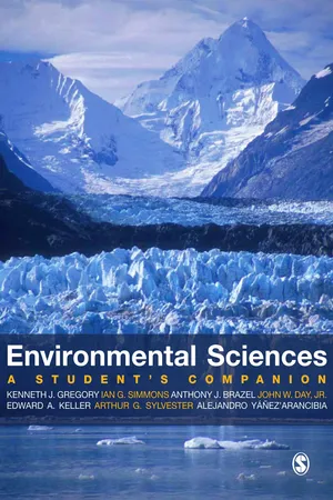 eBook - PDF
Environmental Sciences
A Student′s Companion
- K J Gregory, Ian Simmons, Anthony Brazel, John W Day, Edward A Keller, Alejandro Yanez-Arancibia, Arthur G Sylvester(Authors)
- 2008(Publication Date)
- SAGE Publications Ltd(Publisher)
(Cont'd) 236 Processes and Dynamics as karst processes exclusive to limestone terrain, and some processes such as subsidence can occur in periglacial environments or be the result of tectonic processes. All processes can be envisaged as involving expenditure of energy acting on materials (rock and solids, water, air, organic materials) to produce products which can include landforms, soil profiles or vegeta-tion types. Several processes may be grouped together, especially when studying them in terms of basic laws, so that the principles of fluid flow and fluid mechanics apply to fluvial, coastal, aeolian and glacial processes. Throughout environmental sciences, data is required on Earth surface processes and some is collected by national and international organizations such as hydrological and oceanographic data. In addition data is obtained in the course of national surveys for example of soil types or from vegetation surveys. However if data is not already available it can be obtained empirically by field measurements often through carefully designed experiments such as experimental areas or by remote sensing; by laboratory investigations which include scaled down environ-mental models, of a section of coast for example; and by historical techniques, which use a method of deducing change over time from records or archive materials, such as historical maps of the position of a glacier margin at different dates. Earth surface processes are combined in particular ways in different environments and so process domains are zones in which particular processes operate. Some processes such as glacial processes are confined to particular zones whereas others such as fluvial, aeolian and mass wasting can occur in most regions of the world. eBook - PDF
- James Petersen, Dorothy Sack, Robert Gabler, , James Petersen, Dorothy Sack, Robert Gabler(Authors)
- 2014(Publication Date)
- Cengage Learning EMEA(Publisher)
Fluvial Processes Stream Erosion Fluvial erosion is the removal of rock material by flowing water. Fluvial erosion consists of the chemical removal of ions from rocks and the physical removal of rock fragments (clasts). Physical removal of rock fragments includes breaking off new pieces of bedrock from the channel bed or sides and moving them as well as picking up and removing preexisting clasts that were temporarily resting on the channel bottom. The removal of rock material by erosion does not necessar-ily mean that the landscape is undergoing long-term lowering. If sediments eroded from the bed of a stream channel are replaced by the deposition of other fragments transported in from upstream, there will be no net drop in the position of the chan-nel bottom. Such lowering, known as channel incision, occurs only when there is net erosion compared to deposition. Net ero-sion results in the lowering of the affected part of the landscape and is termed degradation . Net deposition of sediments results in a building up, or aggradation , of the landscape. One way that streams erode occurs when stream water chemically dissolves rock material and then transports the ions away in the flow. This fluvial erosion process, called corro-sion , has only a limited effect on many rocks but can be sig-nificant in certain rock types, such as limestone. Suspension Saltation Traction © Cengage Learning ■ FIGURE 14.13 Transportation of solid load in a stream. Clay and silt particles are carried in suspension. Sand typically travels by suspension and saltation. The largest (heaviest) particles move by traction. What is the difference between traction and saltation? Copyright 2013 Cengage Learning. All Rights Reserved. May not be copied, scanned, or duplicated, in whole or in part. Due to electronic rights, some third party content may be suppressed from the eBook and/or eChapter(s). eBook - PDF
Gravel Bed Rivers
Processes, Tools, Environments
- Michael Church, Pascale Biron, Andre Roy, Michael Church, Pascale Biron, Andre Roy(Authors)
- 2012(Publication Date)
- Wiley(Publisher)
River stability and response to changing envi-ronmental conditions are highly dependent on local context (channel type and associated degrees of freedom; the nature of the imposed sediment, hydrologic, and vegetation regimes; imposed anthropogenic constraints; and the legacy of past natural and anthropogenic disturbances). Understanding the processes responsible for channel change and assessing river stability has long been of interest to geologists and engineers (Gilbert, 1877; du Boys, 1879; Davis, 1889; Lindley, 1919; Shields, 1936; Lane, 1937; Mackin, 1948; Leopold and Maddock, 1953; Schumm, 1969). Over the last several decades, interest in this topic has grown exponentially as a result of envi-ronmental legislation that has spurred greater interdis-ciplinary collaboration amongst physical and biological scientists studying riverine ecosystems and watershed processes. During this time, considerable progress has been made in understanding channel response and in elucidating biophysical interactions. For example, progress has been made in understanding textural and structural response of gravel streambeds and consequent effects on bed mobility (Dietrich et al ., 1989; Church et al ., 1998; Wilcock, 1998; Buffington and Montgomery, 1999a; Nelson et al ., 2009) that, in turn, affect the availability of riparian and aquatic habitats (Lisle, 2005; Burke et al ., 2006; May et al ., 2009; Moir et al ., 2009). Sediment routing models have been devel-oped for examining a wide range of responses, including textural adjustment, reach-scale changes in sediment storage and channel slope, changes in channel width and planform, effects of sediment pulses, and landscape evolution (Hoey and Ferguson, 1994; Nicholas et al ., 1995; Benda and Dunne, 1997a, 1997b; Cui and Parker, 2005; Coulthard et al ., 2008; Parker et al ., 2011; Mosselman, Chapter 9, this volume). eBook - ePub
River Ecosystem Ecology
A Global Perspective
- Gene E. Likens(Author)
- 2010(Publication Date)
- Academic Press(Publisher)
Figure 7 ). The growth of aquatic plants and algae in flooded areas may also augment terrestrial resources if the duration of flooding is sufficiently long and light-temperature conditions are favorable. Temperate rivers also experience periodic floods although these are typically of shorter duration and occur during periods when water temperature is low (e.g., in association with winter rains or spring snowmelt). The three models differ by their emphasis on longitudinal transport of terrestrial organic matter (RCC), autochthonous production within the channel (RPM) and floodplain resources (FPC). They share the common view that an appreciation of river hydrogeomorphology is central to understanding variations in the quantity and quality of food resources and, in turn, the energetic efficiency of river foods webs.Figure 7 7 Inundation of the floodplain near a tributary of the Amazon River (Rio Unini). In many rivers, flood events follow a regular annual cycle to which riverine organisms and riparian communities are adapted. Flooding allows access by river organisms to terrestrial food resources in inundated areas. Photo by A. AufdenkampeGlobal Biogeochemical Cycling
Rivers account for only a small proportion of land area worldwide but play an important role in regional and global biogeochemical cycles. Rivers are the principal means by which terrestrial-derived materials are transported to the ocean. Over 90% of the earth’s landmass is drained by rivers; the 100 largest rivers drain 65% of global land area. Rivers are the most powerful erosive force on the planet, substantially modifying landscape features and transporting 20 gigatons of sediment to the coastal margin annually. The input of dissolved and particulate organic carbon from rivers is sufficient to account for the estimated replacement times of oceanic dissolved organic carbon (ca. 4000–6000 year). Much progress has been made in recent years to assess material export from rivers, but few studies have examined within-River Processes and their significance in regional and global biogeochemical cycles. Work by Jeff Richey and his colleagues has shown that waters of the Amazon release 13 times more carbon through out-gassing (evasion) of respired CO2 eBook - PDF
- G. Mathias Kondolf, Hervé Piégay(Authors)
- 2016(Publication Date)
- Wiley-Blackwell(Publisher)
Geological Society of America Bulletin 95: 1093–1101. Osterkamp, W.R. and Hupp, C.R. 2010. Fluvial processes and vegetation – glimpses of the past, present and future: Geomorphology 116: 274–285. Osterkamp, W.R., Hupp, C.R. and Stoffel, M. 2012 The interactions between vegetation and erosion: new directions for research at the interface of ecology and geomorphology. Earth Surface Processes and Landforms 37: 23–36. Patterson, G.G., Speiran, G.K. and Whetstone, B.H. 1985. Hydrology and Its Effects on Distribution of Vegetation in Congaree National Vegetation as a tool in the interpretation of fluvial geomorphic processes and landforms 231 Monument, South Carolina, US Geological Survey Water-Resources Investigations Report 85-4256 , Washington, DC: US Government Printing Office, 40pp. Pautou, G. 1984. L’organisation des forêts alluviales dans l’axe rhodanien entre Genève et Lyon; comparaison avec d’autres systèmes fluviaux. Documents de Cartographie Ecologique 27: 43–64. Pautou, G. and Arens, M.-F. 1994. Theoretical habitat templets, species traits and species richness: floodplain vegetation in the Upper Rhône River. Freshwater Biology 31: 507–522. Peiry, J.-L., Salvador, P.-G. and Nouguier, F. 1994. L’incision des rivières dans les Alpes du Nord: état de la question. Revue de Géographie de Lyon 69: 47–56. Petts, G.E. and Bravard, J.P. 1996. A drainage basin perspective. In: Petts, G.E. and Amoros, C., eds., Fluvial Hydrosystems , London: Chapman & Hall, pp. 13–35. Phillips, J.D. 2009. Biological energy in landscape evolution. American Journal of Science 309: 271–289. Phipps, R.L. 1983. Streamflow of the Occoquan River in Virginia as reconstructed from tree-ring series. Water Resources Bulletin 19: 735–743. Pickett, S.T.A. 1980. Non-equilibrium coexistence of plants. Bulletin of the Torrey Botanical Club 107: 238–248. Piégay, H. and Gurnell, A.M. 1997. Large woody debris and river geo-morphological pattern: examples from S.E.
Index pages curate the most relevant extracts from our library of academic textbooks. They’ve been created using an in-house natural language model (NLM), each adding context and meaning to key research topics.