Geography
Depositional Landforms
Depositional landforms are physical features on the Earth's surface formed by the deposition of sediment by wind, water, or ice. These landforms include deltas, sand dunes, beaches, and alluvial fans, and are created through the accumulation and settling of eroded material. They play a crucial role in shaping the Earth's landscapes and are often associated with the processes of erosion and sedimentation.
Written by Perlego with AI-assistance
Related key terms
1 of 5
11 Key excerpts on "Depositional Landforms"
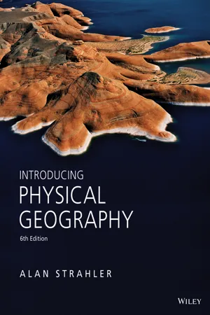 eBook - PDF
- Alan H. Strahler(Author)
- 2013(Publication Date)
- Wiley(Publisher)
The sediment is finally deposited downstream, where it build ups into plains, levees, fans, and deltas. Waves, glacial ice, and wind also shape unique landforms, but these processes are restricted to certain areas on the globe, as we will see in later chapters. The landforms shaped by the progressive removal of bedrock are called erosional landforms . Fragments of soil, regolith, and bedrock that are removed from the parent rock mass are transported and deposited elsewhere, where they take shape as an entirely differ- ent set of surface features—the Depositional Landforms (Figure 15.1). SLOPE EROSION Fluvial erosion starts on the uplands as soil erosion. When raindrops hit bare soil, their force lifts soil particles, which fall back into new positions, causing splash ero- sion (Figure 15.2). A torrential rainstorm can disturb as much as 225 metric tons of soil per hectare (about 100 U.S. tons per acre). On a sloping ground surface, splash erosion shifts the soil slowly downhill. The soil surface also becomes much less capable of absorbing water. This important effect occurs because the natural soil openings ost of the landforms we see around us are sculpted by running water as it erodes, trans- ports, and deposits sediment. What causes slopes to erode, and what happens to eroded particles? How do streams build their beds and wear away their banks? How do stream valleys evolve over time? Under what conditions do streams form floodplains and meanders? These are some of the questions we will answer in this chapter. 500 Landforms Made by Running Water M AirPhoto-Jim Wark Steve Winter/NG Image Collection 15.1 Erosional and Depositional Landforms Erosion, Transportation, and Deposition 501 Alaska Stock Images/NG Image Collection become sealed by particles shifted by raindrop splash. Thus, water cannot infiltrate the soil as easily, so a much greater depth of overland flow can be triggered from a smaller amount of rain. eBook - PDF
- Vijay K. Sharma(Author)
- 2010(Publication Date)
- CRC Press(Publisher)
River deltas are a geomorphic feature of fluvial deposition partly on land and partly in adjacent water bodies of sizable extent. The delta surface represents pro-cess-differentiated upper, intermediate, and distal zones of sedimentation of fluvial, tidal, and wave environments, respectively. The shape and size of river deltas depend on the area of contributing drainage, extent of distributary development, manner of channel avulsion, size and depth of coastal waters, tectonic aspects of the continental shelf, wave, tide, and fluvial influences, and density characteristics of stream water and those of the basin of sedimentation. REFERENCES Allen, J. R. L. 1965. A review of the origin and characteristics of alluvial sediments. Sedimentology 5:89–191. Allen, J. R. L. 1978. Studies in fluviatile sedimentation: An exploratory quantitative model for the architecture of avulsion-controlled alluvial suites. Sedimentary Geol. 21:129–47. Allen, P. A., and Allen, J. R. 1990. Basin analysis: Principles and applications . Oxford: Blackwell Scientific Publications. Ashmore, P. 1993. Anabranch confluence kinetics and sedimentation processes in gravel-braided streams. In Braided rivers , ed. J. L. Best and C. S. Bristow, 129–46. Geological Society Special Publication 75. Geological Society. Beaumont, P. 1972. Alluvial fans along the foothills of Elburez Mountains, Iran. Palaeoecol. Palaeogeogr. Palaeoclimat. 12:251–73. Fluvial Processes and Depositional Landforms 167 Bhattacharya, S. K. 1973. Deltaic activity of Bhagirathi-Hooghly River system. J. Wtrwy. Harb. Coast. Eng. 99:69–87. Blair, T. C., and McPherson, J. C. 1994. Alluvial fan processes and landforms. In Geomorphology of desert environments , ed. A. D. Abrahams and A. J. Parsons, 354– 402. London: Chapman & Hall. Blissenbach, E. 1954. Geology of alluvial fans in semi-arid regions. Bull. Geol. Soc. Am. 65:175–90. Brakenridge, G. R. 1984. eBook - PDF
- James Petersen, Dorothy Sack, Robert Gabler, , James Petersen, James Petersen, Dorothy Sack, Robert Gabler(Authors)
- 2021(Publication Date)
- Cengage Learning EMEA(Publisher)
473 17 FLOWING WATER IS MORE INFLUENTIAL in shaping the surface form of our planet than any other exogenic geomorphic process, primarily because of the sheer number of streams on Earth. Through erosion and deposition, water flowing downslope over the land surface, particularly when concentrated in channels, modifies existing landforms and creates others. Nearly every region of Earth’s land surface in arid as well as humid climates exhibits at least some topography that has been shaped by the power of flowing water, and many regions exhibit considerable evidence of stream action. Polar landscapes buried under thick accumulations of perennial ice are the major exception to Earth’s extensive areas of stream-dominated topography. The study of flowing water as a land-shaping process, together with the study of the resulting landforms, is fluvial geomorphology (from Latin: fluvius, river). Fluvial geomorphology includes the action of channelized and unchannelized flow moving downslope because of the pull of gravity. Stream is the general term for natural, channelized flow. In the Earth sciences, the word stream pertains to water flowing in a channel of any size, even though in general usage we refer to large streams as rivers and use local terms, such as creek, brook, run, draw, and bayou, for smaller streams. The land between adjacent channels in a stream-dominated landscape is the interfluve (from Latin: inter, between; fluvius, river). Because of the common and widespread occurrence of stream systems and their key role in providing freshwater for people and our agricultural, industrial, and commercial activities, a substantial portion of the world’s population lives in close LEARNING OBJECTIVES WHEN YOU COMPLETE THIS CHAPTER YOU SHOULD BE ABLE TO: 17.1 Describe how surface runoff is generated. 17.2 Explain how stream systems are organized and ordered within drainage basins. 17.3 Relate how the amount of water flowing in a stream channel is determined. eBook - PDF
Physical Geography
Made Simple
- Richard H. Bryant(Author)
- 2013(Publication Date)
- Made Simple(Publisher)
However, rather than indicating a stage of erosion, valley shape is more safely regarded as a result of the factors that control slope and stream processes, namely climate, rock type, available relief and geological structure. Terraces are a landform contributing to valley shape and are usually the result of both erosion and deposition. Terraces may be benches cut in solid rock, but more frequently alluvial terraces are formed when a river erodes flood-plain sediments, previously deposited by itself. The river cuts into these deposits because of some environmental change, which in many cases is a climatic one affecting the stream's discharge. In other cases, near river mouths, terraces may have been built and cut in response to sea-level changes. Terrace sediments and morphology are often used as guides in interpreting the geo-morphological history of a region. Deposition A river deposits alluvium when, because of a decrease in energy, it is no longer competent to transport its load. This usually occurs because of a reduction in the gradient of the stream channel, but may also result from an increase in the calibre of the load, perhaps brought in by a tributary into the main stream, or by conditions of accelerated erosion upstream. The first debris to be deposited will be the largest calibre, succeeded downstream by finer material, while the very finest material may continue to be transported even although the river energy has been reduced. This sequence of sediment-ation is found in many of the depositional forms created by rivers. A flood-plain is the most common depositional feature created by all sizes of river, be they very large or just small brooks. The alluvium in a flood-plain is composed of several kinds of deposit. eBook - PDF
- James Petersen, Dorothy Sack, Robert Gabler, , James Petersen, Dorothy Sack, Robert Gabler(Authors)
- 2014(Publication Date)
- Cengage Learning EMEA(Publisher)
393 15 Arid Region Landforms and Eolian Processes :: Outline Surface Runoff in the Desert Water as a Geomorphic Agent in Arid Lands Wind as a Geomorphic Agent Sand Dunes Loess Deposits Landscape Development in Deserts Petrified Forest National Park in Arizona demonstrates how, by lacking a veil of thick soil and vegetation, arid lands highlight the beauty inherent in landforms and rocks, including fossilized wood. Scott Williams/NPS Copyright 2013 Cengage Learning. All Rights Reserved. May not be copied, scanned, or duplicated, in whole or in part. Due to electronic rights, some third party content may be suppressed from the eBook and/or eChapter(s). Editorial review has deemed that any suppressed content does not materially affect the overall learning experience. Cengage Learning reserves the right to remove additional content at any time if subsequent rights restrictions require it. C H A P T E R 1 5 • A R I D R E G I O N L A N D F O R M S A N D E O L I A N P R O C E S S E S 394 Surface Runoff in the Desert Landforms, rather than vegetation, typically dominate desert scenery. The precipitation and evaporation regimes of an arid climate result in a sparse cover of vegetation and, because many weathering processes require water, relatively low rates of weathering. Because of low weathering rates, insufficient vegetation to break the force of raindrop impacts, and a lack of extensive plant root networks to help hold rock fragments in place, a blanket of moisture-retentive soil cannot accumu-late on slopes. Soils tend to be thin, rocky, and discontinuous. This absence of a continuous vegetative and soil cover gives desert landforms their unique character. Under these surface conditions of very limited interception and low permeability, much of the rain that falls in the desert quickly becomes sur-face runoff available to perform fluvial geomorphic work. eBook - ePub
- Michael A. Summerfield(Author)
- 2014(Publication Date)
- Routledge(Publisher)
−1 , a rate comparable to fluvial denudation. (Modified from J. A. Mabbutt (1977) Desert Landforms, Australian National University Press, Canberra, Fig. 62, p. 212.)Large-scale bedrock grooving clearly visible on satellite imagery has been widely attributed to aeolian action. Such grooves are the major landform over a 90 000 km2 area on the south-eastern margin of the Tibesti Plateau in North Africa, and an aeolian origin is strongly suggested by the close match between the regional atmospheric circulation and their gently curving NE–SW trend. The grooves are between 0.5 and 1 km wide, several tens of kilometres long and are spaced 0.5–2 km apart. They are eroded into sandstone, and are generally assumed to have formed in a similar way to yardangs, that is, largely through a combination of wind abrasion and deflation. However, since they also follow the trend of bedrock lineations thought to have a tectonic origin, it is possible that winds may have been in part channelled along pre-existing lines of structural weakness once these had been initially excavated.10.3 Depositional Landforms
10.3.1 Basic depositional forms
Although capable of movement by surface creep and saltation, sand grains spend the vast majority of time in storage in sand accumulations which vary enormously in size and form. The smallest depositional features are calledripples and consist of regular, wave-like undulations orientated at right angles to the direction of the prevailing wind (Fig. 10.11 ). The dimensions of ripples increase with particle size, their heights ranging from 1 to 500 mm and wavelengths from 0.01 to 5 m. Dunes are much larger depositional forms having typical heights of 5 to 30 m and wavelengths of 50 to 300 m. Some dunes, however, attain even greater dimensions with heights of up to 400 m and wavelengths up to 4 km (Fig. 10.12 ). The termsdraa, ormegadune eBook - PDF
Characteristics of Geologic Materials and Formations
A Field Guide for Geotechnical Engineers
- Roy E. Hunt(Author)
- 2006(Publication Date)
- CRC Press(Publisher)
No delta forms when high-energy conditions carry away all but the coarser particles, which remain as spits and bars along the shoreline (see Section 3.4.3). Soil Formations: Geologic Classes and Characteristics 195 FIGURE 3.30 Stereo-pair of aerial photos at a scale of 1:20,000 covering a portion of the Cañada del Oro near Tucson, Arizona. The features of erosion and deposition at the base of mountain slopes in an arid climate are apparent. Upland topography is angular and rugged in the metamorphic rocks. The myriad of dry-drainage channels results from sheet erosion during flash floods. At this location, at the apex of an alluvial fan, the soils are predominantly coarse-grained and bouldery. Deltaic Deposits Deltaic deposits are characterized by a well-developed cross-bedding of mixtures of sands, silts, and even clays and organic soils. Delta formation requires that the river provide materials in such quantities that they are not removed by tides, waves, or currents. This requires either a low-energy environment with little water movement, or a river carrying tremendous quantities of material. The Mississippi delta (Figure 3.33 and Figure 3.34) and the Nile delta are located in low-energy environments. The locus of active deposition occurs outward from the distributary mouths forming the delta front complex. The front advances into the water body, resulting in a sheet of relatively coarse detritus, which thickens locally in the vicinity of channels. Seaward of the delta front is an area of fine clay accumulation, termed prodelta deposits. Over long peri-ods of time, deltas will shift their locations as shown in Figure 3.34. 196 Characteristics of Geologic Materials and Formations FIGURE 3.31 Topographic expression of a bajada dissected by the floodplain of a wash in an arid climate (Cañada del Oro, Tucson, Arizona; scale 1:24,000). (Courtesy of USGS.) FIGURE 3.32 ( Inset ) Terrace deposit of boulders, cobbles, gravel, and sand. eBook - ePub
- F.G.H. Blyth, Michael de Freitas(Authors)
- 2017(Publication Date)
- CRC Press(Publisher)
adobe , a yellowish calcareous clay. A particular feature to note is that loess has a tendency to lose strength and collapse if saturated. It may also flow like a liquid if violently disturbed as during a prolonged earthquake.The work of ice
A land surface whose topographical features have been fashioned by the action of rivers and atmospheric agents is considerably modified when it becomes covered by an ice-sheet or by glaciers. Valleys are deepened and straightened, rock surfaces smoothed by erosion, and when the ice melts away it leaves behind a variety of deposits which mark its former extent. The main features of these processes are discussed here, and glacial deposits formed during the Pleistocene glaciation when large ares of the British Isles, north-west Europe, North America and other northern lands were under a load of ice, are summarized.Ice is formed by compaction of snow in cold regions and at high altitudes, where the supply of snow exceeds the wastage by melting. In an intermediate stage between snow and ice the partly compacted granular mass is called neve. Ice of sufficient thickness on land will begin to move down a slope and such a moving mass is called a glacier. It may occupy a valley, as a valley glacier , of which many examples are found in the Alps, the Rockies, the Himalayas and other mountain regions; they are the relics of larger ice-caps (Fig. 3.37 ). Where several valley glaciers meet on low ground in front of a mountain range a piedmont glacier is formed, e.g. the Malaspina Glacier of Alaska. The accumulations of thick ice much larger than those of valley glaciers, constitute the ice-sheets , and cover great areas. The Greenland ice-sheet extends over about 1.73 × 10⁶ km2 ; drill cores have been obtained from the ice at depths up to 1400 metres. The Antarctic ice-sheet is more than six times greater in extent. Rock peaks protruding through an ice cover are called nunataks. When land ice meets the sea it begins to float and break up into icebergs eBook - ePub
- Richard J. Chorley, Stanley A. Schumm, David E. Sugden(Authors)
- 2019(Publication Date)
- Routledge(Publisher)
Figure 19.15 Glacial deposits at the southern end of Lake Michigan: A. moraines associated with fluctuations of the Lake Michigan lobe of the Laurentide ice sheet; B. proflle across some till sheets in northern Illinois; the location is shown in A.Sources: Frye and Willman, 1973, figure 1, p. 138; Wickham and Johnson, 1981, figure 3, p. 178.A further distinctive landscape of deposition is associated with the retreat of glaciers with their snouts ending in lakes or in the sea. In such a situation the moraine of a land ice margin is replaced by another distinct suite of landforms and sediments. Some of the main characteristics are summarized in Figure 19.18, which shows an active calving glacier in relatively shallow water. In this case a moraine bank is formed as the result of the melting out of debris from beneath, within and on top of the glacier. In addition, debris is dumped from icebergs as they calve from the glacier. Meltwater streams issuing from the base of the glacier build up coarse fans of debris at their exits from the glacier. If the meltwater is sufficiently loaded with suspended sediment, it may form an underflow and transport fine sand and mud well away from the glacier snout. Winter advances of the ice front can cause minor push ridges on the morainic bank, while the exits of the meltwater channels may change from year to year building up an overlapping sequence of deltas. Slumping and sediment gravity flows are common on the front of the slope, when angles are close to 20° or above. Iceberg-dropped debris (mud and dropstones) will occur away from the ice front.Figure 19.16 The glaciation of Finland and the north-western Soviet Union: A. streamlined drumlins and flutes (single lines); striae (arrows) and fluvioglacial deposits (black); B. flowlines of the active lobes during overall retreat.Source: Punkari, 1982.Such subaqueous deposition forms are common in glaciers retreating in fjord country like Alaska, Chile and Norway, and are often exposed above sea level by isostatic recovery. They are also common around the flanks of Hudson Bay and the Baltic Sea where ice retreat was intimately associated with sea calving and again where isostatic recovery has subsequently led to exposure. They are also common in former ice-marginal lakes. Such lakes were particularly common in North America as the ice retreated eastward from the high central plains. Indeed, between one-quarter and one-third of the land vacated by the Laurentide ice sheet was covered by pro-glacial lakes during ice retreat. eBook - PDF
Physical Geography
Great Systems and Global Environments
- William M. Marsh, Martin M. Kaufman(Authors)
- 2012(Publication Date)
- Cambridge University Press(Publisher)
Summary on Wind Erosion and Dune Forms: When wind erodes particles from soil and rock surfaces, it often leaves behind a curious array of forms and features with interesting names like lag, yardangs, and ventifacts. The particles themselves are entrained in the wind system, which then sorts them out according to size. Sand falls out first; silt later and farther away. From the sand, dunes may form that take on a variety of sizes (up to 400 meters high), shapes (includ- ing crescents and hairpins), and orientations (such as parallel and transverse), all depending more or less on sand supply, wind patterns, and geographic setting. 24.5 Global Distribution of Dune, Loess, and Related Wind Deposits Sand dunes are not the only active (moving) sand deposits in the world. In fact, active dunes make up only about 75 percent of Earth’s mobile sand deposits. The remain- ing area of shifting sand is covered mainly by thin blankets of sand called sheets and streaks. The volume of sand represented by sheets and streaks is relatively small, however, probably less than 10 percent of the global total. Like sand dunes, sheets and streaks are concentrated in the dry desert interiors and are easy to identify on satellite imagery such as that in Figure 24.27. Relict dunes: In addition to active ergs (dune, sheet, and streak deposits) there are vast areas of relict or stabilized sand deposits in arid and semiarid areas. Their total coverage is nearly equal to that of Earth’s active sand coverage. Most relict dunes are located in the humid parts of deserts and in grasslands near active ergs in Africa, Asia, and Australia (see the map in Figure 24.28). Their origin and distribu- tion can be traced to climate changes associated with the rise and fall of Pleistocene glaciations. During periods of glaciation, global climate became cooler and drier. Forests and grasslands declined and deserts, with sand dunes, advanced over vast areas. eBook - ePub
Glacial Geology
Ice Sheets and Landforms
- Matthew M. Bennett, Neil F. Glasser(Authors)
- 2011(Publication Date)
- Wiley(Publisher)
11: Landforms of Glacial Deposition in Water Glaciers that terminate in water (Figure 11.1) give rise to very different land-form assemblages than those found on land, although some of the processes and landforms that result are genetically similar. For example, push moraines form in glaciolacustrine and glaciomarine environments in the same way as those on land, and outwash fans develop in all environments. In this chapter we first examine the landforms associated with glaciolacustrine environments before describing those that form along ice margins terminating in marine environments. Figure 11.1 Calving glacier margin in Chile. [Photograph: P. Doyle]. 11.1 GLACIOLACUSTRINE LANDFORMS There is a wide variety of different types of glacial lake, although two broad types can be identified: those that form along an ice margin; and those that occur in a supraglacial setting. Ice-marginal lakes may form in front of glaciers or when ice dams water in a valley or against a hill side (see Figure 2.7). Supraglacial lakes can develop either where an ice-dammed lake expands over an ice margin (Figure 11.2) or in areas of complex ice-cored topography. The geomorphological products of these two categories of lake are different and will be considered in turn. Figure 11.2 Supraglacial lake submerging part of an ice margin in Greenland. Note the debris bands on the glacier surface formed by ice-marginal thrusting. [Photograph: N.F. Glasser]. There are two types of glacier-lake interface at ice-marginal lakes; those at which large fans or deltas form, separating the ice margin from the lake, and those at which the ice front is actively calving (Figure 11.3). At calving margins small fans and moraine banks tend to form depending on whether the ice margin is stationary and upon the amount of meltwater discharge. The development of large deltas is, for example, favoured by a stable ice margin with a high meltwater-sediment discharge
Index pages curate the most relevant extracts from our library of academic textbooks. They’ve been created using an in-house natural language model (NLM), each adding context and meaning to key research topics.