Geography
Hurricane Katrina
Hurricane Katrina was a powerful and destructive Category 5 hurricane that struck the Gulf Coast of the United States in August 2005. The storm caused widespread devastation, particularly in the city of New Orleans, due to flooding from breached levees. The event highlighted the vulnerability of coastal areas to extreme weather events and the importance of effective disaster preparedness and response.
Written by Perlego with AI-assistance
Related key terms
1 of 5
11 Key excerpts on "Hurricane Katrina"
 eBook - PDF
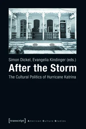
After the Storm
The Cultural Politics of Hurricane Katrina
- Simon Dickel, Evangelia Kindinger, Simon Dickel, Evangelia Kindinger(Authors)
- 2015(Publication Date)
- transcript Verlag(Publisher)
Natural Hazards, Human Vulnerability: Teaching Hurricane Katrina Through Literary Nonfiction P HILIPP S IEPMANN With regard to Hurricane Katrina, the American geographer Neil Smith claims that “there is no such thing as a natural disaster” (2006: n.p.). His statement seems controversial, if not even cynical, in the light of the destruction the Category 5 hurricane left behind in late August 2005. In total, Katrina took more than 1800 lives, injured thousands, damaged or destroyed more than 800.000 houses and caused overall costs of 160 billion USD (cf. URI 2014). What else could Hurricane Katrina be but a natural disaster? Smith, however, explains that “[i]n every phase and aspect of a disaster – the contours of disaster and the difference between who lives and who dies is to a greater or lesser extent a social calculus” (ibid.). Indeed, the impact of Hurricane Katrina affected the lower-class population of New Orleans and the state of Louisiana much more severely than the middle and upper classes, and once more revealed the deep-rooted racial disparities in the southeastern United States. Hurricane Katrina is a powerful reminder that even industrialized societies are vulnerable to humanitarian crises triggered by natural events, and serves as an example of how today’s ecological challenges are interconnected with social and cultural concerns. As environmental issues like meteorological hazards become a core element of the cross-curricular pedagogical agenda of global education in schools across the world (cf. Cates 2002), teaching Hurricane Katrina can foster students’ awareness of the human dimension of apparently ‘natural’ disasters. Approaching the topic of this volume from a pedagogical vantage point, I will propose a concept for teaching the sociocultural implications of Hurricane Katrina which links environmental education to cultural studies. This concept was originally developed for EFL (English as a foreign language) and geography No longer available |Learn more
Natural Hazards
Earth's Processes as Hazards, Disasters, and Catastrophes
- Edward A. Keller, Duane E. DeVecchio, John Clague, Edward Keller, Duane DeVecchio(Authors)
- 2016(Publication Date)
- Routledge(Publisher)
Chapter 11 Hurricanes and Extratropical Cyclones▶ Hurricane KatrinaSatellite image of Hurricane Katrina heading north toward landfall on the Mississippi Delta near Buras, Louisiana. Spiralling rain bands of the storm fill the entire eastern Gulf of Mexico from southwestern Louisiana on the left to the west coast of Florida on the right. A large, well-developed eye marks the centre of the hurricane, which had a Category 5 intensity at the time this infrared image was taken by NOAA’s GOES-12 satellite on Sunday, August 25, 2005. (NASA/Goddard Space Flight Center Scientific Visualization Studio)Cyclones, including hurricanes and their mid-latitude relatives—extratropical cyclones—are the most powerful storms on Earth and among the most deadly and costly of natural hazards. Hurricane Katrina alone was one of the most expensive natural disasters in history. Understanding how these storms work helps us appreciate the threat they pose to our highly technological society. As our climate changes and sea level rises, the threat these storms pose will increase. Yet, coastal populations in areas vulnerable to hurricanes continue to grow. As Hurricane Katrina and Hurricane Sandy demonstrated, choices made by individuals and governments can turn an “act of God” into an “act of man.” Your goals in reading this chapter should be to- ■ Understand the weather conditions that create and sustain cyclones
- ■ Know what geographic regions are at risk from hurricanes and extratropical cyclones
- ■ Recognize links between cyclones and other natural hazards
- ■ Know the benefits that cyclones provide
- ■ Understand adjustments that can be taken to minimize damage and injury from cyclones
- ■ Know the prudent actions to take when a hurricane watch or warning is issued
Hurricane Katrina
Unlike the huge lateral blast from Mount St. Helens volcano in 1980, which surprised many scientists and public officials, scientists had predicted the flooding of New Orleans by a major hurricane for decades. As David Brooks of the New York Times later wrote, “Katrina was the most anticipated natural disaster in American history.”1
- Rick Bissell, Steven Jensen, Shirley Feldman-Jensen(Authors)
- 2013(Publication Date)
- CRC Press(Publisher)
1 CHAPTER 1 What Is a Catastrophe, and Why Is This Important? Rick Bissell When Hurricane Katrina slammed ashore near New Orleans in August 2005, it was bad news for millions of residents of the Gulf coast. Some 1,200 to 3,500 people lost their lives in the storm and related flooding, and many thousands more sustained injuries. 1 Hundreds of thousands had to evacuate their homes, often to places hundreds of miles away, and then many of those could not return to destroyed homes, neighborhoods, and businesses. Houston, Texas and many other communi-ties around the country absorbed “Katrina refugees,” often at great cost and dis-comfort. Motorists in most of the United States found themselves paying higher prices for gasoline due to compromised pumping and refining facilities in the CONTENTS Definitions .................................................................................................................. 4 Continuum of Magnitude ........................................................................................... 6 Historic Examples of Catastrophes ............................................................................ 7 Middle Ages Black Plague .................................................................................... 7 Little Ice Age in Europe ........................................................................................ 9 Irish Potato Famine ............................................................................................. 10 The 1918–1919 Influenza Pandemic .................................................................... 12 Hurricanes Katrina and Rita ............................................................................... 13 Potential Future Catastrophes .................................................................................. 16 Sea Level Rise .....................................................................................................
- John W. Frazier, Joe T. Darden, Norah F. Henry, John W. Frazier, Joe T. Darden, Norah F. Henry(Authors)
- 2010(Publication Date)
- SUNY Press(Publisher)
It is within this unique backdrop — a landscape of cultural amalgamation and racial antagonism, of communal solidarity and class hegemony, of Southern hospitality and deep-seated mistrust and corruption, of rich cultural traditions and profoundly entrenched concentrated poverty — that the drama of Hurricane Katrina unfolded. Hurricane Katrina in New Orleans “The situation, over the week, went from frightening, to desperate, to indescribably brutal and sad and fi- nally to incomprehensible.” (Piazza 2005, p. xiii) The “Katrina experience” will be considered the period in New Orleans from Sunday, August 29 through Saturday, September 5, 2005 that included the impact of Hurricane Katrina, levee breeches, subsequent flooding, and the response paralysis. Piazza provides a vivid, heart-rending description. 154 Lisa R. Rawlings “Women who were raped in the chaos that the government was so slow to recognize and take steps to stop, people whose lives ended on a sidewalk where their bodies lay uncovered for days rotting in the hot sun, or trapped and drowned by rising flood waters in their own attics, and the people who saw all that, who smelled all that, even as they were sustaining their own traumas, people who walked through streets crying, holding on to small children, or who swam through oil-slicked, sewage-filled water, unsophisti- cated people with no one to call and no idea where to go. And the lucky ones who were rescued, brought to the Superdome, where the roof blew off and the toilets overflowed and the food ran out and so did the medicine. Or were set down by the side of an interstate somewhere on the fringes of a city, or at the Con- vention Center next to rotting corpses, and eventually airlifted or bussed out to Red Cross camps in Iowa and Michigan and Missouri and Oklahoma.” (Piazza 2005, pp. 140–1) The Impacts of Hurricane Katrina Hurricane Katrina exacted a devastating toll on many areas of New Orleans. eBook - ePub
Disasters and Public Health
Planning and Response
- Bruce W. Clements, Julie Casani(Authors)
- 2016(Publication Date)
- Butterworth-Heinemann(Publisher)
WMO, 2015 ).Figure 14-2 Hurricane Katrina in the Gulf of Mexico on August 28, 2005. Photograph from U.S. National Oceanic and Atmospheric Administration (NOAA) .Figure 14-3 Tropical Cyclone Yasi as it approaches Queensland, Australia, on February 2, 2011. Photograph from the US National Aeronautics and Space Administration (NASA).The hazards associated with hurricanes are unique to each storm. Although associated hazards consistently include storm surge, flooding, high winds, and tornadoes, the predominant hazard for a given hurricane is not always predictable. This unpredictable nature is most apparent in the morbidity and mortality recorded for each storm. Though one storm may have deaths primarily attributed to drowning, another may have few drowning deaths and a large number of traumatic injuries due to high winds. Other storms have varying balances of both.Because most storms impact coastal areas, a primary factor in the loss of life from most hurricanes is the storm surge. Simply put, storm surge is water pushed ashore by the winds of a hurricane. Storm surge is worst near the eye of the storm and the size of the eye influences the amount of the storm surge as much as the severity of the storm. A “tighter” eye in a more severe storm can have less storm surge than a larger eye in a less severe storm. For example, a dome of water ranging from several feet to as high as 25 ft (nearly 8 m) builds and is pushed ashore as the hurricane makes landfall. The severity can be influenced by a number of factors. The intensity and speed of the storm determine the size of the water dome. The slope of the sea floor and the angle in which the storm hits the shoreline influence how much of the dome is carried ashore. In the Northern Atlantic, the storm rotates counterclockwise, making the right front quadrant of the storm at landfall the area with the greatest surge. The areas left of the eye at landfall have winds blowing toward the ocean, reducing the storm surge. In addition, if the sea floor has a gradual slope, the surge is likely to be far more severe than in areas where the sea floor has a shelf that can help block the surge. The astronomical tide is also an important factor. If the hurricane makes landfall during high tide, the storm tide will be that much deeper (Fig. 14-4 ). Because water weighs about 1700 pounds per cubic yard (1009 kg/m3 ), the rush of a storm surge is capable of leveling nearly any structure (NHC, 2015 eBook - ePub
Stress Testing the USA
Public Policy and Reaction to Disaster Events
- J. Short(Author)
- 2015(Publication Date)
- Palgrave Macmillan(Publisher)
He went on, “This could be the one.” 1 Early the next day, Saturday, August 27, the storm picked up even more energy as it crossed over unusually warm water in the Gulf. At 11 P.M. the same day, wind speeds of 115 miles were recorded, and 12 hours later at 11 A.M. on Sunday, August 28, wind speeds exceeded 170 mph. Katrina was now a full-fledged Category 5 hurricane, capable of inflicting enormous damage and ferocious harm to whatever was in its path, which in this case was the city of New Orleans. At 6:10 A.M. the next morning, Monday, August 29, the hurricane made landfall. Wind speed had dipped slightly although it was still at a destructive force of 145 mph. The resultant storm surge overwhelmed some of the levees that protected New Orleans. The first to go, at around 9 A.M., was the levee protecting the Lower Ninth Ward, the lowest-lying and poorest part of the city. Floodwaters soon reached up to 8 feet. By the afternoon, the 17th Street Canal was breached and 20 percent of the city was under water. By the next day 80 percent of the city was flooded and an estimated 1,000 people were killed, most of them drowned by the rapidly rising floodwater. Initially, the event was called a “natural disaster.” It is still described as such by those who designate it as the “nation’s costliest national disaster.” There is no such thing as a natural disaster. 2 To call something a natural disaster is to naturalize social outcomes. Extreme weather events become disasters through social arrangements, political structures, and economic systems. The disaster that befell New Orleans was not natural; it was neither inevitable nor unavoidable. It was the result of human actions. In this chapter I will identify three interconnected structural flaws revealed by the event
- Susan L. Cutter, Christopher T. Emrich, Jerry T. Mitchell, Walter W. Piegorsch, Mark M. Smith, Lynn Weber(Authors)
- 2014(Publication Date)
- Cambridge University Press(Publisher)
At landfall, hurricane force winds extended outward to 120 miles. Katrina retained much of its strength inland for 150 miles as a Category 1 hurricane before being 16 Tropical depressions are tropical cyclones with sustained surface winds less than 39 mph. They are designated by a number. Tropical storms are tropical cyclones with sustained winds from 39 to 73 mph, and it is at this point that the tropical depression number converts to a name. Once the systems reaches 74 mph wind speeds it offi- cially becomes a hurricane. Saffir-Simpson Hurricane Scale is used to rate hurricane intensity using categories based on wind speed: Category 1 (74–95 mph); Category 2 (96–110 mph); Category 3 (111–130 mph); Category 4 (131–155 mph); and Category 5 (>156 mph). Hurricane Katrina began as Tropical Depression 12 on August 23, 2005, before becoming Tropical Storm Katrina the next day. It reached hurricane status on August 26, 2005. For a synoptic history of the storm see R. D. Knabb, J. R. Rhome, and D. P. Brown, 2005, Tropical Cyclone Report Hurricane Katrina 23–30 August 2005, Miami, FL: NOAA, National Hurricane Center. http://www.nhc.noaa.gov/ pdf/TCR-AL122005_Katrina.pdf (accessed March 13, 2013). 17 A. Graumann, T. Houston, J. Lawrimore, D. Levinson, N. Lott, S. McCown, S. Stephens, and D. Wuertz, 2005, Hurricane Katrina: A Climatological Perspective, Preliminary Report.” Technical Report 2005–01, Asheville, NC: NOAA National Climatic Data Center. http://www.ncdc.noaa.gov/oa/reports/tech-report-200501z.pdf (accessed March 13, 2013). 18 See Knabb et al., Tropical Cyclone Report, p. 2. 52 The Second Big One downgraded to a tropical storm and then a tropical depression. Katrina’s wind field was exceptionally large, and at its peak intensity the hurricane covered most of the eastern Gulf of Mexico (Figure 3.2).
- Jon A. Shaw, Zelde Espinel, James M. Shultz(Authors)
- 2012(Publication Date)
- American Psychiatric Association Publishing(Publisher)
The devastation wrought upon the city of New Orleans by Hurricane Katrina graphically depicts a catastrophe. On the morning of August 29, 2005, a Category 3 hurricane made landfall just east of New Orleans. On that same day, two major levees protecting the city were breached. By the morning of August 30, about 8% of New Orleans was under water, stranding 50,000–100,000 citizens, with many clinging to rooftops. More than 25,000 people sought shelter in the New Orleans Superdome. City and regional support services were submerged in floodwaters and inoperable. Food, water, and electrical power, as well as emergency and life-support services, were unavailable or inaccessible. Community infrastructure was destroyed, looting was widespread, and political and ethnic fissures quickly surfaced with allegations of blame and racism. Reflecting on Katrina, Quarantelli (2006) described the elements that make a catastrophe categorically distinct from a disaster: 1) emergency organizations and operational bases are so severely strained that they become unresponsive; 2) city and local officials are unable to perform their leadership roles; 3) community services are destroyed, and assistance from the affected community is not available; 4) local mass media ceases to function, and so the disaster is described by news sources from afar; and 5) conflict surfaces along the fault lines of race, class, and ethnicity.Other examples of catastrophes that became major complex emergencies include the 2004 Southeast Asia tsunami and the 2010 Haiti earthquake.Disaster Classification
Disasters are generally divided into two broad categories: natural disasters and human-generated disasters . There is increasing recognition of a third category, multidimensional disaster , which encompasses both an act of nature and a nonintentional human-generated disaster. When a multidimensional disaster evolves into a major humanitarian crisis, it can be considered a complex emergency . A classification of disasters is presented in Table 2–1 .Natural Disasters
Natural disasters are described as acts of nature . As shown in Table 2–1 , natural disasters are subcategorized as meteorological, hydrological, geophysical, climatological, or biological.Direct or vicarious exposure to natural disasters is part of the life experience of the majority of individuals. Most persons are familiar with a variety of natural disasters and recognize their relatively common occurrence. Although risks and types of natural disasters vary by region, data from studies conducted throughout the United States suggest that approximately 10%–20% of people will experience direct exposure to a natural disaster during their lifetime (Breslau et al. 1998 ; Copeland et al. 2007 ; Kessler et al. 1995 eBook - PDF
Changes in the Air
Hurricanes in New Orleans from 1718 to the Present
- Eleonora Rohland(Author)
- 2018(Publication Date)
- Berghahn Books(Publisher)
T INTRODUCTION Hurricane Katrina and the Future of the Past I t started over the Bahamas. A tropical depression began forming on Tuesday 23 August 2005, and the National Hurricane Center (NHC) assigned it the name Katrina. It took until Thursday 25 August until people along the Gulf Coast of the United States and in New Orleans really started taking notice. Early evacuees began leaving the city on Friday 26 August. The city’s mayor, Ray Nagin, addressed the public on TV and declared a state of emergency, calling for a voluntary evacuation on the evening of Saturday 27 August. Con-sequently, more citizens packed their cars with a few days’ worth of clothes and their most important belongings and took to the evacuation routes. Those who had set their minds on staying went about boarding up their houses to protect against the hurricane winds. On the morning of Sunday 28 August Mayor Nagin addressed the public on TV again, this time calling for the ex-traordinary measure of a mandatory evacuation, after Katrina had intensified to a Category 4 storm overnight. The first feeder bends, the outermost cirrus clouds of a hurricane vortex and harbingers of the system’s approach, appeared in the sky over New Orleans on Sunday evening. The winds picked up during the night and roared with increasing intensity. Katrina made landfall as a Cate-gory 3 storm in St. Bernard and St. Tammany Parish below the city in the early morning hours of Monday 29 August 2005, after having kept most citizens who stayed behind awake or tossing in an uneasy sleep. At around 8:00 a.m. the first levee breach at the Industrial Canal was recorded and water started flowing into the city. One eyewitness from Tremé who had stayed in the city described this moment: “You’ve seen white caps, on the lakes, or in the ocean? That’s how the water’s rushing in. eBook - ePub
Southeastern Geographer
Economic Geography in the South, Spring 2011
- Robert Brinkmann, Graham A. Tobin(Authors)
- 2011(Publication Date)
- The University of North Carolina Press(Publisher)
Hurricane Katrina as a Lens for Assessing Socio-Spatial Change in New Orleans
CASE WATKINS Louisiana State UniversityRONALD R. HAGELMAN, III Texas State UniversityDisasters are acute events that affect populated landscapes at discrete points in their history. In many locations, these discrete events occur repeatedly over time. This chronology has chorological implications in that one generation’s disaster reconstruction zone could be the next generation’s disaster site. This build-disaster-rebuild approach also occurs within the context of changing social and environmental conditions, the interactions of which have direct implications to the outcome of a specific disaster event. This research focuses on the changing social geography of a large urban disaster site (New Orleans, Louisiana) by employing the U.S. Census, digital inundation data, and a GIS to conduct a spatial analysis of flood patterns during Hurricane Katrina. Following the initial analysis, we replicate our methodology across the three decennial census periods prior to 2000. While the initial analysis discerns the statistical relationship among race, income, and Katrina’s deluge, the subsequent temporal analysis illuminates the changing social patterns that preceded the Katrina-era landscape. In this manner, we use hurricane inundation as a lens to view 35 years of socio-spatial change in New Orleans.Los desastres son eventos agudos que afectan paisajes poblados en puntos discretos de su historia. En muchos lugares estos eventos discretos se producen repetidamente en el tiempo. Esta cronología tiene implicaciones corológicas en esa zona de reconstrucción de desastres de esa generación que podría ser el lugar de catástrofe de la próxima generación. Este enfoque de construcción-reconstrucción de desastres también se produce en el contexto de las cambiantes condiciones sociales y ambientales, de las cuales interacciones tienen implicaciones directas para el resultado de un desastre específico. Esta investigación se enfoca en la cambiante geografía social de un lugar de gran catástrofe urbana (Nueva Orleans, Louisiana), utilizando el Censo de los EE.UU., los datos digitales de inundación, y un SIG para llevar a cabo un análisis espacial de los patrones de las inundaciones durante el huracán Katrina. Siguiendo el análisis inicial, replicamos nuestra metodología en los tres períodos censales decenales anteriores al 2000. Si bien el análisis inicial discierne la relación estadística entre raza, ingreso, y el fenómeno de Katrina, el análisis temporal posterior acentúa los cambiantes patrones sociales que precedieron el paisaje de la era de Katrina. De esta manera, utilizamos las inundaciones del huracán como un lente para ver 35 años de cambio socio-espacial en Nueva Orleans. eBook - PDF
Recent Hurricane Research
Climate, Dynamics, and Societal Impacts
- Anthony Lupo(Author)
- 2011(Publication Date)
- IntechOpen(Publisher)
Pass Christian, Mississippi, on the eastern shore of Bay St. Louis, observed the location of peak storm surge in both of these events. Recent Hurricane Research - Climate, Dynamics, and Societal Impacts 392 Chen et al. (2008) hypothesize that the shallow waters south of the Mississippi Coast, produced by deltaic lobes from the Mississippi River, were the primary reason that Hurricane Katrina’s surge was extraordinarily high, and that the surge may have been four meters lower had Katrina tracked over a wider and more steeply sloping continental shelf, similar to the bathymetry south of Mobile Bay, Alabama (Figure 5). Fig. 5. Average bathymetry, or water depth, located 90 km east of the tracks of Hurricanes Katrina, Ivan and Frederic in the Gulf of Mexico. The bottom profiles indicate that the onshore winds of Hurricane Katrina blew over much shallower water than Ivan and Frederic, as the storm approached shore. From Chen et al. (2008). Storm surges sometimes inundate entire regions; widespread surge events can flood more than 1,000 kilometers of coastline (Berg 2009). Larger cyclones generally inundate more extensive areas than smaller cyclones with similar maximum wind velocities, while cyclones that track parallel or at an oblique angle to the coastline will usually flood longer stretches of shoreline than cyclones that make a perpendicular approach to the coast at landfall. The high water profiles depicted in Figures 3 and 7 reveal that Hurricane Ike inundated a much larger expanse of coastline than Hurricane Camille, even though Hurricane Ike made landfall as a Category-2 storm on the Saffir Simpson Scale, compared with Camille’s extraordinary Category-5 sustained winds and 190-mile-per-hour gusts (National Weather Bureau 1969) along the Mississippi coast. Ike’s much larger geographic size and oblique path relative to the coastline enabled the cyclone to inundate a wider swath of the coast.
Index pages curate the most relevant extracts from our library of academic textbooks. They’ve been created using an in-house natural language model (NLM), each adding context and meaning to key research topics.