Geography
Tropical Storms
Tropical storms are intense weather systems characterized by strong winds and heavy rainfall. They form over warm ocean waters and can cause significant damage to coastal areas through flooding, storm surges, and high winds. These storms are known by different names in different regions, such as hurricanes in the Atlantic and typhoons in the Pacific.
Written by Perlego with AI-assistance
Related key terms
1 of 5
11 Key excerpts on "Tropical Storms"
 eBook - ePub
- Britannica Educational Publishing, John P Rafferty(Authors)
- 2010(Publication Date)
- Britannica Educational Publishing(Publisher)
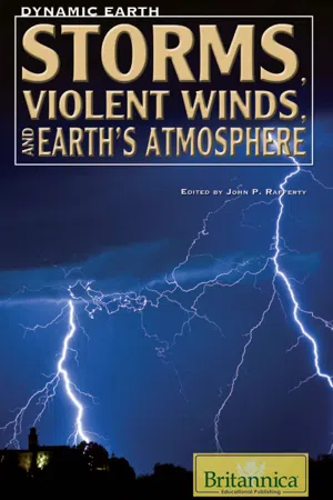
Chapter 5Tropical Storms AND TROPICAL CYCLONEST ropical storms and tropical cyclones develop in ocean basins charaterized by warm water and easterly waves (that is, regions of weak winds centred around areas of low pressure). Both phenomena form and mature the same way. Tropical cyclones are simply more intense. When tropical cyclones strike populated areas, they often cause great amounts of damage, and the strongest ones are capable of tremendous loss of life.Tropical Storms
Tropical Storms are organized centres of low pressure that originate over warm tropical oceans. The maximum sustained surface winds of Tropical Storms range from 63 to 118 kilometres (39 to 73 miles) per hour. These storms represent an intermediate stage between loosely organized tropical depressions and more intense tropical cyclones. A tropical storm may occur in any of Earth’s ocean basins in which tropical cyclones are found (North Atlantic, northeast Pacific, central Pacific, northwest and southwest Pacific, and Indian). The size and structure of Tropical Storms are similar to those of the more intense and mature tropical cyclones. They possess horizontal dimensions of about 160 kilometres (100 miles) and winds that are highest at the surface but decrease with altitude. The winds typically attain their maximum intensity at approximately 30–50 kilometres (20–30 miles) away from the centre of the circulation, but the distinct eyewall that is a characteristic of mature tropical cyclones is usually absent.The precursors of Tropical Storms in the Atlantic are easterly waves that form over Africa and propagate toward the west. The easterly waves are characterized by wind speeds of approximately 16 kilometres (10 miles) per hour and convective clouds that are loosely organized around a central area of low pressure, or trough axis. The winds transfer heat and moisture from the sea surface to the atmosphere. If local atmospheric conditions support deep convection and low vertical wind shear, the system may become organized and begin to intensify. Intensification occurs as the air warmed at the surface begins to rise. The transfer of air away from the centre of the trough axis causes the surface pressure to fall, which in turn causes higher winds that increase the transfer of heat at the surface. The Coriolis force, which is a product of Earth’s rotation, causes the winds to rotate about the centre, thereby generating a closed and symmetric circulation pattern.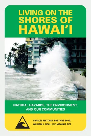 eBook - PDF
Living on the Shores of Hawaii
Natural Hazards, the Environment, and Our Communities
- Charles H. Fletcher, Robynne Boyd, William J. Neal, Virginia Tice(Authors)
- 2010(Publication Date)
- University of Hawaii Press(Publisher)
• Tropical depression: An organized system of clouds and thunder-storms with defined circulation and maximum sustained winds of 38 miles (61 km) per hour or less. Hurricanes tend to form around a preexisting atmospheric distur-bance (an area of low pressure) in warm tropical oceans where there is 68 living on the shores of hawai‘i high humidity in the atmosphere, light winds above the storm, and a high rate of condensation in the atmosphere. If the right conditions last long enough, a hurricane can develop, producing violent winds, incredible waves, torrential rains, and floods. Fig. 5.2. This map shows the tracks of all tropical cyclones that formed worldwide from 1985 to 2005. Storms are plotted at 6-hour intervals and use a color scheme indicating the Saffir-Simpson Hurricane Scale. Hawai‘i lies in the corridor between the East Pacific spawning grounds and the West Pacific. (Image from Wikipedia: http://en.wikipedia.org/wiki/ Tropical_cyclone [last accessed November 4, 2009]) hurricanes 69 There are on average six Atlantic hurricanes each year; over a 3-year period, approximately five hurricanes strike the United States coastline from Texas to Maine. The U.S. Atlantic and Gulf of Mexico coasts are famous for their vulnerability to hurricane damage, but other areas are also at risk. In fact, there are three regions in the Northern Hemisphere known for their tendency to spawn hurricanes: the tropical Atlantic, the eastern tropical Pacific, and the western tropical Pacific. In the Southern Hemisphere there are two primary areas: the western tropical Pacific and the Indian Ocean. 70 living on the shores of hawai‘i Hurricane intensity All hurricanes are ranked by the Saffir-Simpson Hurricane Scale accord-ing to the power of their winds. 4 Yet a storm’s strength fluctuates. What appears to be a weak tropical depression may intensify into a full-blown hurricane. eBook - PDF
Weather
A Concise Introduction
- Gregory J. Hakim, Jérôme Patoux(Authors)
- 2017(Publication Date)
- Cambridge University Press(Publisher)
Forecasting tropical cyclone track has improved greatly in the past 20 years. In some locations, like the North Atlantic Ocean, routine reconnaissance aircraft make detailed measurements of storm location, structure, and intensity, which complements satellite observa- tions. These improvements in track forecasting allow the weather services to prepare local populations and to issue appropriate warnings, and allow local govern- ments to enforce evacuation when necessary. Summary Tropical cyclones (hurricanes, typhoons) are tropi- cal storms with sustained winds greater than 64 knots. Tropical systems are ranked as tropical disturbance, tropical depression, and tropical storm up to 64 knots, the low pressure at the center of the tropical cyclone allows the underlying water to rise above its normal level. Recall that the ocean surface is under atmos- pheric pressure. If you picture the atmosphere push- ing more on some areas (high pressure) and less on others (low pressure), you can visualize that the ocean will be depressed under higher pressure, and bulging upward under lower pressure. Since the atmospheric pressure is extremely low at the center of a tropical cyclone, it allows the water to rise by more than one meter for larger storms. While this does not seem much in itself, it amounts to an enormous amount of water when integrated over the size of the tropical cyclone. The addition of strong winds and wave action interacting with the coastline can greatly enhance this effect to more than 8 m (26 ft), primarily to the right of the storm track where the wind is directed toward the shoreline in the northern hemisphere (Figure 12.11(d)). Strong, fast moving, and larger storms have the highest storm surge. Storm surges often cause more damage than the wind and rainfall associated with the tropical cyclone. eBook - PDF
- Bruce Anderson, Alan H. Strahler(Authors)
- 2012(Publication Date)
- Wiley(Publisher)
Names are reused, but the names of storms that cause significant damage or destruction are retired from further use. To track tropical cyclones, we now use satellite images. Within these images, tropical cyclones are often easy to identify by their dis- tinctive pattern of inspiraling bands of clouds and a clear central eye. Figure 9.8 shows a gallery of satellite images of the Atlantic trop- ical cyclones from 2005. CONCEPT CHECK How do tropical cyclones develop and intensify over time? When do tropical cyclones typically form and in what regions? What track do tropical cyclones typically take? STOP STOP Small trees down, roof damage Moderate to heavy damage to homes, many trees down 1. Minimal Damage Winds 33–42 m/s (74–95 mph) Storm surge 1.2–1.5 m (4–5 ft) 2. Moderate Damage Winds 43–49 m/s (96–110 mph) Storm surge 1.8–2.4 m (6–8 ft) 3. Extensive Damage Winds 50–58 m/s (111–130 mph) Storm surge 2.7–3.6 m (9–12 ft) 4. Extreme Damage Winds 59–69 m/s (131–155 mph) Storm surge 3.9–5.4 m (12–18 ft) 5. Catastrophic Damage Winds > 70 m/s (155 mph) Storm surge > 5.5 m (18 ft) Major damage to all structures Severe damage to all structures Impacts of Tropical Cyclones ropical cyclones can be tremendously destructive storms, with intense rainfall and very strong winds. The effects of wind, sea-level rise, and rain can cause devastation across very large areas. This devastation can occur along the coasts and farther inland along water- ways and over mountain ranges, affecting thousands as the tropical cyclone moves along its track. Explain the various impacts of tropical cyclones. Define storm surge and explain why it occurs. Describe how tropical cyclone activity has been changing over the last 50 years. LEARNING OBJECTIVES T CHANGES IN WEATHER AND SEA LEVEL The intensity of a tropical cyclone is based on the cen- tral pressure of the storm, mean wind speed, and height of the accompanying sea-level rise—also called the storm surge. eBook - PDF
- Suzanne Simard(Author)
- 2010(Publication Date)
- IntechOpen(Publisher)
Tropical cyclones, oceanic circulation and climate 65 x Tropical cyclones, oceanic circulation and climate Lingling Liu Key Laboratory of Ocean Circulation and Waves, Institute of Oceanology, Chinese Academy of Sciences, Qingdao, China 1. Introduction Tropical cyclone, also popular known as hurricane or typhoon, is a non-frontal synoptic scale warm-core system characterized by a large low-pressure center. It forms over most of the world’s tropical waters between about 5° and 22° latitude in an environment with sufficient sea surface temperature (>26.5°C), moisture instability and weak vertical shear, including North Indian, western North Pacific, eastern North Pacific, North Atlantic, South Indian and western South Pacific (Fig.1). Environmental conditions in the eastern South Pacific and South Atlantic are not favorable for the tropical cyclone’s genesis. Thus, so far there has only been one documented tropical cyclone in the South Atlantic basin and it was quite weak. Mostly for the purpose of providing useful warnings, tropical cyclones are categorized according to their maximum wind speed. Tropical cyclones, with maximum winds of 17ms -1 or less, are known as tropical depressions; when their wind speeds are in the range of 18 to 32 ms -1 , inclusive, they are called Tropical Storms, whereas tropical cyclones with maximum winds of 33 ms -1 or greater are called hurricanes in the western North Atlantic and eastern North Pacific regions, typhoons in the western North Pacific, and severe tropical cyclones elsewhere. Fig.1. The tracks and intensity of nearly 150 years of tropical cyclones. (http://earthobservatory.nasa.gov/IOTD/view.php?id=7079 ) 4 Climate Change and Variability 66 A tropical cyclone is driven principally by heat transfer from the ocean. Thus, the genesis and development of the tropical cyclones and its variability of number and intensity are influenced by the oceans importantly. eBook - PDF
- James Goff, C. R. de Freitas(Authors)
- 2016(Publication Date)
- Cambridge University Press(Publisher)
51 Learning objectives 52 Introduction 52 Characteristics of tropical cyclones 53 Tropical cyclone formation and decay 54 Monitoring and warnings 58 Trends and links with large-scale atmospheric circulation 61 Impacts of tropical cyclones 63 Impact mitigation 67 Risk analysis and future trends 68 Summary 69 Glossary 69 Review questions 70 Discussion questions 70 Further reading and other resources 70 References 71 Tropical cyclones C R de Freitas 4 52 NATURAL HAZARDS IN AUSTRALASIA Learning objectives • Appreciate the physical nature of tropical cyclones. • Understand the preconditions for tropical cyclone formation. • Identify the differences between tropical cyclones and other types of storms. • Recognise cyclone tracks and agencies involved in monitoring and warning of tropical cyclones. • Give examples of the effects of tropical cyclones in coastal and inland areas. • Recognise connections between tropical cyclones and other natural hazards. • Become familiar with adjustments that can be made to minimise loss and damage caused by tropical cyclones. • Know what is involved in mitigating the impacts of tropical cyclones. Introduction A tropical cyclone (TC) is a severe storm that develops and intensifies over warm tropical oceans. TCs are called hurricanes in the Atlantic and eastern Pacific region and typhoons in the north-western Pacific. They are among the most powerful and destructive of natural hazards. Gale-force winds, coastal storm surge and heavy rainfall associated with TCs can result in large numbers of human casualties, devastating and widespread damage and huge economic losses. Although wind speeds associated with TCs are less than those often recorded in tornadoes, TCs are likely to affect an area 10 000 times larger than the area covered by a tornado (Aguado & Burt 2013 ). Moreover, most tornadoes last for less than an hour whereas TCs have lifetimes as long as a week or more. There are several other important differences ( Figure 4.1 ). eBook - ePub
The Weather Almanac
A Reference Guide to Weather, Climate, and Related Issues in the United States and Its Key Cities
- Steven L. Horstmeyer(Author)
- 2011(Publication Date)
- Wiley(Publisher)
Once a complex of thunderstorms begins to rotate and the central pressure drops, if conditions are right, the winds increase and the pressure continues to fall. In the Atlantic Ocean the complex becomes a tropical depression; after additional strengthening the depression becomes a tropical storm and then a hurricane.Because of the release of latent heat by condensing water vapor within the storm and warming of sinking air by compression in the eye tropical cyclones are classified as warm-core disturbances.Figure 5.7 shows all tropical cyclone occurrences on Earth from 1985 to 2005 along with the name used to commonly refer to hurricane-strength storms. Table 5.1 gives the regional names at various levels of organization and development, while Table 5.2 indicates the seasons and average storm numbers.Figure 5.7 Worldwide distribution of tropical cyclones with regional names. (Source: NASA.)The tropical South Atlantic is a special case. Only one tropical cyclone is known to have ever reached tropical storm or hurricane strength there (Figure 5.8 ), while a total of only six tropical cyclones are known. Two additional storms classified as subTropical Storms, which have both tropical (deep convective thunderstorms) and middle-latitude characteristics (cool air pool aloft), have formed in the South Atlantic. In Figure 5.8 note that the circulation of Catarina is the opposite of a northern hemisphere tropical cyclone. Just before this chapter was finished, the second known tropical storm strength cyclone was spotted by satellite off the coast of South America. Storm 90Q is shown in Figure 5.9 . The arrow points to 90Q in the visible satellite image. No eye is visible, but 15 hours later, an infrared image from another satellite (inset) shows big thunderstorms near the storm's center and the evidence of an eyelike feature.Many speculate that between South America and Africa the water is too cool for tropical cyclone formation. That may be true at times as the cool water that wells up off the west coast of Africa flows toward South America, south of the equator. But the controlling factors are that vertical wind shear through the atmosphere is too strong in the region and there are few disturbances there to initiate tropical cyclone formation. eBook - PDF
Weather
A Concise Introduction
- Gregory J. Hakim, Jérôme Patoux(Authors)
- 2021(Publication Date)
- Cambridge University Press(Publisher)
If you picture the atmosphere push- ing more on some areas (high pressure) and less on others (low pressure), you can visualize that the ocean will be depressed under higher pressure, and bulging upward under lower pressure. Since the atmospheric pressure is extremely low at the center of a tropical cyclone, it allows the water to rise by more than one meter for larger storms. While this does not seem much in itself, it amounts to an enormous amount of water when integrated over the size of the tropical cyclone. The addition of strong winds and wave action interacting with the coastline can greatly enhance this effect to more than 8 m (26 ft), primarily to the right of the storm track where the wind is directed toward the shore- line in the northern hemisphere (Figure 12.11(d)). Strong, fast moving, and larger storms have the highest storm surge. N L storm motion (d) E The water is pushed by the winds to the right of the storm. L (c) L (b) L (a) Figure 12.11. (a–c) Storm surge propagating westward under a tropical cyclone. (d) Bird’s eye view showing the winds to the right of the storm pushing the surge water against the coastline in the direction of motion of the storm. Tropical Cyclone Hazards 235 Storm surges often cause more damage than the wind and rainfall associated with the tropical cyclone. When they hit a flat coastal area, in particular, the rushing water can penetrate deep inland and inundate a large swath of coastal land, as was the case in Galveston Bay, Texas, in 1900 (8000 killed) and in Bangladesh in 1970 (500 000 killed). Similarly, flooding and landslides resulting from heavy tropical cyclone rainfall can kill many people, as was the case for Hurricane Mitch in 1998 (7000 killed in Honduras alone) and Super Typhoon Haiyan in 2013 (6300 killed in the Philippines alone). 12.5 Conditions for Tropical Cyclone Development In summary, the conditions for tropical cyclone devel- opment are: ► A warm, conditionally unstable atmosphere. No longer available |Learn more
- (Author)
- 2014(Publication Date)
- Library Press(Publisher)
Tropical depression A tropical depression is an organized system of clouds and thunderstorms with a defined, closed surface circulation and maximum sustained winds of less than 17 metres per second (33 kn) or 38 miles per hour (61 km/h). It has no eye and does not typically have the organization or the spiral shape of more powerful storms. However, it is already a low-pressure system, hence the name depression. The practice of the Philippines is to name tropical depressions from their own naming convention when the depressions are within the Philippines' area of responsibility. Tropical storm A tropical storm is an organized system of strong thunderstorms with a defined surface circulation and maximum sustained winds between 17 metres per second (33 kn) (39 miles per hour (63 km/h)) and 32 metres per second (62 kn) (73 miles per hour (117 km/h)). At this point, the distinctive cyclonic shape starts to develop, although an eye is not usually present. Government weather services, other than the Philippines, first assign names to systems that reach this intensity (thus the term named storm ). Hurricane or typhoon A hurricane or typhoon (sometimes simply referred to as a tropical cyclone, as opposed to a depression or storm) is a system with sustained winds of at least 33 metres per second (64 kn) or 74 miles per hour (119 km/h). A cyclone of this intensity tends to develop an eye, an area of relative calm (and lowest atmospheric pressure) at the center of circulation. The eye is often visible in satellite images as a small, circular, cloud-free spot. Surrounding the eye is the eyewall, an area about 16 kilometres (9.9 mi) to 80 kilometres (50 mi) wide in which the strongest thunderstorms and winds circulate around the storm's center. Maximum sustained winds in the strongest tropical cyclones ____________________ WORLD TECHNOLOGIES ____________________ have been estimated at about 85 metres per second (165 kn) or 195 miles per hour (314 km/h). eBook - PDF
Essentials of Meteorology
An Invitation to the Atmosphere
- C. Donald Ahrens, Robert Henson(Authors)
- 2017(Publication Date)
- Cengage Learning EMEA(Publisher)
11 Hurricanes 319 Copyright 2018 Cengage Learning. All Rights Reserved. May not be copied, scanned, or duplicated, in whole or in part. WCN 02-300 320 320 CHAPTER 11 CHAPTER 11 T he introduction on the previous page describes the terrible conditions in New Orleans after Hurricane Katrina made landfall* in August 2005. Born over warm tropical waters and nurtured by a rich supply of water vapor, hurricanes can grow into ferocious storms that generate enormous waves, heavy rains, severe flood- ing, and winds that can exceed 150 knots. What exactly are hurricanes? How do they form? And why do they strike the east coast of the United States far more frequently than the west coast? These are some of the questions we will consider in this chapter. Tropical Weather In the broad belt around the earth known as the tropics—the region between 23½° north and 23½° south of the equator—the weather is much different than it is in the middle latitudes. In the tropics, the noon sun is always high in the sky, and so diurnal and seasonal changes in temperature are small. The daily heating of the surface and high humidity favor the development of cumulus clouds and afternoon thunderstorms. Most of these are individual thunderstorms that are not se- vere. Sometimes, however, they grow together into loosely organized systems called non-squall clusters. On other occasions, the thunderstorms will align into a row of vigorous convective cells or a squall line. The passage of a squall line is usually noted by a sudden wind gust followed immediately by a heavy downpour. This del- uge is then followed by several hours of relatively steady rainfall. Many of these tropical squall lines are similar to the middle-latitude squall lines described in Chapter 10. Because it is warm all year long in the tropics, the weather is not characterized by four seasons (which, for the most part, are determined by temperature variations).
- C. Donald Ahrens, Robert Henson(Authors)
- 2021(Publication Date)
- Cengage Learning EMEA(Publisher)
● Hurricanes can be observed by satellite or by hurricane-hunter aircraft that fly in and around the storm. ● Hurricanes have sustained winds about a central core (eye) that reach at least 64 knots (74 mi/hr), with considerably higher gusts. ● Hurricanes are known by different names in various parts of the world. ● The three primary stages in a developing tropical cyclone are: tropical depression, tropical storm, and hurricane. ● The strongest winds and the heaviest rainfall normally occur in the eyewall—a ring of intense thunderstorms that surround the eye. ● Hurricanes form over warm tropical waters, where light surface winds converge, the humidity is high in a deep layer, and the winds aloft are weak. ● For a mass of thunderstorms to organize into a hurricane there must be some mechanism that triggers the formation, such as converging surface winds along the ITCZ, a preexisting atmospheric disturbance, such as a weak front from the middle latitudes, or a tropical wave. ● Hurricanes derive their energy from the warm, tropical oceans and by evaporating water from the ocean’s surface. Heat energy is converted to wind energy when the water vapor condenses and latent heat is released inside deep convective clouds. Copyright 2022 Cengage Learning. All Rights Reserved. May not be copied, scanned, or duplicated, in whole or in part. Due to electronic rights, some third party content may be suppressed from the eBook and/or eChapter(s). Editorial review has deemed that any suppressed content does not materially affect the overall learning experience. Cengage Learning reserves the right to remove additional content at any time if subsequent rights restrictions require it. HURRICANES 459 ● FIGURE 16.11 Regions where Tropical Storms form (orange shading), the names given to hurricane-strength tropical cyclones, and the typical paths they take (red arrows).
Index pages curate the most relevant extracts from our library of academic textbooks. They’ve been created using an in-house natural language model (NLM), each adding context and meaning to key research topics.