Geography
Tsunamis
Tsunamis are large, powerful ocean waves caused by underwater disturbances such as earthquakes, volcanic eruptions, or landslides. These waves can travel across entire ocean basins, reaching devastating heights and causing widespread destruction when they make landfall. Tsunamis are a natural hazard that pose significant risks to coastal communities and require preparedness and early warning systems to mitigate their impact.
Written by Perlego with AI-assistance
Related key terms
1 of 5
12 Key excerpts on "Tsunamis"
- eBook - ePub
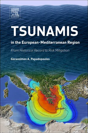
Tsunamis in the European-Mediterranean Region
From Historical Record to Risk Mitigation
- Gerassimos Papadopoulos(Author)
- 2015(Publication Date)
- Elsevier(Publisher)
Chapter 1Tsunamis in the Global Ocean
Abstract
Tsunami waves are generated by several phenomena that cause sudden, large-scale disturbances of the sea level. The most frequent generation mechanisms of Tsunamis are earthquake activity, volcanic eruptions, and landslide processes in submarine and coastal environments. Tsunamis hit not only the Pacific and Indian oceans but also all parts of the global ocean including the European and Mediterranean regions, as is documented in geological and historical documents and instrumental records. The physical properties of Tsunamis are quite complex due not only to the complexity of their source mechanisms but also due to propagation features such as frequency dispersion and amplitude dispersion. No adequate tsunami magnitude scales exist at present, and therefore quantification of the tsunami size is a difficult issue, with tsunami intensity being a proxy of tsunami size for the time being. The lessons learned from the devastating large Tsunamis of 2004 in the Indian Ocean and of 2011 in North East Japan have significantly affected the development of the tsunami studies and risk mitigation actions in global scale. The issue of early tsunami warning today is a rapidly developing, hot topic in which fields such as science, technology, emergency planning, awareness, education, and crisis management all contribute in synergy to protect coastal communities.Keywords
Tsunamis in global ocean tsunami documentation sources generation mechanisms physical properties quantification Indian Ocean 2004 Japan 2011 early warning1.1. Tsunamis and MegaTsunamis
According to the definition of Van Dorn (1968), tsunami is the Japanese name for the gravity wave system formed in the sea following any large-scale, short-duration disturbance of the free surface . The occurrence of tsunami events has been reported in all parts of the global ocean. The documentation of tsunami events that occurred in the preinstrumental period depends on the availability of a variety of records based on geological and archaeological observations and on historical documentary sources. For this reason the tsunami reporting period varies from one side of the global ocean to the other. For example, in Greece and other coastal sites of the east Mediterranean basin one may find the oldest historical tsunami documentation thanks to the availability of relevant historical sources and archaeological observations (Papadopoulos et al., 2014a - eBook - PDF
Ocean Surface Waves: Their Physics And Prediction (2nd Edition)
Their Physics and Prediction
- Stanislaw Ryszard Massel(Author)
- 2013(Publication Date)
- World Scientific(Publisher)
Chapter 9 Tsunami 9.1 Introduction Waves generated by wind are very common on the ocean surface. However, in some circumstances waves of unusual character may appear. Such waves are called Tsunamis. Tsunami is a Japanese word being, in fact, a com-bination of two words: ‘ami’ which means wave, and ‘tsu’ which denotes a particular point at the waterline. Thus, a tsunami is a wave which ap-proaches the shoreline. Tsunami are an impulsively driven water waves caused by the sudden displacement of a large mass of water. This displace-ment can be caused by a strong earthquake with an epicenter in or near an ocean basin (Pelinovsky, 1996; M¨ orner, 1996, 1999; Kowalik et al. , 2005; Gisler, 2008; Levin and Nosov, 2009), by volcanic eruptions (Pelinovsky et al. , 2005), landslides either above or below the water surface (Fritz et al. , 2001; Mader and Gittings, 2002; Yalciner et al. , 2003; Saelevik et al. , 2009) and by meteorites impacts (Mader, 1998; Ward and Asphaug, 2000; Asphaug et al. , 2003). In the open ocean, Tsunamis often remain undetected because of their great wavelength, of the order of hundreds of kilometres, and small wave height, usually in the order of one metre. The velocity of propagation of tsunami in deep water is very high (exceeding 700 km/hour, when the mean ocean depth is used), which can be estimated approximately as C = radicalbig gh, (9.1) in which h is the water depth. When a tsunami is running up onto an ocean coast, its amplitude increases substantially which causes massive destruc-tion to vulnerable populations and structures. Some ocean basins are more prone to tsunami than others. In partic-ular, the Pacific Ocean is the ocean basin where Tsunamis appear, some- 436 Tsunami times producing ocean-wide effects. Gisler (2008) listed some catastrophic earthquake-induced tsunami which appeared in the Pacific. - No longer available |Learn more
Natural Hazards
Earth's Processes as Hazards, Disasters, and Catastrophes
- Edward A. Keller, Duane E. DeVecchio, John Clague, Edward Keller, Duane DeVecchio(Authors)
- 2016(Publication Date)
- Routledge(Publisher)
The devastating Tsunamis in the Indian Ocean in 2004 and in Japan in 2011 were international wake-up calls that we are not yet prepared for Tsunamis and that we need effective tsunami warning systems in the world’s major ocean basins. These systems must be designed to reach both coastal residents and visitors, and they must be coupled with an effective education program so that people are more aware of the hazard.A tsunami is produced by the sudden vertical displacement of water in the sea or a lake. Processes that can produce Tsunamis include large earthquakes, landslides, explosive volcanic eruptions, and the impact of extraterrestrial objects. The largest and most damaging Tsunamis over the past few millennia have been caused by giant earthquakes associated with Earth’s major subduction zones.Distant Tsunamis can travel thousands of kilometres across the ocean to strike a remote shoreline. In contrast, a local tsunami travels a much shorter distance to a nearby coast and can strike with little warning.Tsunami effects are both primary and secondary. The primary effects are related to the direct impact, inundation, and erosion by the tsunami as it moves inland from the shore. Virtually nothing at the shore can survive a large tsunami. In 2004 in Indonesia, the force of the waves flattened concrete buildings. Secondary effects of Tsunamis include possible water pollution, fires in urban areas, and disease.Tsunamis are linked to the earthquakes that cause them, and tsunami inundation may directly follow the ground shaking and land-level change produced by quakes. Both earthquakes and Tsunamis may cause fires. A tsunami can also change the coastline through erosion and deposition of sediment. Following a large earthquake and tsunami, parts of the coast may scarcely resemble what they looked like prior to the event.Many strategies are available to minimize tsunami hazard. These include detection and warning, structural control, construction of tsunami run-up maps, land-use practices, probability analysis, education, and tsunami readiness. We are able to detect distant Tsunamis in the open ocean and accurately estimate their arrival time to within a few minutes. It is more difficult to provide adequate warning of a local tsunami because it arrives at the shore soon after an earthquake. In this case, ground shaking or a sudden withdrawal of water from the coast may signal that a tsunami will soon arrive. In addition, warning sirens can alert people in a community to move inland or to nearby higher ground. - eBook - PDF
- Bhatia, A.L.(Authors)
- 2021(Publication Date)
- NEW INDIA PUBLISHING AGENCY (NIPA)(Publisher)
Tsunami Chapter 14 The phenomenon we call tsunami is a series of large waves of extremely long wavelength and period usually generated by a violent, impulsive undersea disturbance or activity near the coast or in the ocean. A tsunami is a very long-wavelength wave of water that is generated by sudden displacement of the seafloor or disruption of any body of standing water. Tsunami are sometimes called “seismic sea waves”, although, as we will see, they can be generated by mechanisms other than earthquakes. Tsunami have also been called “tidal waves”, but this term should not be used because they are not in any way related to the tides of the Earth. Because tsunami occur suddenly, often without warning, they are extremely dangerous to coastal communities. When a sudden displacement of a large volume of water occurs, or if the sea floor is suddenly raised or dropped by an earthquake, big tsunami waves can be formed by forces of gravity. The waves travel out of the area of origin and can be extremely dangerous and damaging when they reach the shore. The word tsunami (pronounced tsoo-nah’-mee) is composed of the Japanese words “tsu” (which means harbor) and “nami” (which means “wave”). Often the term, “seismic or tidal sea wave” is used to describe the same phenomenon, however the terms are misleading, because tsunami waves can be generated by other, non seismic disturbances such as volcanic eruptions or underwater landslides, and have physical characteristics different of tidal waves. The tsunami waves are completely unrelated to the astronomical tides—which are caused by the extraterrestrial, gravitational influences of the moon, sun, and the planets. Thus, the Japanese word “tsunami”, meaning “harbor wave” is the correct, official and all-inclusive term. It has been internationally adopted because it covers all forms of impulsive wave generation. - eBook - PDF
Earth's Fury
The Science of Natural Disasters
- Alexander Gates(Author)
- 2022(Publication Date)
- Wiley-Blackwell(Publisher)
Tsunamigenic – Any event, natural or man-made, that is capable of generating a tsunami. Tsunami reach – Tsunami reach or inundation line is the maximum inland penetration of the wave measured from the mean sea level line. Wavelength – The distance between the same point on consecutive waves (crest or trough). Wave train – There is usually one main tsunami wave, but it typically has a number of associated waves with it forming a sequence or train. 9.1 Terror from the Sea Tsunamis used to be called “tidal waves,” but the term was dropped because they are not related to tides. Tsunamis were also called “seismic sea waves,” but that term is not in favor because it only refers to Tsunamis generated by earthquakes. Tsunami is a Japanese word that means “harbor wave.” It is called a harbor wave because it can be a clear, calm day when a monster wave emerges in the harbor from apparently nowhere and wreaks havoc on the coastal communities. 9.2 Generation of a Tsunami Tsunamis are extremely deadly waves generated in the ocean. They can be generated by earthquakes, underwater landslides, sur- face to water landslides, volcanoes, extraterrestrial impacts, possibly weather, and large bomb blasts. By far the most common of these is earthquakes. The basic mechanics of most Tsunamis is that a rapid change in the height of the seafloor uplifts or drops the column of water above it. Water cannot form a step on its surface, so it quickly re-equilibrates in a wave. Tsunamis generated by land to sea avalanches are more analogous to splashing water because they act on the water surface instead of depth. Explosions from volcanoes or bombs force the water away in all directions at high speed through rapid expansion. Extraterrestrial impacts have aspects of all of these mechanisms. Once the tsunami is generated, it travels through deep water at phenomenal velocities. They can travel at speeds of 600 mph (965 kmph), which is how they can cross ocean basins so quickly. - eBook - PDF
- Mohammad Mokhtari(Author)
- 2016(Publication Date)
- IntechOpen(Publisher)
These Tsunamis were generated by a rise, or a subsidence, in the seabed. For example, if a part of the seabed rises, owing to an underground fault movement, then the seawater over the deformation lifts, resulting in an increase in the © 2016 The Author(s). Licensee InTech. This chapter is distributed under the terms of the Creative Commons Attribution License (http://creativecommons.org/licenses/by/3.0), which permits unrestricted use, distribution, and reproduction in any medium, provided the original work is properly cited. seawater’s potential energy, then, in order to resolve this energy imbalance, waves, i.e., Tsunamis are generated and travel in all available directions. Tsunamis are, however, triggered not only by such a submarine earthquake, but also other phenomena as illustrated in Figure 1 : landslide (e.g. [2]), sector collapse, glacier fall, submarine eruption, meteorite impact, and others. In the latter cases, where a tsunami source is not directly connected to an earthquake, the wave height of generated Tsunamis could be under‐ estimated or be beyond estimation, by the general prediction for Tsunamis based on only seismic data, as in cases with a tsunamigenic earthquake [3]. In this chapter, we concentrate our discussion on tsunami generation caused by landslide, or submarine eruption. Figure 1. An illustration for examples of tsunami sources. Figure 2. A huge boulder, which was proposed to have been carried by Tsunamis, on Ishigaki Island, Japan. This photo was taken in 2013, and provided by Dr. T. Iribe. He is the person in this photo and is 1.71 m tall. Tsunami 36 First, we will study several characteristics of Tsunamis induced by landslides, or sector collapses. It is proposed that the 1771 Meiwa Earthquake Tsunami occurred owing to a submarine landslide, for although the earthquake was not strong according to the Japanese archive, huge boulders on Ishigaki Island, Japan, were determined to have been carried by the Tsunamis [4]. - eBook - PDF
Advances in Hydroscience
Volume 2
- Ven Te Chow(Author)
- 2013(Publication Date)
- Academic Press(Publisher)
Tsunamis principally occur following undersea earthquakes of magnitude greater than 6.5 (Richter scale) having focal depths less than 50 km, although landslides, bottom slumping, and volcanic eruptions have been cited as primo-genitors in certain cases. Not all such earthquakes produce Tsunamis, and the generation mechanism—which presumably is associated with vertical disloca-tions of the sea floor—undoubtedly differs from event to event. Since the majority of them originate at great depths in the sea, their precise origins will probably remain forever obscure. Once formed, however, the wave system resembles nothing so much as that produced by tossing a stone into the middle of a large shallow pond. In simplest aspect (more complex sources are thought to exist), the wave pattern is axisymmetric at early times, and consists of con-centric rings of crests and troughs, bounded at the outside by an intangible front, that expands everywhere outwards at the limiting velocity c 0 = yjgh for free waves in water of depth h (g = gravitational acceleration), and all subsequent waves travel more slowly. At any instant of time the radial separa-tion between successive crests (wavelength) is largest near the front and be-comes progressively smaller towards the center. In the absence of boundaries which produce reflections, individual waves of the system retain their identity, in contrast to the wind-generated swell, which grows and disappears before the eye in the interval of a few seconds. In general, no two waves of the system are of the same size, nor does the amplitude of any wave remain the same from place to place and time to time. Within the everchanging pattern the energy distribution among waves is mani-fested by amplitude modulation of the wave train in a manner which is deter-mined by the nature of the source, its distance from the point of observation, and the depth of water over the intervening route. - eBook - PDF
Geomorphology and Natural Hazards
Proceedings of the 25th Binghamton Symposium in Geomorphology, Held September 24-25, 1994 at SUNY, Binghamton, USA
- M. Morisawa(Author)
- 2013(Publication Date)
- Elsevier Science(Publisher)
gen-erated by fault displacement on the seabed caused by earthquakes. However, many Tsunamis are generated by submarine landslides and are therefore unrelated to seismic activity. In ocean floor areas where sediment or rock has been displaced, water rushes in from the surrounding sea to restore the water level. When this happens, there is a rapid lowering of sea level along nearby coasts, occasionally below the level of the low-est tides. Thereafter, large kinematic waves travel out-wards from the area located above the zone of seabed displacement. Tsunamis are long period ocean waves with very long wavelengths and very high velocities, the latter being mostly a function of the depth of the water over which the wave trains pass. Areas of very deep water generate the fastest waves that may often exceed 480km h L The height of the waves in the open ocean is usually quite small (often no more than 1-2 m). At the coast, however, the flood levels (run-up) are partly a function of the dimensions of the propa-gated waves, but are also greatly influenced by the topography and bathymetry of the coastal zone. It may often be the case that relatively small tsunami waves may generate the greatest run-up as a result of the effects of wave resonance within confined estuaries. It is well known, however, that most tsunami waves deposit sediment. For example, after the Chilean earth-quake and tsunami of May 1960, ...white sand was deposited on valley slopes wherever the (tsunami) 0169-555X/94/$07.00 © 1994 Elsevier Science B.V. All rights reserved &SD/0169-555X(94)00017-L 84 A.G. Dawson/Geomorphology 10 (1994) 83-94 wave passed, 6-30 cm thick, up to 4.25 km inland. (Wright and Mella, 1963). Despite geomorphological observations such as that described above, the geomorphological impact of tsu-namis on coasts is an area of research that has been neglected in coastal geomorphology. - eBook - PDF
Sea-Level Science
Understanding Tides, Surges, Tsunamis and Mean Sea-Level Changes
- David Pugh, Philip Woodworth(Authors)
- 2014(Publication Date)
- Cambridge University Press(Publisher)
Chapter 8 Tsunamis Mere anarchy is loosed upon the world, The blood-dimmed tide is loosed, and everywhere The ceremony of innocence is drowned. W. B.Yeats, The Second Coming 8.1 Introduction In the past few years, two giant Tsunamis caused by undersea earthquakes have caused major loss of life and damage to coastal infrastructure. 1 On 26 December 2004, a moment magnitude (M w ) 9.3 mega- thrust earthquake, the third largest on record, took place along 1600 km of the subduction zone from Sumatra to the Andaman Islands in the eastern Indian Ocean [1, 2]. 2 The resulting tsunami waves caused enormous damage, particularly in Indonesia, India, Sri Lanka and Thailand, and killed more than 230,000 people (Figure 8.1) [3, 4]. On 11 March 2011, the Tōhoku (or Sendai) M w = 9.0 megathrust earthquake, the fourth largest on record, occurred 130 km off the east coast of Japan leaving some 20,000 people dead and tremendous destruction of coastal infrastructure (Figure 8.2), includ- ing a major nuclear emergency at the Fukushima Daiichi power plant [5]. These two catastrophic events have had many important consequences including, it will be seen, within sea-level research. Major Tsunamis have happened throughout history. The geological record contains evidence for events such as the Holocene Storegga slides, which were submarine landslides on the continental slope of Norway [6]. The largest slide, in approximately 8100–8200 BP, generated a tsunami that impacted coasts from northeast England to north of the Arctic Circle in Norway, and left evidence of its extent in well-defined sand layers [7, 8, 9]. The eastern Mediterranean has been impacted by Tsunamis many times. Events have included the tsunami respon- sible for the demise of the Minoan civilisation in Crete following the Santorini (or Thera) volcanic eruption between 1630 and 1550 BC [10], and those caused by submarine earthquakes that impacted Alexandria in 356 and 1303 [11]. - eBook - PDF
- James Goff, C. R. de Freitas(Authors)
- 2016(Publication Date)
- Cambridge University Press(Publisher)
The final report was produced in 1951 after the war and concluded that, while it was theoretically possible, it was not a very efficient way of doing it. CHAPTER 7: Tsunamis 163 What is a tsunami? A tsunami is composed of a series of waves (a wave train) rippling out and away from their source. It is different from a wind-generated surface wave on the ocean because, while the wave base or depth of movement of a wind wave in water is about half that of the wave length, a tsunami’s passage involves the movement of the entire water column from the surface to the seafloor. This means that the speed of a tsunami is controlled by water depth. In the open ocean, where water depths can be 5 km or more, a tsunami can travel at speeds akin to that of a passenger jet – it took the 1960 Chilean tsunami about 12 hours to travel from Chile to New Zealand, a distance of over 9000 km, at an average speed of 750 km/h. However, when the first wave approaches land and reaches increasingly shallower water it slows down, and because the following waves are still in deeper water and moving faster, they start to catch up, resulting in the waves bunching up and increasing in height. In the open ocean, Tsunamis are usually relatively small, with wave heights of less than 1 m, but in water less than about 100 m deep near the coast things start to change. If a tsunami travels over a long and gradually shallowing seafloor bathymetry that rises up towards the coast, this gives the waves time to grow in height. This is called shoaling . Different configurations of seafloor near the coast can lead to huge variability in wave heights for the same event, with some being large and others being barely noticeable ripples. Whatever the final wave height at the coast, the first wave is not necessarily the largest. Near-shore bathymetry therefore provides one of the controlling factors over just how far inland a tsunami might travel. The other key factor is the coastal geomorphology and topography. - eBook - PDF
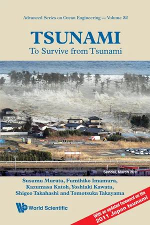
Tsunami: To Survive From Tsunami
To Survive from Tsunami
- Tomotsuka Takayama, Susumu Murata, Fumihiko Imamura(Authors)
- 2009(Publication Date)
- World Scientific(Publisher)
241 Part II Tsunami Behavior and Forecasting This page intentionally left blank This page intentionally left blank 243 Chapter 4 Occurrence and Amplification of Tsunamis 4.1 Mechanism of Tsunami Occurrence (1) Earthquakes which cause Tsunamis At the time of the Meiji Sanriku Earthquake Tsunami (1896), the mechanism by which earthquakes cause Tsunamis was not well understood and several theories had been advanced. Typical examples are the seaquake theory and the seafloor deformation theory. According to the seaquake theory, when the period of oscillation in an earthquake coincides with the natural period of a bay, the water level in the bay undergoes large deformations as a result of resonance, and this becomes a tsunami. Because this theory seems to explain the experience that Tsunamis attack after strong tremors, it seems to have been generally accepted at the time. However, this theory does not adequately explain the following facts: (1) Tsunamis attack various areas after an earthquake, including areas which are not bays, (2) Tsunamis sometimes attack after a certain time is elapsed since an earthquake, and (3) Tsunamis frequently attack from far outside a bay, rather than inside the bay. On the other hand, the seafloor deformation theory hold that a deformation of the seafloor during an earthquake causes displacement of the ocean surface directly above that deformation, and this is transmitted as a tsunami. The seafloor deformation theory satisfactorily explains the phenomena that could not be explained by the seaquake theory. After several controversies, around the beginning of the 20th century, the seafloor deformation theory was recognized as the general mechanism by which Tsunamis occur, based on various research results such as the one that shows the enormous energy of Tsunamis is larger than could be explained by the seaquake theory and corresponds to the energy predicted by the - eBook - PDF
The Tsunami Threat
Research and Technology
- Nils-Axel M?rner(Author)
- 2011(Publication Date)
- IntechOpen(Publisher)
100 The Tsunami Threat - Research and Technology Forecasting Landslide Generated Tsunamis: a Review 21 7. References Ataie-Ashtiani, B. & Nik-Khah, A. (2008a). Impulse waves caused by subaerial landslides, Environ. Fluid Meach. 8(3): 263–280, doi:10.1007 / s10652–008–9074–7. Ataie-Ashtiani, B. & Nik-Khah, A. (2008b). Laboratory investigations on impulsive waves caused by underwater landslide, Coast. Eng. 55(12): 989–1004, doi: 10.1016 / j.coastaleng.2008.03.003. Baldock, T., Hughes, M., Daya, K. & Louysa, J. (2005). Swash overtopping and sediment overwash on a truncated beach, Coast. Eng. 52(7): 633–645, doi: 10.1016 / j.coastaleng.2005.04.002. Boussinesq, J. (1872). Theorie des ondes et des remous que se propagent le long d’un canal rectangulaire horizontal, en communiquant au liquide contenu dans ce canal des vitesses sensiblement pareilles de la surface au fond, J. Math. Pures Appl. 17: 55–108. Bowering, R. J. (1970). Landslide generated waves: a laboratory study , Master’s thesis, Queen’s University, Kingston, Ontario, Canada. Briggs, M. J., Synolakis, C. E., Harkins, G. S. & Green, D. R. (1995a). Laboratory experiments of tsunami runup on a circular island, Pure Appl. Geophys. 144(3 / 4): 569–593, doi: 10.1007 / BF00874384. Briggs, M. J., Synolakis, C. E., Harkins, G. S. & Hughes, S. A. (1995b). Large-scale, three-dimensional laboratory measurements of tsunami inundation, Tsunamis: Progress in Prediction, Disaster Prevention and warning. , Kluver Academic Publishers, pp. 129–149, ISBN: 0-7923-3483-3. Camfield, F. E. & Street, R. L. (1970). Shoaling of solitary waves on small slopes, J. of the Waterways and Harb. Div., Proc. of the Am. Soc. of Civil Eng. 95(WW1): 1–22. Cea, L., Ferreiro, A., Vazquez-Cendon, M. E. & Puertas, J. (2004). Experimental and numerical analysis of solitary waves generated by bed and boundary movements, Int. J. Numer. Meth. Fl. 46(8): 793–813, doi: 10.1002 / fld.774.
Index pages curate the most relevant extracts from our library of academic textbooks. They’ve been created using an in-house natural language model (NLM), each adding context and meaning to key research topics.
