Geography
Tohoku Earthquake and Tsunami
The Tohoku Earthquake and Tsunami occurred on March 11, 2011, off the coast of Japan. It was a powerful undersea megathrust earthquake that triggered a devastating tsunami, causing widespread destruction and loss of life. The event had significant geographical impacts, including coastal landform changes and the release of radioactive materials from the Fukushima Daiichi nuclear power plant.
Written by Perlego with AI-assistance
Related key terms
1 of 5
10 Key excerpts on "Tohoku Earthquake and Tsunami"
 No longer available |Learn more
- (Author)
- 2014(Publication Date)
- White Word Publications(Publisher)
________________________ WORLD TECHNOLOGIES ________________________ Chapter-7 2011 Tōhoku Earthquake and Tsunami 2011 Tōhoku earthquake and tsunami An aerial view of tsunami damage in the Tōhoku region Tokyo Sendai Date 14:46:23, 11 March 2011 (+09:00) ________________________ WORLD TECHNOLOGIES ________________________ Duration 6 minutes Magnitude 9.0 M w Depth 32 km (19.9 mi) Type Megathrust earthquake Countries or regions affected Japan (primary) Pacific Rim (tsunami) Total damage Flooding, landslides, fires, building and infrastructure damage, nuclear incidents Peak ground acceleration 2.99 g Tsunami Yes Landslides Yes Foreshocks 7+ (4+ above 6.0 M W ) Aftershocks 671+ (44+ above 6.0 M W ) Casualties 9,737 deaths, 2,766 injured, 16,501 people missing (all figures preliminary) The 2011 Tōhoku earthquake and tsunami was a 9.0 -magnitude undersea megathrust earthquake off the coast of Japan that occurred at 14:46 JST (05:46 UTC) on Friday 11 March 2011. The epicenter was approximately 72 kilometers (45 mi) east of the Oshika Peninsula of Tōhoku, with the hypocenter at an underwater depth of approximately 32 km (19.9 mi). The earthquake triggered extremely destructive tsunami waves of up to 10 meters (33 ft) that struck Japan minutes after the quake, in some cases traveling up to 10 km ( 6 mi) inland, with smaller waves reaching many other countries after several hours. Tsunami warnings were issued and evacuations ordered along Japan's Pacific coast and at least 20 other countries, including the entire Pacific coast of North America and So uth America. The Japanese National Police Agency has officially confirmed 9,737 deaths, 2,766 injured, and 16,501 people missing across eighteen prefectures, as well as over 125,000 buildings damaged or destroyed. The earthquake and tsunami caused extensiv e and severe structural damage in Japan, including heavy damage to roads and railways as well as fires in many areas, and a dam collapse.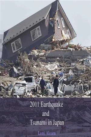 No longer available |Learn more
- (Author)
- 2014(Publication Date)
- White Word Publications(Publisher)
________________________ WORLD TECHNOLOGIES ________________________ Chapter 1 2011 Tohoku Earthquake and Tsunami 2011 Tōhoku earthquake and tsunami An aerial view of tsunami damage in the Tōhoku region Tokyo ________________________ WORLD TECHNOLOGIES ________________________ Sendai Map showing the epicenter of the earthquake Date 14:46:23, 11 March 2011 (+09:00) Duration 6 minutes Magnitude 9.0 M w Depth 32 km (19.9 mi) Epicenter location 38°19′19″N 142°22′08″E / 38.322°N 142.369°ECoordinates: 38°19′19″N 142°22′08″E / 38.322°N 142.369°E Type Megathrust earthquake Countries or regions affected Japan (primary) Pacific Rim (tsunami, secondary) Total damage Flooding, landslides, fires, building and infrastructure damage, nuclear incidents Peak ground acceleration 2.99 g Tsunami Yes (10+ meters) Landslides Yes Foreshocks 7+ (4+ above 6.0 M W ) Aftershocks 837-838+ (56–57+ above 6.0 M W ) Casualties 11,362 deaths, 2,872 injured, 16,290 people missing (all figures preliminary) The 2011 Tōhoku earthquake and tsunami was caused by a 9.0-magnitude undersea megathrust earthquake off the coast of Japan that occurred at 14:46 JST (05:46 UTC) on Friday, 11 March, 2011. The epicenter was approximately 72 kilometers (45 mi) east of the Oshi ka Peninsula of Tōhoku, with the hypocenter at an underwater depth of approximately 32 km (19.9 mi). The earthquake triggered extremely destructive tsunami waves of up to 29.6 m (97 ft) that struck Japan minutes after the quake, in some cases traveling up to 10 km (6 mi) inland, with smaller waves reaching many other countries after several hours. Tsunami warnings were issued and evacuations ordered along Japan's Pacific coast and at least 20 other countries, including the entire Pacific coast of North America and South America. eBook - ePub
Law and Disaster
Earthquake, Tsunami and Nuclear Meltdown in Japan
- Shigenori Matsui(Author)
- 2018(Publication Date)
- Routledge(Publisher)
2 Tohoku Earthquake, tsunami, and aftermath2.1 The Tohoku Earthquake and Tsunami 2.1.1 The Tohoku EarthquakeThe Tohoku Earthquake and the subsequent tsunami inflicted tremendous loss and damage. The government engaged in rescue and assistance operations for all victims. Various legal questions have been raised in the aftermath of the earthquake. They include questions on how to dispose of the remains of such a huge number of disaster victims, how to dispose of post-disaster debris, and how to dispose of automobiles and home electronic devices damaged by the tsunami. The aftermath of the earthquake and tsunami have also raised various questions relating to how assistance should be provided and what types of exceptional treatments can and should be extended to disaster victims. This chapter examines governmental response to these legal questions. It also examines why such devastating loss and damage had to happen and what was wrong with the preparation for the powerful earthquake and tsunami in Japan. This examination will show the serious failures of law in the preparation for and in response to the disaster and the deep-rooted failures of politics behind these failures of law.At 2:46 pm on 11 March 2011, an extraordinarily powerful earthquake rocked the Tohoku Region. The epicenter was 130 km off the Sanriku Coast, 24 km below the ocean’s surface.1 Its strength was unprecedented. The Japan Meteorological Agency (JMA) initially reported the magnitude of the earthquake at 8.4 on the Richter scale but then upgraded it to 8.8 and, ultimately, to 9.0.2 Western research institutions now believe that the earthquake’s magnitude was 9.1.3 Many buildings were destroyed or seriously damaged. The earthquake was very powerful and was felt in many parts of Japan, even at great distances from the epicenter. Earthquake-triggered deaths even incurred in distant Tokyo and Kanagawa as well.4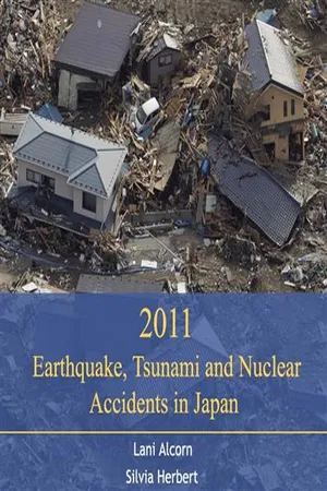 No longer available |Learn more
- (Author)
- 2014(Publication Date)
- College Publishing House(Publisher)
________________________ WORLD TECHNOLOGIES ________________________ Chapter 1 2011 Tohoku Earthquake and Tsunami 2011 Tōhoku earthquake and tsunami An aerial view of tsunami damage in the Tōhoku region Tokyo Sendai Map showing the epicenter of the earthquake Date 14:46:23, 11 March 2011 (+09:00) Duration 6 minutes Magnitude 9.0 M w Depth 32 km (19.9 mi) ________________________ WORLD TECHNOLOGIES ________________________ Epicenter location 38°19′19″N 142°22′08″E / 38.322°N 142.369°ECoordinates: 38°19′19″N 142°22′08″E / 38.322°N 142.369°E Type Megathrust earthquake Countries or regions affected Japan (primary) Pacific Rim (tsunami, secondary) Total damage Flooding, landslides, fires, building and infrastructure damage, nuclear incidents Peak ground acceleration 2.99 g Tsunami Yes (10+ meters) Landslides Yes Foreshocks 7+ (4+ above 6.0 M W ) Aftershocks 837-838+ (56–57+ above 6.0 M W ) Casualties 11,362 deaths, 2,872 injured, 16,290 people missing (all figures preliminary) The 2011 Tōhoku earthquake and tsunami was caused by a 9.0-magnitude undersea megathrust earthquake off the coast of Japan that occurred at 14:46 JST (05:46 UTC) on Friday, 11 March, 2011. The epicenter was approximately 72 kilometers (45 mi) east of the Oshi ka Peninsula of Tōhoku, with the hypocenter at an underwater depth of approximately 32 km (19.9 mi). The earthquake triggered extremely destructive tsunami waves of up to 29.6 m (97 ft) that struck Japan minutes after the quake, in some cases traveling up to 10 km (6 mi) inland, with smaller waves reaching many other countries after several hours. Tsunami warnings were issued and evacuations ordered along Japan's Pacific coast and at least 20 other countries, including the entire Pacific coast of North America and South America. The Japanese National Police Agency has officially confirmed 11,362 deaths, 2,872 injured, and 16,290 people missing across eighteen prefectures, as well as over 125,000 buildings damaged or destroyed. No longer available |Learn more
Natural Hazards
Earth's Processes as Hazards, Disasters, and Catastrophes
- Edward A. Keller, Duane E. DeVecchio, John Clague, Edward Keller, Duane DeVecchio(Authors)
- 2016(Publication Date)
- Routledge(Publisher)
tsunamis . These destructive waves are commonly called “tidal waves,” but they are not tidal; the name is misleading. Tsunamis are common in some coastal regions and very rare in others. For years, scientists attempted to get public officials to expand tsunami warning systems outside the Pacific Ocean basin, but it took the catastrophe of the Indian Ocean tsunami in 2004 for governments and communities to take the tsunami hazard seriously. However, as often occurs after such catastrophes, translating increased awareness of a hazard into improved warning, preparedness, and mitigation is proceeding at a slow pace. This problem came into sharp focus on March 11, 2011, when a giant earthquake occurred beneath the seafloor off northern Honshu, Japan. The earthquake triggered a tsunami that reached elevations of up to 40 m above sea level along the northern Honshu coast and claimed more than 16 000 lives. It also caused meltdowns at three nuclear reactors at the Fukushima-Daiichi nuclear power plant. This chapter explains tsunamis and assesses the hazard they pose to people. Your goals in reading this chapter should be to- ■ Know what a tsunami is
- ■ Understand the process of tsunami formation and propagation
- ■ Understand the effects of tsunamis and the hazards they pose to coastal regions
- ■ Know what geographic regions are at risk from tsunamis
- ■ Recognize the links between tsunamis and other natural hazards
- ■ Know what national, regional, and local governments, and individuals can do to reduce the tsunami risk
Giant Earthquake and Tsunami in Japan
The March 2011 earthquake off the Pacific coast of Honshu in Japan, also known as the 2011 Tõhoku earthquake, had a magnitude of 9.0.1 , 2 It is fourth largest earthquake in the world since modern record keeping began in the late nineteenth century. The earthquake triggered a powerful tsunami that reached heights of up to 40 m above sea level in Iwate Prefecture and travelled up to 10 km inland in the Sendai area (Figures 4.1 and 4.2 ).3The Japanese National Police Agency reported that the tsunami claimed nearly 16 000 lives, although this is likely an underestimate as 2800 people were still missing at the time this book was written.1 , 2 The economic toll was huge: more than 380 000 buildings were destroyed or seriously damaged and another 690 000 buildings were partially damaged. The World Bank estimated the direct damage from the earthquake and tsunami to be U.S.$235 billion, making it the most expensive natural disaster in history. Shortly after the catastrophe, Japanese Prime Minister Naoto Kan said, “In the 65 years after the end of World War II, this is the toughest and the most difficult crisis for Japan.”1 eBook - ePub
Japan after 3/11
Global Perspectives on the Earthquake, Tsunami, and Fukushima Meltdown
- Pradyumna P. Karan, Unryu Suganuma, Pradyumna P. Karan, Unryu Suganuma(Authors)
- 2016(Publication Date)
- The University Press of Kentucky(Publisher)
Part 1Earthquake and Tsunami Damage
 Passage contains an image
1
Historical Geography of the Japanese Tsunami
Unryu SuganumaJapan, one of the most advanced nations in the world and especially known for its high technology, has one of the best tsunami warning systems on earth (Oki and Koketsu 2011). The nation is famous worldwide for its ability to prepare against, train for, and mitigate damage from natural disasters. Nevertheless, Japan was not able to save lives during the ongoing triple disaster of earthquakes, tsunami, and nuclear radiation caused by the Sanriku Coast tsunami earthquake (named the Great East Japan Earthquake by the Japanese government) that took place on March 11, 2011. Some media and so-called experts in the Japanese media suggest that the 2011 Sanriku Coast tsunami earthquake was soteigai [unexpected], but this paper hints otherwise. Already two scientists (Tsuji 2011; Shimazaki 2011) have acknowledged their mistakes in predicting the tsunami earthquake in the Sanriku Coastal Region. Certainly, the experts cannot foresee everything in nature; however, the miscalculation by experts created additional human disaster on top of the natural disaster that occurred within the 2011 Sanriku tsunami. As a result of these miscalculations, the higher tsunami wall at Fukushima Daiichi that was originally planned was not built, and those living in the coastal area became careless about the tsunami warning systems. Almost no one expected this huge tsunami. If residents in the Sanriku region had known that an almost forty-meter-high tsunami was about to hit their area, they might have had a different mind-set and have been able to survive the catastrophic tsunami. Given these facts, the local residents have begun to learn lessons from the recent tsunami. In fact, five months after the 2011 disaster, the government of Miyagi Prefecture decided to launch 342 major recovery projects, including moving houses, schools, and hospitals to higher ground and constructing double-defense tsunami walls over the next ten years (Jiji News
- Rick Bissell, Steven Jensen, Shirley Feldman-Jensen(Authors)
- 2013(Publication Date)
- CRC Press(Publisher)
45 They are Unexpected disaster is a term the Japanese are using to describe this earthquake, as in being unexpectedly large (wide area) and powerful. Its primary impact was in the Tohoku region of three prefectures, but in fact its physical effects were felt through-out the entire country, as well as infrastructure, economic, social, and political effects. Complex disaster : The Great East Japan Earthquake caused the huge tsunami disaster. The nuclear power plant accident followed the tsunami disaster. The nuclear power plant failure caused both physical damage and damage to the reputation of govern-ment, due both to rumors and the way that the power plant response was handled. Multiple disasters occurred successively and together they can be described as a hyper-complex disaster. Dispersed disaster : The damaged areas were dispersed such as local urban areas, rural farming villages, fishing villages, and mountain areas. At the time of the 1995 Great Hanshin-Awaji Earthquake, the damage was concentrated to the urban city area, so the response and recovery operations could be managed intensively in a restricted area. However, it was very difficult to respond to all in the same way in the 2011 earthquake, because of the highly variable needs and circumstances across the broad area affected by this complex event. The loss of abilities of governing bodies: Some areas were completely swept away by the tsunami. Originally in Tohoku (the North-East area of Japan most directly affected by this event), in particular, in rural areas, there have been chronic issues concern-ing decreasing population and an aging society. The earthquake and tsunami were the crowning blow. Many public officers including firefighters, emergency medical technicians (EMTs), and medical doctors who worked in public services lost their lives, which resulted not only in the loss of the ability of a local governing body, but also the local government itself. eBook - ePub
- David Smawfield, Colin Brock(Authors)
- 2013(Publication Date)
- Bloomsbury Academic(Publisher)
Earthquake, Tsunami and Nuclear Disaster in Japan: The Immediate Aftermath Fumiaki EmaIntroductionChapter Outline Introduction Characteristics of the Great East Japan Earthquake The Disaster Culture of Tsunamis and the Role of Education Reports from Teachers in Ishinomaki Mental Care Issues The Nuclear Power Plant Disaster and Education Conclusion Questions for Further Consideration Suggestions for Further Reading ReferencesOn 11 March 2011, a 9.0 Magnitude earthquake struck eastern Japan. As of 16 November 2011, the official death toll has reached 15,839, with a further 3,467 people still missing. The mortality figure exceeds the 6,434 people that died in the Great Hanshin-Awaji Earthquake of 1995, making what occurred in March 2011 the most devastating disaster in Japan since the end of World War II. The massive natural disaster completely transformed the landscape in affected areas. In the nine months that have since passed, the disaster has already led to the beginnings of a major review of previously accepted approaches to disaster preparation, response and recovery that had long been regarded as the norm in Japanese society. Among other things, the Great East Japan Earthquake has exposed problems regarding disaster prevention and energy use in post-war Japanese society. The contribution of this chapter will be to identify and examine some of the conditions faced by schools after the earthquake, based on interviews with teachers and other stakeholders who were affected by the earthquake. An attempt will then be made to identify educational issues for future disaster prevention and disaster mitigation at this time.To achieve all of the above, the following structure will be adopted. The chapter will consider in turn: key characteristics of the Great East Japan Earthquake; the disaster culture of tsunamis and the role of education; the school context, with particular reference to reports from teachers in Ishinomaki; mental care issues; and the nuclear power plant disaster and implications for the role of disaster education. An attempt will then be made to draw some key conclusions. eBook - ePub
Plate Tectonics and Great Earthquakes
50 Years of Earth-Shaking Events
- Lynn R. Sykes(Author)
- 2019(Publication Date)
- Columbia University Press(Publisher)
I spent two months in Japan in late 1974 after visiting China for five weeks. I did much scientific and regular tourism throughout the country because it was my first visit. I took the train to Sendai in northeastern Honshu, which was struck later by a tsunami during the giant earthquake of 2011. Seismologists at Tohoku University were doing outstanding work locating earthquakes along their subduction zone. I visited Kyoto and Nagoya Universities on the bullet train from Tokyo. I was exhausted after many long days of visits to scientific labs and universities and long evenings of drinking with Japanese colleagues, all males. I took a long trip to the southern tip of the island of Kyushu to visit a very active volcano, Sakurajima. It welcomed me with several small explosions, a common occurrence. On my way back by train to Tokyo, I stopped for a day at Hiroshima. I returned to Japan two more times for meetings on earthquake prediction.Giant Tohoku Earthquake and Tsunami of 2011While vacationing in Key West, Florida, on March 11, 2011, I awakened to scenes on TV of a tsunami (seawave) inundating the airport and city of Sendai along the Pacific coast of Japan. Japan’s largest-known earthquake in its long history of destructive shocks had generated this huge tsunami. The giant earthquake of magnitude 9.0 ruptured the subduction zone off northeastern Honshu, the main island of Japan. The maximum tsunami height was 133 feet (40.5 meters) with a wave that traveled up to 6 miles (10 kilometers) inland near Sendai, the major city of the region.More than 18,000 lives were lost in the earthquake and tsunami. The World Bank estimated the economic costs as U.S.$235 billion, the costliest natural disaster in world history. More than 127,000 buildings totally collapsed, and an additional one million were partially damaged. Longer-term financial losses have yet to be tallied from radioactive leakage, evacuation of hundreds of thousands of people, and ongoing attempts at cleanup from major explosions and meltdowns eBook - PDF
Natural Hazards
Risk Assessment and Vulnerability Reduction
- José Simão Antunes do Carmo(Author)
- 2018(Publication Date)
- IntechOpen(Publisher)
Keywords: tsunami, simulation, hazard assessment, Hokuriku region, disaster mitigation 1. Introduction The 2011 Tohoku earthquake (Mw9) generated a giant tsunami and caused the death of more than 18,000 inhabitants (including missing persons). Surprisingly, a considerable number of people did not evacuate due to a misunderstanding regarding the early-stage warning of a © 2018 The Author(s). Licensee IntechOpen. This chapter is distributed under the terms of the Creative Commons Attribution License (http://creativecommons.org/licenses/by/3.0), which permits unrestricted use, distribution, and reproduction in any medium, provided the original work is properly cited. 3 m-high tsunami and/or too much trust in the protection afforded by high tidal banks, despite having sufficient evacuation time after the strong ground shaking. The Pacific coast of the Tohoku region has been repeatedly threatened by tsunamis, and thus appropriate disaster prevention education and evacuation drills have been conducted. However, it was neverthe-less surprising that there were such a high number of victims even in regions with high disaster prevention awareness. Compared with the Pacific coast, the Japan Sea coast has experienced few tsunami disasters, especially in the Hokuriku region, where the seismicity is low; however, disaster prevention awareness is also low. To promote practical disaster prevention education by making full use of lessons learned from the tsunami disaster following the 2011 Tohoku earthquake, it is crucial to deepen our understanding of a devastating tsunami following strong ground shaking and relevant damage from an earthquake. In this study, the focus of interest is the Hokuriku region (Fukui, Ishikawa, and Toyama Prefectures). To date, each prefecture has conducted its own tsunami simulation and published hazard maps in which the region is limited to its own prefecture [1 – 3]. When the same seismic fault is examined, source parameters differ between prefectures.
Index pages curate the most relevant extracts from our library of academic textbooks. They’ve been created using an in-house natural language model (NLM), each adding context and meaning to key research topics.