Geography
Coastal Flooding
Coastal flooding refers to the inundation of land along the coast due to the overflow of seawater. It is often caused by storm surges, high tides, or tsunamis, and can lead to erosion, property damage, and displacement of communities. Climate change and sea level rise are exacerbating the frequency and severity of coastal flooding events.
Written by Perlego with AI-assistance
Related key terms
1 of 5
11 Key excerpts on "Coastal Flooding"
 eBook - ePub
- Christopher G. Collier(Author)
- 2016(Publication Date)
- Wiley-Blackwell(Publisher)
10 Coastal Flood Forecasting10.1 Types of Coastal Flooding
Coastal Flooding occurs when normally dry, low lying land is inundated by sea water. Wind, waves and elevated water levels either singularly or together may cause such flooding. Several different pathways are possible: direct inundation, where the sea height exceeds the elevation of the land; overtopping sea defences (Figure 10.1 ), which may be natural or human engineered (see for example Allsop et al., 2005); or the breaching of a barrier. Generally Coastal Flooding may be caused by tides and storm surges together with waves. Waves and storm surges are caused by storm events with high winds. In addition, tsunamis, resulting from undersea earthquakes, landslides, volcanic eruptions or even meteorites impacting the sea, may also cause massive Coastal Flooding.(source: HR Wallingford)Overtopping wave at Hartlepool, UKFigure 10.1Storms can cause flooding when the waves are significantly larger than normal, and when this coincides with a high astronomical tide. Wind blowing in an onshore direction can cause the water to ‘pile up’ against the coast. This is referred to as wind setup. Low atmospheric pressure tends to increase the surface sea level, referred to as barometric setup. Increased wave break height results in a higher water level in the surf zone, referred to as wave setup. All these processes may act together. Sea level rise in the future due to climate change (as discussed in Chapter 13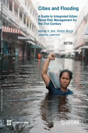 eBook - PDF
Cities and Flooding
A Guide to Integrated Urban Flood Risk Management for the 21st Century
- Abhas K. Jha, Robin Bloch, Jessica Lamond(Authors)
- 2012(Publication Date)
- World Bank(Publisher)
1.2.4. Coastal floods Coastal floods arise from incursion by the ocean or by sea water. They differ from cyclic high tides in that they result from an unexpected relative increase in sea level caused by storms or a tsunami (sometimes referred to as a tidal wave) caused by seismic activities. In the case of a storm or hurricane, a combination of strong winds that causes the surface water to pile up and the suction effects of low pressure inside the storm, creates a dome of water. If this approaches a coastal area, the dome may be forced towards the land; the increasing sea floor level typically found in inshore waters causes the body of water to rise, creating a wave that inundates the coastal zones. The storm surge usually causes the sea level to rise for a relatively short period of time of four to eight hours, but in some areas it might take much longer to recede to pre-storm levels. Coastal floods caused by tsunamis are less frequent than storm surges, but can also cause huge losses in low-lying coastal areas. The 2004 Indian Ocean Tsunami was caused by one of the strongest earthquakes ever recorded and affected the coasts around the ocean rim, killing hundreds of thousands of people in fourteen countries. 61 Cities and Flooding A Guide to Integrated Urban Flood Risk Management for the 21st Century 1.2.5. Groundwater floods Water levels under the ground rise during the winter or rainy season and fall again during the summer or dry season. Groundwater flooding occurs when the water table level of the underlying aquifer in a particular zone rises until it reaches the surface level. This tends to occur after long periods of sustained high rainfall, when rising water levels may cause flooding in normally dry land, as well as reactivate flows in bourns, which are streams that only flow for part of the year. This can become a problem, especially during the rainy season when these non-perennial streams join the perennial watercourses. eBook - PDF
- James Goff, C. R. de Freitas(Authors)
- 2016(Publication Date)
- Cambridge University Press(Publisher)
Other than for very small lakes, lake floods lag well behind rainfall peaks, and with low flood velocities there is low risk of injury or loss of life. Damage caused by lake floods is mainly to buildings and infrastructure. A case in point is the tourist town of Queenstown (population approximately 13 000) in the South Island of New Zealand, located on the shore of Lake Wakatipu. The centre of Queenstown is flooded periodically by the rising waters of the adjacent lake. Since the last major flood in 1999, several types of physical flood control measures have been proposed, but none has been adopted (Forsyth et al. 2004 ). Instead a new flood strategy, branded ‘Learning to live with flooding’ (Otago Regional Council and Queenstown Lakes District Council 2006 ), emphasises increasing the use of public guidelines on risk and adaptation. Coastal inundation is caused by the storm surge of ocean water, tsunamis, and high tides coinciding with periods of excessive rainfall, or downstream flooding in the vicinity of estuaries. Coastal inundation is a distinct category of flooding. It will be covered in a separate section later in this chapter, including case study 2.2, ‘Coastal Flooding and sea level rise’ . Measuring and monitoring floods The physical nature of downstream floods may be best illustrated by the discharge hydrograph curve ( Figure 2.4 ). The curve is produced by continuously measuring run-off from a catchment. The shape and dimensions of the curve are determined by two categories of factors: the meteorological event and the physical features of the catchment itself. The first category involves the intensity and total amount of rain as well as the path of the storm and its spatial extent. The second involves infiltration rates, soil moisture, land cover, the geometry of the river channel, and physical characteristics eBook - PDF
- Fred G. Bell(Author)
- 2004(Publication Date)
- CRC Press(Publisher)
Nonetheless, in developed coastal areas where there is substantial economic investment, there will be a continuing demand for engineered protection works. Obviously, such coastal defences need to be maintained. For example, Ciavola (1997) indicated that because the coastal defences along Spurn Head Spit, England, had not been maintained, the spit probably would be breached by any future storm surge. 8.13 Storm surges and marine inundation Except where caused by failure of protection works, marine inundation almost always is attributable to severe meteorological conditions giving rise to abnormally high sea levels, referred to as storm surges. For example, Murty (1987) described storm surges as oscillations of River and coastal engineering 629 coastal waters in the period range from a few minutes to a few days that were brought about by weather systems such as hurricanes, cyclones and deep depressions. Low pressure and driving winds during a storm may lead to marine inundation of low-lying coastal areas, particularly if this coincides with high spring tides. This is especially the case when the coast is unprotected. Floods may be frequent, as well as extensive where flood plains are wide and the coastal area is flat. Coastal areas that have been reclaimed from the sea and are below high tide level are particularly suspect if coastal defences are breached (Fig. 8.37). A storm surge can be regarded as the magnitude of sea level along the shoreline that is above the normal seasonally adjusted high tide level. Storm surge risk often is associated with a particular season. The height and location of storm damage along a coast over a period of time, when analysed, provide some idea of the maximum likely elevation of surge effects. The seriousness of the damage caused by storm surge tends to be related to its height and velocity of water movement. eBook - PDF
- Gerd Masselink, Roland Gehrels, Gerd Masselink, Roland Gehrels(Authors)
- 2014(Publication Date)
- American Geophysical Union(Publisher)
All coastal communities must live with a certain risk of coastal haz- ards, but measures ranging from coastal engineering to studies of human behaviour can minimize the potential for fatalities and economic loss, and therefore must be undertaken. 5 Coastal Hazards: Storms and Tsunamis ADAM D. SWITZER Earth Observatory of Singapore, Nanyang Technological University, Nanyang Avenue, Singapore 5.1 Coastal hazards, 104 5.1.1 Coastal vulnerability to storm and tsunami hazards, 105 5.1.2 Assessing risk, 106 5.2 Extratropical storms and tropical cyclones, 108 5.2.1 The anatomy of storms and cyclones, 108 5.2.2 Vulnerable coasts and the storm cycle, 109 5.2.3 Disequilibrium in the storm cycle, 112 5.3 Tsunamis, 114 5.3.1 Tsunamis in the ocean, 114 5.3.2 Tsunamis at the coast, 117 5.3.3 Tsunami drawdown, 117 5.3.4 Tsunami warning systems, 117 5.4 Overwash, 118 5.4.1 Overwash impacts, 120 5.4.2 Washover deposits, 121 5.5 Palaeostudies of coastal hazards, 121 5.5.1 Reviewing historical documents, 121 5.5.2 Using the geological record, 121 5.5.3 Overwash studies: successes and limitations, 123 5.6 Integrating hazard studies with coastal planning, 123 5.7 Cyclones in a warmer world, 125 5.8 Summary, 126 Key publications, 126 References, 126 Coastal Hazards: Storms and Tsunamis 105 The previous three chapters have outlined the main long-term drivers of coastal evolution, namely sea-level change, geology and sediment dynamics, and the long-term actions of waves and tides. This chapter investigates storms (including extratropical storms and tropical cyclones) and tsunamis, which are the primary coastal hazards that can generate marine inundation events, and describes their effects on the coast and coastal populations. This chapter will not deal with other coastal hazards such as coastal land subsidence. Sections on co-seismic subsidence and subsid- ence due to sediment loading or to groundwater extraction are found in Chapters 2, 3 and 12. et al ., 1987), which can produce severe flooding (e.g. Lynch, 1987; Mclnnes and Hess, 1992) and storm surges (Manly Hydraulics Laboratory, 1991; Hubbert and Mclnnes, 1999a). Along the east coast of South America, Coastal Flooding and increased ocean wave activity is often experienced as a result of intense cyclones that develop or intensify between 30 and 50° S (Innocentini and Caetano, 1996).
Storm surges
One of the major hazards arising from severe storms is storm surge . Storm surges cause enormous loss of life (approximately 450,000 Bangladeshis were killed by storm surges in the Bay of Bengal in the years 1970-86 (Murty et al ., 1986)) and property damage, and can have devastating impacts on coastal ecosystems and morphology. Storm surges occur in response to changes in atmospheric pressure and to wind stresses that exert a drag on the ocean surface. Currents induced by wind stresses are deflected by Coriolis forces to produce wind-driven Ekman transport. When a coastline blocks the deflected flow, elevated sea levels are produced. This effect is often referred to as coastal current set-up . The atmospheric forcing is uniform neither in time nor in space, and longshore variations exist. Thus surges, once formed on the open coastline, are often observed to travel along the coast in a clockwise (anticlockwise) direction in the northern (southern) hemisphere as forced Kelvin waves (Gill, 1982).Figure 36.3 Locations of tropical cyclone formation during a twenty-year period, based on sustained surface winds exceeding 17.5 m s-1Source: Adapted from Gray, 1979Bathymetry and ocean depth are also important factors in relation to storm surges. Shallow continental shelves amplify the effects of surface winds on the ocean. For example, the northern Bay of Bengal is particularly vulnerable to the effects of storm surge (Murty et al ., 1986; Flather and Khandker, 1993; Kausher et al ., 1994). Often such regions experience large tidal ranges for the same reason and therefore run a greater risk of experiencing severe inundation if high tides and surge coincide. In wide, shallow, partially enclosed bays, steady winds can produce a piling up of the water at the windward end of the bay. This effect is commonly referred to as wind set-up eBook - PDF
Modelling Nature-based Solutions
Integrating Computational and Participatory Scenario Modelling for Environmental Management and Planning
- Neil Sang(Author)
- 2020(Publication Date)
- Cambridge University Press(Publisher)
through force of pressure or erosion (critically important to evaluating risk to life, structural damage and NBS resilience). coastal and freshwater flood models 211 The models are reviewed principally as to whether they are informa- tive for how to manage the water itself, as it accumulates on the surface in volumes which impact physical planning. The chemical and ecological components of the water will not be addressed in any detail, nor slower processes such as groundwater. However, a longer- term perspective will be provided in the section on Integrated Assessment Models. 6.3 sea inundation Both coastal and freshwater floods are commonly estimated in terms of the level expected during a given interval of years, e.g. a 10-year event or a 50-year event, as measured from a stated baseline year. For example, a 50-year event is the highest sea level or rainfall level expected every 50 years given the current climate, i.e. it may occur tomorrow or in 30 years, but it is expected to occur within 50 years. That is not necessarily the maximum level which is to be expected given the climate which might pertain in 50 years from today. Arguably, simply saying ‘there is currently a 1 in 50 chance per year of such a flood level’ is less misleading, but the terminology is well established. This review will deal primarily with how to model the sea inundation spatially once the maximum sea-level rise has been calcu- lated, rather than delve into the complexities of how those sea-level scenarios may be generated (e.g. Bardet et al., 2011). 6.3.1 Basic GIS Coastal Inundation Models The simplest model for sea inundation is the so-called ‘bath-tub’ approach, whereby the predicted sea level is measured against a terrain model of the area (Digital Terrain Model, DTM) based on digital elevation data (a Digital Elevation Model, DEM). The chief advantage is that a bath-tub model is trivial to implement and easy to understand. eBook - PDF
Geomorphology and Natural Hazards
Proceedings of the 25th Binghamton Symposium in Geomorphology, Held September 24-25, 1994 at SUNY, Binghamton, USA
- M. Morisawa(Author)
- 2013(Publication Date)
- Elsevier Science(Publisher)
Floods are part of a very broad range of water-related phenomena that have immense impacts upon human beings. These phenomena exert their influence on human affairs mainly through concerns about water supply and hazard reduction. It is out of such concerns, rather than inherent curiosity, that society provides resources for research on hydrological processes. The designs that serve to bring research results into practice are the products of various water engineers, and engi-neering philosophies have until recently dominated hydrological research. Due in part to heightened rec-ognition of global environmental problems, however, there is a current initiative to emphasize ' 'fundamental hydrologic science... as a geoscience alongside the atmospheric, ocean, and solid earth sciences (National Research Council, 1991). Critical to the rationale for this new emphasis is the relationship of water geoscience to the world of human affairs: water resources management and decision making. The role of geomorphology in this conceptualization (National Research Council, 1991, p. xi) is to be one of many disciplines concerned with understanding water phe-nomena (hydrologic science). When combined with statistics, fluid mechanics, meteorology, and other fundamentals, these sciences provide the basis in understanding for forecasting, which is stated to be the proper role for engineering hydrology. The forecasting role can then be combined with economics, law, polit-ical science, and resource sciences to justify decisions by water-resource managers. Of course, this is business as usual. In this regard, let us consider a possible model forecast, expressing a high flood risk for a certain site. Suppose that the model 150 V.R. Baker / Geomorphology 10 (1994) 139-156 Fig. 3. Destruction of apartment buildings by bank erosion of Rillito Creek, Tucson, Arizona, October 2, 1983. Photograph by S. Reynolds, Arizona Geological Survey.
- John Noye(Author)
- 1999(Publication Date)
- World Scientific(Publisher)
Modelling Coastal Sea Processes B.J. Noye (Editor) ©World Scientific Publishing Co., 1999 Modelling Storm Surges and Coastal Ocean Flooding G r a e m e D . H u b b e r t Global Environmental Modelling Systems, Warrandyte, VIC 3113, Australia P O Box 149, Warrandyte, VIC 3113, Australia g d h S a t m o s . d a r . c s i r o . a u K a t h l e e n L. M c l n n e s CSIRO Division of Atmospheric Research, Aspendale, Vic 3195, Australia Kathy.Mclnnesfldar.csiro. au ABSTRACT. This article discusses the processes that contribute to storm surges and Coastal Flooding and describes numerical techniques used for modelling such processes, particularly with regard to overland Coastal Flooding. A storm surge model, which features a nesting capability and inundation algorithm, is described. The flooding and draining is dependent on the modelled current in adjacent 'wet' grid cells which ensures realistic and smoothly varying results. Several examples of the application of this system are presented. Through these examples, it is demonstrated that the inundation model is robust in a variety of geographical locations and under a range of grid resolutions. Surge heights at the coast are also compared with simulations where overland inundation is switched off and it is found that elevations are greater by up to 17% when the coastal boundary is approximated by a fixed wall. The applications of this system to hazard management and impact studies are also discussed. KEY WORDS: Coastal Flooding, impact studies, inundation, numerical modelling, risk assess-ment, storm surge, tidal modelling. CONTENTS 1. Introduction 160 2. Storm Surges and Coastal Sea Levels 162 3. Sea Level Modelling 163 4. Coastal Ocean Flood Modelling 167 5. Examples of Deterministic Sea Level Modelling 169 6. Hazard Assessment Modelling 183 7. Summary 185 Acknowledgements 186 References 186 159 eBook - PDF
- Robert G. Watts(Author)
- 2013(Publication Date)
- CRC Press(Publisher)
E., Journal of Coastal Research , 8(4), 840–853, 1992; Dean, R. G., Dalrymple, R. A., Coastal Processes with Engineering Applications. Cambridge, U.K.: Cambridge University Press, 2002. FIGURE 4.8 A coastal home on piles for protection against storm surge. 152 Engineering Response to Climate Change bear the financial burden through participation in the Federal Emergency Management Agency (FEMA) insurance program. To do so, FEMA presently uses the HAZUS-MH hurricane wind model to estimate hurricane-induced damage to buildings, essential facilities, transportation, and utility lifelines (HAZUS-MH MR4 Hurricane Manuals 2012). These observations suggest that (1) calibration of the construction code over a wide set of coastal physical conditions, (2) code implementation, and (3) code enforcement are the main factors responsible for preventing contin-ued loss of coastal property from storms. On the other hand, the potential for damage from more intense and frequent storms will require consideration in the coming years. In 1996, a study in Japan used land mass, population, and property as risk indicators to assess the impact of SLR because of a severe storm or tsunami surge. It was revealed that even under non-storm conditions, more than 860 km 2 of land was already below mean high water level. Over 2 million peo-ple live in this zone. If the sea level was to rise by 1 m, this zone would expand to 2300 km 2 . The affected population would be over 4 million and prop-erty loss exceeding a trillion dollars. The present flood-prone area of about 6300 km 2 would expand to 8900 km 2 and the lives of more than 15 million people would be affected (CGER 1996). In fact, the 2011 tsunami on the Pacific coast of T ō hoku hugely exceeded any predicted scenario; the surge rose to heights of up to 40.5 m in Miyako (Iwate Prefecture) and traveled up to 10 km inland in the Sendai area. eBook - PDF
Climate Change at the City Scale
Impacts, Mitigation and Adaptation in Cape Town
- Anton Cartwright, Susan Parnell, Gregg Oelofse, Sarah Ward, Anton Cartwright, Susan Parnell, Gregg Oelofse, Sarah Ward(Authors)
- 2012(Publication Date)
- Routledge(Publisher)
Chapter 3 Understanding the risks to Cape Town of inundation from the sea Geoff Brundrit and Anton Cartwright Introduction Worldwide, people are migrating to the coast, attracted by access to food, transport connections, ports, and work and leisure opportunities. Coastal cities are growing rapidly in population, and require the provision of adequate infrastructure and services to meet demand. This accelerating coastal development is taking place under the assumption of a stable and unchanging coastal environment. However, global climate change and its impacts have been identified as one of the major challenges facing coastal countries in the 21st century. Impacts on the environment, the economy and communities in the coastal zone are expected to be challenging (IPCC 2007; Stern et al. 2006). Reductions in greenhouse gas emissions will help to avoid extremes in the climate response, but the future coastal impacts that actually take place will require well considered adaptation measures. Planning and decision-making are constrained by inadequate understanding of the response to climate change to be expected in the coastal zone. There is an urgent need to quantify the extent of likely impacts of climate change, to identify the vulnerability of coastal settlements to these impacts, and thereby to assess and improve the ability of coastal communities to cope with their consequences. Important responses to climate change along the coast which will impact on coastal communities are sea-level rise and the intensification of coastal storms. Forecasts of the timescales, magnitudes and rates of change of these responses vary considerably, partly because of uncertainties about future emissions but also because of a lack of understanding of how these responses will evolve in the future. However, there is already a better understanding of the present contributions to sea-level rise from changes in ocean volume, ocean mass and thermal expansion and how they might evolve.
Index pages curate the most relevant extracts from our library of academic textbooks. They’ve been created using an in-house natural language model (NLM), each adding context and meaning to key research topics.