Geography
Coastal Retreat Geography
Coastal retreat refers to the gradual or sudden movement of the coastline inland due to erosion, sea level rise, or other natural processes. This geographical phenomenon can result in the loss of land, property, and infrastructure, impacting both human and natural environments. Coastal retreat is a significant concern in the field of geography due to its implications for coastal management and environmental planning.
Written by Perlego with AI-assistance
Related key terms
1 of 5
8 Key excerpts on "Coastal Retreat Geography"
 eBook - PDF
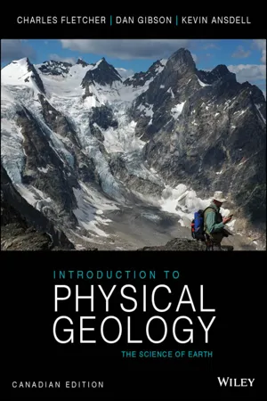
- Charles Fletcher, Dan Gibson, Kevin Ansdell(Authors)
- 2014(Publication Date)
- Wiley(Publisher)
With so much of our culture and economy focused on the shore- line, geologists need to play an active role in advancing the scientific understanding of coastal environments and providing scientific data that can be used to improve management plans and programs. As a result, in recent decades, the new field of coastal geology has emerged. Coastal geology is concerned with understanding coastal processes (such as how waves and currents move sediment), the geologic his- tory of coastal areas, and how humans live in coastal environments (FIGURE 22.2). Coastal Processes Sediments in the coastal zone may come from watersheds (typically siliciclastic sediments) as well as from the ocean (typically carbon- ate sediments). Winds, waves, and currents transport and deposit these sediments, thereby shaping various coastal environments, such as beaches, estuaries, deltas, wetlands, and reefs. Since the last ice age, rising global sea level (over 120 m) has flooded river mouths, drowned low-lying coastal lands, and shifted the coastline landward, in many cases over hundreds of kilometres. Winds, waves, tides, sea-level change, and currents act as agents of change; they are col- lectively called coastal processes. They sculpt the shoreline through erosion and deposition of sediment and by flooding low areas. Un- derstanding how coastal processes and sedimentary materials inter- act is crucial to interpreting the geologic history of coastal systems and finding ways for people to live in the coastal zone in a sustainable manner. FIGURE 22.1 Hurricane Sandy made landfall on October 29, 2012, at Brigantine, New Jersey. The storm produced large, damaging waves and strong winds and raised the ocean level more than 3 m to 6 m above normal. Large segments of the U.S. eastern seaboard were heavily damaged, and roads, homes, and businesses in many communities were destroyed. eBook - PDF
Water Quality Modeling
Rivers, Streams and Estuaries
- R. Manivanan(Author)
- 2021(Publication Date)
It is therefore necessary to study this valuable region so as to prevent that competing activities are gradually causing depletion of the resources in the coastline. The following figures (Fig. 7.1and 7.2) show the typical coastal area of rocky coast and sandy coast. Fig. 7.2 Sandy Shore Coastal geography is the study of the dynamic interface between the ocean and the land, incorporating both the physical geography (i.e coastal geomorphology, geology and oceanography) and the human geography (sociology and history) of the coast. It involves an understanding of coastal weathering processes, particularly wave Fig. 7.1: Rocky Shore 95 MODELING - COASTAL AND ESTUARIES action, sediment movement and weather, and also the ways in which humans interact with the coast. 7.2 Coastal Processes The waves of different strengths that constantly hit against the shoreline are the primary movers and shapers of the coastline. Despite the simplicity of this process, the differences between waves and the rocks they hit result in hugely varying shapes. The effect that waves have depends on their strength. Strong, also called destructive waves occur on high energy beaches and are typical of Winter. They reduce the quantity of sediment present on the beach by carrying it out to bars under the sea. Constructive, weak waves are typical of low energy beaches and occur most during summer. They do the opposite to destructive waves and increase the size of the beach by piling sediment up onto the berm. One of the most important transport mechanisms results from wave refraction. Since waves rarely break onto a shore at right angles, the upward movement of water onto the beach occurs at an oblique angle. However, the return of water is at right angles to the beach, resulting in the net movement of beach material laterally.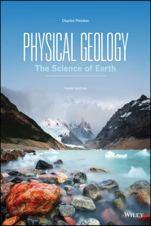 eBook - PDF
Physical Geology
The Science of Earth
- Charles Fletcher(Author)
- 2017(Publication Date)
- Wiley(Publisher)
With so much of our culture and economy focused today on the shoreline, it is essential that geologists advance the scientific understanding of coastal environments and provide reliable data that can be applied to improving management plans and programs. To that end, in recent decades a new field of study, coastal geology, has emerged. Coastal geology is concerned with understanding coastal processes (such as how waves and currents move sediment), the geologic history of coastal areas, and how humans live in coastal environments (Figure 20.2). Shorelines Are in a State of Perpetual Change 615 FIGURE 20.2 Trash like this washes up on beaches around the world because humans have been polluting the ocean for decades. Peter Chadwick/Getty Images, Inc. What are the potential consequences of dumping garbage in the ocean? Coastal Processes Sediments in the coastal zone may come from watersheds (typ- ically, siliciclastic grains) as well as from the ocean (typically, calcium carbonate). Winds, waves, and currents transport and deposit these sediments, thereby shaping various coastal environments—beaches, estuaries, deltas, wetlands, and reefs. Since the last ice age, a rising global sea level (over 120 meters) has flooded river mouths, drowned low-lying coastal lands, and shifted the coastline landward, in many cases over hundreds of kilometers. Winds, waves, tides, sea level change, and currents act as agents of change, collectively called coastal processes. They sculpt the shoreline through erosion and deposition of sedi- ment and by flooding low areas. Understanding how coastal processes and sedimentary materials interact is crucial to inter- preting the geologic history of coastal systems and finding ways for people to live in the coastal zone in a sustainable manner. Coastal Terminology Scientists employ a number of specific terms when describing the coastal zone. eBook - ePub
The Geography of Tourism and Recreation
Environment, Place and Space
- C. Michael Hall, Stephen J. Page(Authors)
- 2014(Publication Date)
- Routledge(Publisher)
et al. 2013). In the latter case, the ability of a resort to adapt by reinventing itself, providing differentiated products and innovating in terms of providing new services, has challenged the conventional notion of the direction resort development follows. Finally, geographers have also made useful contributions to the policy, planning and management of coastal environments. But what marks this area out in the geography of recreation and tourism is the sparse nature of these studies within the mainstream literature, with the entire theme seeming almost unfashionable and knowledge often being based on findings from studies published in the 1960s, 1970s and 1980s, despite the significance of Fabbri’s (1990) and Wong’s (1993b) collections of papers on the topic by geographers and non-geographers (e.g. Phillips and House 2009). As a result, the following section examines the different contributions geographers have made and the significance to increasing our knowledge of the coast in the formation of distinct leisure and tourism geographies.Historical analysis of recreation and tourism in the coastal zoneIn many Anglo-American geographical analyses of recreation and tourism the English seaside resort is a popular topic for discussion and it is often portrayed as a salutory lesson with respect to the rise and fall of tourism destinations. Indeed, A.M. Williams and Shaw’s (1998) interesting analysis of the rise and fall of the English seaside or coastal resort examined two principal concerns of the historical geographer and contemporary tourism geographer: continuity and change in the development, organisation and prospects for the resort. Most analyses of the English seaside resort by geographers (e.g. Patmore 1968) refer to the seminal studies by E.W. Gilbert (1939, 1949) and the doctoral thesis by Barrett (1958). Despite these influential studies, the most notable contributions to the analysis of English resorts came from the social and economic historians, such as Walton (1983), and the geographical analysis by Towner (1996). What these studies emphasise are the role of historical sources, such as the census, development plans, advertising, photographic archives and other documentary sources, in reconstructing the recreational and tourism environments in coastal areas in the Victorian, Edwardian and subsequent periods. Specific phenomena, such as the English holiday camp, examined by Ward and Hardy (1986), are also charted using similar sources. An illustration of the importance of examining the historical issues in the development of the coast as a tourism and leisure resource is seen in Box 8.1 eBook - PDF
- Mateo Gutierrez(Author)
- 2012(Publication Date)
- CRC Press(Publisher)
11 COASTAL GEOMORPHOLOGY 1. Introduction 2. Brief history of coastal geomorphology 3. Temporal and spatial scales 4. Sea level variations 5. Waves, currents, and tides 6. Cliff coasts and rocky platforms 7. Coral reef coasts 8. Beaches, barriers, and spits 9. Coastal dunes 10. Mudflats, salt marshes, and mangroves 11. Estuaries and deltas 12. Coastal environments: Uses, management, and risks 11.1 Introduction Bird (2000) defines coastal geomorphology as the study of the evolution of coastal landforms, the processes that affect them, and the changes they undergo. These landforms include cliffs, rocky coastal margins, beaches, dunes, estuaries, lagoons, and deltas. The world’s coastal margins are about 100 m wide and 440,000 km long; humans use them for industrial pur- poses, transportation, and recreation. These human activities profoundly impact these areas. The United Nations estimates that 66% of the world’s population lives within a few kilom- eters of the coast (Pethick, 1984). As a result, food produc- tion, communication, cities, and recreational areas all affect the coast. Coasts have significant problems that include flood- ing, erosion, pollution, and sea level variations that require constant attention. Interdisciplinary studies by coastal engi- neers, oceanographers, and geomorphologists have led to significant advances in coastal management (Stephenson and Brander, 2003). In addition, coasts are constantly changing; the change may be catastrophic or imperceptible. Modifica- tions may occur over decades or centuries but they can also take place in a period of hours or minutes. 11.2 Brief history of coastal geomorphology Prior to the 20th century, research on coastal geomorphology was limited to engineering topics related to coastal erosion (Walker and MacGraw, 2005). Charles Darwin made impor- tant observations on coral reefs and the origin of atolls during his famous voyage on the British ship, the Beagle, in 1835 (Shepard, 1959). eBook - ePub
Climatic Hazards in Coastal Bangladesh
Non-Structural and Structural Solutions
- Bimal Paul, Harun Rashid(Authors)
- 2016(Publication Date)
- Butterworth-Heinemann(Publisher)
Coastal landforms include both depositional (e.g., sand spits, dunes, shore platforms, tombolo, and cuspate forelands) and erosional (e.g., sea cliffs, sea arches, and sea stacks) features. As one of the most dynamic environments, coastal landforms' constant changes are the result of both human activities and physical processes (Masselink and Gehrels, 2014). Over 4 billion people worldwide now live on the coast. With rapid coastal population growth, human impact on coastal regions increased dramatically during the 20th century, and this trend will continue through the 21st century. Human interventions have led to widespread conversion of natural coastal landscapes to agriculture, aquaculture, and silviculture, as well as to industrial and residential uses (Valiela, 2006). About 23% of the world's population currently lives within 67 miles (100 km) of the coast (Masselink and Gehrels, 2014). In addition, 21 of the 33 megacities can be considered coastal cities (Martinez et al., 2007). 1 The attractiveness of the coastal resources has resulted in disproportionately rapid expansion of economic activity, settlements, urban centers, and tourist resorts. Migration of people to coastal regions is common in both developed and developing nations. Exploitation of coastal resources has led, in many cases, to severely damaged coastal ecosystems and depleted natural resources. Environmentalists suspect that the direct impacts of human activities on the coastal zone have been more significant over the past century than impacts that can be directly attributed to observed climate change (Lotze et al., 2006). The other major direct impacts of human interventions on the coastal zones include drainage of coastal wetlands, dune alterations, highway construction, deforestation and reclamation, and discharge of sewage and contaminants into coastal waters eBook - PDF
Climate Change and the Coast
Building Resilient Communities
- Bruce Glavovic, Mick Kelly, Robert Kay, Ailbhe Travers, Bruce Glavovic, Mick Kelly, Robert Kay, Ailbhe Travers(Authors)
- 2014(Publication Date)
- CRC Press(Publisher)
285 Chapter 13 From coping to resilience The role of managed retreat in highly developed coastal regions of New Zealand Andy Reisinger, Judy Lawrence, Georgina Hart, and Ralph Chapman Abstract: Sea-level rise is an inevitable consequence of a warming world and will continue long after global average temperatures may have been stabilized. Nonetheless, significant uncertainty remains about the rate and magnitude of this rise over the coming decades to centuries, in particular, the contribution from polar ice sheets. Most responses to sea-level rise con-sist of coping mechanisms, such as raising minimum floor levels applied to existing developments, or preventative measures, such as coastal haz-ard lines applied to greenfield developments. However, the effectiveness of such responses, if they are employed in a static way and not supported by additional policies that recognize the dynamic nature of coastal haz-ards, is expected to diminish as sea level continues to increase in the long term (beyond 2100) and may exceed process model-based projections even within the twenty-first century. Here, we aim to advance the discussion of managed retreat as an additional tool to promote the resilience of highly developed coastal regions and to increase the flexibility of local response options. We provide an overview of policies to support managed retreat that link with different socioeconomic contexts, community preferences, and timescales for implementation. We explore the potential implications of these alternative approaches for two case study sites in New Zealand and highlight the technical and institutional elements that would support the implementation of managed retreat in practice. eBook - PDF
- Tom Garrison, Robert Ellis(Authors)
- 2017(Publication Date)
- Cengage Learning EMEA(Publisher)
Copyright 2018 Cengage Learning. All Rights Reserved. May not be copied, scanned, or duplicated, in whole or in part. WCN 02-300 153 8 Coasts KEY CONCEPTS The location of a coast depends on global tectonic activity and the ocean’s water volume. The shape of a coast is a product of uplift and subsid-ence, the wearing down of land by erosion, and the redistribution of material by sediment transport and deposition. Coasts may be classified as erosional coasts (on which erosion dominates) or depositional coasts (on which deposition dominates). Beaches change shape and volume as a function of wave energy and the balance of sediment input and removal. Human interference with coastal processes has generally accelerated the erosion of coasts near inhabited areas. Coasts are places of rapid change, tenacious organisms and often great beauty. The northern California coastline along Big Sur is a stunning example of the complexity that can occur at the land and sea interface. Lynn Y/Shutterstock.com Post-Glacial Sea Level Rise 20 18 0 12 6 0 14 8 4 16 10 2 Thousands of years ago 00 50 50 25 75 75 Copyright 2018 Cengage Learning. All Rights Reserved. May not be copied, scanned, or duplicated, in whole or in part. WCN 02-300 CHAPTER 8 154 8.1 Coasts Are Shaped by Marine and Terrestrial Processes Coastal areas join land and sea. Our personal experience with the ocean usually begins at the coast. Have you ever wondered why a coast is shaped as you see it? These temporary, often beautiful junctions of land and sea are subject to rearrange-ment by waves and tides, by gradual changes in sea level, by biological processes, and by tectonic activity. The place where ocean meets land is usually called the shore , and the term coast refers to the larger zone affected by the processes that occur at this boundary.
Index pages curate the most relevant extracts from our library of academic textbooks. They’ve been created using an in-house natural language model (NLM), each adding context and meaning to key research topics.