Geography
Flooding
Flooding is a natural disaster that occurs when water overflows onto land that is normally dry. It can be caused by heavy rainfall, snowmelt, or a combination of both. Flooding can have devastating effects on communities, causing damage to homes, businesses, and infrastructure.
Written by Perlego with AI-assistance
Related key terms
1 of 5
11 Key excerpts on "Flooding"
 eBook - PDF
Floods, from Defence to Management
Symposium Proceedings of the 3rd International Symposium on Flood Defence, Nijmegen, The Netherlands, 25-27 May 2005, Book + CD-ROM
- Jos van Alphen, Eelco van Beek, Marco Taal(Authors)
- 2006(Publication Date)
- CRC Press(Publisher)
This contribution gives an overview of characteris-tic data on floods and Flooding on a global scale. Data on flood events from 1985 till 2003 have been analysed and will be presented. An overview and comparison of flood management strategies gives an indication how different societies and nations attempt to cope with these hazards. In order to analyse data on floods and Flooding, a distinction is made between different categories of countries and continents. The categorisation is based on the economic status of countries, as defined by the World Development Indicators database of the World Bank (2003): • Least developed countries: low (US$ 2,975 or less) Gross National Income (GNI)/capita; • Emerging countries: middle (US$ 2,976–9,205) GNI/capita; • Developed countries: high (US$ 9,206 or more) GNI/capita. Definition of floods and Flooding Definitions of ‘floods’ and ‘Flooding’ are often con-founding and mixed up when issues concerning high water stages or peak discharges are portrayed. Here both denominations are defined as follows: • A flood is defined as a temporary condition of sur-face water (river, lake, sea), in which the water level and/or discharge exceed a certain value, thereby escaping from their normal confines. However, this does not necessarily result in Flooding (Munich-Re, 1997). • Flooding is defined as the overflowing or failing of the normal confines of e.g. a river, stream, lake, sea or accumulation of water as a result of heavy pre-cipitation by lacking or exceedance of the discharge capacity of drains, both affecting areas which are normally not submerged. 1.1 Floods, Flooding and other natural disasters The worldwide damage caused by floods has been extremely severe in recent decades. No other natural hazard appeared so frequent, has claimed more human lives, generated such large economic losses, ruined more fertile land and destroyed more houses. eBook - PDF
- James Goff, C. R. de Freitas(Authors)
- 2016(Publication Date)
- Cambridge University Press(Publisher)
Flooding occurs in all climatic regions of Australasia. Unlike many other natural hazards, their frequency puts them high in importance on the list of natural hazards for most countries. A combination of factors is responsible, mostly but not entirely due to weather and climate. Heavy rainfall is implicated in causing a flood, but vulnerability to flood loss is generated by human action. Types of flood damage include injuries and loss of life, physical damage, income loss (including indirect losses), emergency costs, and social disruption. Measures for reducing the impacts of floods fall into one or more of five categories of response: avoidance, protection, regulation, relocation, compensation and education. Watershed and floodplain management is a multi-faceted approach that involves all of these categories of responses aimed at decreasing the effects of Flooding. When similar physical events are described as hazards, quite different features may become important. Take, for example, the urban snow hazard. The threshold for a crippling snowfall in Toronto, Canada, is higher than the threshold for the even colder Canadian city of Regina (de Freitas 1975 ). Therefore, a snow storm producing 20 cm of snow will cause much more disruption in Regina than in Toronto. This is because the physical character of a snowfall event involves more than just snowfall amount. The snow water equivalent and the air temperature and wind speed at the time of the snowfall event need to be considered alongside snow accumulation. To understand and explain the human response to snowfall and its impact, a number of other snowfall hazard event characteristics are also important (de Freitas 1975 ). This applies to all natural hazards. The physical significance of the flood event may be gained only by taking into account the combined effects of hazard event characteristics. eBook - PDF
Flood Risk
The Holistic Perspective
- Zoran Vojinovic(Author)
- 2015(Publication Date)
- IWA Publishing(Publisher)
1.1 SETTING THE SCENE Floods are commonly defined as an overwhelming flow of water onto land that is normally dry and which under certain circumstances can cause unprecedented losses and devastation. The argument put forward in this book is that these losses are often the result of a wide range of interactions between different actors and processes which can be natural, human and technology related. Therefore, flood-related problems should be viewed from as many different perspectives as possible before a way of dealing with them is selected. The purpose of the discussion in this opening chapter is to illustrate the complexity of flood-related problems and to suggest the way forward. According to the International Disaster Database (EM-DAT), over the last seventy years, the incidence of floods has shown the fastest rate of increase relative to other types of disasters (see also Guha-Sapir et al. 2012), Figure 1.1. Devastation due to these events occurs almost daily. Even though our technological capabilities for dealing with floods have advanced rapidly over the same period, and while global economic growth per capita has doubled, flood events have become ever more disastrous (see for example, Pelling, 2011). Does this mean that our technological developments have advanced independently from the social and wider ecological needs? This paradoxical situation can be viewed as a result of our narrow and fragmented perception of reality which has proved to be inadequate for dealing with some of the greatest problems of our time. As pointed out some time ago by Burton and Kates (1964), the perception of floods and other natural disasters as ‘those elements of the physical environment harmful to man and caused by forces extraneous to him’ has led to the preference for physical rather than social treatment of floods, with urban societies being allowed to live under the shadow of increasing risk. eBook - PDF
Geomorphology and Natural Hazards
Proceedings of the 25th Binghamton Symposium in Geomorphology, Held September 24-25, 1994 at SUNY, Binghamton, USA
- M. Morisawa(Author)
- 2013(Publication Date)
- Elsevier Science(Publisher)
Floods are part of a very broad range of water-related phenomena that have immense impacts upon human beings. These phenomena exert their influence on human affairs mainly through concerns about water supply and hazard reduction. It is out of such concerns, rather than inherent curiosity, that society provides resources for research on hydrological processes. The designs that serve to bring research results into practice are the products of various water engineers, and engi-neering philosophies have until recently dominated hydrological research. Due in part to heightened rec-ognition of global environmental problems, however, there is a current initiative to emphasize ' 'fundamental hydrologic science... as a geoscience alongside the atmospheric, ocean, and solid earth sciences (National Research Council, 1991). Critical to the rationale for this new emphasis is the relationship of water geoscience to the world of human affairs: water resources management and decision making. The role of geomorphology in this conceptualization (National Research Council, 1991, p. xi) is to be one of many disciplines concerned with understanding water phe-nomena (hydrologic science). When combined with statistics, fluid mechanics, meteorology, and other fundamentals, these sciences provide the basis in understanding for forecasting, which is stated to be the proper role for engineering hydrology. The forecasting role can then be combined with economics, law, polit-ical science, and resource sciences to justify decisions by water-resource managers. Of course, this is business as usual. In this regard, let us consider a possible model forecast, expressing a high flood risk for a certain site. Suppose that the model 150 V.R. Baker / Geomorphology 10 (1994) 139-156 Fig. 3. Destruction of apartment buildings by bank erosion of Rillito Creek, Tucson, Arizona, October 2, 1983. Photograph by S. Reynolds, Arizona Geological Survey. eBook - PDF
- Chris Zevenbergen, Adrian Cashman, Niki Evelpidou, Erik Pasche, Stephen Garvin, Richard Ashley(Authors)
- 2010(Publication Date)
- CRC Press(Publisher)
In extreme floods, only reservoirs that retain large volumes of floodwater clearly exhibit an impact on flood magnitude. 2.2.5 Causes of Flooding The different types of watercourses, runoff regimes, flow processes and land uses all combine with physical geography to create various causes of Flooding. Broadly speak-ing, flood events affecting urban areas stem from six main causes: 1. in mountain areas, the effects of heavy, warm spring rains on winter snow causing sudden melting; 2. regional weather systems that are blocked by high pressure systems and produce widespread heavy rain over large sections of major river catchments; FIGURE 2-9 Flooding from small watercourses Water flows from small watercourse into urban area as culvert capacity is exceeded Flood zones adjacent to small water courses just like large ones FIGURE 2-10 Flooding from minor drainage systems Capacity exceeded due to additional runoff from excess urbanisation/ climate change Capacity exceeded due to runoff inadequately drained green space 2.2 TYPES OF Flooding 50 3. flash floods in hilly and mountainous regions; 4. short duration, high intensity thunderstorm-driven local Flooding on small streams entirely within the urban areas; 5. sewer Flooding associated with blocked sewer overflows to larger rivers or surcharg-ing through manhole covers; 6. groundwater Flooding can be a result of prolonged heavy rainfall in certain geologi-cal conditions. Regional widespread Flooding may result from prolonged heavy rain, saturating the ground and reducing its permeability. Under these conditions, any significant rainfall event will give rise to immediate increases in runoff and can lead to widespread Flooding which will also affect urban areas. Streams that drain water from upland areas and then descend into urban areas often cause serious damage to urban infrastructure. However, flash floods are not evenly distributed in time and space.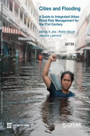 eBook - PDF
Cities and Flooding
A Guide to Integrated Urban Flood Risk Management for the 21st Century
- Abhas K. Jha, Robin Bloch, Jessica Lamond(Authors)
- 2012(Publication Date)
- World Bank(Publisher)
Instead of implementing conventional hard engineering measures to control floods in the Yangtze River, the Government adopted a new approach that includes restoration of 14,000 km2 of natural wetlands by 2030. Floodplain restoration is a flexible, no regret approach that will be cost- effective regardless of changes in future flood risk. Source: Pittock and Xu 2011. 60 1.2.3. Pluvial or overland floods Pluvial floods also known as overland floods are caused by rainfall or snowmelt that is not absorbed into the land and flows over land and through urban areas before it reaches drainage systems or watercourses. This kind of Flooding often occurs in urban areas as the lack of permeability of the land surface means that rainfall cannot be absorbed rapidly enough, Flooding results. Pluvial floods are often caused by localized summer storms or by weather conditions related to unusually large low pressure areas. Characteristically, the rain overwhelms the drainage systems, where they exist, and flows over land towards lower-lying areas. These types of floods can affect a large area for a prolonged period of time: the 2007 floods in the Hull area in the UK were the result of prolonged rainfall onto previously saturated terrain which overwhelmed the drainage system and caused overland Flooding in areas of the city outside the fluvial floodplain. Pluvial floods may also occur regularly in some urban areas, particularly in tropical climates, draining away quickly but happening very frequently, even daily, during the rainy season. 1.2.4. Coastal floods Coastal floods arise from incursion by the ocean or by sea water. They differ from cyclic high tides in that they result from an unexpected relative increase in sea level caused by storms or a tsunami (sometimes referred to as a tidal wave) caused by seismic activities. eBook - PDF
- Muthukrishnavellaisamy Kumarasamy(Author)
- 2012(Publication Date)
- IntechOpen(Publisher)
The likelihood of increasing frequency of heavy precipitation events is assessed as ’likely’ for the last four decades of the 20th century and ’very likely’ for the 21st century. This also means that over most regions of the Earth’s land surface an ever growing proportion of total precipitation will fall in the form of heavy rainfalls (Burroughs, 2003). The intensification trend of tropical cyclone activity, observed in some regions since 1970, will probably also continue in the 21st century. As a consequence, rainfall events concentrated in time and space are expected to lead to serious local Flooding in many parts of the world. Floods are remarkable hydrometeorological phenomena and forceful agents of geomorphic evolution in most physical geographical belts and, from the viewpoint of human society, among the most important environmental hazards. Except for extreme environments, floodplains and the immediate surroundings of streams are usually densely inhabited areas and, therefore, they are of high vulnerability to floods. According to the European Environment Agency (EEA, 2010), floods rank as number one on the list of natural disasters in Europe over the past decade. Authors of the report claim that ”the events resulting in the largest overall losses were the floods in Central Europe (2002, over EUR 20 billion), in Italy, France and the Swiss Alps (2000, about EUR 12 billion) and in the United Kingdom (2007, over EUR 4 billion)” (p. 8.). With accumulating knowledge on the water regime of major rivers, the inundation hazard from riverine floods can be defined with some precision. To estimate the magnitude of this hazard in small catchments, however, poses more problems. 2. Flash flood research 2.1 Definitions and approaches Flash floods (synonym: storm-driven floods) can be defined from various aspects: as hydrometeorological phenomena, natural hazards or geomorphic agents. eBook - PDF
Forest Hydrology
An Introduction to Water and Forests, Third Edition
- Mingteh Chang(Author)
- 2012(Publication Date)
- CRC Press(Publisher)
Obviously, as discussed above, the impact of an activity is greater and the chance of flood occurrences is higher when these activities are conducted under wet antecedent conditions. Careful planning for the activities to be conducted during dry seasons can mitigate the impact. 383 Forests and Flooding The controversy over deforestation has become more intense and drawn more atten-tion than the discussion of any other human activity and has involved the following considerations: 1. The effect of forests on streamflow regimes, being greatest among all the ecologi-cal systems 2. Forests covering about 30% of the Earth’s total land surface, the largest type of land-use on Earth 3. Previous experiences with Flooding and forest clear-cutting in upstream areas 4. Historical lessons on the abuse of forest resources in the Middle East 5. Conservation Reports and research on flow response to human forest activities show little consensus. As discussed in Chapter 10, some reports indicate that deforestation causes increases in flow volumes and peak discharge, while other reports indicate little effect or even reductions in the flow of water. 14.2.2 Types of Floods 14.2.2.1 Flash Floods Flash floods occur in mountain streams, upper tributaries, or canyons with relatively small watershed areas. Small watersheds have smaller water storage capacity than large watersheds do. The water storage capacity refers to the ability of a watershed to keep water or delay the movement of water within its drainage system (such as time of concentration) through vegetation, land surface, topography, soil profiles, and stream channels. Thus, smaller watershed storage means that water moves out of the watershed faster and in greater volume per unit area. Most flash Flooding is associated with slow-moving thunderstorms, intensive rains from hurricanes or tropical storms, a sudden release of water from snowpack, or a collapse of a dam or levee. jökulhlaups . He concludes with an analysis of factors influencing flood frequencies, including global warming.Scientific knowledge about the causes of floods is advancing, although Cordery and Pilgrim (see Chapter 39 ) are sanguine about the pace of this progress. In the subsequent chapter, Chapter 35 , Tony Jones takes the analysis further by focusing upon the ways in which human activities, such as land clearance, agricultural activity, urbanisation and channel modification, alter flood-producing processes and the evidence from scientific, experimental catchment studies. Human activity, particularly deforestation, is often accused of causing and intensifying flood hazards. However, the scientific evidence is much more discriminating about these effects and the direction in which they work. In practice, flood risk is both inadvertently increased and reduced, and some approaches (e.g. afforestation) generally believed to reduce flood risk may actually increase it in some circumstances. The scientific evidence relating to the worsening effects of urbanisation on floods is clearer than for deforestation, and the draining of wetlands is also now widely acknowledged to have exacerbated floods. Tony Jones discusses the important methodological and data problems underlying experimental catchment studies and, through the wide range of evidence cited, demonstrates how hazardous it can be to generalise about those human activities which increase and reduce flood frequency, magnitude and timing.Both Richard Warrick et al . (Chapter 36 ) and Robert Nicholls (Chapter 37 ) focus on the developing and likely future implications of global warming and sea-level rise for the occupation of coastal zones and coastal Flooding. Globally, population and urbanisation are growing fastest in our coastal zones, which are the very zones that are most susceptible to intensifying sea flood problems. Warrick et al.
 eBook - PDF
Characteristics of Geologic Materials and Formations
A Field Guide for Geotechnical Engineers
- Roy E. Hunt(Author)
- 2006(Publication Date)
- CRC Press(Publisher)
As natural events, floods can be predicted with some degree of accuracy, but it is very often human activities that cause them to occur in locations where they previously did not occur. Human activities of several kinds increase the incidence of Flooding. Construction in the river floodplain involving filling decreases the river’s natural storage capacity, conse-quently increasing the extent of the floodplain. Removal of vegetation from valley slopes increases runoff volumes, and sedimentation from erosion reduces stream storage capac-ity. Ground subsidence over large areas can result from the extraction of oil, gas, or water, causing a general lowering of drainage basins. Sudden floods, with a disastrous potential for destruction, result from the failures of dams. Forecasting Flood Levels General The forecasting of flood levels is necessary for floodplain zoning, which imposes restric-tions on the construction and design of flood-control systems such as dikes, upstream holding reservoirs, channel straightening and lining, etc., and the design of culverts and other drainage works. Emergency spillways for earth dams must be designed to prevent overtopping, the most common cause of catastrophic failures of earthen embankments (Sherard et al., 1963). The objective of flood-level forecasting is to predict the quantity of flow and the level of Flooding that have a probability of occurring with a given frequency such as once in every Water: Surface and Subsurface 293 Contoured wattling rows Low wall Road Stakes Wattling bundles Wattling bundle of live brush with butts alternating 8-10 in dia., tied 12-15 in oc 1. Stake on contour 2. Trench above stake 1/2 bundle diameter 3. place bundles in trench 4. Add stakes through and below bundles 5. eBook - PDF
Wetland Ecology
Principles and Conservation
- Paul A. Keddy(Author)
- 2010(Publication Date)
- Cambridge University Press(Publisher)
2 Flooding Water creates wetlands. The most important causal factor that we need to study is therefore water. The biological composition of the wetland, from its fish to its birds, from its plants to its insects, depends upon the way in which water moves through the wetland. Timing and rate of flow are critical. In most landscapes there tend to be drier periods interrupted by pulses of Flooding after rainfall or when snow melts. The more we study wetlands, the more we find that these cycles of Flooding, also called flood pulses, are critical to understanding wetlands. There is an entire scientific discipline of hydrology, that addresses the occurrence, distribution, and movement of water (Ward and Trimble 2004 ; Brutsaert 2005 ). Here we shall focus on Flooding. The amplitude and frequency of water level fluctuations are probably the most important factors affecting the composition and function of wetlands. Water levels change over many timescales – the annual cycle of Flooding is the most obvious, but there is also change from one year to the next. Let us begin, then, by considering these two sources of variation, Flooding within and among years. Within years Pictures of Flooding ( Figure 2.1 ) are a vivid reminder that flow rates change with the time of year in rivers around the world ( Figure 2.2 ). High water periods or pulses (Middleton 2002 ) are natural and entirely predictable events. In the temperate zone pulses are produced each spring by the rapid melting of the accumulated precipitation of an entire winter. In tropical and subtropical rivers pulses are usually caused by rainy seasons such as monsoons. The size of pulses is often remarkable – the Amazon River, which carries approximately one-fifth of the Earth’s total freshwater runoff, can change level by more than 10 m within a single year! Among years There are also pronounced differences in water levels from one year to the next in most wetlands.
Index pages curate the most relevant extracts from our library of academic textbooks. They’ve been created using an in-house natural language model (NLM), each adding context and meaning to key research topics.