Geography
Somerset Floods
The Somerset floods were a series of severe floods that occurred in the Somerset Levels of South West England in 2013-2014. The floods were caused by a combination of heavy rainfall, high tides, and inadequate drainage systems. The floods caused significant damage to homes, businesses, and infrastructure in the area.
Written by Perlego with AI-assistance
Related key terms
1 of 5
4 Key excerpts on "Somerset Floods"
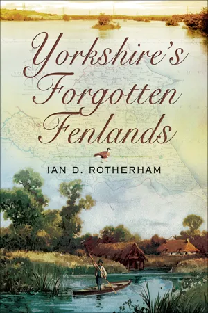 eBook - ePub
- Ian D. Rotherham(Author)
- 2010(Publication Date)
- Wharncliffe Books(Publisher)
History, both recent and further back in time, tells us that flooding is not a new phenomenon. Accounts since biblical times have told stories of floods and of terrible storms. It seems strange therefore to view recent events as somehow unusual or unexpected; extreme, yes, but unexpected, no. There have even been major tsunamis in Britain, with a massive series of tidal waves striking eastern Scotland around 7,000 years ago, and then one around the Severn Estuary in the 1700s. There have always been storms and tempests and people have always suffered. Indeed, not only have floods and flood risk always been with us, but our management and use of the landscape, now combined with climate change, make them more rather than less likely. Some of this is actually very hard to prove beyond doubt in a scientifically testable way. However, observation of trends, a triangulation of findings and plain common sense leave little doubt as to what is happening. There is a degree of denial in certain quarters. Yet even a cursory dip into history and a sifting through newspapers over the last 200 years produces a vast array of examples of flood and storm catastrophes. Whilst coastal flooding has different causes and raises other issues, some of the context is the same. Again, a brief historic survey reveals the same location being affected time and again. Holmfirth, for example, suffered severe floods in 1738 and 1777, and then in 1852 there was the famous Holmfirth Flood when Bilberry Reservoir burst its dam and eighty-one lives were lost. But floods struck again in 1944 with further loss of life and extensive damage to property. The 1852 flood followed heavy rain but it was linked to reported construction defects in the reservoir. The torrent of waves crashed through Holmfirth and on as far as Lockwood, near Huddersfield. York is regularly inundated, but over the decades Malton, Doncaster, Sheffield, Hull and many others have also suffered.FloodsIt is always suggested that each flood results from unprecedented and unusual weather, a case of an ‘extreme event’, so how many unusual and infrequent events must we experience before they are accepted as increasingly the norm? In Yorkshire, for example, we had floods in York and Thirsk in November 2000, Helmsley in June 2005, Leeds and Harrogate in September 2006 and South Yorkshire and Ryedale in July 2007. This suggests these are not so unusual. They are extreme, but with climate change extreme becomes commonplace. Climate manifested in the weather is changing, getting more extreme, both hot and dry, or, as we witnessed in 2007, bringing torrential deluges of rain. The autumn of 2000 was the wettest for 270 years; the associated flooding affected 10,000 properties. In January 2005 there were floods affecting around 3,000 properties, with a similar figure for June and July 2007. With global climate change now accepted fact, although we can debate the exact causes, it has been calculated that the associated costs of flood damage might be £25 billion per year, an increase from the present £1 billion. These are the raw figures that disguise even greater worries and costs. eBook - ePub
- Hugh Matthews, Vince Gardiner(Authors)
- 2002(Publication Date)
- Routledge(Publisher)
Anthropogenic influences on flooding are not restricted to urbanisation, for recent agricultural developments have also had important hydrological consequences. The expansion of arable cultivation, the enlargement of fields by the removal of hedges and copses, the use of machinery which compacts soil thereby reducing infiltration, and the massive post-war growth in the use of tile-drains, have all contributed to the increasingly rapid transport of larger and larger proportions of precipitation from slopes into channel systems. Thus, the flashiness of most streams and small rivers in lowland Britain has been increased during the last half century.Coastal flooding
A very different flood-hazard threat exists around the coastline of Britain, where adverse weather conditions combined with slowly changing land-sea relationships result in occasional breaches of defensive structures and the inundation of adjacent lowlands by saline water. The most important recent examples of such events are the Uphill (Somerset) floods of 13 December 1981, the Selsey (Sussex) floods of 4–5 January 1998 and the Towyn (Clwyd) inundation of 26 February 1990. The Towyn flood was the most significant of these events, inundating 2,800 homes and resulting in the evacuation of 5,000 people from the town itself. It also highlighted many of the features of coastal flooding: the high proportion of old people affected because of the tendency to ‘retire to the coast’, the low proportion of inhabitants with contents insurance, and the high levels of trauma which result in significant numbers of post-event deaths (fifty-four in the Towyn case).FIGURE 17.10 Generalised pattern of predicted sea-level change Sources: Modified from Jones et al. (1993b) and Wigley and Raper (1992).It is along the coastline of eastern and southern England that the threat is greatest with documented records of local coastal flooding along the east coast dating back to 1236, including at least seven inundations that were of disastrous proportions. Here, local tectonic movements, including the progressive downwarping of the North Sea basin, together with the global (eustatic) rise in sea-level (currently c. 1.2 mm per annum) and changes in tidal configuration due to dredging, dumping, reclamation and coastal defences, have combined to produce significant rates of local sea-level rise. Analysis of tide-gauge records in the South East indicate that sea-level is currently rising at varying rates of 140–540 mm/100 years (Figure 17.10 eBook - PDF
- C. Embleton, C. Embleton-Hamann(Authors)
- 1997(Publication Date)
- Elsevier Science(Publisher)
In view of the size and importance of many modern engineering undertakings, however, it is unwise to assume that Britain is immune from larger seismic events. 3. River flooding Floods resulting from heavy rainfall and/or snowmelt represent a serious natural hazard to river valley populations in the UK. The history of flooding is well documented and there is a long tradition of flood management and control; nevertheless, the problem of flooding is a recurrent and widespread one and there is much scope for further mitigation of the hazard (Penning-Rowsell and Underwood, 1972; Newson, 1975; Ward, 1978). The fundamental meteorological causes of river flooding in the UK are intense and/or prolonged rainfall and, to a lesser extent, snowmelt. The most intense rainfall occurs mainly in the western highlands, from western Scotland in the north, the Lake District in north-west England, western Wales, to the uplands of south-west England, but intense events also occur from time to time in the lowlands (Rodda, 1970). Indeed, the largest 24-hour rainfall ever recorded was near Dorchester, southern England, in July 1955, when nearly 300 mm fell. Bleasdale (1970) in a study of records since 1863 counted 151 falls exceeding 125mm in 24 hours; the areas affected can be quite small, often less than lOOkm^. Meteorologically, short-period convective thunderstorms are the main cause, and therefore these intense events are most common in summer. The relief Great Britain 183 factor can also be very important in increased intensification. A well-documented example of flooding caused by localised intense rain was the severe flood of August 1952 at Lynmouth, Devon, when 229mm of rain fell in 24 hours on an already saturated upland catchment (Kidson, 1953). Other summer flood disasters include that in the Lud catchment of Lincolnshire in May 1920 when 23 people were killed, and the severe thunderstorm at Norwich in August 1912. eBook - PDF
Geomorphology and Natural Hazards
Proceedings of the 25th Binghamton Symposium in Geomorphology, Held September 24-25, 1994 at SUNY, Binghamton, USA
- M. Morisawa(Author)
- 2013(Publication Date)
- Elsevier Science(Publisher)
gg] GEOMORPHOUWV E L S E V I E R Geomorphology 10 (1994) 183-196 _ = ^ = _ ^ ^ _ = _ Flooding of property by runoff from agricultural land in northwestern Europe John Boardman a , Laurence Ligneau b , Ad de Roo c , Karel Vandaele d a School of Geography and Environmental Change Unit, University of Oxford, Mansfield Road, Oxford 0X1 3TB, UK b A.R.E.A.S., 25 Rue de Dieppe, 76460 St Valery en Caux, France department of Physical Geography, University of Utrecht, P.O. Box 80115, 3508 TC Utrecht, The Netherlands d Laboratory for Experimental Geomorphology, KU Leuven, Redingenstraat 16bis, B-3000 Leuven, Belgium Received February 10, 1994; revised April 7, 1994; accepted April 8, 1994 Abstract In the last twenty years there has been an increase in the incidence of flooding of property by runoff from agricultural land in many areas of northwestern Europe. These events take the form of inundations by soil-laden water associated with erosion and the formation of ephemeral or talweg gullies developed in normally dry valley bottoms. Costs of such events may be considerable e.g. almost US$2M at Rottingdean, southern England, in 1987. These costs are largely borne by individual house occupants, insurance companies and local councils. The distribution of flooding is widespread but areas of high risk can be identified: the hilly area of central Belgium, parts of northern France, the South Downs in southern England and South-Limburg (the Nether-lands). All these areas have silty, more or less loessial soils. Two types of flooding may be distinguished: winter flooding associated with wet soils and the cultivation of winter cereals, and summer flooding due to thunderstorm activity and runoff particularly from sugar beet, maize and potato crops. The distribution of these types of erosion varies in relation to the interaction between physical characteristics (soils and topography), climatic conditions and land use across the region.
Index pages curate the most relevant extracts from our library of academic textbooks. They’ve been created using an in-house natural language model (NLM), each adding context and meaning to key research topics.