Geography
Flood Management
Flood management refers to the strategies and techniques used to prevent or reduce the impact of floods on people and the environment. This includes measures such as building flood defences, improving drainage systems, and implementing early warning systems. Effective flood management is essential for protecting lives and property in flood-prone areas.
Written by Perlego with AI-assistance
Related key terms
1 of 5
10 Key excerpts on "Flood Management"
 No longer available |Learn more
Policy Options for Effective Implementation of the Hyogo Framework for Action in Asia and the Pacific
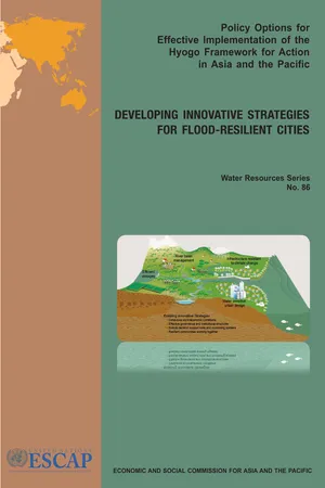
Developing Innovative Strategies for Flood Resilient Cities
- (Author)
- 2011(Publication Date)
- United Nations Publications(Publisher)
Integrated Flood Management employs an approach that allows for preventive action within the full range of interrelationships between flooding and human habitation. The concept is based on the following principles (APFM, 2004): ● Employing a basin-wide approach; ● Considering floods as part of the water cycle; ● Integrating land and water management; ● Adopting a mix of strategies based on risk management approaches; ● Facilitating cooperation between different agencies; ● Ensuring a participatory approach. The Government of Malaysia has a comprehensive approach to storm-water management, balancing considerations of flooding, water quality, aquatic habitats, riparian vegetation, recreation, aesthetics and economic issues. The Government has begun to allocate substantial funds and 21 efforts to implement flood mitigation measures in parallel with the infrastructural developments in its recent projects such as Putrajaya, the administrative centre, and the Cyber Corridor. The Government uses the concept of control at source in Flood Management and addresses other issues such as prevention and mitigation of flash floods, river pollution, soil erosion, and development in highlands and low-lying lands (Seang, 2009). In China, the Ministry of Water Resources proposed in 2003 the conceptual transition from flood control to strategic Flood Management, aiming to enhance understanding about interconnecting systemic disaster-related issues and total risk awareness. General flood-control capacity enhancement includes waterway dredging and restoration, engineering construction such as defensive dykes and dams, and enhancement of existing flood-prevention facilities. Storm-water was also utilized as a complementary resource for water supply, thus introducing the whole-of- water-cycle management principles (Liu, 2009, p. 2). In India, rainwater is commonly harvested for flood prevention as well as for water supply. eBook - PDF
Urban Hydroinformatics
Data, Models and Decision Support for Integrated Urban Water Management
- Zoran Vojinovic, Sarah Thorne, Roland Price(Authors)
- 2011(Publication Date)
- IWA Publishing(Publisher)
13.3 URBAN Flood Management PROCESS The main aim of the urban Flood Management process is to develop, implement and maintain sustainable flood mitigation strategies that will enable safe occupation and use of urban land for present and future residents; see 466 Urban Hydroinformatics: Data, Models and Decision Support for Integrated Urban Water Management Figure 13.1. In this process, emphasis is placed on the importance of developing Flood Management plans that address existing, future and continuing flood risk for the entire urban area, rather than an ad hoc or individual basis. Planning and assessment of mitigation measures Flood Management plan Implementation of plan Data collection Flood study Figure 13.1 The Flood Management process In general terms, solutions to Flood Management problems should be assessed in a broader context with the aim to produce positive outcomes by: ● reducing the social and financial costs resulting from flood-related risks; ● increasing the social, economic and ecological values of flood-prone areas. The Flood Management process (as given in Figure 13.1) involves a number of discrete tasks and subtasks which can be described as follows: ● Formation of a consortium by involving drainage system planners, experts and all relevant stakeholders. This consortium is needed to oversee and facilitate the process of developing and implementing Flood Management plans for a given area. ● Data collection; Within the Flood Management process, the data collection task refers to the compilation of existing data and collection of additional data for system analysis, modelling and decision making. For a more detailed description of data collection see Chapter 4. eBook - PDF
- Jos G. Timmerman, Claudia Pahl-Wostl, Jorn Moltgen(Authors)
- 2008(Publication Date)
- IWA Publishing(Publisher)
The motivation behind this directive are the rising impacts of floods during the last decades, increasing potential damage of floods in the near future and the notion that severe floods events might become more common due to global climate change (Milly et al. 2002). The integration of spatial planning and water management is considered to be of special importance with respect to integrated Flood Management (Burby et al. 2000; Hooijer et al. 2004), as they are the main sectors managing the occurrence and the impact of floods. In this chapter we will explore how spatial planning is integrated in flood risk management projects in EU research projects, how their results contribute to the integration of Flood Management and spatial planning in practice and what gaps still exist in EU research that should be addressed in the future. 9.2 FLOOD RISKS Floods account for about a third of all economic losses insured worldwide and about half of the people that were killed by natural hazards were casualties of floods (Munich RE 2005). Floods are therefore regarded as the most dangerous natural hazard (ARMONIA Project 2005c). Moreover, because of the high economic losses associated with floods, there is a rich history of Flood Management practices aiming at preventing floods from happening and reducing costs 130 The adaptiveness of IWRM associated with them (known as risk management). Before going further into flood risk management, some concepts need to be clear though as their use is not always consistent. Flooding , which is in essence the covering of land by water, often refers only to fluvial floods, from rivers. eBook - PDF
Handbook of Engineering Hydrology
Environmental Hydrology and Water Management
- Saeid Eslamian(Author)
- 2014(Publication Date)
- CRC Press(Publisher)
301 Different Methods of River Management 14.4 Flood Behavior .................................................................................. 302 14.5 Flood Mitigation in River Basin ..................................................... 302 14.6 Flood Mitigation Methods in Regard to River Characteristics ..... 303 Structural Flood Mitigation • Nonstructural Methods in River Management 14.7 Case Study .......................................................................................... 304 Flood Defense in Iran • Integrated Golestan Flood Management 14.8 Summary and Conclusions ............................................................. 313 Acknowledgments ........................................................................................ 314 References ...................................................................................................... 314 Akram Deiminiat KPM Consulting Engineers Saeid Eslamian Isfahan University of Technology 300 Handbook of Engineering Hydrology: Environmental Hydrology and Water Management 14.1 Introduction Due to the position and value, the floodplains are the preferred places for investment and socioeconomic activities. Floods categorized as natural disasters, which may have both negative and positive impacts, and generally should not be considered a hindrance to economic development. Floods play a major role in replenishing wetlands, recharging groundwater and support agriculture and fisheries system, making floodplains preferred areas for human activities. Extreme demands on natural resources due to population growth have forced people and their property to move closer to rivers in many parts of the world. Further, flood control and protection measures have encouraged people to utilize newly protected areas extensively, thereby increasing flood risks and consequent losses [3]. eBook - PDF
Geomorphology and Natural Hazards
Proceedings of the 25th Binghamton Symposium in Geomorphology, Held September 24-25, 1994 at SUNY, Binghamton, USA
- M. Morisawa(Author)
- 2013(Publication Date)
- Elsevier Science(Publisher)
Floods are part of a very broad range of water-related phenomena that have immense impacts upon human beings. These phenomena exert their influence on human affairs mainly through concerns about water supply and hazard reduction. It is out of such concerns, rather than inherent curiosity, that society provides resources for research on hydrological processes. The designs that serve to bring research results into practice are the products of various water engineers, and engi-neering philosophies have until recently dominated hydrological research. Due in part to heightened rec-ognition of global environmental problems, however, there is a current initiative to emphasize ' 'fundamental hydrologic science... as a geoscience alongside the atmospheric, ocean, and solid earth sciences (National Research Council, 1991). Critical to the rationale for this new emphasis is the relationship of water geoscience to the world of human affairs: water resources management and decision making. The role of geomorphology in this conceptualization (National Research Council, 1991, p. xi) is to be one of many disciplines concerned with understanding water phe-nomena (hydrologic science). When combined with statistics, fluid mechanics, meteorology, and other fundamentals, these sciences provide the basis in understanding for forecasting, which is stated to be the proper role for engineering hydrology. The forecasting role can then be combined with economics, law, polit-ical science, and resource sciences to justify decisions by water-resource managers. Of course, this is business as usual. In this regard, let us consider a possible model forecast, expressing a high flood risk for a certain site. Suppose that the model 150 V.R. Baker / Geomorphology 10 (1994) 139-156 Fig. 3. Destruction of apartment buildings by bank erosion of Rillito Creek, Tucson, Arizona, October 2, 1983. Photograph by S. Reynolds, Arizona Geological Survey. eBook - PDF
Floods, from Defence to Management
Symposium Proceedings of the 3rd International Symposium on Flood Defence, Nijmegen, The Netherlands, 25-27 May 2005, Book + CD-ROM
- Jos van Alphen, Eelco van Beek, Marco Taal(Authors)
- 2006(Publication Date)
- CRC Press(Publisher)
The eleven guiding principles of the flood manage-ment strategy of Bangladesh are: 1 Phased implementation of a comprehensive flood plan. 2 Effective land and water management of pro-tected and unprotected areas. 3 Strengthening and equipping the disaster man-agement machinery. 4 Improvement of the flood forecasting system and establishment of a reliable and comprehensive flood warning system. 5 Safe conveyance of the large cross-boundary flow to the Bay of Bengal by channelling it through the major rivers. 6 Effective river training works for the protection of embankments, infrastructure and population centres. 7 Reduction or distribution of load on the main rivers through diversion of flows into major dis-tributaries or interception of local runoff. 8 Improvement of the conveyance capacity of the river networks. 9 Development of floodplain zoning to allocate space for habitation patterns, economic activities and environmental assets. 10 Coordinated planning and construction of all rural roads, highways and railway embankment with provision for unimpeded drainage. 11 Encouraging maximum possible public partici-pation by beneficiaries in the planning, imple-mentation, operation and maintenance of flood protection infrastructure and facilities. Looking back, we discern major shifts in strategy of how to deal with floods, from adaptation, through flood control, to Flood Management. In Bangladesh, floods are so severe that full flood control is impossi-ble. Thus flood protection measures focus on the urban areas only where the population are most vul-nerable compared to the rural areas where inundation is either a benefit or only a nuisance. The relative importance of flood prediction and warning in the case of dangerous floods arises from the impractica-bility of full control of flood. In practice, Bangladesh has a good flood prediction, although the subsequent warning requires further improvement, hampered by the low level of development. eBook - PDF
Environmental Hydrology and Hydraulics
Eco-technological Practices for Sustainable Development
- S N Ghosh, V.R. Desai(Authors)
- 2016(Publication Date)
- CRC Press(Publisher)
During a flood listen to a battery operated radio for the latest storm information, fill bathtubs, sinks and jugs with clean water in case water gets contaminated. It is recommended to move valuable household properties upstairs. From Flood Management point of view several measures are available. These are construction of flood embankments, drainage channels, erosion control measures, construction of reservoirs and flood shelters, watershed management, flood plain zoning, flood forecasting etc. In many areas a combination of such measures are required to provide relief from flood. One of the most effective measures is the proper implementation of flood plain zoning. Here it is necessary to demarcate areas liable to floods, preparation of detailed contour plans of such areas to a larger scale with contour intervals of 0.2 to 0.5 m, fixation of reference river gages and then determining the areas likely to be inundated for different water levels and magnitude of floods. Demarcation of areas liable to be affected by floods of different frequencies like say once in 5, 10, 15, 20, 30, 50, 100 years and similar exercise to account for accumulated rain water of different rainfall ' frequencies say, 5, 10, 25 or 50 years with the help of modern tools like satellite imageries. The above means that a balance between the values available from the use of flood plains and the potential losses to individuals and society arising from such use There are two schools of Flood Management group, one school has faith on adjustment and control and the other school has faith on modifying the flood, reducing the susceptibility to damage and reducing the impact of flooding. Flood Management has been practiced from ancient times. A flood bank was built on the Hwang Ho river in China more than 2,500 years ago and the diversion of flood waters from the river Nile into lake Moeris was done many years ago. eBook - PDF
- Theodore Hromadka, Prasada Rao, Theodore Hromadka, Prasada Rao(Authors)
- 2017(Publication Date)
- IntechOpen(Publisher)
This national strategy was particularly atten-tive upon integration of disaster management to socioeconomic position of community for effective response and preparedness to combat the disaster. The strategy also tends to raise public awareness. Flood Management strategies revealed inadequate success pertinent to several inefficien-cies. Water Resource and Flood Storm Control Division Report (2011) reflected that inad-equate funds allocation hindered Flood Management policies. Improved financial assistance and healthier observation could have enhanced the effectiveness [120], but it does not appear practical. In fact, existing Flood Management approaches remain failed in combating disasters. Defense system against floods was insufficient in recent incidences [ 121 ]. To take floods in account, early warning system could be strengthened [ 117, 120], which is meager at current. More focus on improving socioeconomic position of community through alleviating inequal-ity and poverty [ 122, 123 ] is need of time. This phenomenon may bring a concept of integrated Flood Management approaches and holistic action [ 124 ] for sustainable management of flood risks in Vietnam. 3.8. Sri Lanka Sri Lanka is a flood prone country of Asian region. The country has faced some notewor-thy floods in 1989, 2006, and 2008 damaging huge areas and human killings. Flood is the often hazard faced by Sri Lanka [ 125 ]. In last four decades, floods were more often and Flood Risk Management 190 devastating for highest number of people [ 126 ]. However, Sri Lanka has implemented flood mitigation measures from the past. In late nineties, systematic forecasting programs were started in Sri Lanka [ 127 ]. Occurrence of Tsunami in 2004 urged government of Sri Lanka to precede tangible mitigation measures against the floods. Soon after Tsunami, Disaster Management Act, No. 13, was established in 2005 with aim of building institutional frame-work and national policy on disasters management [ 128 ]. eBook - ePub
- Robert C. Ferrier, Alan Jenkins, Robert C. Ferrier, Alan Jenkins(Authors)
- 2021(Publication Date)
- Wiley-Blackwell(Publisher)
9 Flood ManagementMark FletcherArup, Leeds, UKSource: M. Fletcher, Arup, UK.9.1 Introduction
9.1.1 The Water Cycle and Flooding
The water cycle operates at catchment or supra‐catchment scale. The main human activities that historically first affected catchments are related to changing land use for agriculture. This included tree and scrub clearance, grazing, field creation and in due course cropping, drainage, and the creation of enclosures. The gradual impact of agricultural intensification changed semi‐natural rural landscapes through the removal of hedgerows, creation of larger fields, development of under‐drainage, river and stream channel straightening, use of hand then animal drawn agricultural implements and tools, to the development of agricultural machinery, evolution of bigger machinery, greater livestock density, greater compaction of soil and the faster delivery of runoff from upstream to downstream. During this process, soil quality deteriorated and the increasing application of fertilisers created water quality issues in rivers and aquifers.There has been a continual population increase (globally) and shift in where people are living over recent history. We have now passed the point when more people live in rural areas than urban areas (cities), and by 2050, it has been estimated that 70% of the global population will live in cities. This migration to urban areas has driven development; cities are expanding, reclaiming land from sea, developing on floodplains and dramatically changing the land use across our catchments, transforming more natural areas into impervious land. This growing population in turn requires the generation of more food, leading to further intensification on an already strained agricultural landscape. The impact of human development adds further stress by reducing resilience of the land to deal with extremes. These impacts occur to varying extents depending on the amount of development and balance of land use around the world. Regional patterns of impacts are, therefore, land use and climate‐specific. eBook - PDF
- John Abbot, Andrew Hammond, John Abbot, Andrew Hammond(Authors)
- 2019(Publication Date)
- IntechOpen(Publisher)
Either intentionally or by chance, roads, railroads, and buildings may function as barriers to keep flood waters from spreading to a wider area [9]. Consequently, urban flooding may be characterized as being confined and deep. It is well documented that the degree of fatality and direct economic cost of flood-ing is proportional to inundation depth [10]. Therefore, redesigning urban form to transform confined and deep flooding to wide and shallow flooding is a way to reduce vulnerability if the prevention of inundation is not totally avoidable. The concept can be rephrased as “managing flood waters up to your knees”. Policy sup-porting such a concept can be termed flood sharing. How it can be implemented is a question to be answered. An important driver of vulnerability reduction is better planning. Poorly planned and managed urbanization leads to growing flood hazard due to unsuitable land use change and increasing flood vulnerability due to development in flood-prone areas and overpopulation of such areas. As shown in Figure 5 , river flood manage-ment planning in Japan starts with setting up a planning scale, which is the level of 9 New Frontiers in Flood Risk Management DOI: http://dx.doi.org/10.5772/intechopen.81925 safety against flood disasters to be provided in the area of concern. The next step is to select a number of target rainfalls for the planning site based on rainfall and historical flood records. Then, by performing rainfall-runoff simulations, a flood hydrograph can be determined as the management target, which is termed as either design flood without regulation or maximum probable flood. Once the maximum probable flood is estimated, allocation of flood water by dam, retarding basin, and river channel will be determined to safely convey flood water to its destination. In this planning procedure, however, the increase of maximum probable flood due to future urbanization is not directly considered.
Index pages curate the most relevant extracts from our library of academic textbooks. They’ve been created using an in-house natural language model (NLM), each adding context and meaning to key research topics.