Geography
Oceanic Islands
Oceanic islands are landmasses that arise from the ocean floor, typically formed by volcanic activity. They are distinct from continental islands, which are connected to a continental landmass. Oceanic islands are often characterized by unique ecosystems and biodiversity due to their isolation, and they play a significant role in the study of biogeography and evolution.
Written by Perlego with AI-assistance
Related key terms
1 of 5
7 Key excerpts on "Oceanic Islands"
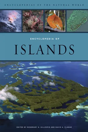 eBook - PDF
- Rosemary Gillespie, David Clague, Rosemary Gillespie, David Clague(Authors)
- 2009(Publication Date)
- University of California Press(Publisher)
Conversely, there are many islands that rise from the ocean floor but have not yet pushed their heads above the ocean surface. Some may do so eventually, and some not. Irrespective of whether they attain the surface, they should be included in any survey of Oceanic Islands. Such islands are generally referred to as seamounts, character-ized by a conical form, attesting to their volcanic origins. As noted above, in contrast to continental crust, oce-anic islands are transient entities, never more than 120 million years in age and rarely emergent (above sea level) for even 50% of that time. Of course, there are excep-tions, including Oceanic Islands that have become scraped off along continental margins and now lie far above the reach of the ocean, their insides exposed for all to see. Good examples are found in the accreted Wallowa terrane (Oregon) and others along the western side of the North American continental core. There are three main external influences on the life cycles of Oceanic Islands: first, island tectonics—the rises and falls of the island itself; then islands and sea-level changes; and finally, island landscape evolution. Oceanic-Island Tectonics In any part of the world, the solid Earth’s crust can rise and fall, but in the ocean basins these processes are more widespread and are a major cause of oceanic island emer-gence and submergence. Long-term uplift and subsidence also affect islands as a result of changing water loads on the ocean crust. Particularly following land-ice melt dur-ing deglaciation, rapid inputs of water into the oceans can cause the ocean floor to deform. Yet the principal cause of individual island emergence and submergence over shorter time periods is vertical tectonics—movements of the Earth’s crust resulting from the accommodation of stresses associated with plate movements. The process of crustal rise is known as uplift, and many Oceanic Islands have been uplifted, especially near conver-gent plate boundaries. eBook - PDF
The People of the Sea
Environment, Identity, and History in Oceania
- Paul D'Arcy(Author)
- 2006(Publication Date)
- University of Hawaii Press(Publisher)
To the west of this line humans can usually travel between islands without losing sight of land because of the high mountains on these islands and the relatively narrow sea gaps between them. In contrast, Remote Oceania is made up of islands clustered into archipelagos that are now separated by at least 350 kilometers of ocean. Islands in this region tend to be smaller than those in Near Oceania, and their flora and fauna more attenuated. This is because it was populated by an extremely limited Indo-Malayan biota that dispersed from the larger islands in Near Oceania. New Caledonia and Aotearoa/New Zealand are exceptions. Both are continental in terms of size and diverse resource base, although New Caledonia is neverthe-less relatively impoverished compared to islands of a similar size in Near Oceania. Both lie west of the Andesite Line, which is the main geograph-ical division within Remote Oceania. East of this line no andesite lava or continental rocks occur. The only island landforms in this eastern sector are high volcanic islands, coral atolls, and other kinds of coralline islands. Within Remote Oceania there is great variation between localities in terms of relative isolation and immediately accessible resources. For example, while there are only ten inhabitable islands within an 800 kilo-meter radius of Rarotonga in the Cook Islands, the same radius centered on the Ha‘apai group in the Tongan archipelago encompasses hundreds of islands with 2400 square kilometers of land. 22 Anthropologist William Alkire divides the coral islands of the Pacific into four groups on the basis of relative isolation and accessible resource base. He makes a convincing argument that these variables play a significant role in determining cul-tural patterns. 23 Essentially Alkire’s argument is that the larger the envi-ronmental system, the greater the cultural development, until the popu-lation reaches the limits of its environment’s carrying capacity. eBook - PDF
On the Road of the Winds
An Archaeological History of the Pacific Islands before European Contact, Revised and Expanded Edition
- Patrick Vinton Kirch(Author)
- 2017(Publication Date)
- University of California Press(Publisher)
Over a period of tens of millions of years, an entire linear chain of volcanic islands successively rises from the ocean depths. Mid-plate islands in such linear chains typically pass through the following evolutionary stages: (1) initial volcanism and shield building; (2) subsidence due to point-loading of the thin oce-anic crust; (3) subaerial erosion by streams, the pacific islands as a human environment 41 ing Pacific islands; another important variable is that of changes in an island’s landform resulting from submergence and the formation of coral reefs, or by later emergence of reefs. Geogra-phers (e.g., Thomas 1963) have long used a sim-ple four-part classification of Pacific islands that remains useful for understanding the varied island environments to which Pacific peoples adapted. The four island types are (1) island-arc islands; (2) high islands of midplate hot spot ori-gin; (3) coral atolls, formed on volcanic masses that have subsided beneath the ocean’s surface; and (4) makatea islands, in which coral atoll or reef formations have been uplifted or have emerged through tectonic activity. The last three types of islands are illustrated in figure 2.2. island-arc islands Formerly labeled “conti-nental” islands because they sometimes incor-porate ancient continental rocks, island-arc islands are among the largest islands in the Pacific, concentrated along the western margins by coral reefs. Such contrasting landforms were of great consequence to colonizing Oceanic peo-ples who, with their horticultural subsistence economy, preferred environments with ample water and good soils. Coral reefs and lagoons offered abundant fish and shellfish. The Oce-anic peoples were keen observers of geological differences between islands, and they had their own folk theories about island origins. The Hawaiians, for example, recognized that their archipelago had originated progressively from the southeast, the abode of the volcano goddess Pele. eBook - PDF
- Patrick L. Osborne(Author)
- 2012(Publication Date)
- Cambridge University Press(Publisher)
12 Islands, archipelagos, biogeography and evolutionary ecology The ecological theatre and the evolutionary play. (BOOK TITLE, HUTCHINSON 1965 ) The evolutionary exuberance of some island clades is impressive. (LOSOS AND RICKLEFS 2009 ) Island biogeography theory has profoundly in fl uenced the study of biogeography, ecology, and even evolution, and has also had enormous impact on conservation biology. (LAURANCE 2010 ) Geographically, islands are de fi ned as areas of land surrounded by water. This results in a degree of biological isolation – it is dif fi cult for terrestrial organisms to colonise small islands which lie far from a large land mass. Other habitats of similar types may also be isolated from each other. Mountain tops form ‘ islands in the air ’ surrounded by a ‘ sea ’ of lowland which may form, for some species, a barrier as dif fi cult to cross as an expanse of sea is for many terrestrial organisms. Similarly, lakes are watery ‘ islands ’ surrounded by land, and movement of aquatic species from one lake to another is hindered by this land barrier. Organisms that inhabit patchy habitats, such as rotting logs or dung, also face the challenge of moving from one isolated habitat to another. Rotting logs and dung piles are special islands in that the resources they provide to the organisms that colonise them dwindle with time and, therefore, these are not only isolated habitats, but also temporary. The biological communities of islands, lakes and mountain tops, therefore, share a degree of biological isolation as a common characteristic, and these habitats provide natural laboratories for studies of biogeography and evolution . There are a number of reasons for studying the biogeography of islands and isolated habitats. eBook - PDF
Ocean Thermal Energy Conversion (OTEC)
Past, Present, and Progress
- Albert S. Kim, Hyeon-Ju Kim, Albert S. Kim, Hyeon-Ju Kim(Authors)
- 2020(Publication Date)
- IntechOpen(Publisher)
Project deployment will commence in 2020/21. There remains much work and learning to be undertaken. Projects and aspirations do not, of course, always run to plan. However, the preparation of the KRISO-OTEC programme with respect to the principles of interconnected geoscience has been a positive model. 4. Pacific Islands geography and geology The Pacific Islands region occupies an area of close to 30 million km 2 , mainly in the western and central Pacific, east and north of Australia, and north of New Zealand ( Figure 2 ). Most island groups are in the southern hemisphere, with coun-tries such as Kiribati, the Marshall Islands, Federated States of Micronesia, and Palau mainly in the northern hemisphere, close to the equator. Cook Islands, French Polynesia, and Pitcairn are the easternmost island groups (see [14] for further details). There are 22 PSIDS, some of which are independent nations such as Fiji, and some of which are territories of western countries, particularly France (e.g. New Caledonia). Papua New Guinea (PNG) is unusual in that it contains a large area of continent in addition to islands and has a relatively large land surface area (460,000 km 2 ) and population ( > 8 million people). If PNG is excepted from the 8 Ocean Thermal Energy Conversion (OTEC) -Past, Present, and Progress analysis, the remaining countries have a combined land surface area of c. 87.000km 2 . The Pacific Islands geographical context therefore is similar to a coun-try with a land area of Austria set in an ocean the size of Africa. Most PSIDS are archipelago nations, some with hundreds or over one thousand islands and tens of island groups within their jurisdiction. Many PSIDS are not only small island states but also large ocean states with exclusive economic zones extending up to 5 million km 2 . Populations vary between 900,000 (Fiji) and 10,000 (Tuvalu). The Pacific Islands region contains a high degree of geodiversity ( Figure 3 ). eBook - PDF
- Joseph Hobbs(Author)
- 2016(Publication Date)
- Cengage Learning EMEA(Publisher)
Read the dramatic firsthand account by Maori geographer Helen Hayward in her Life in New Zealand essay on page 376 ). The city has been rebuilding amidst a lively debate on whether the city center should be reconstructed as it was or fashioned into a new “smart city,” employing the latest technology, to improve infrastructure, seismic safety, and quality of life. The geographer Tom McKnight explained that the high is-lands’ topography has historically influenced its cultural and economic patterns. 2 Each drainage basin formed a relatively distinct unit that was governed by a different chief. Within each unit, there were several subchiefs, each of them control-ling a bit of each type of available habitat: coastal land, stream land, forested land, and gardening land. Because available re-sources were distributed relatively equally among chiefdoms, there were few power struggles or monopolies over resources. It is important to note that these are general rather than uni-versal patterns of association between physical geography and human adaptations in the Pacific. Geographers reject the out-dated notion of environmental determinism , which insisted that certain environmental conditions always correlate with specific culture traits. Today, the main cities and seaports of Oceania, and the largest populations, are on the volcanic high islands and the continental islands. Their rich soils, typically of volcanic ori-gin, support a diversity of tropical crops. These islands are gen-erally more prosperous than the low islands. The low islands are formed of coral. Most take the shape of an irregular ring surrounding a lagoon; such an island is called an atoll . Generally, the coral ring is broken into many pieces separated by channels leading into the lagoon, but the whole circular group is commonly considered one island. Charles Darwin devised a still widely accepted explanation for the three-stage formation of atolls ( ● Figure 8.11 ).
- Patrick D. Nunn(Author)
- 2008(Publication Date)
- University of Hawaii Press(Publisher)
This supports the contention that incidences of island disappearance recalled by humans through oral traditions (discussed in chapters 6 and 9) are not necessarily fanciful or even wildly exaggerated versions of something that actually happened. At the outset, we need to distinguish islands from continents. Unfortunately, this has never really been done successfully although continents are generally considered to be larger, older, and geologically more complex than islands. As a working definition, this has to suffice.1 Islands go up and down for many reasons, and sea-level changes also cause some is-3 Islands That Vanished Long Ago 36 Vanished Islands and Hidden Continents of the Pacific lands to become either emergent or submergent. The purpose of this chapter is to show, using a number of well-documented examples, how such processes led particular islands to vanish. Islands That Have Disappeared into Ocean Trenches Ocean trenches, those asymmetrical steep-sided chasms etched into the ocean floor, are often portrayed as smooth-sided: places where one plate slides effortlessly beneath the other, part of the great engine that is plate tectonics. The reality is very different. Oceanic crust is everywhere marred by irregularities — islands, ridges, swells — that are carried into ocean trenches and distort or sometimes disrupt the process of subduction. Some of the best examples in the Pacific come from lines of islands that have been carried along the moving ocean floor, pulled down into ocean trenches, and finally thrust under-neath the overlying plates. The Louisville Ridge is an underwater ridge in the South Pacific with several high spots that were once probably islands. It collided obliquely with the Tonga-Kermadec Trench around six million years ago and has since been dragged down beneath the Tonga Island Arc (see Figure 2.4c).
Index pages curate the most relevant extracts from our library of academic textbooks. They’ve been created using an in-house natural language model (NLM), each adding context and meaning to key research topics.