Geography
Volcanoes
Volcanoes are natural openings in the Earth's crust through which molten rock, ash, and gases are ejected. They are typically found at tectonic plate boundaries and hotspots. Volcanic eruptions can have significant impacts on the environment, including the formation of new land, release of gases into the atmosphere, and potential hazards to human populations.
Written by Perlego with AI-assistance
Related key terms
1 of 5
11 Key excerpts on "Volcanoes"
 eBook - PDF
- Payson D. Sheets, Donald K. Grayson, Payson D. Sheets, Donald K. Grayson(Authors)
- 2013(Publication Date)
- Academic Press(Publisher)
Volcanoes and Their Activity^ FRED M. BULLARD rNTRODUCTION There is a tendency to view Volcanoes as agents of destruction and to overlook their beneficial contributions to the development of the earth and to our present environment. Their most obvious effect is the destruction caused by eruptions, in which cities and the countryside are often buried by ash or lava. Equally important, and probably more widespread, is the destruction resulting from mudflows generated by volcanic eruptions. Many Volcanoes have crater lakes that may be suddenly ejected in an eruption, sending a flood of water and mud racing down the side of the cone. Some Volcanoes support glaciers that may be melted in an eruption and also may generate huge mudflows. The word volcano itself, in everyday language, is synonymous with something explosive and violent. However, it seems appropriate to enumerate some of the useful contributions of Volcanoes, or, more appropriately, of vol-canism ^ to our environment. Volcanism is a general term that includes the process by which magma (molten rock below the Earth's crust) and associated gases rise into the crust and are extruded on the Earth's surface or into the atmosphere. Thus, Volcanoes, as the term is commonly used, are the surface manifestations of volcanism. We shall use the term volcano with the under-standing that, in some cases, other aspects of volcanism are also involved. ^ This chapter is based on the author's Volcanoes of the Earth, 579 pages, 24 color plates, 184 black-and-white figures (Austin: University of Texas Press, 1976). VOLCANIC ACTIVITY AND HUMAN ECOLOGY Copyright © 1979 by Academic Press, Inc. All rights of reproduction in any form reserved. ISBN 0-12-639120-3 1 o FRED Ě . BULLARD 1. Eruptions of ash periodically renew the fertility of the soil in many areas, and this must rank as one of the more important contributions of Volcanoes to our environment. 2. Volcanoes are an important factor in changes in the Earth's climate. eBook - PDF
- Charles Fletcher, Dan Gibson, Kevin Ansdell(Authors)
- 2014(Publication Date)
- Wiley(Publisher)
6-1 A volcano is any landform that releases lava, gas, or ash or has done so in the past. LO 6-1 Define the term “volcano” and describe why geologists study Volcanoes. 6-2 There are three common types of magma: basaltic, andesitic, and rhyolitic. LO 6-2 Compare and contrast the three common types of magma. 6-3 Explosive eruptions are fuelled by violent re- leases of volcanic gas. LO 6-3 Describe volcanic gases and the role they play in explosive versus effusive eruptions. 6-4 Pyroclastic debris is produced by explosive eruptions. LO 6-4 Describe the formation of pyroclastic debris. 6-5 Volcanoes can be classified into six major types based on their shape, size, and origin. LO 6-5 Compare and contrast central vent Volcanoes with large-scale volcanic terrains. 6-6 Shield Volcanoes are a type of central vent volcano. LO 6-6 Identify what gives a shield volcano its distin- ctive shape. 6-7 StratoVolcanoes and rhyolite caldera complex- es are central vent Volcanoes. LO 6-7 Compare and contrast the magma composi- tion of stratoVolcanoes versus rhyolite caldera complexes. 6-8 Large-scale volcanic terrains lack a central vent. LO 6-8 Identify the main characteristics of large-scale volcanic terrains and give examples. 6-9 Most Volcanoes are associated with spreading centre volcanism, arc volcanism, or intraplate volcanism. LO 6-9 Describe the role of plate tectonics in sprea- ding centre volcanism, arc volcanism, and intraplate volcanism. 6-10 Volcanic hazards threaten human communities. LO 6-10 List and define several types of volcanic hazards. Chapter Contents and Learning Objectives (LO) CHAPTER 6 Volcanoes A volcano, such as this one on Hawaii erupting lava and pyro- clastic material, is any landform that releases lava, gas, or ash or has done so in the past. Volcanoes are a critical component of the rock cycle. They rejuvenate the crust, renew soil, impact global climate, and contribute to gases in the atmosphere. eBook - PDF
- Mateo Gutierrez(Author)
- 2012(Publication Date)
- CRC Press(Publisher)
4 VOLCANIC GEOMORPHOLOGY 1. Introduction 2. Plate tectonics and volcanism 3. Magma and volcanic activity 4. Types of volcanic activity 5. Principal types of volcanic eruptions 6. Nuées ardentes and pyroclastic flows 7. Hydrovolcanic eruptions 8. Rock avalanches and lahars 9. Gaseous or hydrothermal eruptions 10. Lava flows 11. Pyroclastics 12. Volcano morphology 13. Pyroclastic cones 14. StratoVolcanoes 15. Calderas 16. Volcanic landforms resulting from erosion 17. Volcanic risk and prediction 4.1 Introduction Volcanic eruptions are the most powerful manifestation of the energy present in the Earth’s interior. Of the approximately 60,000 Volcanoes in the world, about 50 erupt above sea level every year, potentially affecting the lives and property of millions of people. The human race is linked to volcanic erup- tions in another way. Paleoanthropologists have provided absolute dating of volcanic materials in the East Africa Rift Valley (Tanzania, Kenya, and Ethiopia) that are related to the first hominids (3.7 Ma). Volcanic ash is also known to pre- serve fossils in perfect condition (Sigurdson, 2000). Active Volcanoes are classified according to their activity, which is of great importance for towns located in these areas. Tsuya and Morimoto (1963) established a clas- sification that includes active Volcanoes, which erupt every few years; dormant Volcanoes, which erupt once every ten to one hundred years; and finally, extinct Volcanoes. It is difficult to differentiate between extinct and dormant Volcanoes. We can define a volcano as “the surface expression of internal thermal processes of a planet or satellite manifested by the emission of solid, liquid or gaseous products at the surface” (Francis, 1993). A volcano contains a vent or chimney that connects it to molten material called magma. Magma is molten rock that contains gases; magma is not synonymous with lava. eBook - PDF
Earth's Fury
The Science of Natural Disasters
- Alexander Gates(Author)
- 2022(Publication Date)
- Wiley-Blackwell(Publisher)
47 CHAPTER 4 Earth’s Fury: The Science of Natural Disasters, First Edition. Alexander Gates. © 2022 John Wiley & Sons Ltd. Published 2022 by John Wiley & Sons Ltd. Companion website: www.wiley.com/go/gates/earthsfury Types of Volcanoes CHAPTER OUTLINE 4.1 What Is a Volcano? 49 4.2 Classification by Shape 49 4.3 Parts of a Volcano 50 4.4 Classification of Volcanoes by Threat 51 4.5 Decade Volcanoes 52 4.6 Evacuation of Volcanic Areas 54 4.7 SuperVolcanoes 57 Classification by Shape 49 4.1 What Is a Volcano? A volcano is an opening in the surface of the earth from which liquid rock, solid rock, and/or gas is expelled from a subsurface magmatic source. Magma is melted rock, but it is usually not just a rock found on the surface that is heated to the point of being a liquid. It always contains dissolved gases, some of which could be liquid under standard surface conditions, and it typically contains solids. Magma is driven toward the surface by pressure either through buoyancy from being less dense than surrounding rock or from being forced up from below by expansion of materials, or a combination of the two. The liquid rock is magma until it escapes to the surface through a vent where it becomes lava. The vent is the volcano. Volcanoes do not always emit lava; they can emit gas, liquid, and/or solid material, or any combination of the three. Emissions can be ferocious eruptions or even explosions or just minor nonthreatening events. It is the degree of energy of the eruption and the location of the eruption that dictates whether it will be a natural disaster or go unnoticed. Volcanoes can be the most dangerous of natural disasters because not only can the event be devastating but the effects can wreak havoc on the planet for many years after the eruption ends. 4.2 Classification by Shape Volcanoes can have a variety of shapes dictated primarily by the viscosity and stickiness of the lava, the amount of solid mate- rial, and the surface conditions.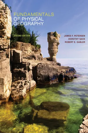 eBook - PDF
- James Petersen, Dorothy Sack, Robert Gabler, , James Petersen, Dorothy Sack, Robert Gabler(Authors)
- 2014(Publication Date)
- Cengage Learning EMEA(Publisher)
Probably no area on Earth could be called entirely earthquake safe. Igneous Processes and Landforms Landforms resulting from igneous processes are related to eruptions of extrusive igneous rock material or emplacements of intrusive igneous rock. Volcanism is the extrusion of rock matter from Earth’s subsurface to the exterior and the creation of surface terrain features as a result. Volcanoes are mountains or hills formed in this way. Plutonism refers to igneous pro-cesses that occur below Earth’s surface, including the cooling of magma to form intrusive igneous rocks and rock masses. Some masses of intrusive igneous rock are eventually exposed at Earth’s surface where they comprise landforms of distinctive shapes and properties. Volcanic Eruptions Few spectacles in nature are as awesome as a volcanic erup-tion ( ■ Fig. 11.20). Although large, violent eruptions tend to be infrequent events, they can devastate the surrounding environment and completely change the nearby terrain. Yet, volcanic eruptions are natural processes and should not be unexpected by people who live or travel in the vicinity of active Volcanoes. Eruptions vary greatly in size and character, and the vol-canic landforms that result are extremely diverse. Explosive eruptions violently blast pieces of molten and solid rock into the air, whereas molten rock pours less vio-lently onto the surface as flowing streams of lava in effusive eruptions . Variations in eruptive style and in the landforms pro-duced by volcanism stem mainly from dif-ferences in the viscosity —that is, resistance to flowing—of the magma feeding the eruption and in its gas content. Viscosity and gas content are determined especially by the chemical properties of the magma, but temperature is also involved. The chemical composition of the magma is the most important factor deter-mining the nature of a volcanic eruption.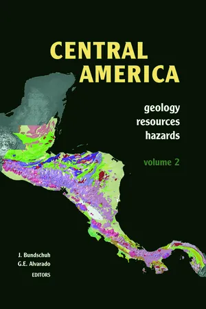 eBook - PDF
Central America, Two Volume Set
Geology, Resources and Hazards
- Jochen Bundschuh, Guillermo E. Alvarado(Authors)
- 2012(Publication Date)
- CRC Press(Publisher)
CENTRAL AMERICA: GEOLOGY, RESOURCES AND HAZARDS; BUNDSCHUH & ALVARADO (EDS) 125 Figure 4.1. Map of the main Central American volcanic front (CAVF), showing the location of individual centres and main structural features, such as the Motagua fault zone, the Central valley of El Salvador and the Nicaraguan depression. Principal Volcanoes are named, where space permits. 126 GEOMORPHOLOGY Figure 4.2. Photos illustrating the differences possible in volcanic landforms: (a) The featureless black flanks of a cinder cone, Cerro Negro, part of the El Hoyo complex, Nicaragua; (b) A rough lava dome, Santiaguito, part of the Santa María stratocone, seen behind, Guatemala; (c) A shield volcano, Zapatera complex, Nicaragua, seen as a silhouette from Concepción volcano in Nicaragua lake; (d) Vertical view of a large complex stratovolcano, Orosí-Cacao, Costa Rica (radar image), several coalescing, deformed and eroded cones are present. erosion, and (3) Deformational topography, caused by surface change due to tectonic, gravitational or magmatic deformation [8]. From a landform perspective, a volcanic edifice could be considered to end when it no longer has a constructional effect on topography. Such a definition runs into problems when volcanic material runs into ravines or collects far from the vent on distal fans that are separated from the edifice. As yet there is no truly satisfactory morphological definition of a volcano. For working purposes, the interpretations divide the central edifice from the distal fans. Within the above three-fold morphological classification there are numerous different landforms, described below. 4.2.1 Basic volcano A volcano is basically an accumulation of volcanic deposits around a source vent. Deposits may be lava flows, tephra, ballistics and pyroclastic flows (Fig. 4.2). The growth of a volcano creates a new topographic landform on top of the pre-existing surface. eBook - PDF
Geology
Earth in Perspective
- Reed Wicander, James Monroe, Reed Wicander(Authors)
- 2019(Publication Date)
- Cengage Learning EMEA(Publisher)
Lava erupted under water typically forms bulbous masses known as pillow lava. • Volcanoes occur in various shapes and sizes, but all form where lava and pyroclastic materials are erupted from a vent. • The summits of Volcanoes have either a crater or a much larger caldera. Calderas form following volumi- nous eruptions, and the volcanic peak collapses into a partially drained magma chamber. • Shield Volcanoes have low, rounded profiles and are composed mostly of mafic flows that cool and form basalt. Small, steep-sided cinder cones form around a vent where pyroclastic materials erupt and accumulate. Composite Volcanoes (stratoVolcanoes) are composed of lava flows and pyroclastic materials of intermediate composition and volcanic mudflows. • Viscous bulbous masses of lava, mostly of felsic compo- sition, form lava domes, which are dangerous because they erupt explosively. • Fluid mafic lava from fissure eruptions spreads over large areas to form basalt plateaus. • Pyroclastic sheet deposits result from huge eruptions of ash and other pyroclastic materials, particularly when calderas form. • Approximately 80% of all volcanic eruptions take place in the circum-Pacific and Mediterranean belts, mostly along convergent plate boundaries. Most of the rest of the eruptions occur along mid-oceanic ridges or their extensions onto land. • The two currently active Volcanoes on the island of Hawaii, and one just to the south, lie above a hot spot over which the Pacific plate moves. • Geologists have devised a volcanic explosivity index (VEI) to give a semiquantitative measure of the size of an eruption. Volume of material erupted and the height of the eruption plume are criteria used to determine the VEI; fatalities and property damage are not considered. • To effectively monitor Volcanoes, geologists evaluate several physical and chemical aspects of volcanic regions. No longer available |Learn more
- James Petersen, Dorothy Sack, Robert Gabler(Authors)
- 2016(Publication Date)
- Cengage Learning EMEA(Publisher)
A volcano that has erupted more than 1000 cubic kilometers (240 cu mi) of mate- rial onto the landscape is known as a supervolcano. The area of Yellowstone National Park in Wyoming and Montana, Long Valley in California, Taupo in New Zealand, and Toba in Indonesia are among the world’s superVolcanoes. Volcanic ash from an eruption of the Yellowstone supervolcano 2.1 million years ago was deposited over half the area of the conterminous 48 U.S. states and into northern Mexico. Copyright 2017 Cengage Learning. All Rights Reserved. May not be copied, scanned, or duplicated, in whole or in part. Due to electronic rights, some third party content may be suppressed from the eBook and/or eChapter(s). Editorial review has deemed that any suppressed content does not materially affect the overall learning experience. Cengage Learning reserves the right to remove additional content at any time if subsequent rights restrictions require it. C H A P T E R 1 4 • T E C T O N I S M A N D V O L C A N I S M 412 Distribution of Endogenic Processes The geographic distributions of most of Earth’s igneous intrusions, earthquakes, and volcanic activity are related to plate tectonics. The greatest tectonic forces, most extensive faults, most dangerous earthquakes, and most of the world’s volcanic activity are concen- trated in relatively narrow zones along the boundaries of litho- spheric plates or at hot spots associated with plumes of magma rising from the mantle. Plutons also form along plate boundaries, but because of the time needed for the igneous intrusions to achieve surface exposure, their distribution tends to represent ancient loca- tions of plate margins. The amount and severity of earthquakes and volcanic activity vary with the type of plate boundary. Tensional tectonic forces associated with lithospheric plate divergence cause faulting and create fractures that provide avenues for molten rock to reach the surface. eBook - PDF
- James Petersen, Dorothy Sack, Robert Gabler, , James Petersen, James Petersen, Dorothy Sack, Robert Gabler(Authors)
- 2021(Publication Date)
- Cengage Learning EMEA(Publisher)
Many regions with earthquake or volcanic activity are incredibly scenic and offer attractive environments in which Copyright 2022 Cengage Learning. All Rights Reserved. May not be copied, scanned, or duplicated, in whole or in part. Due to electronic rights, some third party content may be suppressed from the eBook and/or eChapter(s). Editorial review has deemed that any suppressed content does not materially affect the overall learning experience. Cengage Learning reserves the right to remove additional content at any time if subsequent rights restrictions require it. 414 C H A P T E R 1 4 • T E C T O N I S M A N D V O L C A N I S M to live and vacation. It is not surprising then that some of these hazard-prone regions are densely populated. To mini- mize the impacts of tectonic, volcanic, and other related haz- ards, such as landslides and tsunamis, it is essential that ● FIGURE 14.44 (a) Crater Lake, Oregon, formed about 7700 years ago when a violent eruption of Mount Mazama blasted out solid and molten rock matter, leaving behind a deep crater, the caldera, which later accumulated water. (b) Wizard Island is a later, secondary volcano that has risen within the caldera. Could other Cascade Volcanoes erupt to the point of destroying the volcano summit and leaving a caldera? (a) (b) USGS J. Petersen ● FIGURE 14.43 Lassen Peak in northern California is a plug dome that was active between 1914 and 1921. Stiff silica-rich lava plugs are the darker areas protruding from the volcanic peak, and they give plug domes their steep slopes. Why are plug dome Volcanoes considered dangerous? people in these regions have a basic understanding of the nature of the hazards with which they live, and for residents and governmental agencies to make detailed preparations for coping with such disasters before they occur. D. Ramsey/USGS Copyright 2022 Cengage Learning. All Rights Reserved. May not be copied, scanned, or duplicated, in whole or in part.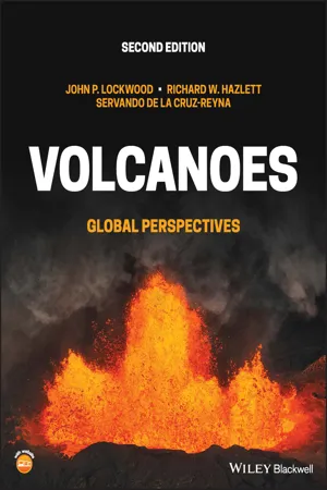 eBook - PDF
Volcanoes
Global Perspectives
- John P. Lockwood, Richard W. Hazlett, Servando de la Cruz-Reyna(Authors)
- 2022(Publication Date)
- Wiley-Blackwell(Publisher)
McGuire, W.J., Jones, A.P., and Neuberg, J. (1996). Volcano instability on the Earth and other planets. Geological Society of London Special Paper 110, 388 p. Pierson, T.C., Janda, R.J., Umbal, J.V. et al. (1992). Immediate and long-term hazards from lahars and excess sedimentation in rivers draining Mount Pinatubo, Philippines. US Geological Survey Water Resource Investigations Report 92-4039, pp. 1–35. FIGURE 11.15 Burial of homes in 1982 by hyperconcentrated flow deposits alongside Cibanjaran River, 8 km below lahar sources, Galunggung volcano [129], Indonesia. Roof tiles have been salvaged from the abandoned homes. Source: USGS photo by J.P. Lockwood. 314 CHAPTER 12 Volcanoes: Global Perspectives, Second Edition. John P. Lockwood, Richard W. Hazlett, and Servando De La Cruz-Reyna. © 2022 John Wiley & Sons Ltd. Published 2022 by John Wiley & Sons Ltd. Companion website: www.wiley.com/go/lockwood/Volcanoes2 Volcanoes Unseen and Far Away Source: Credit_NASA. Chapter 12 Volcanoes Unseen and Far Away 315 Представляется весьма вероятным, что вулканизм мог играть определяющую роль в формировании внешних оболочек многих космических тел. [It appears highly likely that volcanism might play a defining role in the formation of the outer shells of many cosmic bodies.] (Yevgenii Markhinin 1985) Half a century ago, the science of volcanology was for the most part focused only on subaerial Volcanoes of planet Earth. Although submarine eruptions had been documented as the causative phenomenon responsible for shallow-water explosive volcanism, vol- canologists had no inkling that submarine volcanism was the dominant manifestation of volcanic activity on Earth, nor that active volcanism was taking place anywhere else in our solar system. There were theories that volcanic activity had occurred on the moon and Mars, but the extent or complexity of this volcanism was unimagined.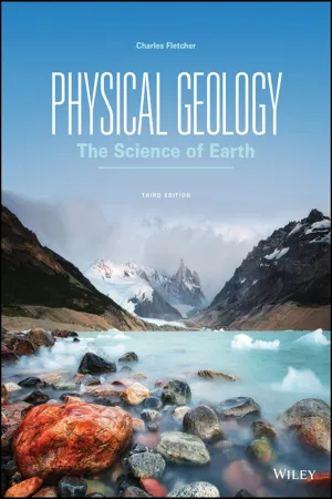 eBook - PDF
Physical Geology
The Science of Earth
- Charles Fletcher(Author)
- 2017(Publication Date)
- Wiley(Publisher)
Monogenetic fields are collections of cinder cones and/ or maar vents (low-relief, broad volcanic craters formed by shallow explosive eruptions) and the lava flows and pyro- clastic deposits associated with them. The explosions are usually set off when groundwater is invaded by magma, pro- voking a phreatomagmatic eruption. Often, a maar later fills with water to form a lake. Sometimes, a stratovolcano is at the center of the field—as in the San Francisco Volcanic Field in Arizona, which has produced more than 600 Volcanoes in its (geologically speaking) short 6-million-year history. In this case, both volcanic categories appear in the same geo- graphic area. Large Igneous Provinces Large igneous provinces (LIPs) are formed at locations where massive quantities of basaltic lava pour from systems of long fis- sures (ground cracks) instead of from central vents. An immense outwelling of lava floods the surrounding countryside or sea- floor over a period of millions of years, forming broad plateaus hundreds of meters high. There are places where so much lava has issued from the ground that it is referred to as flood basalt. LO 6.8 Identify the main characteristics of a large-scale volcanic terrain, and give examples. Large-scale volcanic terrains are formed by massive eruptions of, typically, basaltic magma over sustained periods. These types of Volcanoes have no central vent and often repave large areas of Earth’s surface with vol- canic products. FIGURE 6.23 The San Francisco Volcanic Field in Arizona has produced more than 600 Volcanoes during its 6-million-year history. This image shows over two dozen separate Volcanoes in one portion of the field. Flickr Open/Getty Images FIGURE 6.24 Ship Rock is the erosional remnant of the “throat” of a volcano in the Navajo volcanic field of New Mexico.
Index pages curate the most relevant extracts from our library of academic textbooks. They’ve been created using an in-house natural language model (NLM), each adding context and meaning to key research topics.