Geography
Water Geography
Water geography is the study of the distribution, movement, and physical properties of water on Earth's surface. It encompasses the examination of rivers, lakes, oceans, and other water bodies, as well as the impact of water on shaping landscapes and influencing human activities. This field also explores the interconnectedness of water systems and their significance for ecosystems and human societies.
Written by Perlego with AI-assistance
Related key terms
1 of 5
11 Key excerpts on "Water Geography"
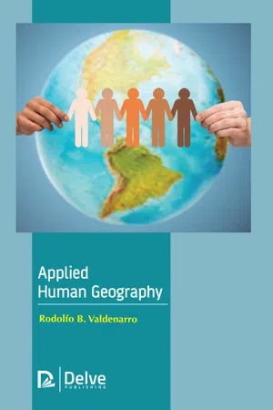 eBook - PDF
- Rodolfo B. Valdenarro(Author)
- 2019(Publication Date)
- Delve Publishing(Publisher)
Introduction to Geography 11 • Glaciology: This area of physical geography addresses the study of the inter-dynamics of glaciers and their impacts on the environment of the planet. Therefore, glaciology comprises of the study of the cryosphere, which involves the alpine glaciers and the continental glaciers. Glacial geology, snow hydrology, and many more., are some of the sub-division of the field of glaciological studies. • Oceanography: As it is known that oceans consist of the 96.5% of the water of the planet, special area of oceanography is required to be devoted to the study of oceans. The science of oceanography comprises of the geological oceanography (research of the geological features of the ocean floor, its mountains, volcanoes, and many more.), biological oceanography (study of the marine life and ocean ecosystems), chemical oceanography, is the study of the chemical composition of the marine waters and their impact on the forms of the marine life), physical oceanography, is described as the study of the oceanic movements like the waves, currents, etc. • Hydrology: This is considered as another important feature of physical geography. Hydrology addresses the study of the characteristics of the water resources of the Earth and the movement dynamics of water in association to the land. The field covers the study of the rivers, lakes, glaciers, and underground aquifers on the planet earth. It studies about the constant flow of water from one source to another source, above, and under the surface of the Earth, in the type of the hydrological cycle. • Pedology: A field of soil science, pedology comprise of the study of the diverse types of soil that is present in the natural environment on the surface of the planet Earth. This area of study assists collects the information and knowledge on the procedure of soil formation (pedogenesis), soil constitution, soil texture, categorization, etc. eBook - PDF
- Alan F. Arbogast(Author)
- 2017(Publication Date)
- Wiley(Publisher)
Geography, a word derived from the Greek words for “Earth description,” is an ancient discipline that examines the spatial attributes of the Earth’s surface and how they differ from one place to another. The concept of geography has likely been important to the human experience for tens of thousands of years. It is easy to imagine, for example, that prehistoric hunters and gatherers were intimately aware of their surround- ings, including the location and character of forests, streams, lakes, berry patches, migrating animal herds, and competing groups of people. In short, this geographical awareness would have been absolutely essential for people to sustain them- selves and their communities. It would also have been critically important to pass this awareness on to future generations so that they, in turn, could successfully compete for resources. So, for thousands of years at least, geography was a descriptive discipline that focused on the generalized loca- tion and character of places and features on the landscape. Climatology Remote sensing Geography Physical Human Geographic information systems Hazard assessment Biogeography Economic geography Cultural geography Historical geography Medical geography Political geography Marine geography Geomorphology Soils Environmental geography Agricultural land use Regional development Ecology Biogeography Climatology Hydrology Geology Physical Geography Meteorology Soils Geomorphology (a) (b) FIGURE 1.1 Subdisciplines of geography. (a) The field of geography can be broadly subdivided into physical and human geography. Many subfields occur within these two broad categories, with many that overlap. (b) Physical geography itself overlaps with several other areas of science. Many of these areas require a good understanding of chemistry and physics as well. As civilization evolved, however, geography slowly became an academic discipline with numerous specialized subfields. eBook - PDF
- James Petersen, Dorothy Sack, Robert Gabler, , James Petersen, James Petersen, Dorothy Sack, Robert Gabler(Authors)
- 2021(Publication Date)
- Cengage Learning EMEA(Publisher)
All Rights Reserved. May not be copied, scanned, or duplicated, in whole or in part. Due to electronic rights, some third party content may be suppressed from the eBook and/or eChapter(s). Editorial review has deemed that any suppressed content does not materially affect the overall learning experience. Cengage Learning reserves the right to remove additional content at any time if subsequent rights restrictions require it. 5 1 - 1 G E O G R A P H Y I S P H Y S I C A L , H U M A N , A N D S P A T I A L plant and animal species, seeking to discover the natural and human-induced environmental factors that influence them. Physical geographers who are soil scientists analyze and map soil types, determine the suitability of different soils for various uses, and work to conserve soil as a natural resource. Water plays a critical role in many natural processes on Earth. Meteorology, climatology, geomorphology, biogeography, and soil science each involve water in some way. Physical geogra- phers participate widely in the study of water, water bodies, and water resources, and physical geographers may also work directly with water as hydrologists, oceanographers, or glaciologists. Many geographers contribute to the effective management of water resources to ensure that water in lakes, streams, springs, and groundwater sources meet human and environmental needs in terms of quality and quantity. involves forecasting weather conditions. Geographers who spe- cialize in climatology are interested in the averages and extremes of long-term weather data, regional climates, large-scale atmo- spheric circulation processes, climate-related hazards, under- standing climate change, and how climate and climate change impact people and the environment. Geomorphology, another major subfield of physical geogra- phy, is the study of landforms and how the interactions of Earth’s processes and surface materials contribute to landform develop- ment and modification.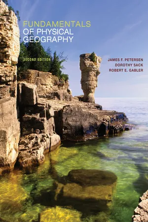 eBook - PDF
- James Petersen, Dorothy Sack, Robert Gabler, , James Petersen, Dorothy Sack, Robert Gabler(Authors)
- 2014(Publication Date)
- Cengage Learning EMEA(Publisher)
Learning the relevant questions to ask is an important step toward finding answers and explanations. Understanding how Earth’s features and processes interact to develop the environmental diversity on our planet is the goal of a course in physical geography. The Study of Geography Geography refers to the examination, description, and expla-nation of Earth—its variability from place to place, how places and features change over time, and the processes responsible for these variations and changes. Geography is often called the When you complete this chapter you should be able to: ■ Explain physical geography as a discipline and profession that con-siders both the natural world and the human interface with the natu-ral world. ■ Understand how geographic information and techniques are directly applicable in many career fields. ■ Describe the three major perspectives of physical geography: the spatial perspective, the physical science perspective, and the envi-ronmental perspective. ■ Conceptualize Earth as a system of interacting parts that respond to both natural and human-induced processes. ■ Discuss several interactions between humans and their environ-ments, including examples that are advantageous and others that are detrimental or risky. ■ Recognize how knowledge of physical geography invites better un-derstanding of our environment. :: Objectives PHYSICAL SCIENCE SOCIAL SCIENCE Geomorphology Climatology Biogeography Political Geography Economic Geography Cultural Geography Historical Geography Soils Geography Social Geography Mathematical Geography Environment Geography People P h y s i c a l g e o g r a p h y H u m a n g e o g r a p h y M e t e o r o l o g y G e o l o g y B i o l o g y P e d o l o g y A s t r o n o m y S o c i o l o g y E c o n o m i c s H i s t o r y A n t h r o p o l o g y P o l i t i c a l S c i e n c e ■ FIGURE 1.1 Geography has many subdivisions that are related to other disciplines and share some of their interests.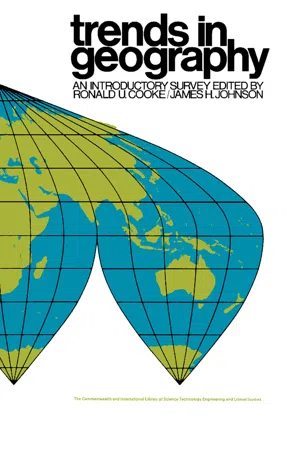 eBook - PDF
Trends in Geography
An Introductory Survey
- Ronald U. Cooke, James H. Johnson, Ronald U. Cooke, James H. Johnson(Authors)
- 2013(Publication Date)
- Pergamon(Publisher)
The International Association of Scientific Hydrology recognizes four distinct branches: (1) surface water, (2) ground water, (3) snow and ice, and (4) limnology (the study of lakes) ; and of these, the first two have re-ceived the greatest attention. As a branch of earth science, hydrology en-compasses the history of the hydrological cycle. The complex sequence of events in this system of circulation is illustrated in Fig. 7. A more conventional approach is to regard hydrology as that discipline which deals with the potable water resources of the earth, their occurrence, circulation, and distribution, their physical and chemical properties, and their interactions with the physical and biological environment, including their responses to human activity. Such a lengthy description gives some indi-cation of the wide diversity, not to say clash, of interest in the field, and identi-fies the unifying theme of water resources. An understanding of the basic concepts of hydrology is implicit in any study of water resources and their proposed management for the optimum good of mankind. HISTORICAL DEVELOPMENT Hydrology is a young science, brashly extending its boundaries into the scientific disciplines from which it takes its strength. It was created by draw-ing upon the general aspects of those disciplines that traditionally served the water-supply industry. Use brought refinement and a growth of special-ized sectors within the major disciplines, and to these have been added the powerful analytical tools provided by the mathematical sciences. 58 Progress in Hydrology 59 FIG. 7. The hydrological cycle. (After Wisler, G. O. and Brater, E. F., 1959, Hydrology, 2nd edn., Wiley, New York.) Being such a new science it has not yet received universal recognition, either as a scientific discipline in its own right or indeed as a profession. eBook - PDF
Hydrology
An Advanced Introduction to Hydrological Processes and Modelling
- Arved J. Raudkivi(Author)
- 2013(Publication Date)
- Pergamon(Publisher)
Chapter 1 INTRODUCTION The word hydrology is derived from the Greek words hydor, meaning water, and logos, meaning science. In this broad sense hydrology is concerned with all water on the Earth, its occurrence, distribution and circulation, its physical and chemical pro-perties, its effects on the environment and on life of all forms. It is hard to think of a discipline of science which could not come under this definition. The botanist studying the movement of moisture through the plant, the medical scientist studying the role of water in human body, etc. could all come under the braod de-finition of hydrology. Many branches of hydrology are scientific disciplines in their own right, such as meteorology and hydrometeorology (study of atmospheric water); oceanography; hydrography (study of surface waters) which is further sub-divided into potamology (potamos-river), dealing with flow in streams and rivers, limnology (limne-lake) is concerned with fresh water lakes, reservoirs, etc. and cryology (kruos-frost) with snow and ice; geohydrology dealing with water in the ground, and many more. In customary usage, however, hydrology has come to mean studies of precipitation and runoff, that is, it has been linked with problems associated with design and manage-ment of water resources projects, such as water supply, flood control, or recreatio-nal use of water. In fact, hydrologists are expected to supply the basic data on which the design as well as management will be based. The most sophisticated methods of optimization and management studies are still only as good as the basic data supplied by the hydrologists and much of the data is very difficult to obtain and interpret. 1.1 Water Resources of the World. It is hardly necessary to state that water is one of the most important minerals and vital for all life. It has played an important role in the past and in the future it will play the central role in the well-being and development of our so-ciety. eBook - PDF
- R. Knowles, J. Wareing(Authors)
- 2014(Publication Date)
- Made Simple(Publisher)
PART ONE: THE STUDY OF ECONOMIC AND SOCIAL GEOGRAPHY CHAPTER ONE MAN AND ENVIRONMENT Geography is currently going through an exciting period in its development as new problems are identified and new methods of analysis are formulated. It is not easy to say precisely what geography is about because geographers often hold different views of the subject, and these views change from time to time, but this is not surprising since geographers are interested in a very wide range of problems and rapid advances are being made in the subject, as they are in all branches of knowledge. Because geography involves such a wide range of knowledge, the subject has been divided into two major areas of study. The first of these is physical geography, which is concerned with the physical environment of landforms, weather and climate, soils, and plants and animals (see Physical Geography Made Simple). The second is human geography, which is concerned with man's activities over the surface of the earth. In many ways this is a false distinction since the activities of man take place within the physical environment, and the physical environment is considerably affected by these activities, but the divi-sion is a useful one and in this book the physical environment will only be considered in relation to man. Human geography can be studied in two principal ways. First, the earth's surface can be studied part by part. This is the approach of regional geography, which seeks to understand the unique character of an area as produced by the interaction of human activity and the physical environment. Secondly, human activity over the earth's surface can be studied part by part. This is the approach of systematic geography, which isolates particular elements such as agriculture, industry or transport, and seeks to understand their spatial patterns and the processes which have produced them. No longer available |Learn more
- James Petersen, Dorothy Sack, Robert Gabler(Authors)
- 2016(Publication Date)
- Cengage Learning EMEA(Publisher)
Physical geography considers all spatial scales, from local to global, and all component parts of the natural environment: the atmosphere, earth materials, plants and animals, and water. By examining the whole set of factors, features, and processes that work together at Earth’s surface, physical geographers tend to ask different questions than physicists, geologists, chemists, or biolo- gists and provide different insights into the planet’s dynamic nature. Because of its holistic approach to the study of Earth’s surface characteristics and processes, physical geography is especially well suited to using the scientific notion of systems in studying Earth. Earth as a System A system is any organized entity that consists of interrelated and interacting components. Physical sys- tems have matter and energy as well as an organizational structure consisting of pathways and linkages between components. Our planetary environment, the Earth system, includes interactions among a vast combination of factors. The individual components of a system interact with each other as parts of a functioning unit. System attributes that can change value are called variables. The sta- tus or magnitude of one variable commonly influences the nature of other variables in the system, and a change in one variable typically leads to changes in others. For example, in the environ- mental system of a mountainous region, the distribution of higher and lower elevations influences temperature and rainfall patterns, which in turn affect the density, type, and variety of vegetation. As the moisture, temperature, plants, and also the type of underlying rock vary over the region, so too will the nature of the soil that forms.
- Karrie Lynn Pennington, Thomas V. Cech(Authors)
- 2021(Publication Date)
- Cambridge University Press(Publisher)
Others enjoy learning about the historical aspects of water resources and hope to find opportunities to utilize past efforts to improve future activities. Still other students and practitioners focus on more human- related social or legal aspects of water resources management and the environment. In this chapter, we’ll start with an overview of water distribution across the globe. Then, ecosystems and watershed basics will be examined, followed by global water use and population issues. We’ll finish with a discussion of the Earth’ s carrying capacity for humans and how global climate change influences these populations. Our goal is to whet your appetite – there’ s much to learn (and consider) as you read our work. We’ re pleased you’ re interested in water resources and environmental issues; now let’ s get started. 1.2 Distribution of Water on Earth Water is found everywhere on Earth and is the only substance that can naturally occur as a liquid, solid, or gas. The Earth contains approximately 1.39 billion cubic kilometers (331 million cubic miles) of water. Examination of Figure 1.1 (Bar 1) shows that the majority, 96.5 percent, is stored in the oceans of the world. This water is saline. Freshwater, the water we use for almost everything, is only 2.5 percent of the total. Most freshwater is stored in glaciers, permanent snow, on sea ice, and in polar ice caps, or exists as groundwater (Bar 2). Surface water is still largely frozen, leaving human’ s major liquid water source in lakes, with smaller amounts in rivers, wetlands, and soil. Water in the atmosphere can be solid, liquid, or gas and although a very small amount, 0.04 percent, it is vitally important to global weather and climate conditions (Bar 3). Globally, freshwater is abundant. However, it is not evenly distributed across the contin- ents. Freshwater amounts vary season to season and year to year. eBook - PDF
- Johan Rockström, Malin Falkenmark, Carl Folke, Mats Lannerstad, Jennie Barron, Elin Enfors, Line Gordon, Jens Heinke, Holger Hoff, Claudia Pahl-Wostl(Authors)
- 2014(Publication Date)
- Cambridge University Press(Publisher)
water is intimately linked essentially to all other biophysical processes on the planet that regulate the functioning of the Earth System and thereby its ability to support human development – from the generation of biomass to the regulation of climate; and 7. water, at any given location in the world, can no longer be governed and managed without an active understanding of the drivers of and impacts on other spatial and temporal scales, from the local to the global, for now and the decades and centuries to come. 3 What emerges is a deeper understanding of the fun- damental role played by water in sustaining the living biosphere on Earth (Falkenmark and Chapman, 1989), as well as the role of water as a key driver of change (IPCC, 2007) and as a strategic agent in build- ing resilience in our societies (Falkenmark and Folke, 2003). The above insights are currently maturing in the scientific world, at a time of increased social, economic and ecological turbulence across the globe. We are seeing increasing evidence of abrupt changes and undesirable social feedback – of financial and social crises moving from the local to the regional and the global scales – but there is also evidence of a similar globalisation of environmental change, gener- ating unexpected interactions between social and eco- logical changes, posing new challenges for human development. Water plays a central role in this new era of social, economic and ecological globalisation. This book is written in the context of the new water-related turbulence in the world. We address the question of how the governance and management of water need to change to enable a transition to global sustainability that meets human needs for water and water-dependent ecosystem services (such as food, medicine and bioenergy) while building resilience to unavoidable change. eBook - PDF
Groundwater around the World
A Geographic Synopsis
- Jean Margat, Jac van der Gun(Authors)
- 2013(Publication Date)
- CRC Press(Publisher)
Our purpose here is therefore limited to outlining the hydrogeological basics and the major features of a world geography of groundwater. This geography is full of contrasts and much of it is still unknown. The outline will facilitate a better under-standing of what is presented in the next chapters. The two main variables defining the hydrogeological setting of a continent or region are its geological conditions and climate. Small-scale hydrogeological maps exist for all continents (see Appendix 6.4 and the web address given in Box 3.1) and together they yield a fairly complete global picture, although with emphasis on near-surface conditions. The WHYMAP project, an initiative of UNESCO and IAH, has in recent years developed a small-scale map that presents a global synthesis at the scale 1: 25 000 000 (analogous to the Geological Map of the World). Its consolidated ver-sion was published in 2008 under the title ‘Groundwater Resources of the World’. This map, reproduced in reduced and simplified form in Figure 3.4, was designed as a synopsis of available continental or regional hydrogeological maps, after introducing significant but necessary simplifications. Nevertheless, it offers a fairly homogeneous Box 3.2: What is an aquifer system? 1 Groundwater movement and transfer of water pressures are two distinct phenomena in an aquifer environment.The conceptual model of an aquifer system results from analysing the subsurface in the light of these two dynamic factors. An aquifer system is a three-dimensional continuous subsurface domain that serves as both a reservoir for groundwater and a preferential natural conduit for groundwater flow (‘subsurface highway’). Along its boundaries it has externally imposed hydrodynamic conditions (imposed in- or outflow rates or water levels) that link it with surface water and soil systems.
Index pages curate the most relevant extracts from our library of academic textbooks. They’ve been created using an in-house natural language model (NLM), each adding context and meaning to key research topics.