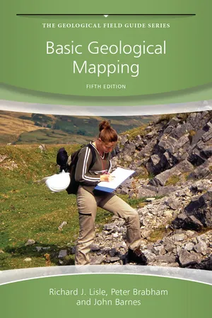
Basic Geological Mapping
eBook - ePub

Basic Geological Mapping

Richard J. Lisle, Peter Brabham, John W. Barnes

Share book
  1. English
  2. ePUB (mobile friendly)
  3. Available on iOS & Android
eBook - ePub

Basic Geological Mapping

Richard J. Lisle, Peter Brabham, John W. Barnes

Book details
Book preview
Table of contents
Citations

About This Book

Part of The Geological Field Guide Series, Basic Geological Mapping, 5 th Edition is an essential basic guide to field techniques in mapping geology. Now completely revised and updated the book retains the concise clarity which has made it an indispensable instant reference in its previous editions. It provides the reader with all the necessary practical information and techniques that they will need while carrying out work in the field, covering a wide spectrum of different conditions, needs and types of countries. This edition covers new developments in technology including Google Earth and the use of GPS. This is an ideal field guide to geological mapping for 2 nd /3 rd year undergraduates of Geology, Hydrogeology and Geological Engineering.

Frequently asked questions

How do I cancel my subscription?
Simply head over to the account section in settings and click on “Cancel Subscription” - it’s as simple as that. After you cancel, your membership will stay active for the remainder of the time you’ve paid for. Learn more here.
Can/how do I download books?
At the moment all of our mobile-responsive ePub books are available to download via the app. Most of our PDFs are also available to download and we're working on making the final remaining ones downloadable now. Learn more here.
What is the difference between the pricing plans?
Both plans give you full access to the library and all of Perlego’s features. The only differences are the price and subscription period: With the annual plan you’ll save around 30% compared to 12 months on the monthly plan.
What is Perlego?
We are an online textbook subscription service, where you can get access to an entire online library for less than the price of a single book per month. With over 1 million books across 1000+ topics, we’ve got you covered! Learn more here.
Do you support text-to-speech?
Look out for the read-aloud symbol on your next book to see if you can listen to it. The read-aloud tool reads text aloud for you, highlighting the text as it is being read. You can pause it, speed it up and slow it down. Learn more here.
Is Basic Geological Mapping an online PDF/ePUB?
Yes, you can access Basic Geological Mapping by Richard J. Lisle, Peter Brabham, John W. Barnes in PDF and/or ePUB format, as well as other popular books in Physical Sciences & Geology & Earth Sciences. We have over one million books available in our catalogue for you to explore.

Information

Publisher
Wiley
Year
2011
ISBN
9781119977513

Chapter 1
Introduction

Most geological maps record the regional distribution of rocks belonging to different formations. However, such maps reveal far more than where we could find rocks belonging to a given formation. The geometrical shape of the different formations on the geological map can also be interpreted in terms of the geological structure and geological history of the region concerned. As an earth scientist you must remember that accurate geological maps form the basis of most geological work, even laboratory work. They are used to solve problems in earth resource exploration (minerals and hydrocarbons), civil engineering (roads, dams, tunnels, etc.), environmental geoscience (pollution, landfill) and hazards (landslides, earthquakes, etc.). Making a geological map is therefore a fundamental skill for any professional geologist. As Wallace (1975) states, ‘There is no substitute for the geological map and section—absolutely none. There never was and there never will be. The basic geology still must come first—and if it is wrong, everything that follows will probably be wrong.’
There are many kinds of geological map, from small-scale reconnaissance surveys to large-scale detailed underground maps and engineering site plans, and each is made using different techniques. In this textbook, however, we are concerned only with the rudiments of geological mapping. The intention is to provide basic methods and good field practice on which you can further build, and adapt, to deal with a wide range of types of geological mapping.

1.1 Outline and Approach

This book is arranged in what is hoped is a logical order for those about to go into the field on their first independent mapping project. This first chapter includes the important issue of fieldwork safety and appropriate conduct during fieldwork, which should always be considered before anything else. The equipment you will need for mapping is described in Chapter 2, which is followed by a chapter devoted to the many types of geological map you may have to deal with some time during your professional career. A description follows of the different kinds of topographic base maps that may be available on which to plot your geological observations in the field. Methods to locate yourself on a map are also described, and advice is given on what to do if no topopgraphic base maps at all are available.
The following four chapters describe the methods, techniques and strategies used in geological mapping, including a brief description of photogeology—that is, the use of aerial photographs in interpreting geology on the ground. A further chapter is devoted to the use of field maps and those most neglected items, field notebooks.
The last three chapters concern ‘office work’, some of which may have to be done whilst still at your field camp. They cover methods of drawing cross-sections and the preparation of other diagrams to help your geological interpretation. Advice is also given on preparing a ‘fair copy’ geological map that shows your interpretation of the data from your field map. However, a geological map is not, as is sometimes supposed, an end in itself. The whole purpose is to explain the geology of the area and your map is only a part of that process: a report is also needed to explain the geological phenomena found in the area and the sequence of geological events. Chapter 11 is a guide on how to present this important part of the geological mapping project.
The approach here is practical: it is basically a ‘how to do it’ book. It avoids theoretical considerations. It is a guide to what to do in the field to collect the evidence from which conclusions can be drawn. What those conclusions are is up to you, but bear in mind what the eminent geologist Lord Oxburgh has said about mapping—that making a geological map is one of the most intellectually challenging tasks in academia (Dixon, 1999).

1.2 Safety

DO NOT PROCEED UNTIL YOU HAVE READ THIS SECTION!
Geological fieldwork is not without its hazards. In Britain, field safety is covered by the Health and Safety at Work Act 1974, and its subsequent amendments. Both employers and workers have obligations under the Act and they extend equally to teachers and students.
The safety risks depend on the nature of the fieldwork as well as on the remoteness, weather conditions and topography of the area being mapped. Before starting the mapping project, a formal risk assessment should be carried out. This will determine the safety precautions and the equipment to be carried whilst in the field. Table 1.1 lists some common risks, but your risk assessment must also consider the specific dangers associated with the area to be mapped. This will involve doing your homework before leaving for the mapping, for example consulting topographic maps, finding the address of nearest medical services, looking at tide tables, and so on.
Table 1.1 Common safety hazards associated with geological mapping
Risk Precautions
Fall from steep slopes Stay away from cliffs, steep slopes, quarry edges, overgrown boulder fields, and so on. Do not rely on Global Positioning System (GPS) but examine a topographic map to identify steep slopes and plan your route. Avoid climbing; leave dangerous exposures unmapped rather than take risks. Do not run down slopes. In mountains but not on a path, stay put in dense mist, fog and darkness
Struck by falling rock and splinters from hammering Avoid rock overhangs; wear a helmet if near cliffs, quarry faces. Do not enter mines or caves. When hammering always use safety goggles and take care with bystanders and passers-by
Drowning after being swept away by waves, tides and floods Avoid the water's edge at sea, lakes and rivers. Consult tide tables. Do not enter caves, mines, potholes. Do not attempt to cross fast-flowing rivers
Cannot be reached by emergency services Work in pairs, or in close association; leave details of the day's route in camp before leaving for the field; wear bright clothing, carry a mobile phone, whistle, torch, flashing LED beacon or a mirror to attract the attention of passers-by or mountain rescue teams
Exposure, an extreme chilling arising from sudden drop in temperature The symptoms range from uncontrolled shivering, low body temperature, exhaustion and confusion. Carry warm clothing and waterproofs, thermal safety blanket, matches, emergency rations (e.g. glucose tablets, water)
Motoring accident Drive carefully on narrow mountain roads; at roadside exposures take care with passing traffic and wear high-visibility jackets. Never drive whilst under the influence of alcohol or drugs.
A geologist should be able to swim, even if fully clothed. If you swim you are less likely to panic when you slip off an outcrop into a river; or from weed-covered rocks into the sea or a rock pool, or even if you just fall flat on your face when crossing a seemingly shallow stream. Such accidents happen to most of us sometime. If you are faced by something risky, play it safe, especially if you are on your own. A simple stumble and a broken ankle in a remote area can suddenly become very serious if nobody knows where you are and you are out of mobile phone coverage.
In some northern latitudes (e.g. northern Canada, Svalbard) geologists have to carry guns and flares to ward off the unwanted attentions of polar bears. So if you are planning work abroad, do your homework on special dangers before you go.

1.3 Field Behaviour

Geologists spend much of their time in the open air and, more often than not, their work takes them to the less inhabited parts of a country. If they did not like being in open country, presumably they would not have become geologists in the first place: consequently, it is taken for granted that geologists are conservation-minded and have a sympathetic regard for the countryside and those who live in it. Therefore, remember the following:
  1. Do not leave gates open, climb wire fences or drystone walls or trample crops, and do not leave litter or disturb communities of plants and animals.
  2. Do not hammer for the sake of it. Greenly and Williams (1930, p. 289) observe that ‘indiscriminate hammering is the mark of a beginner’ (several key localities once showing beautiful structures have been defaced by geological hammering, drilling and graffiti). When you are collecting specimens do not strip out or spoil sites where type fossils or rare minerals occur. Take only what you need for your further research.
  3. Before you embark on any field programme you should have studied your public access rights on footpaths using maps or web-based enquiry. In the UK, you do not have the right to walk wherever you want, but open access to many remote areas is now covered by the Countryside and Rights of Way Act 2000. These are typically areas of mountain, moor, heathland, downland and registered common land; further details can be found on the Ramblers website. When in the field always ask permission to enter any private land when not on a public footpath. Most owners are willing to cooperate with geology students if they are asked politely first; landowners are usually very interested in what lies beneath their land, but understandably get very annoyed to find strangers sampling their rocks uninvited.
If working in a foreign country, carry a simple A5 size laminated card explaining in the local language who you are and what you are doing; this often diffuses any conflict and confusion with landowners due to your poor communication skills. Bear in mind that irate farmers can inhibit/restrict geological acti...

Table of contents