![]()
1
The Giver of Abundance and Peace
Water and Society on the Slopes of Kilimanjaro
There once lived two neighbors in the forest. They used to love and help each other. They were both girls and they did not want to get married. Their names were Kibo and Mawenzi.
One day, Mawenzi wanted to prepare a dish of bananas, but she found no fire in her hearth. She went to ask for some live embers from her neighbor because it was getting too late to go to the shop and buy a matchbox.
When she was near Kibo’s hut, she could smell something nice being cooked there. “Hodi?” she asked, meaning “May I come in?” Then her friend said, “Karibu.” That means “Welcome.” After greetings, Mawenzi asked for some fire. Before she was given it, Kibo gave her some of the sweet food she was pounding. This was dried bananas well cooked and mixed with some milk. Then Mawenzi left for her home.
On the way, she thought to herself how to get more of that food, and an idea came to her head. She put out the fire, went back to Kibo’s hut, and said the fire went out because of the cold weather. So Kibo gave her more of her food and some fire.
Mawenzi did the same thing again for a third time. But Kibo didn’t take the time to listen to her. They started to quarrel, and at the end, Kibo took the pestle she was using to pound her food and started to beat Mawenzi very hard on the head several times.
Mawenzi ran back home crying and started to nurse her wounds, which she still does today.1
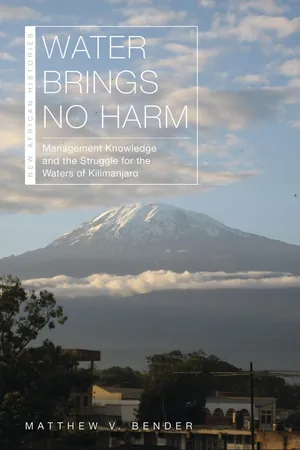
THIS LEGEND of Kibo and Mawenzi, recited to me in Kilema in 2004, has been told in various forms across Kilimanjaro for centuries.2 In the story, the neighbors represent the peaks of the mountain: Kibo, the white-capped peak that dominates the landscape, and Mawenzi, the lesser peak to its east. The purpose of the story is to explain their difference in stature and the latter’s jagged appearance. Kibo is depicted as bountiful, generous, and wise, while Mawenzi is eager to take advantage of her neighbor’s good fortune. The legend reveals much about how people define themselves in relation to their surroundings. For them, Kibo is more than the highest peak of the mountain; it is the source of life, a symbol of vitality, and the embodiment of all that sustains them.
The term “Kilimanjaro,” which we now use to refer to the entire massif, comes not from the mountain itself but rather from outsiders. The peoples of the mountain inhabited not a singular space, but rather a diverse one defined by numerous valleys and ridges. Kibo, visible from all parts of the mountain, served as the geographic focal point. With its distinctive white cap and frequent cloud coverage, it came to be considered the source of water and, therefore, of life itself. For generations people have revered it, made offerings to it, washed themselves while looking in its direction, and buried their relatives so that they face it. Its centrality to local life can be seen in proverbs and adages such as “Endure like Kibo” and “As Kibo moves not, so may life not be removed from you.”3 As Charles Dundas described in his 1924 study of Chagga culture, Kibo is the “Giver of Abundance and Peace.”4
This chapter discusses the mountain communities of Kilimanjaro and the centrality of the waterscape to their development up to the mid-nineteenth century. It does so by examining what it meant to “manage” water and how water management in turn shaped the development of social, political, and cultural institutions and relationships. Water was clearly a necessary resource, essential to agriculture as well as a multitude of other human needs, from brewing to bathing. Water management involved numerous kinds of sources—streams, springs, waterfalls, mifongo—each with different properties, uses, and seasonal variations. Because of the diversity of sources, the organization of communities on mountain ridges, and the persistent threat of drought, water management empowered a wide range of people. These included the societies that managed mifongo, the wamangi and elders who possessed rainmaking skills, the women responsible for procuring domestic water, and even children who were entrusted with protecting watercourses. Yet as reverence for Kibo indicates, the significance of water extended well beyond its physical uses. The resource held deep religious significance; it was key to beliefs about creation, the actions of the spirit world, and Kibo as the source of all life. It also held tremendous cultural power, defining notions of inclusion and exclusion based on categories such as status, education, gender, and generation. The need to manage water in its physical, cultural, and spiritual dimensions engendered a wide range of social interactions and empowered many different actors. Because of this, Kilimanjaro was not a hydraulic society—one where, as Wittfogel imagined, the need to control water led to centralization of power.5 Rather, the dynamic nature of the waterscape led to a diverse yet interconnected body of knowledge that promoted decentralized control.
THE WATERSCAPES OF KILIMANJARO
Mount Kilimanjaro has long stood among the continent’s most notable geographic features. Though impressive in its stature, the mountain has been of greatest value to human societies because of its water features. The humid zones of the mountain—the temperate and tropical woodlands—are most pronounced on its south and east sides. The moisture that gives rise to them originates from monsoon winds that come off the Indian Ocean. As these winds confront the mountain from the southeast, they rise along its slopes and generate precipitation as the atmospheric pressure drops. The north and west sides of the mountain, blocked from these winds, lie in rain shadows. Most precipitation falls in two periods: a long rainy season from March to June known as the kisiye, and a shorter period in October and November called the fuli.6 Most of this water flows down the mountain in rivers and streams—some of which flow year-round and others only during the rains—while a lesser amount seeps into the ground and reemerges as springs. Smaller watercourses converge into larger ones as they flow southward, eventually forming the Pangani River more than 40 kilometers beyond the mountain.
The mountain’s renowned ice cap lies on the upper reaches of Kibo. What appears as a single layer is actually three separate ice fields situated around and inside the volcanic caldera.7 Within these fields are sixteen glaciers, most bearing the names of German mountaineers. The glaciers have been mapped only since 1912, which creates some uncertainty as to their size in earlier times. Glaciologists estimate that in the early nineteenth century, they covered about 20 square kilometers of Kibo’s surface, compared with 2.5 square kilometers today.8 This indicates that the white cap used to be more prominent. Though the ice represents a substantial holding of fresh water, it contributes little to the downhill water supply. Studies indicate that the glaciers are not large enough to act as reservoirs or contribute to downstream water flow.9 Furthermore, the chemical composition of glacial melt differs from downstream springs and rivers.10 As much as 96 percent of the surface water that flows through mountain settlements originates as precipitation in the rainforest and temperate woodlands.11 Aside from the permanent ice, Kibo and Mawenzi also receive around 100 millimeters of seasonal snowfall annually.
Though little water from the glaciers makes it to the lowlands, those who first settled the mountain’s slopes viewed Kibo as the heart of the waterscape. According to Dundas, people believed “that it is the water from this ice that feeds the forest springs which waters their gardens.”12 This perceived connection between the peak and surface water made sense, given that seasonal rainfall and high river volume coincided with seasonal snowfall. As the white cap grew, rivers and streams filled with water, and as it shrank, the dry periods emerged. Though people understood Kibo to be the source of water, they did not know until the twentieth century that ice and snow accounted for its white appearance. Dundas asserts that most people believed the white cap to be formed by hail, which fell periodically in the settled regions of the mountain.
In terms of settlement, the most important zone is the temperate woodland, or agroforest belt. These highland areas are where the ancestors of the current populations chose to settle when they arrived at the mountain more than five hundred years ago. Approximately 100 kilometers in length but only 12 kilometers in width, the agroforest belt wraps around the mountain’s south and east sides. It features fertile volcanic soils, thick vegetation, moderate temperatures, ample rain, and widespread surface water. The topography slopes downhill gradually, with alternating valleys and ridges that emerge in a radial pattern from the upper reaches of the mountain. These valleys, carved over millennia by swiftly flowing water, run deep by the point they reach the agroforest belt. The ridges afforded early communities protection from hostile neighbors as well as wild animals. The richness and diversity of the region are difficult to overstate. In general, temperatures fall and precipitation rises as one approaches the peaks, meaning that the highland areas receive considerably more rainfall than the foothills. Precipitation also decreases as one moves eastward along the southern slopes; it decreases even more as one turns northward along the eastern side of the mountain. Within each mountain ridge, one finds even more variation, with microclimate conditions generated by elevation, sun and wind exposure, and other factors.
One way to conceptualize the diverse conditions of the agroforest belt is to distinguish between three geographic regions: the southwest, the southeast, and the east. The southwest, known since the twentieth century as Hai, features gradual slopes, broad ridges, and a series of deep ravines formed by the mountain’s most voluminous rivers: the Sanya, the Karanga, the Kikafu, and the Weru Weru.13 It has the most surface water of any region of the mountain as well as high rates of annual rainfall, its middle-altitude areas averaging 1,500 millimeters and upper areas exceeding 2,000.14 The southeast, known as Vunjo, is more rugged and steep than Hai. It features narrower ridges with more sharply descending ravines. Its main rivers—the Mue, the Mwona, and the Himo—are less voluminous than those of Hai and lie in shallower valleys. Rainfall is similar, however, averaging 1,500 millimeters per year in middle elevations. The east is referred to as Rombo. Lying on a broad, gradual incline, it is the most distinct of the three in terms of geology and hydrology. The terrain slopes like Hai but with much shallower ravines. Annual rainfall averages are lower than the other areas, reaching around 1,000 millimeters in middle elevations and 1,400 millimeters in upper ones. The most significant difference is the relative dearth of surface water. Rombo contains only one year-round river, the Lumi. While there are a number of rivers that appear seasonally, there are fewer watercourses in Rombo than in either Hai or Vunjo. This contributes to a landscape that is lush compared with the plains but substantially less verdant than the south side of the mountain.
Another factor to consider when thinking about the lands and waters of Kilimanjaro is timing. The bimodal rainfall pattern determines growing seasons, as temperature is largely consistent year-round. During periods of normal weather, precipitation can be highly variable, falling unevenly and causing localized shortages or flooding. The mountain also experiences periodic drought conditions, which has a tremendous impact on surface water. Rivers, streams, and springs that are normally permanent experience reduced flow, while seasonal ones dry up entirely. In his study of nineteenth-century Kilimanjaro, Wimmelbücker shows that prolonged droughts often resulted in famine, leading to political destabilization and warfare between rival chiefdoms. Famines were so common that they were often named in reference to the impacts they had. In the mid-1930s, for example, a severe drought afflicted much of Kilimanjaro. In Machame, it came to be known as njaa ya mowishi, or “the famine in which people had to eat raw whatever they came across.”15 Those who settled the mountain thus came to realize that though Kilimanjaro was a place of relative water abundance, this abundance was by no means absolute. The often-unpredictable nature of rainfall is reflected in adages and fables, the most notable being kipfilepfile kirundu kechiwa mvuo kilawe. Translated as “a little rainy cloud that never became rain,” it reminds people that they should not trust that rain is inevitable, and that they should be prepared for conditions of scarcity.16
Kilimanjaro is a landscape defined by juxtaposition. It is an area of high altitude surrounded by flat grassland, an island of water abundance in a sea of aridity. The waters of the mountain generate a rich, green expanse of vegetation absent from the brown grasslands. The altitude moderates temperatures, creating an area of relative coolness in stark contrast to the intense heat of the steppe. The mountain even sets itself apart in terms of safety; its sharp slopes and cool tempe...