Geography
Hot Deserts
Hot deserts are arid regions characterized by extreme temperatures, low precipitation, and sparse vegetation. They are typically found in subtropical regions and experience high daytime temperatures and significant temperature fluctuations between day and night. Hot deserts are home to specialized plant and animal species adapted to survive in harsh, dry conditions.
Written by Perlego with AI-assistance
Related key terms
1 of 5
10 Key excerpts on "Hot Deserts"
 eBook - ePub
- Hilton Kramer, Kenneth Walton(Authors)
- 2017(Publication Date)
- Routledge(Publisher)
2 The Climates of the Arid LandsSignificant variations in the character of the world’s dry lands have already been established using criteria based on rainfall, vegetation and soils. Desert and steppe, arid and semi-arid, betray the combined eifects of rainfall and evaporation yet a further basic distinction remains, namely between the hot and temperate deserts with their associated steppe lands. Since summer temperatures are high in both types, the terms hot and temperate apply to the thermal characteristics of the winter half-year and it is to be expected that latitude will be mainly responsible for this variation.The Hot Deserts
With an annual average temperature of over 18°C (64-4°F), the Hot Deserts typified by the Sahara, Libyan, Arabian and Great Australian deserts fall into the BWh category of Köppen’s classification. On the Equator and poleward sides they are transitional to the hot steppe lands (BSh) where the rainfall is not only more plentiful but has also a prominent seasonal maximum. Occasionally the hot desert may grade directly into temperate desert as in the arid south-west of the USA and in Central Asia.Lying roughly within latitudes 20° and 25° north and south of the Equator but with marginal extensions 5° or more beyond these limits, the Hot Deserts occur principally where the subsiding and diverging air masses of the high-pressure cells provide atmospheric conditions unfavourable to precipitation. Such areas are characterised by very high summer and high winter temperatures, large diurnal temperature ranges but only moderate annual temperature variations. Evaporation is high and relative humidity low. There is a high sunshine and low cloud amount; a hot sun beating down from a clear blue sky is the normal weather and climate in one. Wind speeds are moderate and usually regular in force and direction. Variations in any of these characteristics provide such diversity as is present in the hot arid zones. eBook - PDF
- Charles Fletcher, Dan Gibson, Kevin Ansdell(Authors)
- 2014(Publication Date)
- Wiley(Publisher)
As a result, deserts heat up strongly during the day as most of the sunlight reaches the ground, but as soon as the Sun sets, heat rapidly escapes from the surface and deserts cool quickly. Why do we study deserts? Deserts are a major global environ- mental feature, and they cover approximately one-third of Earth’s State a hypothesis explaining the location of the largest deserts on Earth. FIGURE 21.1 Deserts are characterized by a lack of precipitation and sparse vegetation. The Atacama Desert in Chile is the driest place on Earth. TABLE 21.1 Ten Largest Deserts Rank Desert Area (km 2 ) 1 Antarctic Desert (Antarctica) 13,829,430 2 Arctic Desert (regions of permafrost above the Arctic Circle) 13,700,000+ 3 Great Sahara (Africa) 9,100,000+ 4 Arabian Desert (Middle East) 2,330,000 5 Gobi Desert (Asia) 1,300,000 6 Kalahari Desert (Africa) 900,000 7 Patagonian Desert (South America) 670,000 8 Great Victorian Desert (Australia) 647,000 9 Syrian Desert (Middle East) 520,000 10 Great Basin Desert (North America) 492,000 Expand Your Thinking—Describe how desertification would impact or change specific aspects of the community where you live. 21-1 Deserts May Be Hot or Cold, but Low Precipitation Is a Common Trait • 569 7UDGH ZLQGV *REL 6\ULDQ $UFWLF *UHDW %DVLQ 3DWDJRQLDQ .DODKDUL *UHDW 9LFWRULD $QWDUFWLF 6DKDUD $UDELDQ 7URSLF RI &DQFHU 7URSLF RI &DSULFRUQ (TXDWRU FIGURE 21.2 Deserts are found on every continent. Some examples are shown on this map. What are the physical characteristics of a desert? THE GREAT SAHARA Amazingly, the Sahara was a lush and humid place between 5,000 and 10,000 years ago. The region had plenty of rainfall and was teaming with large animals, such as giraffes, gazelles, lions, ele- phants, and even hippopotamuses and crocodiles. Populations of early farmers and herders lived throughout the area (FIGURE 21.3). The Sahara lies under the influence of the yearly monsoons (sea- sons of high rainfall in the tropics). eBook - PDF
- Mateo Gutierrez(Author)
- 2012(Publication Date)
- CRC Press(Publisher)
Hot Deserts are located in tropical and subtropical zones. These deserts have high temperatures, variable precip- itation, high evaporation rates, and significant wind action. Due to their latitudinal position and the anticyclonal system, they have high insolation; air temperatures can reach 58°C in some deserts such as the Sahara (Nicholson, 1993). The sky remains clear at night, allowing temperatures to drop considerably due to radiation; diurnal thermal oscil- lations are about 22°C in interior deserts at high latitudes although values up of 56°C have been recorded in Tucson (Arizona) (Goudie and Wilkinson, 1977). Annual temperature oscillations are high and seasonal contrasts become more pronounced with increasing latitude. The highest tempera- ture on the Earth’s surface, 83.5°C, occurs in the sands of Port Sudan in the Red Sea. In coastal deserts, temperatures show less contrast and have low daily and seasonal varia- tions; landlocked deserts have much higher oscillations. In lit- toral deserts affected by cold ocean currents, daily variations are about 11°C, which is about half that of interior deserts, and annual ranges are about 18°C (Goudie and Wilkinson, 1977). Precipitation is extreme; convective-type rains may interrupt dry periods. Temporal variability is accompanied by spatial irregularity; these variations increase as annual precipitation decreases. The variability can be estimated by the ratio of deviation from the average to the average value of annual precipitation; this ratio is expressed as a percent- age. Large deserts (Fig. 16.4) have values higher than 30%; they are classified as arid and hyper-arid zones (Goudie and Wilkinson, 1977). This spatial and temporal variability is due to the fact that the dominant rains, which result from storms, constitute a significant fraction of the total annual precipita- tion. A 24-hour desert storm rainfall event can exceed the average annual precipitation recorded over a 30-year period. eBook - PDF
- Pat Willmer, Graham Stone, Ian Johnston(Authors)
- 2009(Publication Date)
- Wiley-Blackwell(Publisher)
The boundaries of deserts were set quite recently in geological terms; the massive Pleistocene glaciers tied up free water, leading to aridity at low latitudes so that deserti-fication occurred, and in the 10,000 years since the last glaciations these areas have never recovered. We generally think of deserts as exceptionally hot and dry areas with sweeping sand dunes (see Plate 8e, between pp. 386 and 387), but in fact a variety of biotopes are included within this general category and they are surprisingly varied. Their most important shared characteristic is aridity; the three subdivisions of semiarid (see Plate 8f), arid, and hyperarid deserts, as defined by international agreements, cover one-third of the Earth’s land surface, about half of this being true desert as traditionally perceived by the layman (Fig. 16.2). Natural aridity arises for three main reasons, varying in import-ance for different desert areas. Deserts in parts of North and South America arise from a rain-shadow effect, lying on the leeward side of high mountain ranges (sierras), and where no rain clouds occur as the rising air has precipitated all its water on the mountains (see Plate 9a, between pp. 386 and 387). Deserts in the center of large contin-ents are arid principally due to their sheer distance from the sea; the Gobi and Turkestan deserts are examples. However, the largest deserts on Earth arise from the third factor, occurring in latitudes (25 –35°N or S) where there are dry, stable air masses of high pressure, resistant to invasion by storm systems to the north or south. The Saharan and Arabian deserts, and the Australian desert, are of this type. Hyperarid deserts, where high-pressure weather dominates, normally receive less than 25 mm of rainfall per annum; within this there are areas that effectively receive no rain at all. eBook - PDF
Physical Geology
The Science of Earth
- Charles Fletcher(Author)
- 2017(Publication Date)
- Wiley(Publisher)
The Sahel is not the only region threatened by desertifica- tion. Every continent on Earth has large areas suffering due to this hazardous process. But the experiences in the Sahel can serve as a mirror of the strife that is emerging in. Study Guide 611 Study Guide 19.1 Deserts may be hot or cold, but low precipitation is a common trait • A desert is an arid region that receives less than 25 centimeters of precipitation per year, and where vegetation is so sparse that the area is unable to support significant populations of animals. Slightly wetter regions, receiving between 25 and 51 centimeters of precipitation, are considered semiarid. • Expanding deserts, a process known as desertification, alter the distribution of natural resources (especially water), which can lead to political unrest when one group of people appropriates the resources of another, or migrates into new, resource-rich lands. • Deserts experience a wide daily and seasonal temperature range. High daytime temperatures (up to 45°C), followed by low nighttime temperatures (down to 0°C), are the result of the low humidity. 19.2 Atmospheric moisture circulation determines the location of most deserts • Global atmospheric circulation creates the general characteris- tics of weather everywhere. The basic components of the system are the Hadley cell, the Ferrel cell, and the Polar cell. There is one of each cell type in the northern hemisphere and one of each cell type in the southern hemisphere. • Air warms and contracts as it sinks closer to Earth’s surface. This causes evaporation to exceed condensation. No clouds will form in locations with a lot of sinking air. These areas, such as at the poles and 30° latitude, will have few clouds and little precipi- tation, thus forming a great belt of deserts that girdles the globe. Many of the world’s deserts are clustered around 30° N and 30° S latitudes for this reason. eBook - PDF
Agriculture in Dry Lands
Principles and Practice
- I. Arnon(Author)
- 2012(Publication Date)
- Elsevier Science(Publisher)
Rains are rare and completely unpredictable. Only rarely will they suffice for arable cropping without additional water, excepting possibly in favoured niches, such as depressions, sabhas, water courses, etc. Several years may sometimes elapse without rains. The occasional rains may be of high intensity and cause floods. Solar intensities are very high, excepting when a high dust-laden atmosphere re-duces the intensity of solar radiation. The ability to survive under desert conditions is an essential characteristic of the xerophytic natural vegetation of the arid regions. Typically, many of these plants have adapted themselves to arid conditions by a reduced transpiring surface resulting in dwarfed plants with very limited leaf surfaces (cf. Ch. 6). The traditional land use of the world's deserts has been pastoralism, and in its modern form - ranching. Hot arid climates. These comprise deserts and semi-deserts with less than two humid months. Nomadic pastoralism is the dominant land use. Game is a resource that can be a source of income, either as a tourist attraction, and/or for systematic harvesting (cf. Ch. 8). Cool arid climates. Middle-latitude deserts are located either in regions that are remote from oceans or are on the leeward side of mountains (cf. pp. 33, 34). These are typically continental climates found chiefly in parts of the USA, Canada, Siberia and Argentine. These climates are characterized by long cold winters, cold soils, short growing seasons, high summer insolations, high daytime temperatures in summer, and by potential evaporation exceeding precipitation for much of the growing season (Thorne and Thorne, 1979). Cold arid climates. The cold deserts, in which the mean temperatures in the warmest months are less than 10°C, and where even irrigation cannot ensure a reasonable level of productivity, are not included in the scope of this work. eBook - PDF
Desert Biology
Special Topics on the Physical and Biological Aspects of Arid Regions
- G. W. Brown(Author)
- 2013(Publication Date)
- Academic Press(Publisher)
Coastal sand dunes, even in areas of heavy precipitation, thus often display desertic characteristics, par-ticularly in their vegetation, as do kames and outwash plains in areas glaciated in the later phases of the Pleistocene, surface outcrops of lightly cemented sandstones, and closely jointed, readily soluble lime-stones. Physiological deserts are present in the Arctic and the Antarctic and at high altitudes on mountains in all latitudes because of the fact that water is present there only in the solid form (ice) and hence is unavailable to plants. Indoor deserts are created in winter in all the colder areas of the world when very cold air, with accompanying very low absolute humidity, is brought indoors and greatly heated. The extremely low relative humidity thereby produced creates problems involving the hair and skin of humans and the water balance of plants. True deserts result from a deficiency in the amount of precipitation received relative to water loss by evaporation. Deserts, then, as the term is usually and properly used, are basically climatic phenomena. The precise delimination of desert areas is fraught with difficulties. While generally agreeing upon the core areas of deserts, experts are not always in agreement regarding their outer limits. The drier areas of the earth are commonly divided into two groups: arid and semiarid (or des-ert and semidesert, or desert and steppe, each pair of terms being es-sentially synonymous with the other pairs), based upon the severity of their aridity. By the most widely accepted system, that of Koeppen, the boundary between the humid and the semiarid is drawn at the point where the potential evaporation equals the precipitation. Thornthwaite shifts this somewhat, making use of theoretical figures for evapotranspira-tion in place of simple evaporation. In a similar manner, the boundary between arid and semiarid is arbitrarily set by Koeppen at the point where evaporation is twice as great as the precipitation.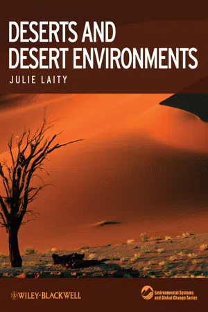 eBook - PDF
- Julie J Laity(Author)
- 2009(Publication Date)
- Wiley-Blackwell(Publisher)
3 THE CLIMATIC FRAMEWORK 3.1 I NTRODUCTION: CLASSIFICATION OF DESERTS BY TEMPERATURE Climatologists have divided the world’s deserts into a threefold division (Meigs 1953): Hot Deserts in tropical and subtropical latitudes, such as the Sahara, Sahel, Kalahari, Thar, Middle Eastern, Arabian, and central Australian deserts; temperate deserts in higher latitudes in continental interiors, including the Gobi and Kazakhstan deserts of central Asia, interior deserts of western North America, and the Patagonian region of Argentina, where temperatures are high during the summer, but winters are cold or very cold; and cold-water coast deserts found on the west coasts of continents in tropical latitudes, includ-ing the Namib and the Atacama and, to a lesser extent Baja California and the Atlantic coastal fringe of the Sahara. High temperatures, and the persistence of high temperatures, characterize hot inland deserts. They have absolute maximum temperatures of 40°C and above, with maximum temperatures commonly between 45 and 49°C (Evenari 1985a). Mean annual temperatures in the Sahara exceed 30°C, with the global temperature record of 58°C set at El Azizia, Libya, in September 1922. Typical temperatures of Alice Springs in central Australia are 35–40°C in the warmer months (Mabbutt 1977b). Hot Deserts may also experience a considerable diurnal range of tem-peratures (E. Smith 1986). Owing to clear skies, nighttime outgoing radiation causes large drops in temperatures and daily ranges of 17–22°C are normal (Fig. 3.1). In Death Valley, California, a maximum diurnal range of 41°C was recorded in August 1891, and the mean diurnal range of temperature for that month was 35°C. However, the fluctuations of the mean annual temperature from year to year are very small.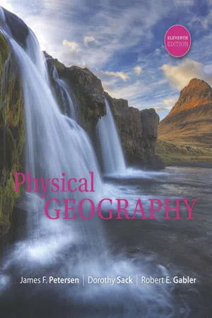 No longer available |Learn more
- James Petersen, Dorothy Sack, Robert Gabler(Authors)
- 2016(Publication Date)
- Cengage Learning EMEA(Publisher)
● FIGURE 9.14 Desert landscapes accentuate the terrain and can be quite scenic. The setting sun lights up the mountains here in Red Rock Canyon National Conservation Area, just west of Las Vegas, Nevada. The area offers miles of hiking trails and a scenic drive for observing and experiencing the natural desert environment. In Google Earth fly to: 36.136 N 8 , 115.427 W 8 ● FIGURE 9.15 The Atacama Desert, mainly in Chile, continues into the highlands of the Andes Mountains of South America. Even at higher elevations, the Atacama is a barren landscape. Many areas of this desert region are completely free of vegetation. In Google Earth fly to: 24.50 S 8 , 69.258 Bob Wick/Bureau of Land Management A. Duro/European Southern Observatory Copyright 2017 Cengage Learning. All Rights Reserved. May not be copied, scanned, or duplicated, in whole or in part. Due to electronic rights, some third party content may be suppressed from the eBook and/or eChapter(s). Editorial review has deemed that any suppressed content does not materially affect the overall learning experience. Cengage Learning reserves the right to remove additional content at any time if subsequent rights restrictions require it. A R I D C L I M A T E R E G I O N S 247 Desert Climates The world’s deserts extend through such a wide range of lati- tudes that the Köppen classification system recognizes two major subdivisions. The first consists of low-latitude deserts where temperatures are relatively high year-round and frost is absent or infrequent even along poleward margins. The second includes midlatitude deserts, which have distinct seasons, includ- ing below-freezing temperatures during winter. However, the most significant characteristic of all deserts is their aridity, which is dramatically illustrated by their climographs (● Fig. 9.16). Land of Extremes Deserts, by definition, are associated with low precipitation, and they also include some extremes in other atmospheric conditions. eBook - PDF
- Patrick L. Osborne(Author)
- 2012(Publication Date)
- Cambridge University Press(Publisher)
How do organisms respond to environmental factors? How quickly can organisms respond to a changing environment? How are the resources that plants and animals require distributed temporally and spatially within the environment? These questions are addressed in this chapter. 2.1 Tropical deserts Hot Deserts predominantly straddle the Tropics of Cancer and Capricorn ( Figure 2.1 ). Here, the air, carried up from the Inter-Tropical Convergence Zone (see section 1.3.2 ), settles to form high-pressure cells that dominate the climate over these deserts. As the air descends, it warms adiabatically and air temperatures become oppressive ( Figure 2.2 ). Some deserts are situated on the west coast of large continents adjacent to cold ocean currents; others are in the interior of large continents (Louw and Seely 1982 ). Cloudsley-Thompson ( 1977 ) classi fi ed the large desert areas of the world into four categories (see Figure 2.1 ): 1. Sub-tropical deserts straddle latitudes 30°S or 30°N and result from persistent overlying high atmospheric pressure cells; e.g. Sahara Desert. 2. Cool, coastal deserts : dry air conditions produced by descending high-pressure air masses are exacerbated by the proximity of cold ocean currents. However, the cold ocean currents, while intensifying atmospheric pressure may also bring cool, moist oceanic winds and advective fog; e.g. Namib and Atacama Deserts. 3. Rain-shadow deserts : oceanic winds, interrupted by a topographical barrier such as a mountain range, are de fl ected upwards and cool adiabatically. The relative humidity rises and orographic precipitation occurs on the windward slopes of the mountain range. The air mass loses much of its moisture before it reaches the leeward side of the mountain and, as it descends, it warms through compression heating ( Figure 2.3 ); e.g. Mojave Desert, Great Basin of North America and part of the Great Australian Desert.
Index pages curate the most relevant extracts from our library of academic textbooks. They’ve been created using an in-house natural language model (NLM), each adding context and meaning to key research topics.