Geography
Nation State Geography
Nation state geography refers to the study of the spatial organization and characteristics of a nation state, including its physical, cultural, and political features. It examines how the natural environment and human activities shape the boundaries, resources, and landscapes of a specific country. This field of geography also explores the interplay between a nation's identity, governance, and territorial space.
Written by Perlego with AI-assistance
Related key terms
1 of 5
12 Key excerpts on "Nation State Geography"
- eBook - PDF
Human Geography
People, Place, and Culture
- Erin H. Fouberg, Alexander B. Nash, Alexander B. Murphy, Harm J. de Blij(Authors)
- 2015(Publication Date)
- Wiley(Publisher)
Because a nation is identified by those who are able to define and control membership, we cannot simply define a nation as the people within a territory. Indeed, rarely does a nation’s extent correspond precisely with a state’s borders. For example, in the country of Belgium, two nations—the Flemish and the Walloons—exist within the state borders. While some groups who envision themselves as nations do not seek territo- rial control and autonomy, there are numerous examples of groups seeking independence and the creation of their own ter- ritorially defined nation-state—for example, the Kurds of Iraq, Turkey, Syria, and Iran; Tamils in northern Sri Lanka; and the Québécois in the province of Quebec. • Political geographers are interested in nations and states, their territorial organization and boundaries, and nationalist ideologies. Political geographers are also interested in the political organization of space from the global to the local. • Borders are never natural. They are always socially con- structed; they are products of social practice, historical context, and are often the result of conflict. • A state is not a “natural” organizational structure. It is a particular form of political and social order created by hu- mans. The state is a politically organized territory with a per- manent population, a defined territory, and a government. It must be recognized as such by the international commu- nity in accordance with international law. • States need to establish boundaries and do so in a number of different ways. Disputes between countries about boundaries take a number of different forms including definitional, locational, operational, and allocational. • A nation is a group of people who collectively understand themselves as having a shared history and a common cul- ture attached to a particular homeland. Some states are made up of many nations, and many nations do not have their own state. - eBook - ePub
New Models In Geography
Volume 1
- Richard Peet, Nigel Thrift(Authors)
- 2013(Publication Date)
- Routledge(Publisher)
The state, political geography, and geographyR. J. Johnston
A major component of the spatial organization of the Earth’s surface is its division into 150 or so sovereign states, each with a well defined (though perhaps contested) territorial reach. This division is commonly used in social sciences as a basic set of units of analysis – the world is described, and accounted for, in terms of similarities and differences among its states. That division is often accepted as unproblematic: it is natural to use countries as reporting units (despite some debate over whether countries are regions (Johnston 1984d)). The validity of this approach has rarely been questioned by political geographers, among whom the need for, and hence existence of, states has normally been taken for granted (Johnston 1980a, 1981a, 1981b). Further, the links between political geography and economic and social geography have rarely been explored, so that until recently the rôles of the state in everyday life, and the importance of state territory in that, have not been central geographical concerns.Attention has recently been directed towards the study of the state, however, and to incorporating political geography within the broader corpus of the discipline. In part this reflects the growth of the institution and apparatus of the state; it has been enlarged into a phenomenon that cannot be ignored in analyses of the contemporary scene (as many of the other chapters in this book indicate). There are studies not only of what the state does, but also of why: to understand state action, it is argued, we must understand why we have states.The issue of why we have states could be dismissed as of little relevance to the study of human geography. However, according to some arguments (e.g. Mann 1984, 1986) the state differs from other institutions because it is necessarily a territorial body - eBook - PDF
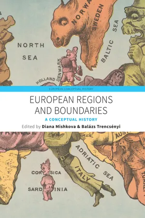
European Regions and Boundaries
A Conceptual History
- Diana Mishkova, Balázs Trencsényi, Diana Mishkova, Balázs Trencsényi(Authors)
- 2017(Publication Date)
- Berghahn Books(Publisher)
As far as political geography is concerned, regions are important as politi-cal constructs, as arenas of political engagement, and as terrains of the projec-tion of power. Regional identities are mobilized at different scales and provide Political Geography and Geopolitics 259 matter for the perception, performance, and representation of politics. Still, political geographers have studied one scale much more than others: that of the (sovereign national) state. The territory of modern nation-states has been the object of much of the analysis of the classic works in political geography, covering issues as diverse as state borders, capital cities, administrative and electoral geographies, and international relations. The state territory is seen as such a specific region that the term “region” has generally been used in political geography to label regions other than the state, either subnational regions (i.e., regions inside the territory of the state) or supranational regions (i.e., regions as groupings of states). In this contribution, we want to engage with the latter types of regions and discuss how Europe has been subdivided in regions in political geography and geopolitics. We emphasize explicit re-gionalization—that is, studies in which delineating regions was a central goal—as opposed to implicit regionalization, in which assumptions about re-gions are made in the context of other research goals. Geopolitics can be considered a subfield of political geography. Originally it was primarily concerned with the impact of physical geographical features, such as topography, orography, climate, and vegetation, on power politics (i.e., relations between the most powerful states) and closely connected to the imperialist and nationalist practices of statehood of the first half of the twen-tieth century. - eBook - PDF
- Rodolfo B. Valdenarro(Author)
- 2019(Publication Date)
- Delve Publishing(Publisher)
Rather than rigidly describing the political geography it is possibly best to think in context of geographical methods being brought to bear on an extensive variety of political concerns. Political geographies: Close Encounters with State 97 Figure 5.1: Political geography is the science of studying the geography in relevance with the politics of the world. Source: https://c.pxhere.com/photos/12/99/syria_middle_east_map_globe_ iraq_continent_world_turkey-677493.jpg!d It has been observed that for some the study of spatial political units is vital. On the other hand, for others there is an emphasis on the main procedures like colonialism . Meanwhile, for still others it is considered as concepts like territory, state, or nation that are considered as important. The variety of the concerns and methods means that it is more meaningful to talk about the political geographies rather than a single unidimensional political geography. The alterations in themes, methods, and approaches have started in response to the intelligent and procedural expansions inside the wider discipline and in academia more generally. Despite the fact that there are various depictions of several social, financial, political, ethnical, and environmental fluctuations, it is noted that these variations are much larger in amplitude than they are assumed. The diminishing boundaries that were present as the division between the subdisciplines of the field of human geography indicates that there are various researches and studies that may be considered as going down inside the sphere of the political geography. This process of falling down is being carried forward by the individuals who are not qualified enough necessarily so that they can call themselves as political geographers. Indeed, they might Applied Human Geography 98 not even regard themselves as geographers at all. - Tim Edensor(Author)
- 2020(Publication Date)
- Routledge(Publisher)
– 2 – Geography and Landscape: National Places and SpacesTo conceive the nation in spatial terms is a complex matter that brings together a number of processes and theoretical approaches. For the relationship between space and national identity is variegated and multi-scaled, producing a complex geography that is constituted by borders, symbolic areas and sites, constellations, pathways, dwelling places and everyday fixtures. And the national is evident not only in widely recognised grand landscapes and famous sites, but also in the mundane spaces of everyday life. My approach here is to look at a range of different national forms of spatialisation which interweave with each other to consolidate a strong cognitive, sensual, habitual and affective sense of national identity, providing a common-sense spatial matrix which draws people and places together in spectacular and banal ways. Accordingly I will look at spatial boundaries, preferred ideological landscapes, iconic sites, sites of popular assembly, generic everyday landscape, and the notion of ‘home’.The Nation as Bounded Space
The nation continues to be the pre-eminent spatial construct in a world in which space is divided up into national portions. The nation is spatially distinguished as a bounded entity, possessing borders which mark it as separate from other nations. Borders enclose a definable population subject to a hegemonic administration in the form of a discrete political system holding sway over the whole of this space but which, in a world of nations, is expected to respect the sovereignty of other nations. These borders are also imagined to enclose a particular and separate culture, a notion which is articulated by hegemonic ways of differentiating and classifying cultural differences. It is not that different cultures cannot exist within any nation, but that they are subordinate to the nation, and conceived as part of national cultural variety.- eBook - PDF
- Joseph P. Stoltman(Author)
- 2011(Publication Date)
- SAGE Publications, Inc(Publisher)
As regional geography became dominant in the first half of the 20th century, scholars focused their energy on cata- loguing and classifying different types of boundaries (Hartshorne, 1936). The study of political geography and geopolitics became a backwater with only a few scholars sustaining the field in the 1950s and 1960s after the work of some political geographers, who applied the Darwinian theory of natural selection to races and states, was used by Nazi Germany to justify expansionary state policies during World War II (Minghi, 1963). In the 1970s and 1980s, as the stigma of Nazism faded, the field of political geogra- phy began to reemerge, often through research employing a world systems perspective (Taylor, 1982). Scholars using this approach studied borders by analyzing the role they play in organizing the global economy and the sovereign state system. The 1990s saw a rapid growth in the study of borders as postmodern and poststructural critiques of knowledge destabilized the notion that boundaries were fixed and finalized. Instead, scholars emphasized how dis- courses and practices create, reiterate, and contest notions of fixity (Newman & Paasi, 1998). Simultaneously, the global context changed as the cold war ended and the pro- cess of globalization appeared to be connecting the world economically and culturally. The object of study in politi- cal geography expanded greatly during this period to include the symbolic connections between cultural bound- aries and political borders, the uneven changes brought by the process of globalization, and the political and social construction of borders (R. Jones, 2009b; Newman, 2006). These boundary narratives ofthe 21st century are analyzed in depth later in the chapter, but first it is important to understand the coevolution of sovereign states and national boundaries in the modem era. Boundaries and Sovereign States Building a wall to keep someone out (or in) is not a new phenomenon. - eBook - ePub
- Colin Flint(Author)
- 2021(Publication Date)
- Routledge(Publisher)
By the end of the chapter you will not only have a better sense of the human geography perspective but also of how it can be used as a framework for understanding and explaining geopolitics. You should also come away with two important overarching ideas. The first is contestation: Geopolitics is a continual process of defining the meaning of places, regions, and territory in a politics of inclusion and exclusion (who does and does not “belong”). In other words, geography is always political and, in some instances, the politics is violent. The second idea is context: The political events that are reported in the media happen within different geographical and historical settings, which partially define what happens and what possibilities for peace and resolution exist.Geography and politics
Human geography may be defined as the systematic study of what makes places unique and the connections and interactions between places (Knox and Marston, 1998, p. 3). In this definition, human geographers are seen to focus upon the study of particular neighbourhoods, towns, cities, or countries (the meaning of place being broad here). Geographers are people who study the specifics of the world – not just where Pyongyang is, but what its characteristics are. “Characteristics” may include weather patterns, physical setting, the shape of a city, the pattern of housing, or the transport system. Political geographers are especially interested, amongst other things, in topics such as how the city of Pyongyang, for example, is organized to allow for political control in a totalitarian country.However, places (whether neighbourhoods or countries) are not viewed as isolated units that can only be understood through what happens within them. The first definition also highlights the need to understand places in relation to the rest of the world. Are they magnets of in-migration or sources of out-migration? Are investors of global capital seeking to put their money in a particular place, or are jobs being relocated to other parts of the world? Is a place a site for drug production, such as areas of Afghanistan, or the venue for illegal drug use, such as suburban areas of the United States or Europe? Understanding a place requires analyzing how its uniqueness is produced through a combination of physical, social, economic, and political attributes – and how those attributes are partially a product of connections to other places, near and far. - eBook - ePub
- David Newman(Author)
- 2013(Publication Date)
- Routledge(Publisher)
It is interesting 17 years on, to note that in the first editorial of the, then, new journal, Political Geography Quarterly, the editors saw the research agenda of the journal as focusing on such issues as the spatial organisation of the State, internal state politics and the study of locational conflict. 7 The nearest they came to raising issues which could be defined as falling within the broader realm of geopolitics, was the revival of geostrategic studies and the concept of the nation state. Since that point in time, the research agenda of political geography has undergone major changes and probably sees geopolitics as being no more than one sub-constituent of the wider study of the relationship between politics and space. More recently, the collapse of the Soviet Union and the territorial reordering of Central and Eastern Europe, together with the impact of globalisation and supra-national processes on what is traditionally seen as the Westphalian territorial compartmentalisation of the world into sovereign states, has raised a host of new questions concerning the nature of the world political map. 8 The study of these topics has assisted in the re-legitimisation of Geopolitics as an academic sub-discipline, and has been illustrated in the reports reflecting the development of Political Geography during the past two decades, with the introduction of such concepts as the new world order in 1991, 9 critical geopolitics in 1992, 10 and theorising the nature of the contemporary world disorder in 1995. 11 The final nails in the coffin of geopolitical excommunication were to be seen in two recent international conferences, the one focusing on a reassessment of past geopolitical writings, the other highlighting the contemporary geopolitical research agenda - eBook - ePub
- John Morrissey, David Nally, Ulf Strohmayer, Yvonne Whelan, Author(Authors)
- 2014(Publication Date)
- SAGE Publications Ltd(Publisher)
The case study of the hotly contested and deeply segregated nature of territory in the north of Ireland captures some of the issues that attend human territoriality more broadly, especially in zones of conflict. As a symbolic strategy, the painting of wall murals is just one means of appropriating the cultural landscape in order to bolster territorial control. We could also ponder the ubiquitous ‘peace-lines’ that separate communities in parts of Belfast, for example, or the painting of kerbstones in some loyalist and republican areas. As the political context in Northern Ireland stabilizes, however, the territorial markers referred to above are beginning to take on an altogether different set of functions and purposes. What were once the primary symbolic signifiers of conflict and spaces which reinforced division and fear are today taking on new meanings in a ‘post-conflict’, peace process, context. In July 2006, for example, the government announced a £3.3 million scheme to replace paramilitary wall murals as part of a communities action plan scheme. The ‘Re-Imaging Communities Programme’ is one of 62 actions included in the Renewing Communities Action Plan which has set about engaging with local people and their communities in order to find ways of replacing divisive murals and emblems with more positive imagery. The aim is to create new murals and public art which ‘will transform parks, housing estates and built-up areas across Northern Ireland, celebrating the aspirations of the whole community and helping people feel part of their own local community’ (Arts Council of Northern Ireland, July 2006). So, what were once landscapes of fear, comprising numerous territorial divisors, are very gradually being rewritten as shared spaces of heritage.KEY POINTS• For geographers, territory has long been a key concern, overlapping and intertwining with concepts like place, space, power and the cultural landscape. Territory refers to bounded places, for example the land that is claimed or occupied by a particular country, institution or person• The allocation of people or social groups to distinct areas or territories, invariably separated by borders or boundaries is at the heart of human territoriality, a term used to describe the strategies used by people, groups or organisations to exercise power and control over a particular place and its component parts.• Territory has increasingly come to be conceptualized not as a passive grid of lines and space but rather as inextricably implicated one way or another in virtually all aspects of human social interaction, from state formation through to the personal space that surrounds an individual.• Over the course of generations a large amount of knowledge has been produced about the forms, functions and processes associated with territoriality and boundaries, from the macro through to the micro level.• The case study of Northern Ireland captures in microcosm some of the issues that attend human territoriality more broadly, and especially in zones of conflict whereby symbolic signifiers, such as wall murals, take on particular territorial significance.ReferencesArts Council of Northern Ireland (2006) Reimagining Communities Programme: Creating a Welcoming Environment for Everyone. Belfast: Arts Council.Agnew, J.A. (1994) ‘The territorial trap: the geographical assumptions of international relations theory’, Review of International Political Economy, 1(1): 53–80.Agnew, J.A. (1997) Political Geography: A Reader. London: Arnold.Anderson, B. (1990) Imagined Communities. London: Verso.Buckley, A. (1998) ‘Introduction: daring us to laugh: creativity and power in Northern Irish symbols’, in A. Buckley (ed.) Symbols in Northern Ireland - No longer available |Learn more
Geofusion 2.0
The Power of Geography in the Economic and Geopolitical World Order
- Norbert Csizmadia, Bence Gáspár(Authors)
- 2021(Publication Date)
- PublishDrive(Publisher)
The Ad Hoc Committee on Geography claimed that “it seeks to explain how the subsystems of the physical environment are organized on the earth’s surface, and how man distributes himself over the earth in his space relation to physical features and to other men” (Ad Hoc Committee on Geography, 1965). M. Yeates asserted that “geography can be regarded as a science concerned with the rational development and testing of theories that explain and predict the spatial distribution and location of various characteristics on the surface of the earth” (Yeates, M. 1968).In the mid-1990s, Harm de Blij said that “geography is the science of place. Its vision is grand, its view panoramic. It sweeps the surface of the Earth, charting the physical, organic, and cultural terrains.” Also in the mid-1990s, the most prestigious geographical grouping, the American Geographical Society (AAG) defined the study of geography as “an integrative discipline that brings together the physical and human dimensions of the world in the study of people, places, and environments” (American Geographical Society, 1994).Not long after, Haggett argued in the aforementioned work that the study of geography is the examination of varied correlations. It describes what type of places are where, and answers why they are there and how they came to be the way they are, and what it causes that they are there.The interdisciplinary nature of geography as described in Geography: A Global Synthesis is presented in Figure 1. My research develops Haggett’s ideas shown in red as well as the related sciences to which a link is established (blue). This figure also shows how Haggett’s arguments on the complex and varied nature of geography paved the way for the advanced, multi-disciplinary nature of geofusion.Figure 1: The related of geographical synthesis Source: Author’s work based on Peter Haggett’s Geography: A Global Synthesis Geography as a tool for getting to know the worldTo me, geography is “a tool for getting to know the world”. In the classic approach, the two main branches of geography are physical geography and social geography, and both can be divided into general geography and regional geography. In another approach, the uniform science of geography can be divided into social geography, physical geography, and regional geography. Physical geography deals with surface landforms and their spatial distribution. Its subbranches include geomorphology, hydrogeography, biogeography, and soil geography. The other branch of geography, social geography, examines the spatiality of life’s phenomena and social developments. It covers the economy (economic geography, industrial geography, agricultural geography, geography of services), the settlement network (settlement geography, in particular urban geography), transportation networks (transport geography), and the spatial distribution of the population (population geography). Other related fields of social geography include tourism geography, strategic geography, military geography, political geography, historical geography, cultural geography, behavioral geography, innovation geography, geography of talent, and sports geography. - eBook - ePub
Politics
Critical Essays in Human Geography
- Virginie Mamadouh, John Agnew(Authors)
- 2017(Publication Date)
- Routledge(Publisher)
The different roles and functions of territoriality at different spatial scales have provided an important focus for some political geographers (Sack, 1986; Johnston, 1991). Scale plays an important part in the process of boundary construction, while national boundaries can have a differential impact at different scales of analysis (Minghi, 1963; Paasi, 1996a). State boundaries, for instance, are not universal phenomena in their territorial meanings and functions, but exist in varying concrete and symbolic forms simultaneously as part of the international geopolitical landscape, the nation-state system and local life. The everyday life meanings, for their part, differ crucially in border areas and elsewhere in states. Boundaries and territoriality are therefore contextual. At the global scale, this context is the geopolitical and economic landscape of the world, while, at the scale of the state, it is the continual nation-building process which manifests itself in different social practices. The third significant scale is the sphere of everyday life experience (Agnew, 1987; Taylor, 1993; Smith, 1995; Paasi, 1996a), where the meanings of (state) boundaries are ultimately reproduced and contested. The state makes a difference as far as boundary functions are concerned. Taylor (1994) argues that the state as power container tends to preserve existing boundaries; as a wealth container it tends towards larger territories; and, finally, as a cultural container it tends towards smaller territories.As far as the basic parameters of the global geopolitical landscape are concerned, and in spite of the globalization argument, the state still appears to provide the basic frame for discussing boundaries. We five in a world of some 190 states. Our world is a world of ‘territorial containers’ but it is also ‘interterritorial’ – almost every portion of the settled ecumene is part of the sovereign territory of some state (Taylor, 1995). The relationship between state and nation has become increasingly complicated, partially evidenced by the increase in the number of separate entities: at the turn of the 1980s, there were some 160 states; at the turn of the 1960s, 90; and before the second world war, fewer than 70. In the contemporary world, there exist 800 nationalist movements or groups and several thousand cultures, among and between whom new questions regarding territorial and social identity may continually arise (Rapoport, 1996). Thus questions of national identity are also tied up with different spatial scales, as ethnic territories become smaller and smaller.Whereas national identities are expressions of general sociospatial consciousness, at the local level and in daily life, dimensions of identity and the meanings of history and heritage become complicated. The national narratives of state borders, therefore, may have different meanings in different contexts. Local experience and folklore mediate the national forms of identity, and it is impossible to understand the latter without knowledge of the former (Cohen, 1982; Paasi, 1996a). Clearly people come to terms with a relatively small number of representations of general sociospatial consciousness in their daily life and local experience, and most of these are representations set forth by the media and education. Billig (1995) argues that, in local experience, these national symbols become expressions of banal nationalism that are ‘flagged’ and lived in daily life. This also holds true in the case of boundaries. For people living in border areas, boundaries are an essential part of the activities and discourses of daily life, which are not necessarily translated into the collective and historical meanings that manifest themselves in the more general sociospatial consciousness and its concrete manifestations, such as national literature, monuments, curricula, etc. For people living elsewhere in states, boundaries are typically ‘present’ in the form of this general social consciousness (Paasi, 1996a). Local contexts therefore present several theoretical and methodological challenges for boundary studies, not least in the case of research methods, where qualitative, interpretative and ethnographic methods may be useful. This also provides a framework for bridging the gap between political geography and contemporary approaches within cultural research (Cohen, 1982; 1986; Sahlins, 1989; Krishna, 1996). - eBook - PDF
- John A. Agnew, Katharyne Mitchell, Gerard Toal, John A. Agnew, Katharyne Mitchell, Gerard Toal(Authors)
- 2008(Publication Date)
- Wiley-Blackwell(Publisher)
Boundaries are not only static, unchanging, features of the political landscape, they also have their own internal dynamics, creating new realities and affecting the lives of people and groups who reside within close proximity to the boundary or are obliged to transverse the boundary at one stage or another in their lives. Neither are boundaries simply territorial and geographic phenomena. Social, economic, political, and virtual boundaries all create compartments within which some are included and many are excluded. Boundaries are hierarchical: a person's location within the society±space frame is determined by the many boundaries within which he/she is enclosed, some of them being crossed with ease, others retaining features which make it more difficult, in some cases impossible, for the lines to be crossed. This chapter surveys the place of boundary studies in political geography, past and present, focusing on the importance of lines in creating the spaces and territories within which we reside and which also provide us with identities and affiliations at a variety of spatial scales. The majority of boundary studies have focused almost exclusively on the territorial and the state, and have been descriptive in nature, giving rise to an accumulated knowledge of boundary case studies and territorial change as the world political map has itself experienced a number of major trans-formations and territorial reconfigurations during the past hundred years. Recently, the focus has began to shift to the notion of ``boundary'' as a line that separates, encloses, and excludes, at a number of spatial and social scales, thus moving away from the exclusive focus on hard international borders. Notwithstanding this, there is, as yet, no solid conceptual or theoretical framework for the holistic study of the boundary/border phenomenon, linking both spatial scales and alternative disciplin-ary approaches.
Index pages curate the most relevant extracts from our library of academic textbooks. They’ve been created using an in-house natural language model (NLM), each adding context and meaning to key research topics.
